

Normandy
-
Posts
820 -
Joined
-
Last visited
Content Type
Profiles
Blogs
Forums
American Weather
Media Demo
Store
Gallery
Posts posted by Normandy
-
-
Earlier photos showed Tampa bay being partially emptied by the offshore winds of Ian. Any coastal flooding in the south shore likely just brought the tide level back to normal.
-
No way this is firing hot towers after landfalling
-
 4
4
-
 1
1
-
-
Anybody who chased this on the coast is likely fighting for their life right now. Immense surge flooding on going
-
On 9/26/2022 at 2:02 PM, Normandy said:
Port charlotte. 150 mph
Give me my money!
-
Good news is Ian's CDO is rapidly warming....if Ian can just NOT do that bursting thing that it does perhaps we can give SW FL some kind of better news.
-
3
-
-
Ian is going to produce much more inland wind than charley. Charley was falling apart as it crossed Orlando and was much smaller. Orlando easily sees those gusts (and over three times as long in duration) with this one I think.
-
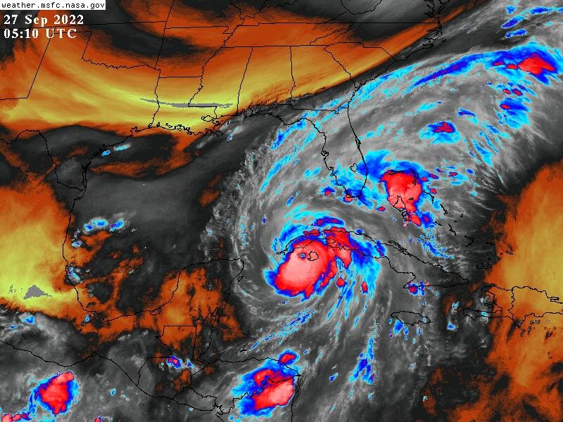
Ian already showing the difference between he and Charley. Its one thing dealing with 150 mph winds.....a whole other thing dealing with that and tsunami like storm surges. the reverse surge out of Tampa Bay is wild. Historic storm, no other way to describe it.
-
3
-
-
Never seen such violent motion with convection on infrared loops before. Wild ass hurricane man.
-
3
-
-
Several instantaneous winds measured in the 130s and 140s in both north and south eyewall
-
Unreal intensification going on right now
-
I am guessing by the flight pattern recon wants to taste that new convective burst.
-
 1
1
-
-
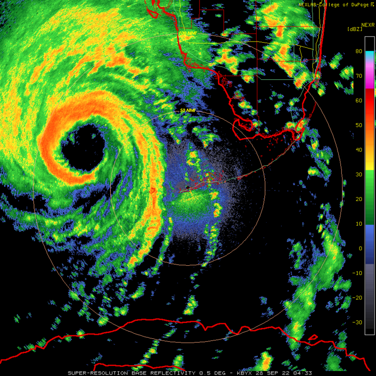
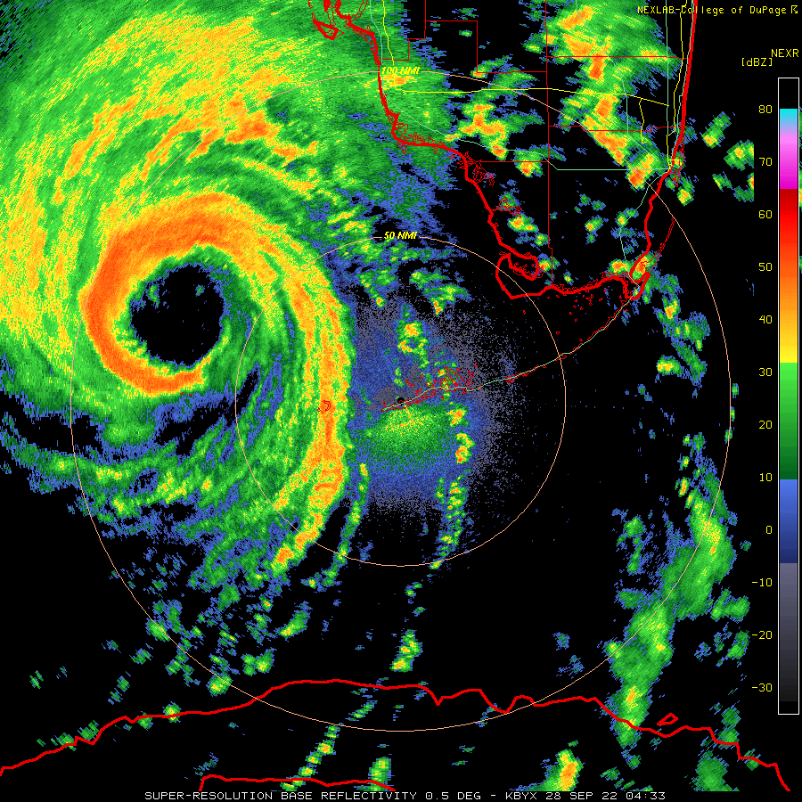
Excellent Radar presentation. Satellite presentation will follow soon.
-
2
-
 1
1
-
-
The trough interaction has made this an absolute monster of a storm. This one will be the benchmark strike for SW FL.
-
3
-
2
-
-
The monster hot tower being ejected wnw south of the eye is absolutely wild to see. Monster hot tower on the west side. Insane trough interaction creating a wild outflow jet to the north. The Freak show is about to start I think.
-
1
-
-
The season is not over. I don’t know how else to illustrate to people this point. It’s maddening
-
1
-
-
Season already has been disastrous. Members who still talk about seasonal busts should be 5-posted instantly.
-
1
-
1
-
-
Seeing this continually slide NNE-NE and constantly be on the right hand side of the guidance even after said guidance corrects east is very unnerving.
-
Excellent call by the NHC. Nuclear core development going on right now.
-
I see a deep trough that is digging and a rapidly intensifying hurricane directly to its south. I am having a hard time seeing this getting further west.
-
7
-
-
Ian is cranking right now....might be taking advantage of some land interaction tightening the circulation up. For the first time in its life deep convection surrounds the eye.
-
2
-
-
Latest Euro is a punishing strike to the West Coast of Florida. Lots of wind, surge, and flooding damage.
-
2
-
-
Torch Tiger is going to win. Never even considered picking the keys
-
1
-
-
Here come the east shifts.......Knew it was coming. Its the same thing that happens to storms that are recurving off the east coast....they always trend east.
-
2
-
 1
1
-
-
Port charlotte. 150 mph
TD 9/Ian Banter
in Tropical Headquarters
Posted
Can we talk about the irony of Tampa bay not only dodging a bullet, but Tampa residents being able to grab a beer and have drinks on the bay floor? Mother Nature is cruel and hilarious at the same time