eyewall
-
Posts
13,313 -
Joined
-
Last visited
About eyewall

- Birthday 12/19/1976
Recent Profile Visitors
17,512 profile views


-
It sure is:
-
Oh I bet! That spot is always horrible. Here is the roll cloud I caught: https://www.facebook.com/share/v/1CwggxCZbM/ - Video
-
Caught a nice roll cloud before the bottom dropped out here.
-
Not enough shear so if it isn't on top of you it won't make it.
-
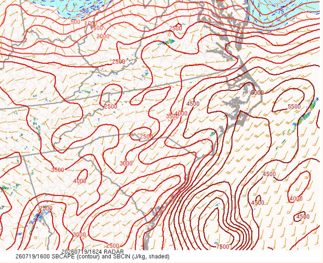
The atmosphere is primed. Just need more shear. There is enough for organization northeast of the Triangle:

-
Oh please let this verify!
-
I am beyond done with this summer.
-
Yeah we had that last evening in Raleigh. You can tell in some of the sunset images in this reel of shots I put together from the Dix Park sunflowers: https://www.facebook.com/reel/27933012633049621
-
IF we get enough smoke it may stop us from getting to 100F LOL.
-
Another launch this morning at the right time for the jellyfish effect. It was delayed until the optimal window and the clouds broke enough just in time.
-
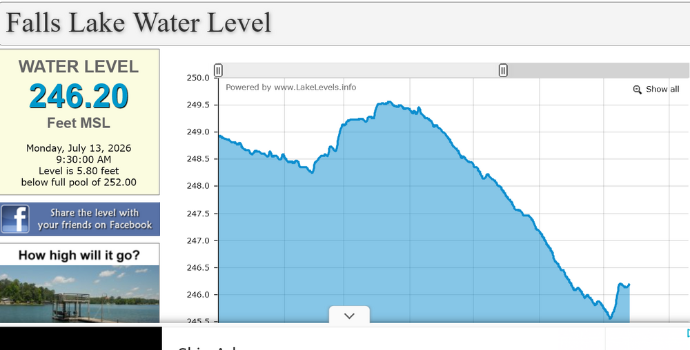
Falls Lake has risen by nearly a foot since all of this rain and will likely climb a bit more today.
-
Winter 2026-2027 Seasonal Outlook
eyewall replied to WinstonSalemArlington's topic in Southeastern States
After the dry slot in a near-perfect setup for snow I know better than to look into long term outlooks for winter lol. This is a region where it is always easy to fumble at the goal line. -
I think the El Nino pattern is finally starting to take shape.