

sbnwx85
-
Posts
1,445 -
Joined
-
Last visited
Content Type
Profiles
Blogs
Forums
American Weather
Media Demo
Store
Gallery
Posts posted by sbnwx85
-
-
1 hour ago, Danny8 said:
1991-2020 is out now. Although the map definitely has some issues, for example Gaylord & Kalkaska normals should have them in the red

Interesting to see such low totals in these parts compared to the previous map. I believe at one point the average snowfall in South Bend was near 70" per year. The data I can find now shows it is 62.5" per year. I wonder if that number will drop again with this latest release.
-
Breaking news: Snow melts quickly when it's 53 degrees.
-
 2
2
-
-
Keeping the lake warm. More chances for lake effect later in the winter.

-
2
-
-
We ended up with around 6 inches of snow. Blizzard conditions subsided late Saturday morning. Got on the road for the Chicago suburbs for Christmas yesterday evening. It was slow going until about Lake County, IN then it was fine.
-
Still blizzarding. I'm not sure I'll make it home. Might have to stay in the hotel across the street from work.
-
I'll be in Mount Prospect for this one. Gotta bring my Chicagoland peeps some luck.
-
 1
1
-
 1
1
-
1
-
-
Guess I'll start posting in here since we're in the lake-effect portion of the storm locally. Snow has eased but should get a boost with the wave currently moving down the lake around Green Bay.
-
Winds picking up...
At 12:12 PM EST, 2 WNW Goshen [Elkhart Co, IN] TRAINED SPOTTER reports NON-TSTM WND GST of M57 MPH
-
Blizzard Warning has verified here. The drive into work was horrible. Occasional white out conditions with visibility around 1/4 mile or less the entire way. Roads are a disaster. Would not recommend.
-
2
-
-
Up to an average snow depth of 4.7”. Absolutely miserable conditions. Snow falling and blowing. Occasional blizzard conditions. I’ll be going into work in an hour. Woo!
-
1
-
-
Good afd from IWX
SHORT TERM...(Today and Tonight)
Issued at 455 AM EST Fri Dec 23 2022

The upper level low`s main vort max lobe moves away from the area
into this morning taking the main surface low pressure system into
southern Canada. Additionally, trajectories become more westerly
allowing for a transition into lake effect snow being the main snow
event. With it being so cold, the DGZ is basically into the ground
with lake enhanced omega residing above the DGZ. This factor of the
cross-hair method being slightly off as well as the strong winds
being able to rip apart the snow flakes should help provide a
ceiling to our lake effect snow amounts. Additional snowfall amounts
will be the greatest downstream of the lake reaching 8 to 12
additional inches of snow there from now through Saturday night.
Thereafter, the lake effect snowfall looks to be the main snowfall
event through at least much of Sunday. The snow paired with the
strong winds will help to lower visibility and so will hold onto the
blizzard warning for our lake effect area. One thing to watch for
today will be that additional counties could be added on the eastern
edge of the blizzard warning.

Another hazard today will be the strong gusty winds. Wind gusts will
likely be able to surpass 50 mph at their peak and that combined
with the powdery natured snow will allow for blowing and drifting of
snow as well as lowered visibility. This will impact the N-S roads
the most with drifting snow, but travel across all roads will need
to use caution where visibility does become lowered.

Temperatures this morning have dropped below zero away from the lake
influence. With the very strong winds expected to reach between 40
and 50 mph today, wind chills will be able to reach into the upper
20s and low 30s below zero. This is wind chill warning criteria.
-
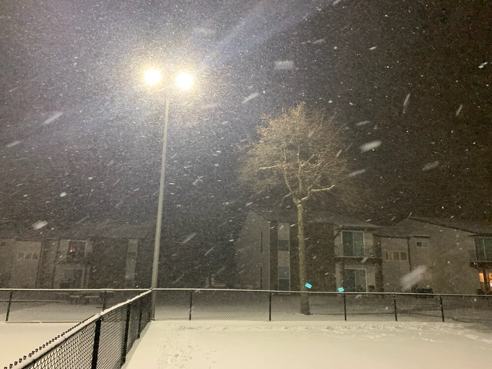
I woke up about 20 minutes ago, looked at radar and thought “well, the lake effect event must be a bust”.
Then looked at current conditions and assumed blowing snow must be causing the observation below.
Turns out lake effect snow at -7 is the pixiest of dust but it is indeed coming down at a decent clip. Winds help reduce visibility at times. Not true blizzard yet but if winds pick up later…yikes. Ratios must be garbage because it doesn’t look like we’ve gotten much new snow. Drifts will make it impossible to tell how much snow we really get.
Current conditions atSouth Bend International Airport (KSBN)
Lat: 41.71°NLon: 86.32°WElev: 801ft.
Heavy Snow and Breezy
-7°F
-22°C
Humidity 79% Wind Speed SW 21 G 33 mph Barometer 29.72 in (1008.3 mb) Dewpoint -12°F (-24°C) Visibility 0.25 mi Wind Chill -32°F (-36°C) Last update 23 Dec 6:54 am EST
-
Couple inches in the ground. Wind is causing drifting but not horrible. I drove through a snow devil on my way home which was cool. Flake size increases dramatically under lake effect bands. If that can get going there will be some good totals and true blizzard conditions tomorrow.
-
2
-
-
Latest thoughts from IWX:
.Update...(Tonight)
Issued at 900 PM EST Thu Dec 22 2022

GOES vapor shows intense mid level sw digging through se MO attm
with bombing sfc cyclone near KTOL. Swath of heaviest snow had
shifted east into wrn OH in association with intense fgen burst
along sharp arctic front. Meanwhile post frontal locations were
plummeting with nearly all of IL below zero now.

Sat/radar trends show lake streamers now into nw zones and enhancing
ongoing snow. Of note is additional tilting of upper trough and
expect additional enhancement of wrn extent of snow shield from srn
IL nwd into nw IN this evening. Thus given more favorable thermal
profile with time expect another 1-2" of snow for most outside lake
belt likely overnight. This will occur coincidental with further
deepening of sfc cyclone toward lake Huron and yield steadily
increasing west/nwrly winds with gusts pushing 40kts by daybreak.
Thus conditions will deteriorate further overnight. Travel is
strongly discouraged as life threatening cold and near blizzard
conditions develop. Otherwise prior forecast remains in tip top
shape with no changes needed.
-
Measure 1.8" at work.
-
1
-
-
Pixie dust flying. Down to 21 degrees. Wind has picked up but not too bad yet.
-
Still 32 degrees and snowing moderately. Good banding trying to form. Closing in on an inch.
-
Light snow has commenced.
-
1
-
-
Indiana Department of Homeland Security is deploying military personnel to help drivers who get stuck on the Indiana Toll Road starting tonight.
-
Based on social media comments on my station's pages, people aren't quite grasping the seriousness of this. They're getting caught up on snow amounts, most saying it won't be that bad. I'm sure many are going to push it to make it home for Christmas. It's going to be a long weekend for first responders.
-
10" seems reasonable here. Areas in Berrien County. MI should hit 16" or more. This is essentially an monster arctic front turned into a long duration lake effect event on steroids.
-
1
-
1
-
-
7 minutes ago, michsnowfreak said:
So then who in the midwest and northeast has had a good start to this winter? I must have missed it lol.
There is no truth to that statement whatsoever. This has been an abnormally slow start to winter everywhere, and for someone from a different area they need to know that. Dec 2020 literally no one but MI was enjoying a decent start, and we were one of the best spots in Dec 2017. Everyone gets hits and misses. If it was true that one area was a void, it would show up in climate data. And it does not.

-
1
-
1
-
1
-
-
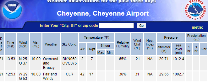
Cheyenne just dropped 40 degrees in one hour.
-
6
-
-
2 minutes ago, HillsdaleMIWeather said:
IWX on the other hand is considering upgrading more counties to a Blizzard Warning later if the higher winds verify
I wouldn't be surprised. The lake effect is going to be reaching far inland. Plus, ground blizzard conditions should occur if winds do indeed verify.

January 2023 General Discussion
in Lakes/Ohio Valley
Posted
Had a burst of decent snow this afternoon. DAB