

sbnwx85
-
Posts
1,445 -
Joined
-
Last visited
Content Type
Profiles
Blogs
Forums
American Weather
Media Demo
Store
Gallery
Posts posted by sbnwx85
-
-
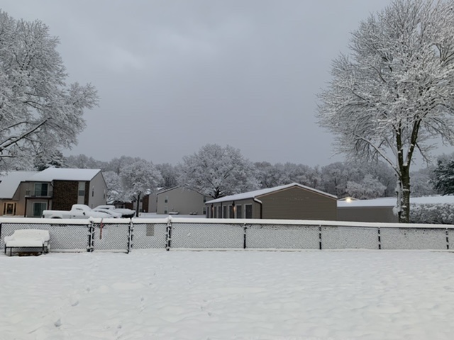
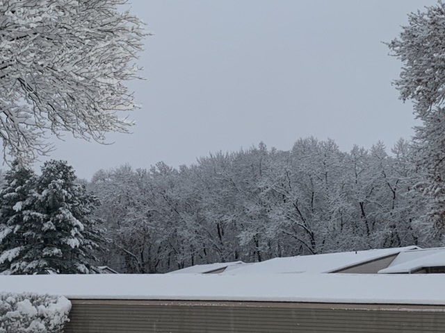
The lake-effect definitely over performed on this side of the lake on Saturday night. Most models indicted 2-4 inches of snow, except the HRRR which had 6+, and I ended up with 7 inches. Also, Benton Harbor (right along the lake) had 8 inches of snow on Saturday night.
-
 2
2
-
-
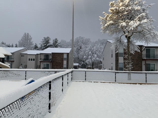
Will post this information here since it’s really outside the dates of the event thread ongoing. IWX is all in on a relatively widespread lake effect event in Michiana. Potential for a foot or more in some places.
LONG TERM...(Wednesday through Sunday)
Issued at 212 PM EST Mon Nov 14 2022

Elongating/sharpening upper trough through the wrn lakes of sig
concern this period. 12Z guidance a bit stronger/deeper aloft and
dig primary nrn stream wave through srn IL/IN late Wed. While lake
based thermal trough not as strong as was seen Sat, favorable long
axis fetch combined with good synoptic moisture plume will enhance
otherwise strongly forced focused single band during the day/evening
Wed over nw IN initially before backing into sw MI Wed night. Strong
multi-model consensus here lends confidence of sig, heavy snow
accums and no doubt impactful. However subtle differences on exact
placement/duration differ substantially enough to hold for another
model cycle before notching certain headlines. Nevertheless would
expect a fairly sizable swath of >6 inches northwest of a Knox-
Plymouth-Goshen-Sturgis line and potential for a foot or more in the
typical snowbelt from nrn Laporte/St Joe north through Cass/Berrien
by Thu aftn.

Elsewhere numerous snow showers expected far west early Wed,
spreading east and south through Wed night before activity shifts
north into lower MI as upper trough swings through. Accums outside
lakeband influence though will remain limited, generally 1-2 inches.
-
An over achiever on the first snow of the year. 7.3 inches north of South Bend.
-
12
-
-
Absolutely ripping. Lake effect machine is turned all the way up.
-
8
-
-

Let the winter magic begin!-
3
-
-
Snowing in OKC.
Current conditions atOklahoma City, Will Rogers World Airport (KOKC)
Lat: 35.39°NLon: 97.6°WElev: 1293ft.
Light Snow Fog/Mist
31°F
-1°C
Humidity 92% Wind Speed N 12 mph Barometer 30.20 in (1023.5 mb) Dewpoint 29°F (-2°C) Visibility 5.00 mi Wind Chill 22°F (-6°C) Last update 11 Nov 7:52 pm CST -
1
-
-
A minor lake effect event locally still looking good. Generally, 1 to 3 inches with a few 4 inch lollipops. Active pattern and the flow off the lake should keep things interesting through next week.
-
Daily record tied!
RECORD EVENT REPORT
NATIONAL WEATHER SERVICE NORTHERN INDIANA
240 PM EDT THU NOV 10 2022

...RECORD HIGH FOR TODAY TIED AT SOUTH BEND...

AT 233 PM EST, THE TEMPERATURE AT SOUTH BEND CLIMBED TO 75 DEGREES
AND TIED THE RECORD HIGH FOR TODAY THAT WAS SET JUST 2 YEARS AGO IN
2020. THE LOW TEMPERATURE SO FAR TODAY WAS ONLY 55 AND AT THIS TIME
HAS ALSO TIED FOR THE WARMEST LOW FOR THIS DATE THAT WAS SET IN
2020. THE RECORDS FOR SOUTH BEND GO BACK TO 1893.
-
The lake-effect response in Michiana behind the front Saturday night will be interesting to watch. Temps will be too warm to get much appreciable accumulation during the day Saturday, but if there's a single-band set up Saturday night someone could get a decent snowfall in these parts.
-
A bit of a lake-effect response in Michiana on Sunday.
-
Might be a long couple of days. At least temperatures are mild.

-
 2
2
-
-
Just experienced what had to be a 60+ mph gust. Twigs and small branches hovering above the ground. Had to take cover in the garage for a half a minute. Exhilarating!
-
Power just went out at my mom’s house in Elkhart, IN. Safe to say there have been some 50+ mph gusts in the last couple hours.
-
IWX says upgrade to High Wind Warning something to monitor.
.LONG TERM...(Saturday through Thursday)
Issued at 410 AM EDT Fri Nov 4 2022

Main concern in long term will be frontal passage on Sat and
associated rain/wind. Very dynamic system anticipated over the Great
Lakes given coupled upper jets and increasingly negative tilt to
mid/upper trough. Very deep PV anomaly is noted with surface
cyclogenesis down to roughly 985mb by the time it reaches Lake
Superior. Corresponding low level adjustments lead to 60-70kt LLJ
over our CWA much of the day. True mixing depths and efficiency are
always questionable in a WAA regime but most forecast soundings
suggest mixing into at least 40 kt winds Sat morning. Greater
concern will be immediately behind the front Sat afternoon with dry
air advection and some potential to mix into 50 kts. Feel confident
in at least advisory criteria gusts of 45 mph Sat. Some concern we
could reach warning criteria of 60 mph along and immediately behind
the front given very impressive wind profile just above ground level
(50 kts at 925mb). However, warning criteria events are rare for our
area and require near-perfect alignment of ingredients. One negative
factor is that isentropic analysis indicates winds largely parallel
to the isobars which may limit a more abrupt/efficient downward
momentum surge behind the front. Soundings are also fairly stable
and not expecting any thunder. Strongest gradient is also in
prefrontal segment in WAA regime with a sharp drop in gradient
strength behind the front later Sat. Given these factors decided to
just go with a high-end advisory. Later shifts may upgrade to a
warning if signals become stronger.
-
Christmas tree FTW
-
Pretty sure I’m seeing mosquitoes on my walk lol
-
 1
1
-
-
I went back and looked...sure enough last November was cooler than average. The beginning of the month had a few nice, sunny days which is probably what I'm remembering. I also remember leaves still being on the trees in mid-November while snow was falling...probably leading me to believe the beginning of the month was warm.
-
So anyway, going off memory, it seems the last three Novembers have started off pretty warm during these three consecutive La Nina's. If this winter also follows suit the best hope for big snows IMBY would be a lake-effect event in December with synoptic snows in February.
-
1
-
1
-
-
69 (nice) degrees in South Bend. Daily records for this week are well into the 70's, so barring overachieving temps I don't think we'll hit any records. But this is a memorable stretch of beautiful weather for this time of year.
-
1
-
-
I'm going to my cousin's wedding tomorrow. It's an outdoor ceremony and all year we were preparing to need coats and/or raingear. They picked one heckuva weekend. Love, temps in the 70's and an open bar. What more can you ask for?
-
1
-
-
I work 2nd shift at a TV news station, so a storm that begins in the late afternoon or early evening. Preparations for the storm dominate headlines all evening and it starts just as the 4, 5 and 6 newscasts begin. The worst hits after I get home and we end up with 20+ inches with 40 mph winds and thundersnow. My co-workers need to pick me up to get into work the next day because I can't get out of the apartment complex. All this as lake-effect wraps around the backside the following day dropping another 6-12 inches.
I've experienced parts of these scenarios during a storm, but not all at once. Although, I've always been able to get myself into work.
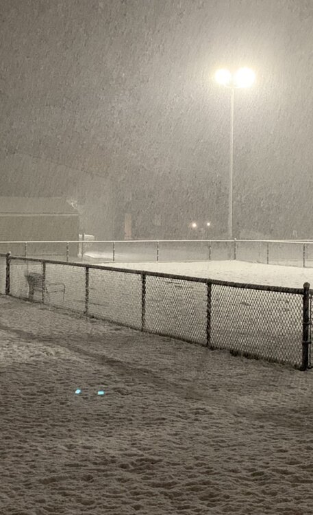
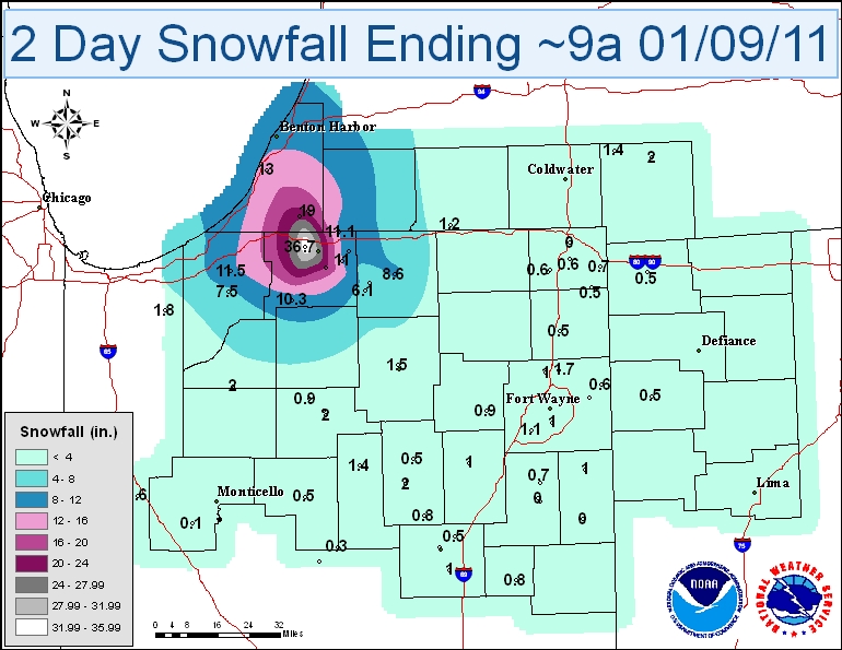
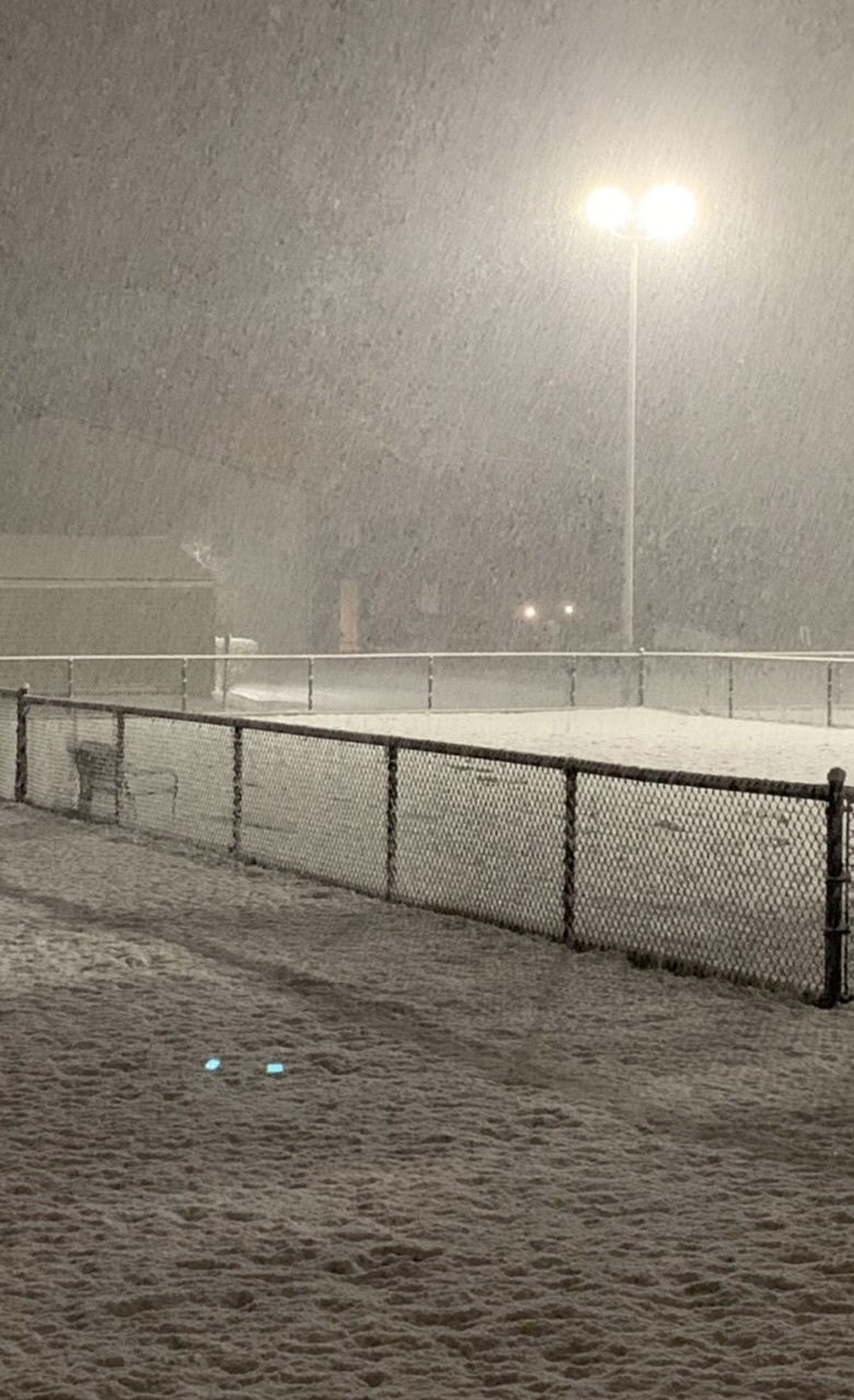
I'd also love to experience a monster lake-effect event. I grew up in Northern Indiana, but just outside the best lake belts. I'd love to get in on a 30+ lake effect storm one day. I was in nearby Elkhart for this storm in 2011 and only get a measly 8 inches. https://www.weather.gov/iwx/20110108_les
-
2
-
-
1 hour ago, Hoosier said:
Certainly looks like a potentially dynamic system early next week. Will have to see how it trends and if we can muster enough instability for a severe threat.
The "2nd severe weather season" is certainly upon us. Potential could be there next week. So far, SPC waiting for consistency among the models.
-
Saw some flakes mixing in before bed last night and again this afternoon on the way to work. Nothing accumulated in my immediate area, but a county east had anywhere from a dusting to 3 inches.
-
Think I’ll call it a night. I’m not holding my breath on getting snow. Too close to the lake this time around. If only it were 10 degrees colder.
-
1
-

November 15-16 Snowfall Potential
in Lakes/Ohio Valley
Posted
Yeah, I thought the setup might be a little different. Honestly, no two lake effect events are exactly alike.