Eskimo Joe
-
Posts
24,722 -
Joined
-
Last visited
Content Type
Profiles
Blogs
Forums
American Weather
Media Demo
Store
Gallery
Everything posted by Eskimo Joe
-
Radar reallly lighting up over far NW WV and Pittsburgh. Hopeful that everyone gets another 2" - 4" on top of this as the sun sets.
-
Cautiously optimistic that Maryland gets 2" - 3" on the back side this afternoon.
-
Noticeable uptick in snow here in Gaithersburg over the past 20 min.
-
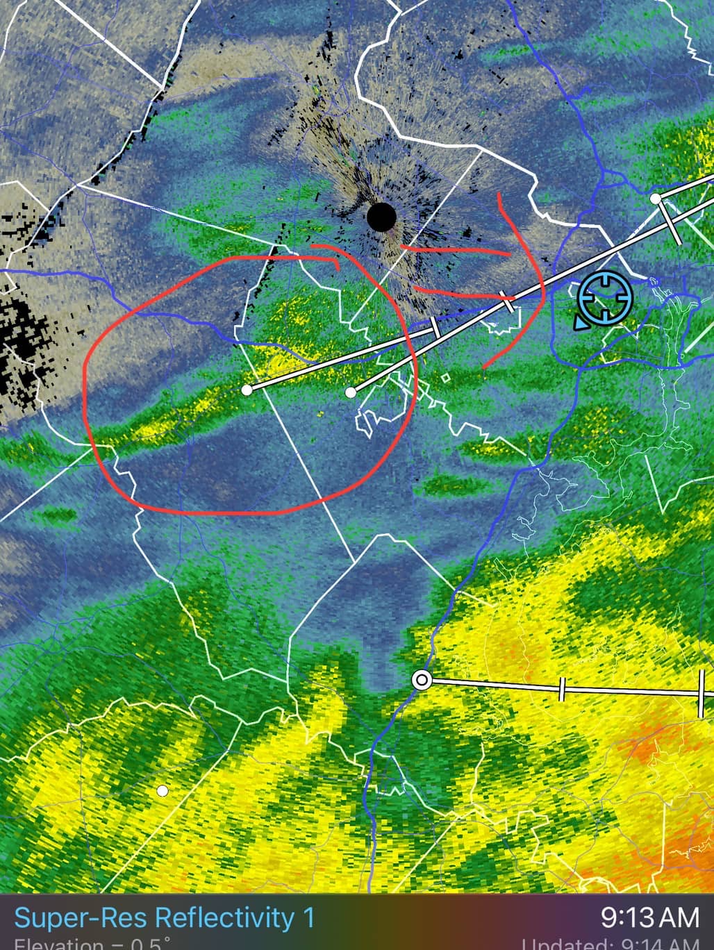
Regional radar mosaic showing better returns across SW PA into WV. Encouraging.
-
Legit dendrites in NW Montgomery County near Hyattstown per DOT cameras.
-
Not enthused at the latest HRRR for north of I-70.
-
Not even close. Warm air advection snow is ending and we're about to transition to more cellular snow until the upper energy passes through this afternoon. I remain cautiously optimistic about the back end potential giving a fresh 1" - 3".
-
For those in Maryland, especially north of US 50, watch SW OH and extreme northern KY. That seems to be out shot at the higher ratio fluff snow later today.

-
Evergreen post.
-
Very happy to see the lowlanders winning with this event.
-
Dry air seems to have knocked down the boom potential north of I-70. Looks like a low end warning event is more likely north of DC.
-
M4.0" Gaithersburg. You likely have the same.
-
Waldorf mesonet site reporting a snow depth of 6".
-
Radar filling in nicely in OH and IN. Looks like the backside stuff is trying to form up.
-
12z RAOB from Sterling will be interesting. There has to be a narrow warm layer around 700mb causing the sleet in NOVA.
-
Radar looks great all the way back to Central West Virginia.
-
Off to bed, but already seeing a few LSRs out along the I-81 corridor. Impressive.
-
The 00z RAOB out of Sterling, VA & Pittsburgh, PA both depicted a dry layer around 700mb. Once that moistens up it will snow.
-

January Medium/Long Range: A snowy January ahead?
Eskimo Joe replied to mappy's topic in Mid Atlantic
Gimme. You see a big jet at the base of the trough and it screams fun times. -
OMG
-
No better feeling than waking up at 4am and it was brighter than usual because it was already snowing. You knew it was going to be a SNOW DAY!
-
Meso'd to our west. It's coming.

-
Garrett County airport in Oakland now reporting light snow with visibility under 1/2 mile. Grant County Airport in WV reporting light snow as well with visibility just under 2 miles. It's coming!