osubrett2
-
Posts
385 -
Joined
-
Last visited
Content Type
Profiles
Blogs
Forums
American Weather
Media Demo
Store
Gallery
Everything posted by osubrett2
-
-
93 at DAY today
-
Front Range snowstorm nowcast/conditions 3/13-15
osubrett2 replied to mayjawintastawm's topic in Central/Western States
Friend of mine has measured 5.5” so far in Littleton. What happened that the city has missed out? -
Is the BOU radar down? Can’t get it to load in RadarScope.
-
There are still pockets of warm air aloft that caused mixing around Dayton and now around Columbus. These pockets will cool completely overnight and moisture near CVG will move this way as snow. 850s shouldn't rise above 0C until 9-10am. That's when our risk of rain and melting starts.
-
First flakes flying here. Not completely buying the higher totals the NAM keeps spitting out, but I'm keeping a close eye on the 850 temps. NAM wants to keep I-70 and north below 0, HRRR says otherwise but may be trending cooler. But regardless, 2m temps will inhibit much accumulation between 12-6p tomorrow.
-
A mix of sleet was modeled by the hi-res models in this initial band. Dewpoints and wetbulbs are still below freezing, so the column still has to fully cool.
-
Good recall on those dates... 6” was at least a decent recovery for the 1/19/19 storm for YBY, I think I ended up with 4.5” IMBY all from the ULL after sunset. I felt pretty scorned over that bust. 2/1/19 was a nice, over-performing clipper. I didn’t officially measure, but I recall eyeballing close to 5.5-6”. Yes our climate isn’t friendly to 6”+ storms, but going 6 years between confirmed WSWs is brutal.
-
1/19/19 was a fairly noteworthy bust within 12 hours for south of US 36. So I’d argue the WSW drought is longer than 738 days.
-
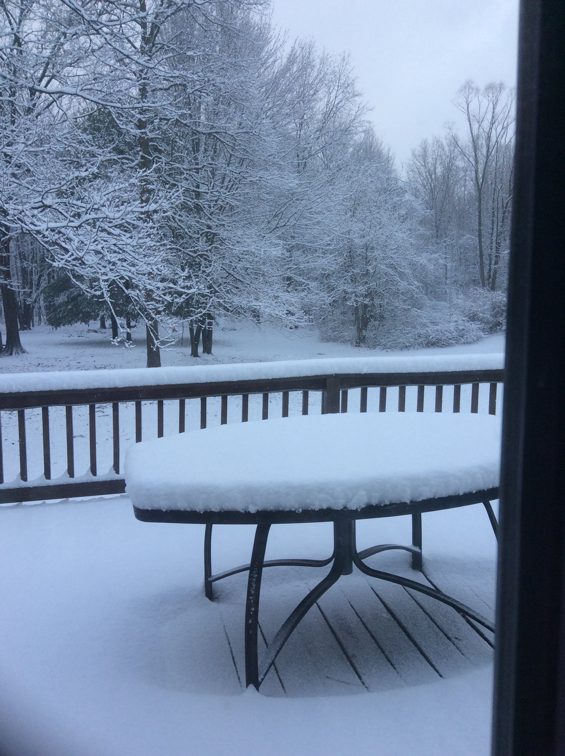
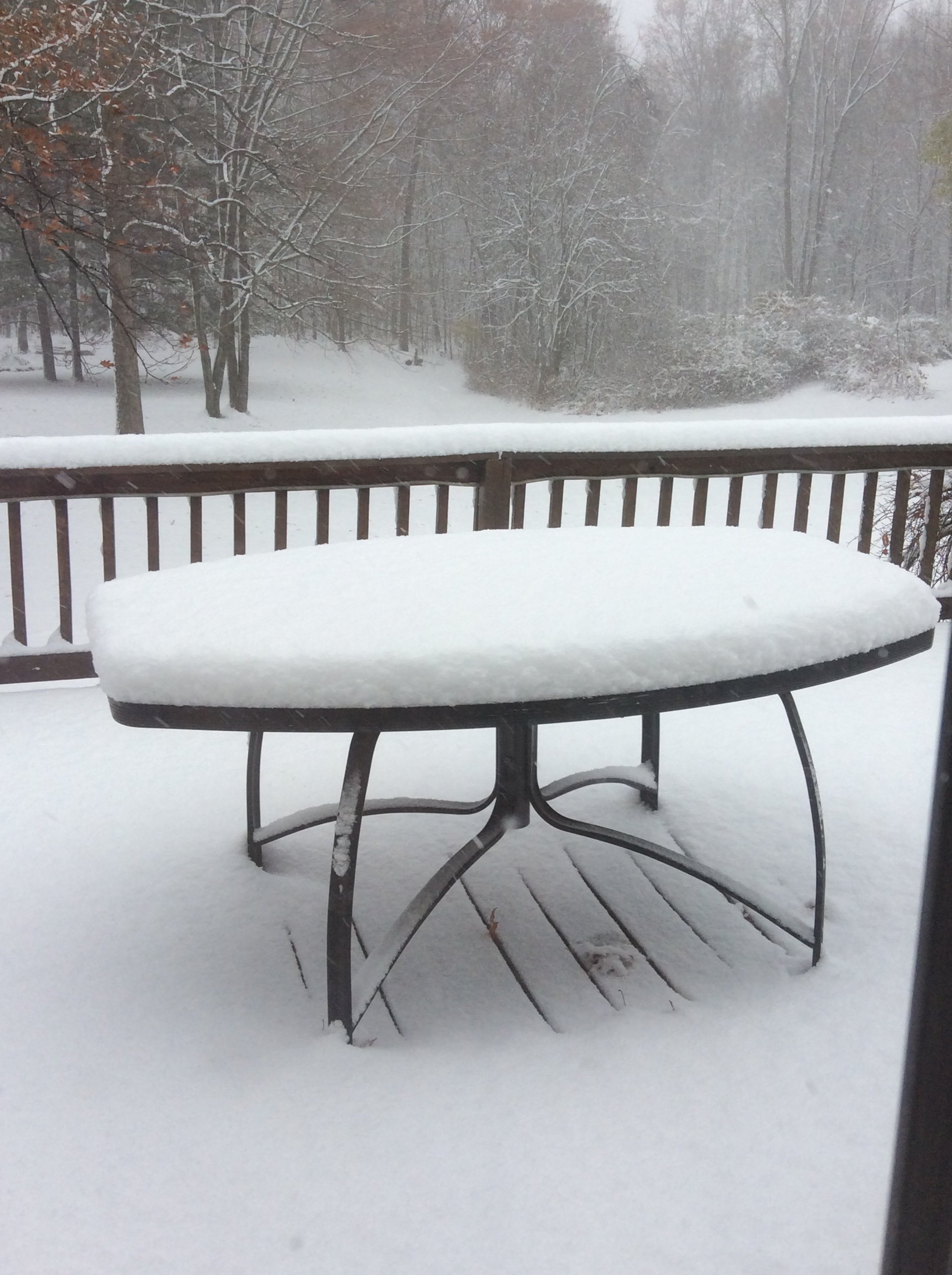
Have done well here locally; snowing most of the day since 8am. Had a nice moderate burst in the late morning which brought MBY ~2" by 1230/1. This last round may bring MBY to 3" total.
-
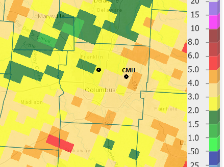
Ohio’s numbers have looked “better” than last week, trending between 6400-7800/day. But DeWine confirmed today that ~12k cases, since Monday, are being double checked. And most of them are likely positive. So some backdating or a bulk upload will increase Ohio’s number dramatically.
-
Record day in Ohio: 3,509. Prior high was last Saturday ~2,600.
-
ILN has the Frost/Freeze program up for most of the CWA. Coldest temperature so far this season: -CMH: 33 on 10/17 -CVG: 34 on 10/17 -DAY: 35 on 10/16
-
I mean, he's not wrong. We know geography is not in our favor, but we'll still whine and complain when the rug gets swept out from under us 72 hours out.
-
Just a few miles makes a huge difference, as always, but heavy rain has skirted around MBY all summer. August Month to Date: -MBY: 1.46" -CMH: 3.32" (~6-7 miles as the crow flies)
-
Ohio had its largest single day in reported cases since the pandemic began: 1,525.
-
My parents measured 4" in the western Youngstown area, but it sounds like it was very hit/miss around the area. Further south and east of the city picked up only 1".
-
Models kept waffling back and forth south of I-80. It looked like a last minute whiff, but my parents in Youngstown picked up a nice 4".
-
I know living up by the lake causes pretty significant differences in weather, but it's been a pretty stark difference the past few days between Central/NE Ohio. I talked to my parents in Youngstown yesterday and they mentioned how it had been snowing for a while and they were stuck in the mid-20s. Meanwhile, we had bright, sunny, clear blue skies and temps in the low 40s. This morning, I saw a lot of places dropped down into the mid-teens (some even in the single digits), and we only bottomed out in the low-mid 30s just before sunrise.
-
My parents ended up with just under 4" down in the Youngstown area. Didn't follow the Cleveland or Pittsburgh radar closely last night, but very surprised they saw that much.
-
CLE getting gutsy with accums.
-
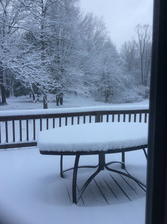
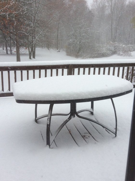
Youngstown did well as expected. My parents measured 8" with light snow still falling.
-
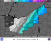
Updated map from CLE. Youngstown jackpot.
-
As long as they can stay all snow, Youngstown looks to be the OH jackpot.
-
http://www.weather.gov/cle/Winter_Weather Doesn't appear they have a map out yet. I would think tonight or tomorrow morning they'd release one.