WestMichigan
-
Posts
1,376 -
Joined
-
Last visited
Content Type
Profiles
Blogs
Forums
American Weather
Media Demo
Store
Gallery
Everything posted by WestMichigan
-
Almost a complete whiff here. I had a trace and that is it. At least the air is better today.
-
That's a picture I didn't need in my head today.
-
Almost expect to wake up to one of those every day right now. Since it started we haven't missed a day yet. Hoping some day this week will not have an air quality alert!
-
I told you you didn't want anything to do with what was north of you. Hanging out in the mid to high 400's overnight. Looking for relief later today.
-
You don't want what is just north of you
-
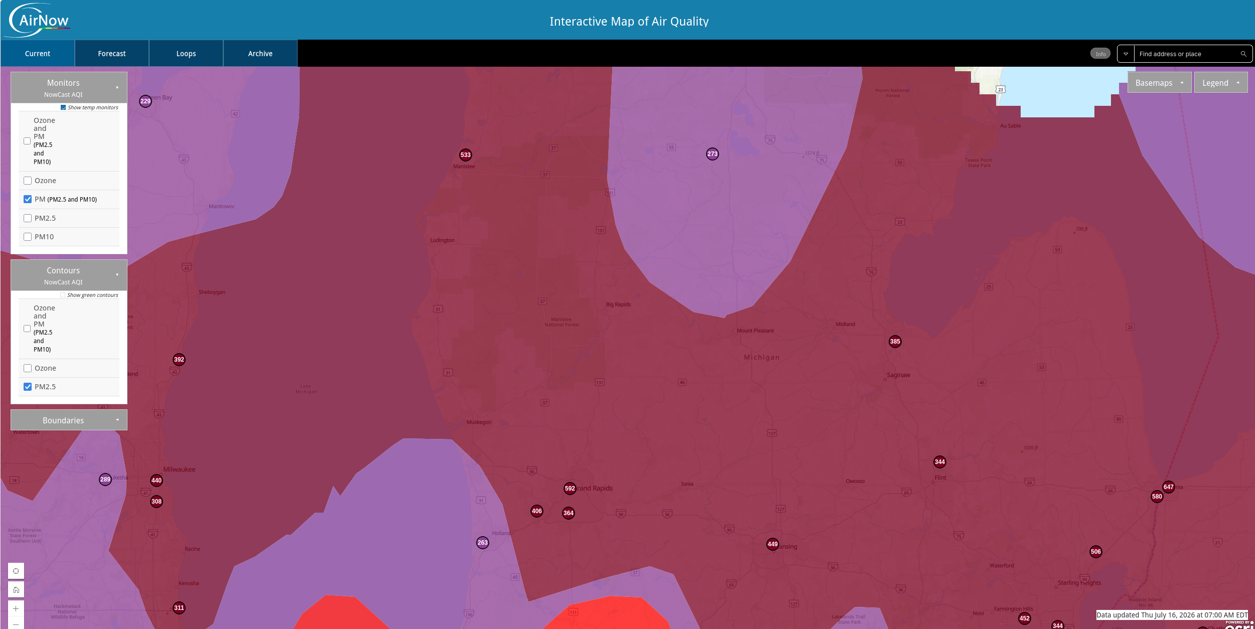
AQI is 590 at the closest reporting spot I could find. Just flat out nasty and not getting better any time soon.
-
Pretty nasty out there this morning

-
Still squeaking by with only upper air smoke here now but it is coming.
-
Is that Greenfield Vilage?
-
That is a crazy view of that fire. It is going to be a long summer out there.
-
How does that compare to the bank thermometer?
-
GRR is at -1.4° below normal heading into the final day.
-
Looks like we are going to finish June with a negative temperature departure for the month. A warm period at the beginning and end of the month couldn't overcome an incredibly pleasant middle part. It would take something like +42 departure today to bring us back to normal. It might feel like it with the humidity today, but that is a different story.
-
Looking like once it arrives the heat might be here to stay for a while according to the GFS.
-
Dew point was in the mid 30's this morning. Not something you normally see in this part of Michigan in the latter part of June.
-
A few days ago there were model forecasts of record low barometric pressures for the month of June out of the current system. Anyone know if that is verifying?
-
You've had more rain today that I have had all month.
-
I was just a period of short heavy rain and lightning/thunder when it came through my area.
-
I have a large one of those in my hay field. I lost one side of it about 5 years ago but it is massive. They are fragile but can turn into impressively large trees given the right environment.
-
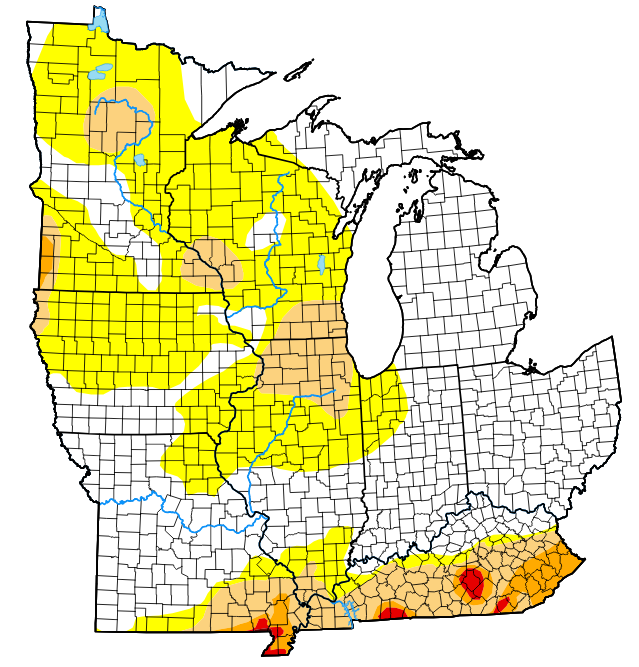
Pretty big jump in the D0 category this week.
-
The weekly drought monitor is going to start being of interest across a wide part of the sub given the dryness. We need some rain soon.
-
You aren't married are you. Wives tend not to be so fond of this idea.
-
There is a forum for the Philly area. Feel free to post Philly stats there. As for me, this month is -3.1 so far through May 26. I don't think this month will end up in the + departure column after a warm March/April.
-
We were +4.3 and +4.1 for that timeframe. It was a warm two months here for sure.
-
Amazing how different the UP is compared to the lower peninsula.