StormyClearweather
-
Posts
698 -
Joined
-
Last visited
Content Type
Profiles
Blogs
Forums
American Weather
Media Demo
Store
Gallery
Everything posted by StormyClearweather
-

Jan 15-16 Storm Threat Thread: The Return of Hope??
StormyClearweather replied to stormtracker's topic in Mid Atlantic
To your point, here's Nashville's disco tonight, FWIW: It`s snowing!!! All of our observation sites are reporting snow this hour with the heaviest falling along and south of I-40. We`ve already received a report of 0.5" of snow in Bellevue. Looking at the latest run of the HRRR tonight, boy did it come in hot. It paints a narrow band of higher totals ranging from 6-8 inches from Wayne County all the way through to our furthest NE counties on the Plateau, including Nashville. This solution would mean this event overachieves a little further north than originally forecasted and it pumps out more snow in any heavier bands that move through. This will be something to watch as the night progresses. There were talks of bumping up QPF along our northern border to match up with this latest run of the HRRR, but for now, we`re going to hold off on that to see what the next round of models show since this is only 1 run. Our sounding tonight shows a textbook snow event; big, healthy layer of moisture right in the snow growth region with all layers below 0 degrees Celsius. As for temperatures, they have tanked. Most everyone is sitting right around 20 degrees and dropping. We will be back with a full forecast update in the next several hours. In the meantime, stay safe, stay warm, and enjoy the snow! -
Jan 15-16 Storm Threat Thread: The Return of Hope??
StormyClearweather replied to stormtracker's topic in Mid Atlantic
Seems like noise to me more than anything. Maybe responding to the HRRR?
-
Jan 15-16 Storm Threat Thread: The Return of Hope??
StormyClearweather replied to stormtracker's topic in Mid Atlantic
ICON is slightly improved again, too. If I keep posting these, maybe it'll help me forget about the 0Z HRRR.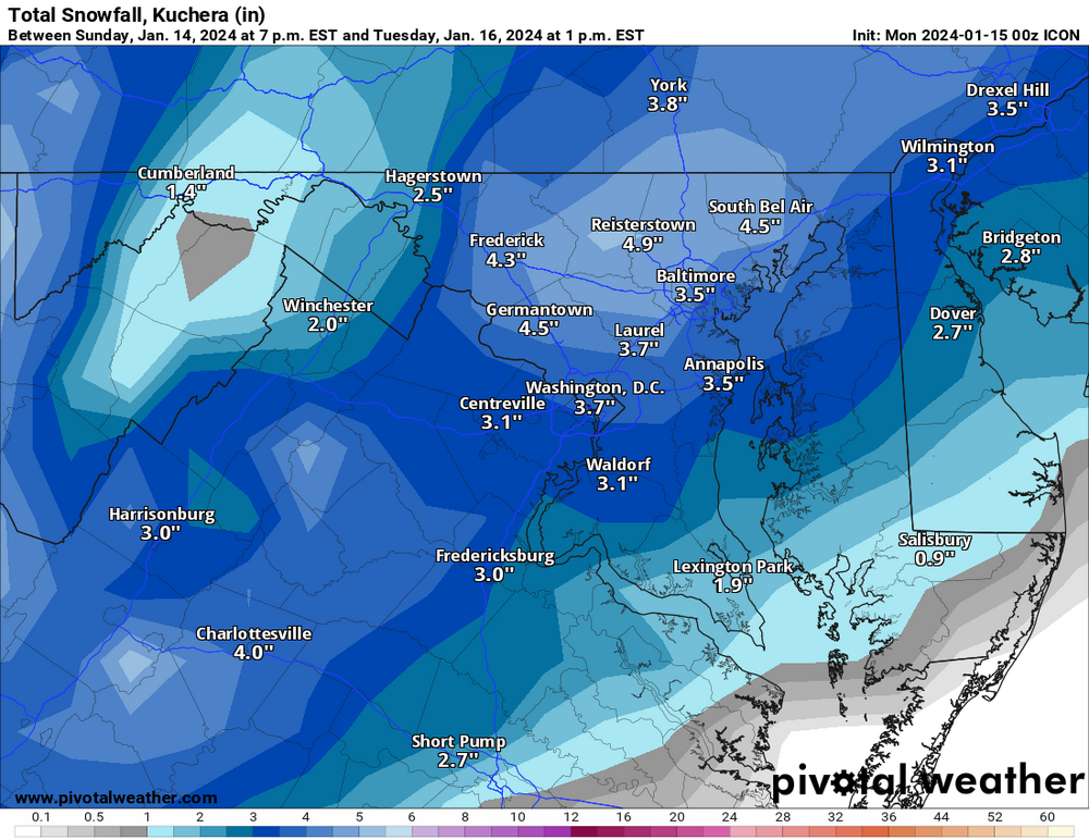
-
Jan 15-16 Storm Threat Thread: The Return of Hope??
StormyClearweather replied to stormtracker's topic in Mid Atlantic
Screw the NAM, I've got a new daddy now. HRW FTW!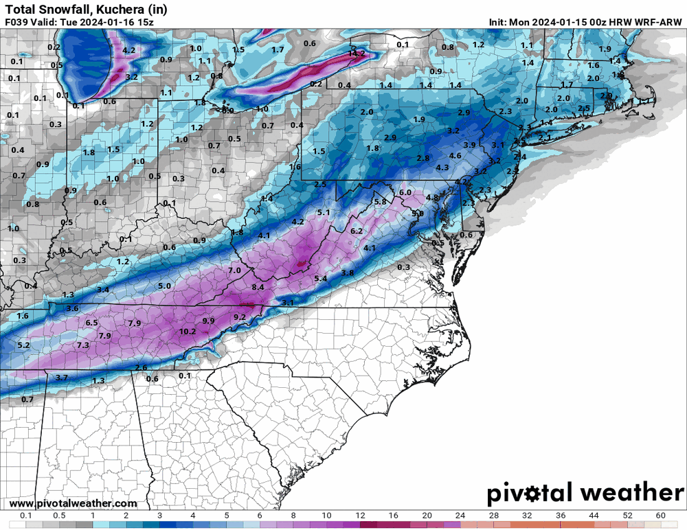
-
Jan 15-16 Storm Threat Thread: The Return of Hope??
StormyClearweather replied to stormtracker's topic in Mid Atlantic
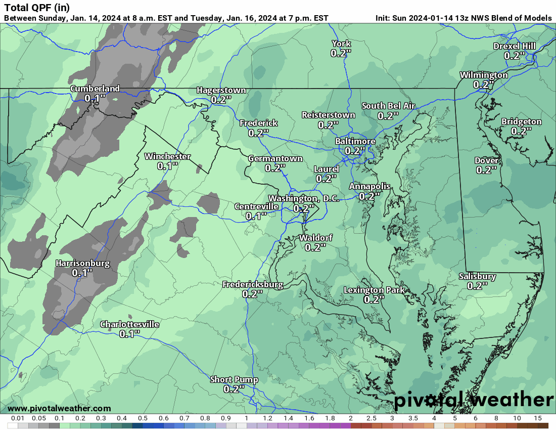
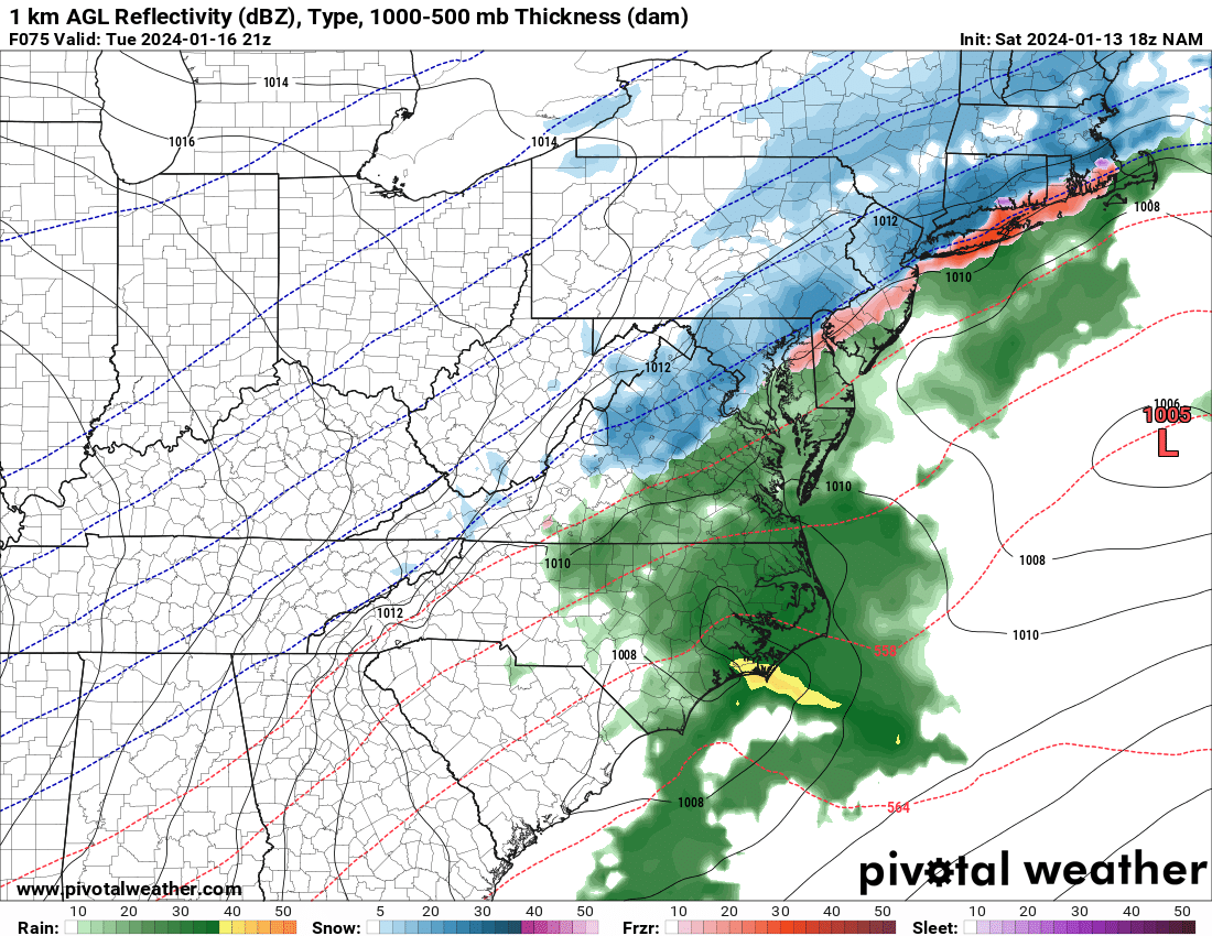
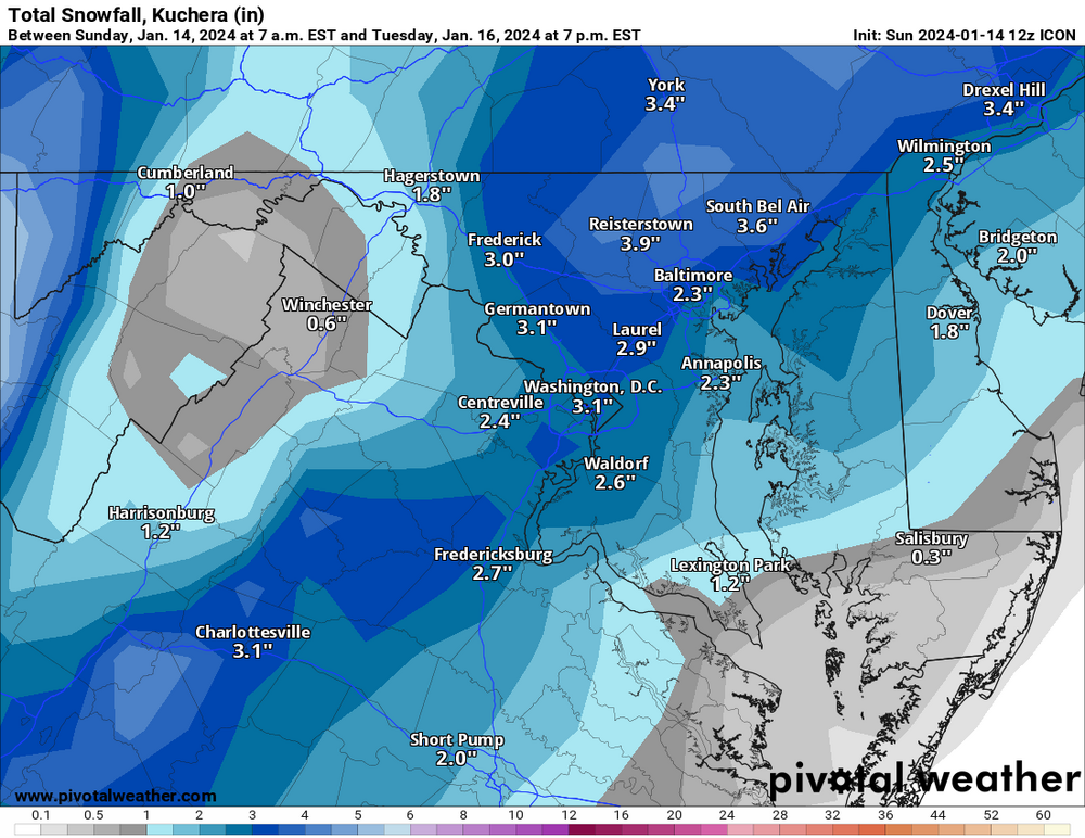
The short-term discussion was updated (pulled out the important piece) - guessing this means they'll be hoisted with the early morning update. THE SECOND PERIOD OF SNOW IS EXPECTED FROM MID MONDAY AFTERNOON INTO TUESDAY MORNING, AND THIS IS EXPECTED TO PRODUCE WIDESPREAD SNOW AMOUNTS OF 1 TO 4 INCHES WITH ISOLATED HIGHER AMOUNTS POSSIBLE. ADDITIONAL WINTER WEATHER ADVISORIES ARE EXPECTED TO BE ISSUED DURING THE NEXT FORECAST CYCLE TONIGHT TO ACCOUNT FOR THE SECOND PERIOD OF SNOW. WHILE INCONSISTENT IN DEPICTION IN THE MODELS, A MORE PERSISTENT HEAVIER BAND CLOUD RESULT IN A STRIPE OF UP TO 6 INCHES, ESPECIALLY IN SOME OF THE HIGHER ELEVATIONS. WARM AIR ALOFT DOES BEGIN TO INTRUDE LATER MONDAY NIGHT, ESPECIALLY SOUTHEAST OF I-95. THIS MAY RESULT IN MIXED PRECIPITATION, OR EVEN FREEZING DRIZZLE IF A DRY SLOT LESSENS PRECIPITATION RATES. -
Jan 15-16 Storm Threat Thread: The Return of Hope??
StormyClearweather replied to stormtracker's topic in Mid Atlantic
But then gains it back at 39 with a final (?) round of light to moderate snow. -
Jan 15-16 Storm Threat Thread: The Return of Hope??
StormyClearweather replied to stormtracker's topic in Mid Atlantic
Man that's beautiful.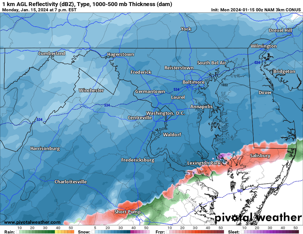
-
Jan 15-16 Storm Threat Thread: The Return of Hope??
StormyClearweather replied to stormtracker's topic in Mid Atlantic
18Z runs of all the models because I have nothing better to do.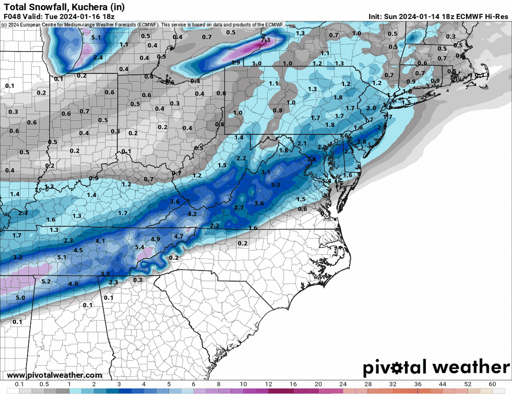
-
Jan 15-16 Storm Threat Thread: The Return of Hope??
StormyClearweather replied to stormtracker's topic in Mid Atlantic
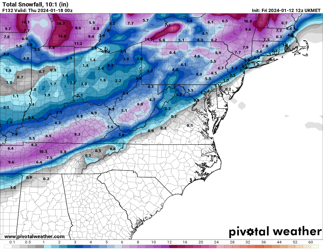
Euro with a healthier "finger" of very light precip late tonight, which is new from 12Z. -
Jan 15-16 Storm Threat Thread: The Return of Hope??
StormyClearweather replied to stormtracker's topic in Mid Atlantic
You love to see it.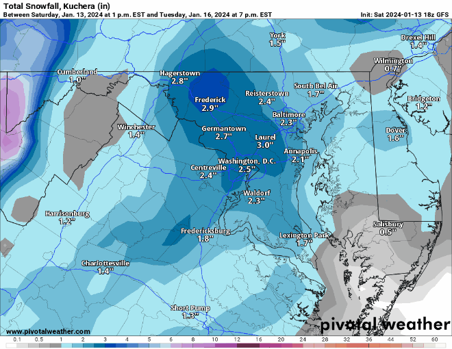
-
Jan 15-16 Storm Threat Thread: The Return of Hope??
StormyClearweather replied to stormtracker's topic in Mid Atlantic
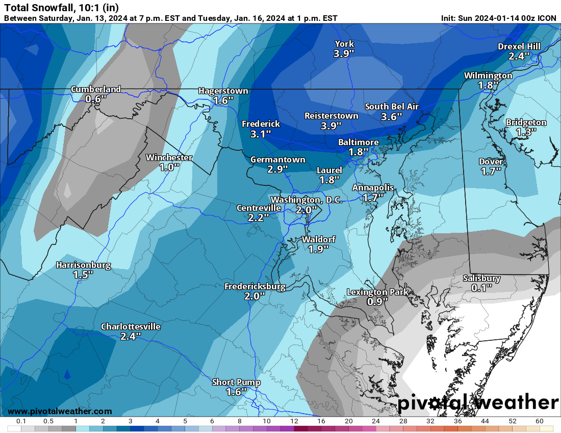
Happy 12Z ICON run, for those who celebrate: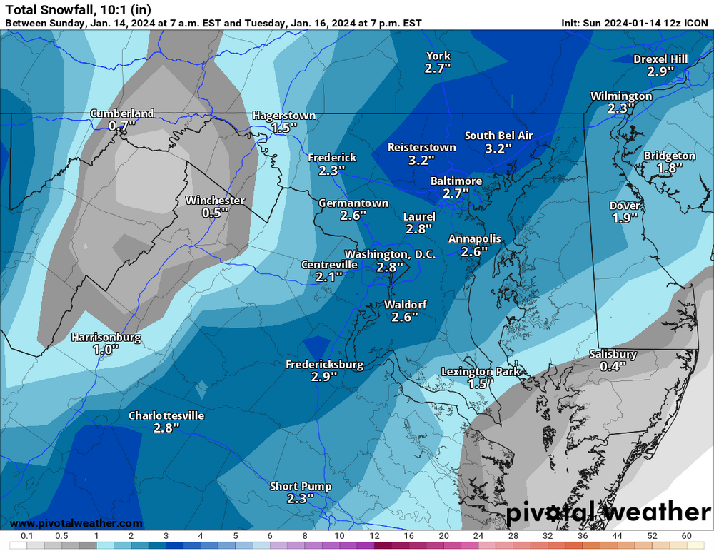
-
Jan 15-16 Storm Threat Thread: The Return of Hope??
StormyClearweather replied to stormtracker's topic in Mid Atlantic
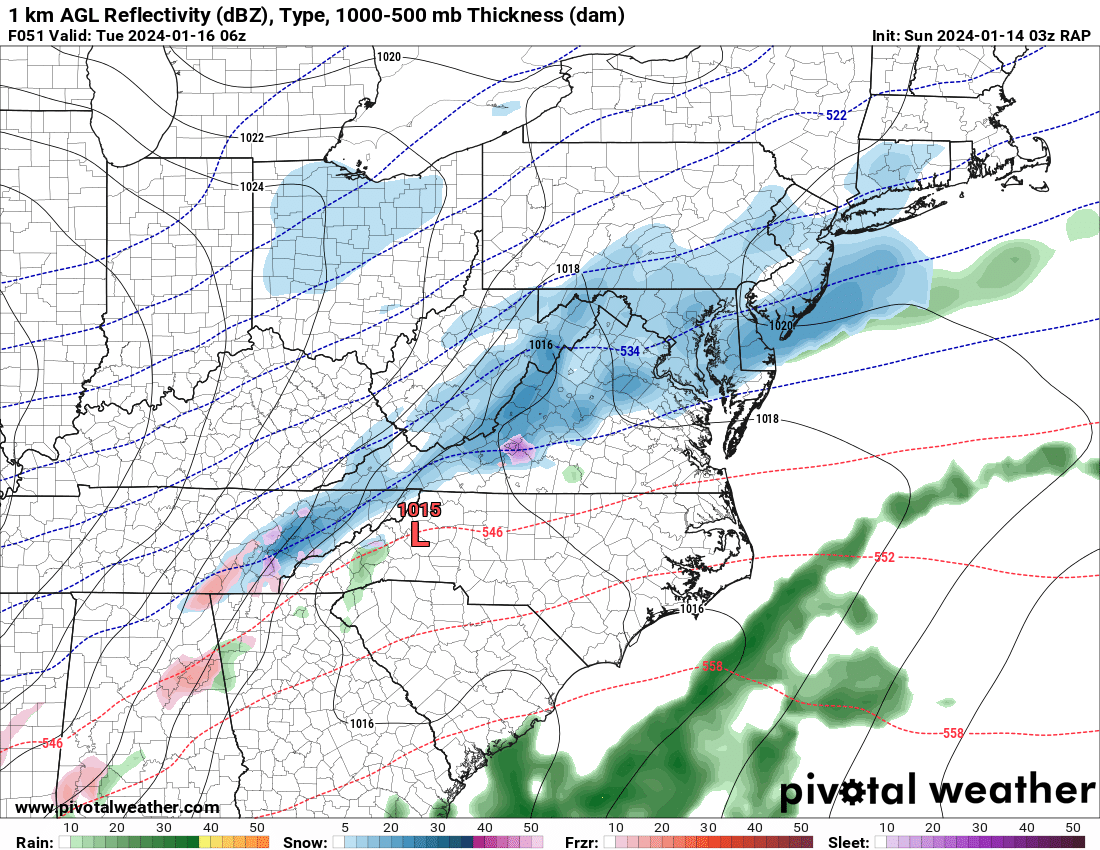
While y'all are getting NAMed, I'm geting... uh... RAPPED. (Had to be careful there.) Snow ongoing at this point.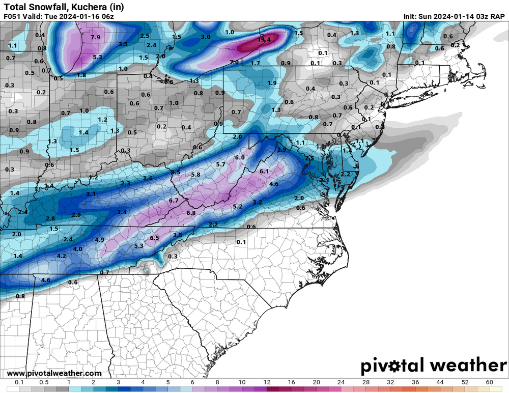

-
Jan 15-16 Storm Threat Thread: The Return of Hope??
StormyClearweather replied to stormtracker's topic in Mid Atlantic
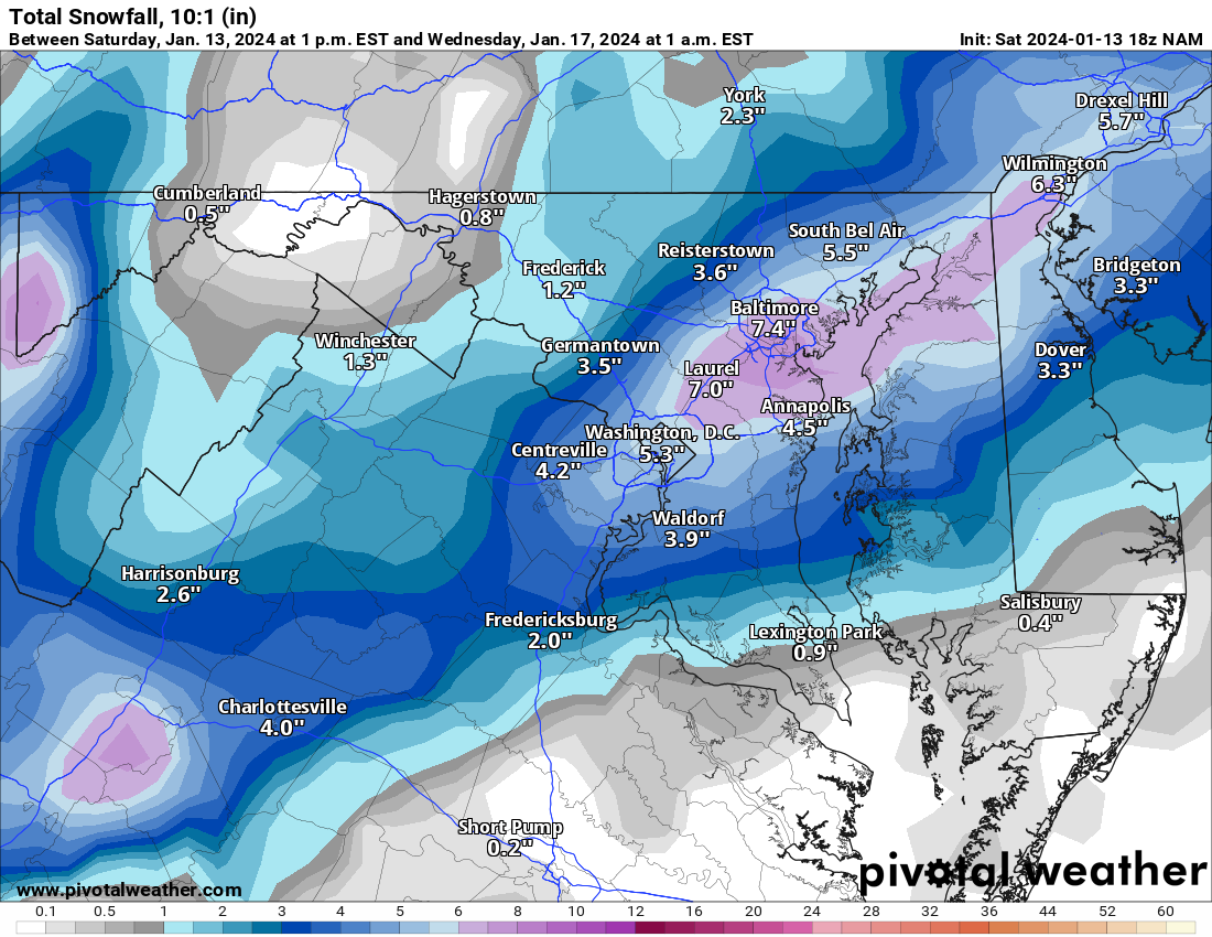
ok thx Anyway, ICON is fine:
-
Jan 15-16 Storm Threat Thread: The Return of Hope??
StormyClearweather replied to stormtracker's topic in Mid Atlantic
Not bad for a day's work. Better than the alternative anyway.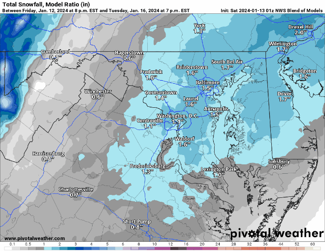
-
Jan 15-16 Storm Threat Thread: The Return of Hope??
StormyClearweather replied to stormtracker's topic in Mid Atlantic
Maybe because it's virga prior to? PV shows 0 QPF through 18Z.
-
Jan 15-16 Storm Threat Thread: The Return of Hope??
StormyClearweather replied to stormtracker's topic in Mid Atlantic
I hate this model and this obsession hobby.
-
Jan 15-16 Storm Threat Thread: The Return of Hope??
StormyClearweather replied to stormtracker's topic in Mid Atlantic
Lol a proper NAMing. It hits some of us with the first slot, and then hits us again Tuesday. "Hit" is a very relative term, of course.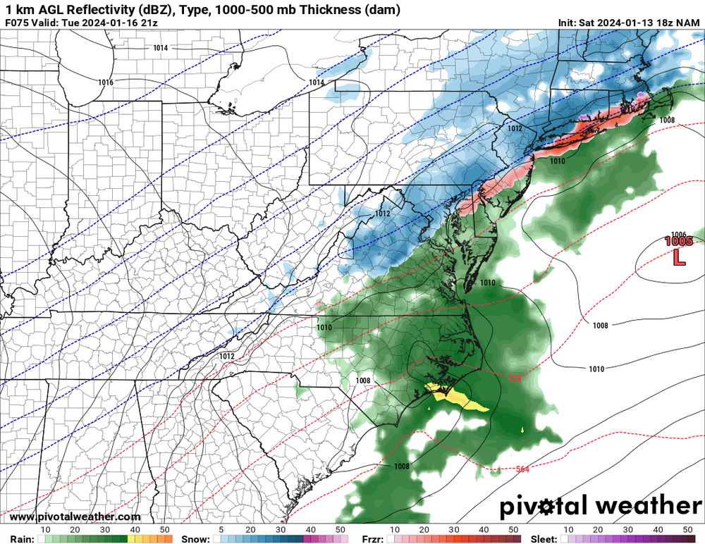
-
Being from Greenville and having moved up here a bit over two years ago, I can vouch for this. And to your point, where I lived in Greenville got 8 inches in a January 2022 storm. It was a fluke, proving they can still happen, but that was the sort of thing that happened roughly every 5-6 years, not that long ago.
-
Jan 15-16 Storm Threat Thread: Do we finally win or get Saltburned?
StormyClearweather replied to H2O's topic in Mid Atlantic
- 425 replies
-
- 2
-

-
- jinx
- kiss of death
- (and 3 more)
-
Jan Medium/Long Range Disco 2: Total Obliteration is Coming
StormyClearweather replied to Jebman's topic in Mid Atlantic
That's the 0Z Here's 12Z.
-
Jan Medium/Long Range Disco 2: Total Obliteration is Coming
StormyClearweather replied to Jebman's topic in Mid Atlantic
Ukie
-
Jan Medium/Long Range Disco 2: Total Obliteration is Coming
StormyClearweather replied to Jebman's topic in Mid Atlantic
That reminded me of the "AI" version of the Euro, which you can find here: https://charts.ecmwf.int I have no idea how accurate it is and all that, but it ran at 0Z and certainly looks better than the base Euro to my untrained eye. You can read more about it here: https://deepmind.google/discover/blog/graphcast-ai-model-for-faster-and-more-accurate-global-weather-forecasting/ Edit: The screenshot cut off, but that's at 18Z on Tuesday.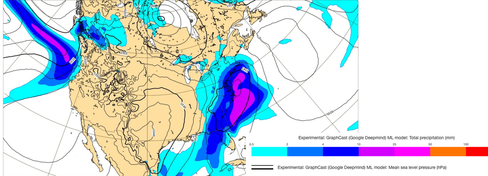
-
Jan Medium/Long Range Disco 2: Total Obliteration is Coming
StormyClearweather replied to Jebman's topic in Mid Atlantic
Understandably, the focus is on Tuesday, but can anyone speak to how things are looking as we head into late month/Feb.? I don't remember seeing much talk about the longer term after the 12Z runs, but maybe I missed it. -
Jan Medium/Long Range Disco 2: Total Obliteration is Coming
StormyClearweather replied to Jebman's topic in Mid Atlantic
According to the GFS many of us go below freezing this Sunday morning and are still below freezing next Sunday at 18Z and counting. Seems unlikely, but would be wild. -
Jan Medium/Long Range Disco: Winter is coming
StormyClearweather replied to stormtracker's topic in Mid Atlantic
I feel like Jan. 2022 (or at least the first system that month) was a little like this. Granted, I had just moved here, so maybe I just wasn't paying attention. Either way, it was fun.