StormyClearweather
-
Posts
716 -
Joined
-
Last visited
Content Type
Profiles
Blogs
Forums
American Weather
Media Demo
Store
Gallery
Everything posted by StormyClearweather
-
I checked GEFS maxes to at least have some hope of a respite, but nope - also shows straight 90s through the end of the run.
-

Late Feb/March Medium/Long Range Discussion
StormyClearweather replied to WinterWxLuvr's topic in Mid Atlantic
Are you seriously asking for people to take fault for failing to accurately predict the future weeks in advance, despite using the best science and guidance available at the time, all because you wanted more snow than you've gotten? Get over it. If you need that kind of accuracy, you need to stay away from this thread and stick to listening to the nice man on the news for your weather forecasts. With long-range forecasting comes great uncertainty. If you can't handle it, move on. -
The Weekend Rule? Saturday 2/17 - The Icon Storm
StormyClearweather replied to DDweatherman's topic in Mid Atlantic
https://x.com/nwsstlouis/status/1758627226227277925?s=46 There’s still hope? -
The Weekend Rule? Saturday 2/17 - The Icon Storm
StormyClearweather replied to DDweatherman's topic in Mid Atlantic
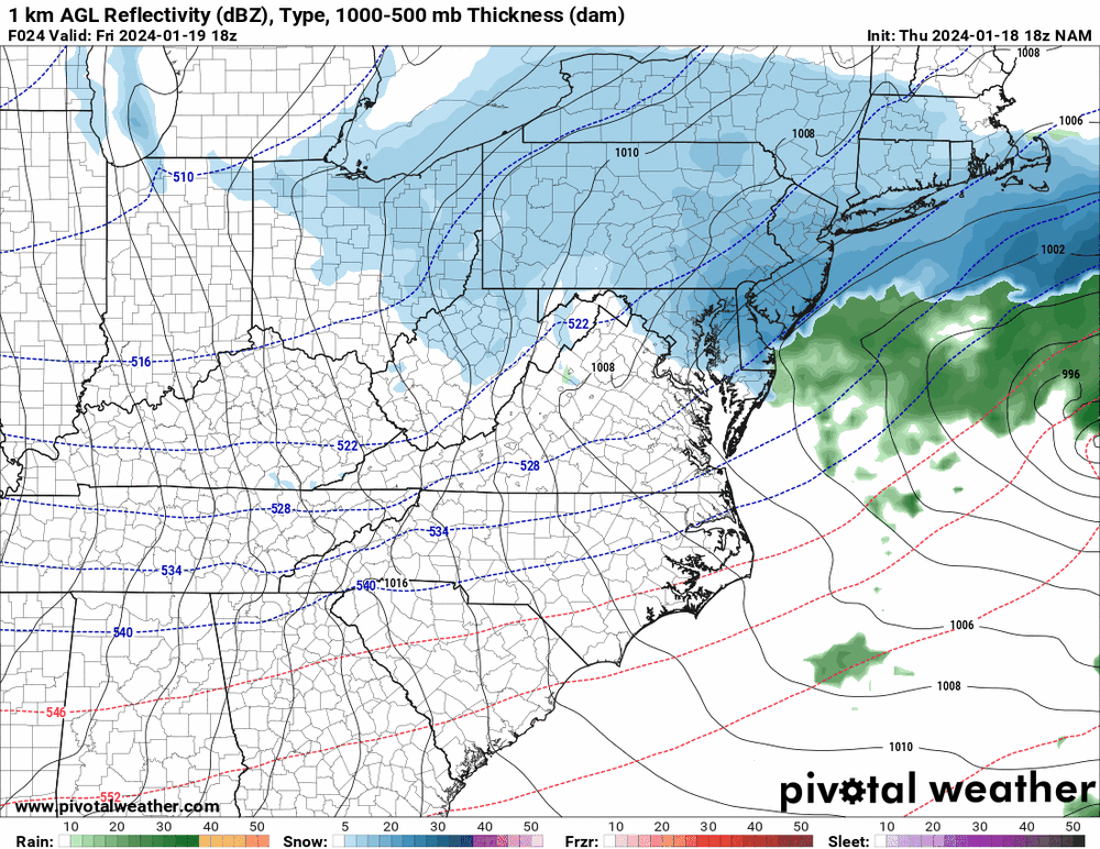
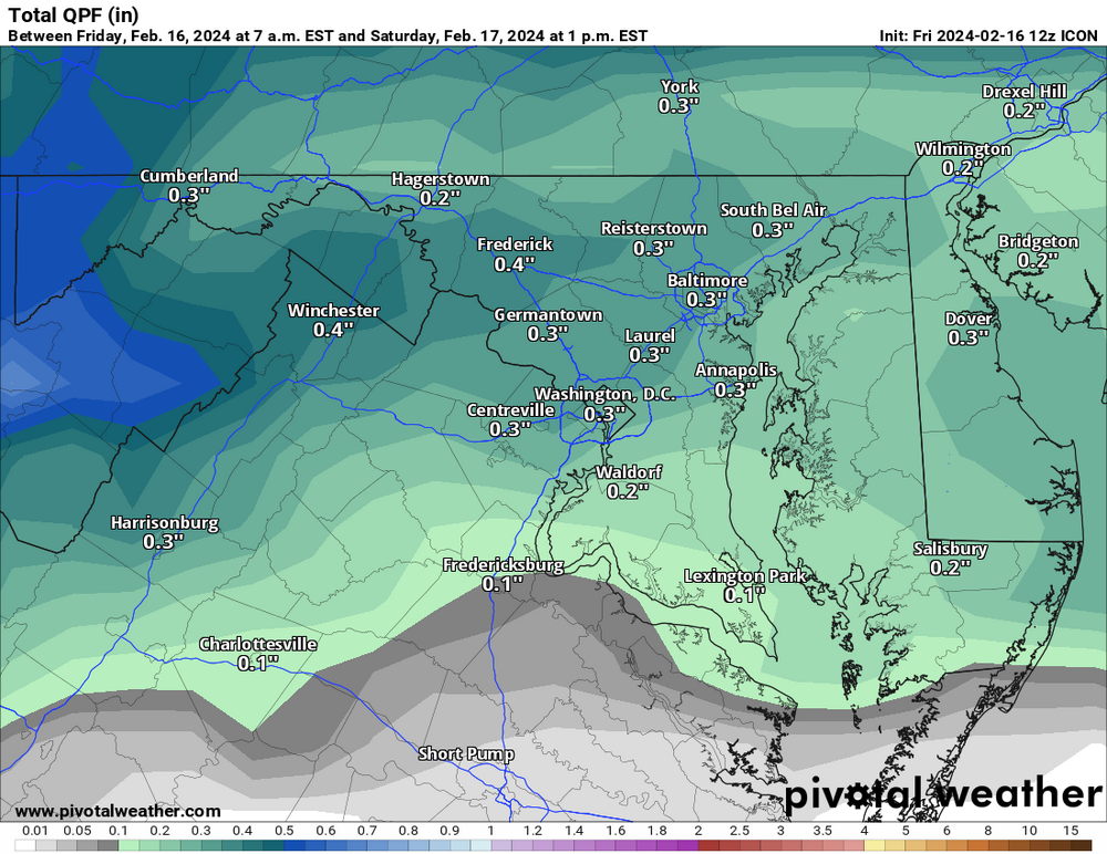
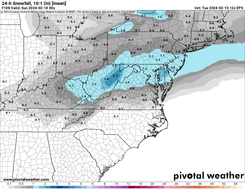
I know its value is limited at this range, but since I like what it shows, I'm sharing it anyway.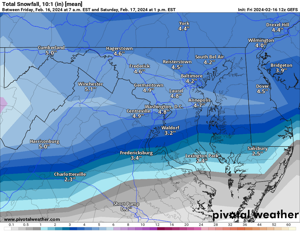
-
The Weekend Rule? Saturday 2/17 - The Icon Storm
StormyClearweather replied to DDweatherman's topic in Mid Atlantic
ICON. Noise changes mostly but a little improved from 6Z, I think.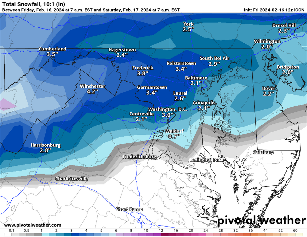
-
The Weekend Rule? Saturday 2/17 - The Icon Storm
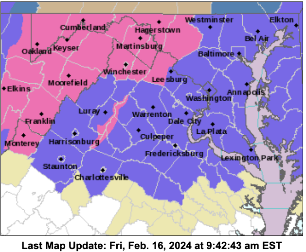
StormyClearweather replied to DDweatherman's topic in Mid Atlantic
-
The Weekend Rule? Saturday 2/17 - The Icon Storm
StormyClearweather replied to DDweatherman's topic in Mid Atlantic
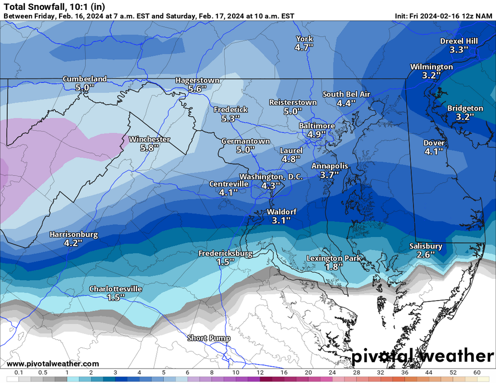
3K is pretty similar, too.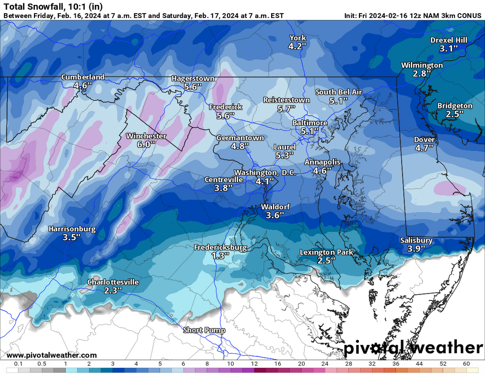
-
The Weekend Rule? Saturday 2/17 - The Icon Storm
StormyClearweather replied to DDweatherman's topic in Mid Atlantic
-
The Weekend Rule? Saturday 2/17 - The Icon Storm
StormyClearweather replied to DDweatherman's topic in Mid Atlantic
Ignore those other silly models. Everyone knows the HRW WRF-ARWHGLTLSGBRBZ is the bee's knees.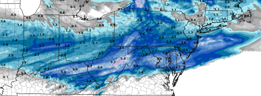
-
The Weekend Rule? Saturday 2/17 - The Icon Storm
StormyClearweather replied to DDweatherman's topic in Mid Atlantic
Not sure if this was posted or not. Looks good to me!
-
The Weekend Rule? Saturday 2/17 - The Icon Storm
StormyClearweather replied to DDweatherman's topic in Mid Atlantic
-
The Weekend Rule? Saturday 2/17 - The Icon Storm
StormyClearweather replied to DDweatherman's topic in Mid Atlantic
-
2024 Valentines Day Who the Hell Knows - Comeback Thread
StormyClearweather replied to DDweatherman's topic in Mid Atlantic
Of course they are. Hopefully, people here are smart enough to not take these maps literally or as a forecast. But they still lend credibility to a trend toward snowier for many. -
2024 Valentines Day Who the Hell Knows - Comeback Thread
StormyClearweather replied to DDweatherman's topic in Mid Atlantic
Ahem
-
April 8th Eclipse- Last Easy One To See In My Lifetime
StormyClearweather replied to Interstate's topic in Mid Atlantic
Was still living in Greenville, SC for the last one, lucky enough to be right in the middle of the path of totality. It was one of the most amazing experiences I've ever personally had. Even my husband, who is not easily impressed, was stunned silent. Nothing can beat watching it from your backyard, but it's definitely worth a trip to see it at least once! -
2024 Valentines Day Who the Hell Knows - Comeback Thread
StormyClearweather replied to DDweatherman's topic in Mid Atlantic
I don't mind this. Even if it winds up being snow TV.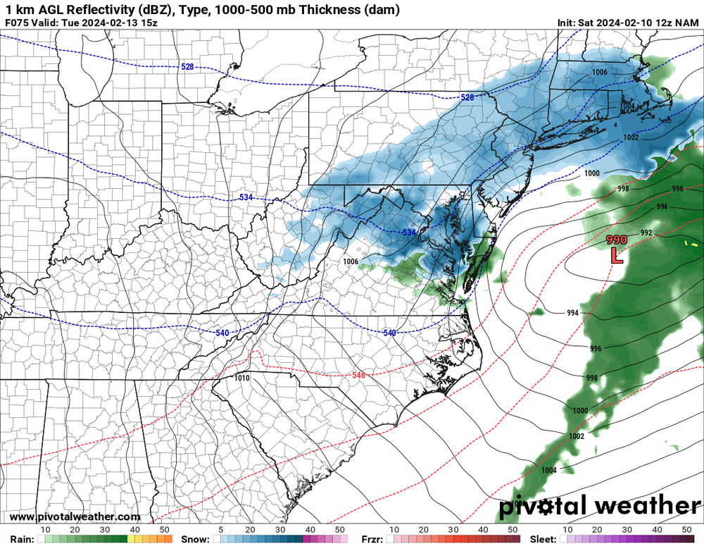
-
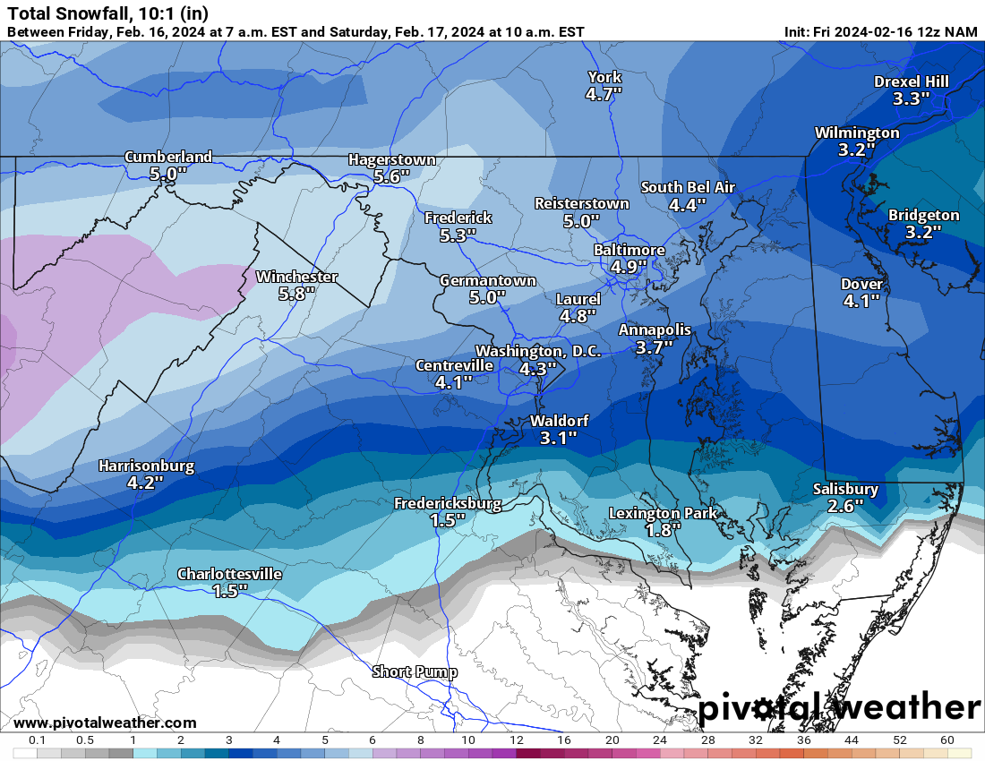
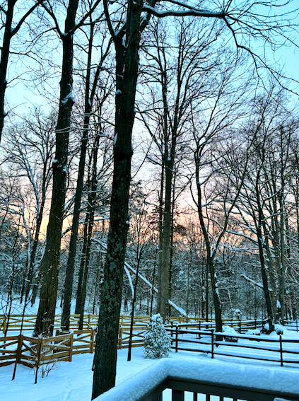
Moving up here from SC in 2021, between Tuesday's storm and today's storm, this is the most snow I've seen on the ground... ever. Don't take it for granted! Most of the SE Forum would kill for this.
-
Ya love to see it! Posted by NWS LWX about 10 minutes ago.

-
Have you measured lately? You're close enough to me that I find it easier to use yours than walk outside and do it myself.
-
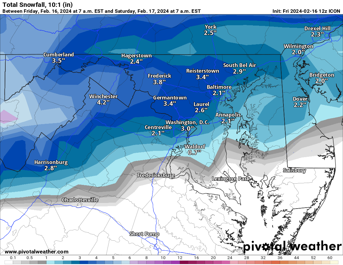
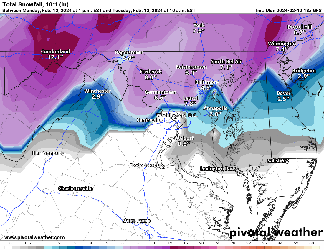
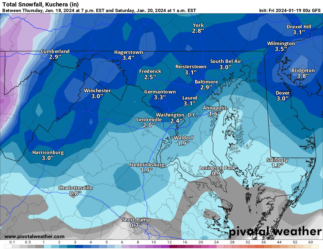
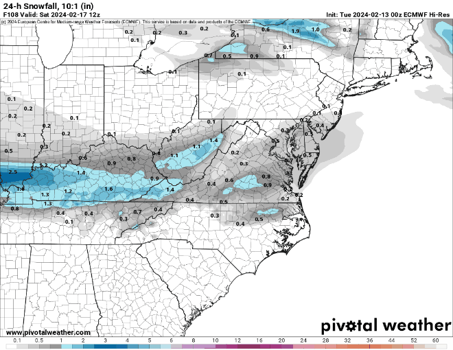
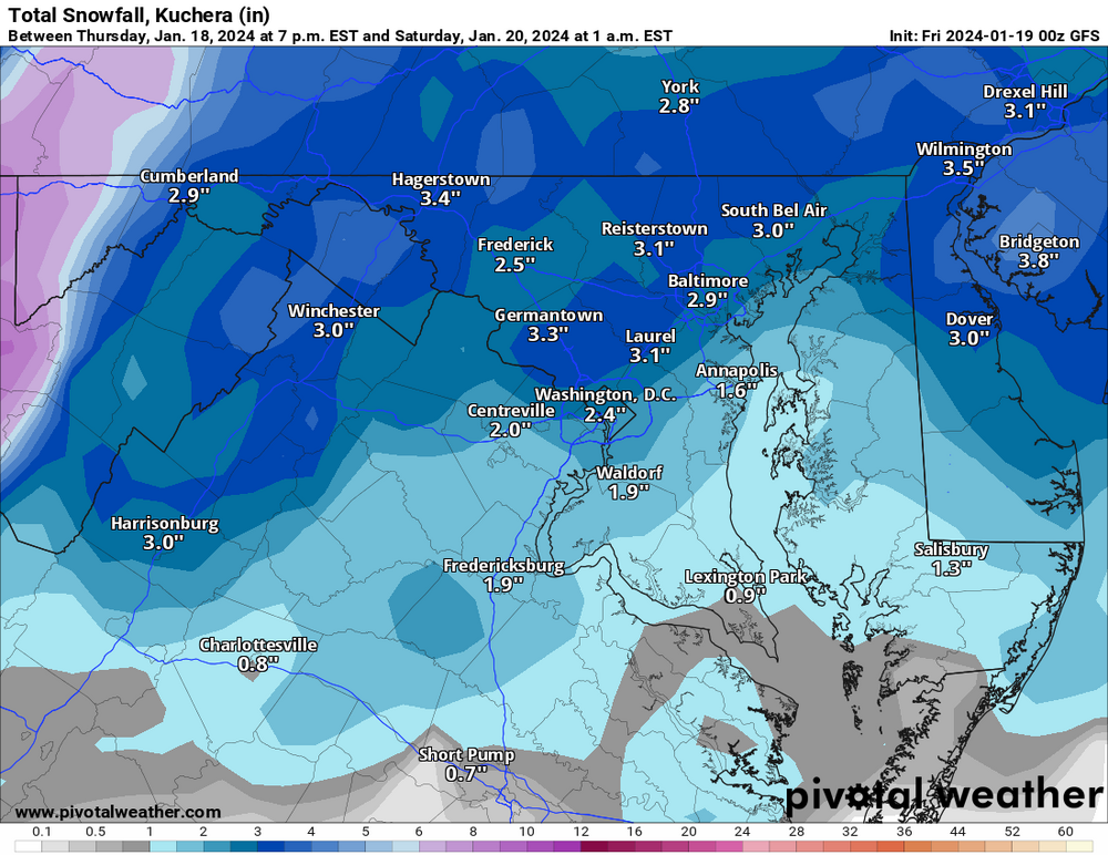
CMC is a similar 2-4.
-
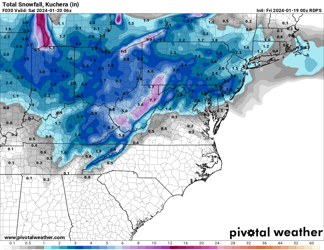
But what about conservatives? GFS Snow Map (see? this wasn't a wasted post)
-
It's aight.

-
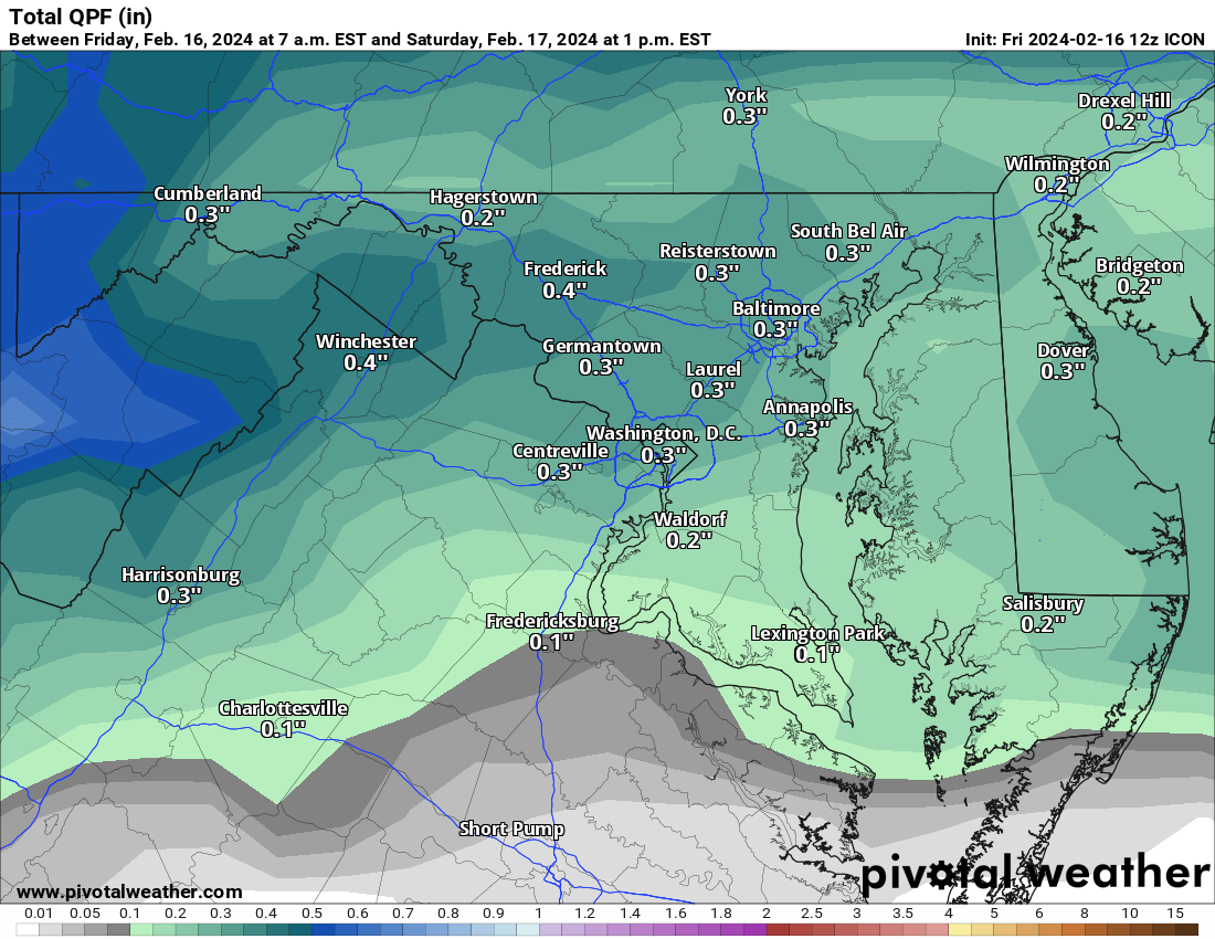
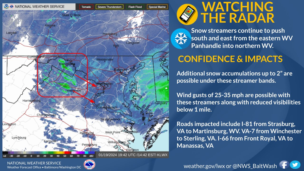
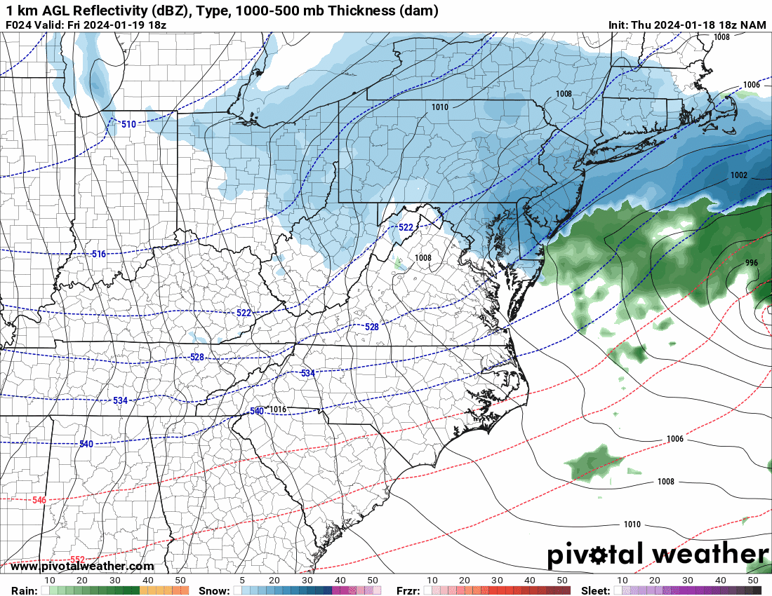
Models don't appear to be picking up the "precip" streaming overhead, while it looks like HRRR takes a couple of hours after precip starts for it to start hitting the ground. Maybe, just maybe, the stuff falling now helps moisten the column, reducing virga when the real stuff gets here?
-
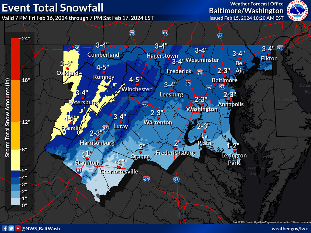
Latest from LWX: PRECIP ALOFT HAS BEEN NOTED ON REGIONAL 88DS AND GPM MICROWAVE IMAGER OVER THE PAST 6 HOURS ACROSS NORTH CENTRAL AND NORTHEAST MARYLAND, BUT NO SFC OBS HAVE SHOWN ANYTHING REACHING THE GROUND AS LOW-LEVEL DEWPOINT DEPRESSIONS REMAIN AT OR ABOVE 20C PER 19/00Z IAD SOUNDING. NEW SET OF 18Z GUIDANCE DOES NOT SHOW ANY APPRECIABLE CHANGES TO SPEAK OF ABOUT FRIDAY'S FORECAST. STRONG SHORTWAVE-TROUGH AND ASSOCIATED VORT MAX WILL PASS THROUGH THE AREA AROUND MIDDAY FRI SUPPORTING STRONG LIFT TO GENERATE SNOW. HOWEVER, THE SYSTEM WILL LACK DEEP MOISTURE TO MAKE THIS A MAJOR STORM IN ADDITION TO BEING FAIRLY PROGRESSIVE. BLENDED TPW PRODUCT SHOWS PWAT VALUES GENERALLY LESS THAN 0.4 INCHES WITH NO SIGNIFICANT AREAS OF HIGHER MOISTURE LIKELY TO ADVECT IN. FOR BIGGER STORMS, TYPICALLY 0.5 INCH PWAT VALUES AND HIGHER ARE NEEDED UNLESS IS A SUPER COLD AIR MASS. ALL OF THESE FACTORS, IN ADDITION, LACK OF A CLOSED 850-700 MB CIRCULATION, SUGGEST WARNING LEVEL SNOW ACCUMULATIONS SEEM UNLIKELY. OVERALL, THE FORECAST AND SNOW AMOUNTS SEEM ON TRACK AND WILL REMAIN UNCHANGED TONIGHT. FCST SNOW AMOUNTS ACROSS THE FAR SOUTHERN AREAS LIKE FREDERICKSBURG VA MAY BE SOMEWHAT OVERDONE DUE TO LACK OF MID-LEVEL SATURATION WHICH MAY INHIBIT SNOWFALL RATES. IT STILL LOOKS LIKE THE HEAVIEST ACCUMULATIONS OUTSIDE OF THE MOUNTAIN AREAS WILL OCCUR ALONG AND NORTH OF THE I-70 CORRIDOR WITH UP TO A FOOT POSSIBLE ACROSS THE APPALACHIAN REGION. HEAVIEST ACCUMULATION IS EXPECTED IN THE 13Z-19Z FRI TIME FRAME.
-
Me likey.