

EastonSN+
-
Posts
6,846 -
Joined
-
Last visited
Content Type
Profiles
Blogs
Forums
American Weather
Media Demo
Store
Gallery
Posts posted by EastonSN+
-
-
24 minutes ago, Rjay said:
Bad setups ftw!
We earned this one.
-
 2
2
-
-
Still coming down good here. Last measurement was 25 mins ago. Hopefully making it to 8
-
1
-
-
20 minutes ago, donsutherland1 said:
Central Park's next measurement is at 1 pm. The 7 am figure was 1.2". Central Park should be at or over 4".
I really hope they measure before too much compaction/melting.
-
2
-
-
4 minutes ago, Brian5671 said:
I have 6 on my deck but still going. There could be compaction involved-I didn't do a snowboard or anything.
Yeah I do several measurements across the yard and deck. Grass had more than deck oddly.
-
1
-
-
2 minutes ago, NittanyWx said:
Wilton, CT - 11:35
32/32
7.5"
8 minutes ago, Brian5671 said:Being inland sure makes a difference. About 6 here
Hey did you measure for Fairfield, I am in line with Wilton at 7.5. I am only 1.5 miles from the Fairfield boarder.
-
1
-
-
1 minute ago, LibertyBell said:
But that's basically the entire city. Even Central Park, although it's grass, it's surrounded by UHI, so you'll usually get higher numbers in surrounding areas outside of the city (except here to the south near the ocean lol.)
No I get that but in this case there is no denying CPK would have had more snow if the bands were east or west. That's all I am saying.
-
1
-
-
1 minute ago, LibertyBell said:
Not all of Long Island is getting "blitzed" though, here it's a nice light to moderate snow. We'll get to 4" and there's an outside shot of 6"
I wouldn't call it "bad luck" I just think it's the natural evolution of the storm.
I don't believe in "luck" as you probably know.
Yeah I get it. Just gets me mad that a record keeps going when a small subsidence zone caused it. It would be another thing if it turned to rain or was 35 degrees.
-
1
-
-
Just now, ILoveWinter said:
Def a beautiful snowy scene in the UWS but not to sound like a downer, we clearly missed out on the best rates. I'll of course take it as it's still better than anything in the past few years!
Yeah bad luck for Manhattan.
-
1 minute ago, Krs4Lfe said:
Yeah still moderate to heavy snow in Queens. I still think Central Park can make it to 5” before it ends in 2 hours. What do you think?
I wish they would provide an update already.
-
Just now, kat5hurricane said:
Heat Island, Concrete Jungle, New Puddle City...

Doesn't matter they measure at CPK.
-
1 minute ago, mikem81 said:
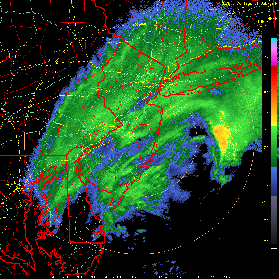
These are the good returns. Seems like another hour of heavy stuff east of NYC and 2-3 hours Suffolk east
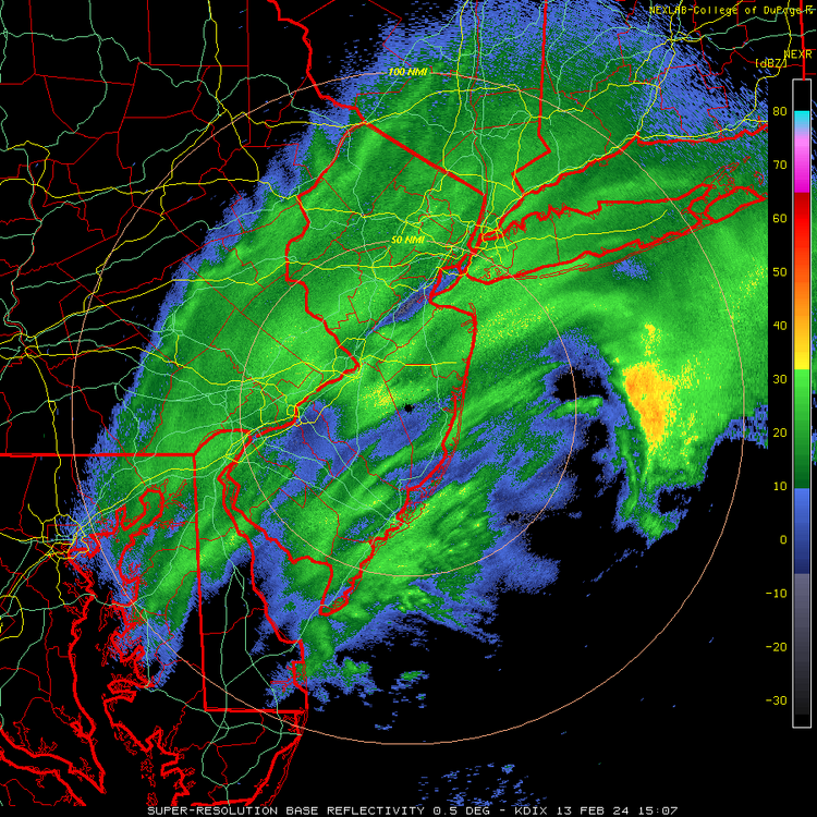
Awesome radar where to you get?
-
Just now, bluewave said:
It only got down to 33° after it had been snowing for several hours. So not having cold air in place ahead of a storm is going to reduce accumulations to some extent especially in such an urbanized setting like NYC. Where the banding sets up is always an issue but it helps to maximize accumulations if we are colder when the storm starts.
Right I get that if it were 19 degrees like the blizzard of 96 it would have accumulated quicker. However, what I am saying here is if everyone else gets say 6 inches, yet CPK gets 2.9, an under 3 inch record is misleading. The fact that CPK only got 2.9 has nothing to do with temps when all other areas with same or higher temps received more. The under 3 inch record would be very misleading.
-
1
-
-
Lol we need someone on this forum to go over to CPK and measure/provide snow rates.
-
 1
1
-
-
14 minutes ago, hooralph said:
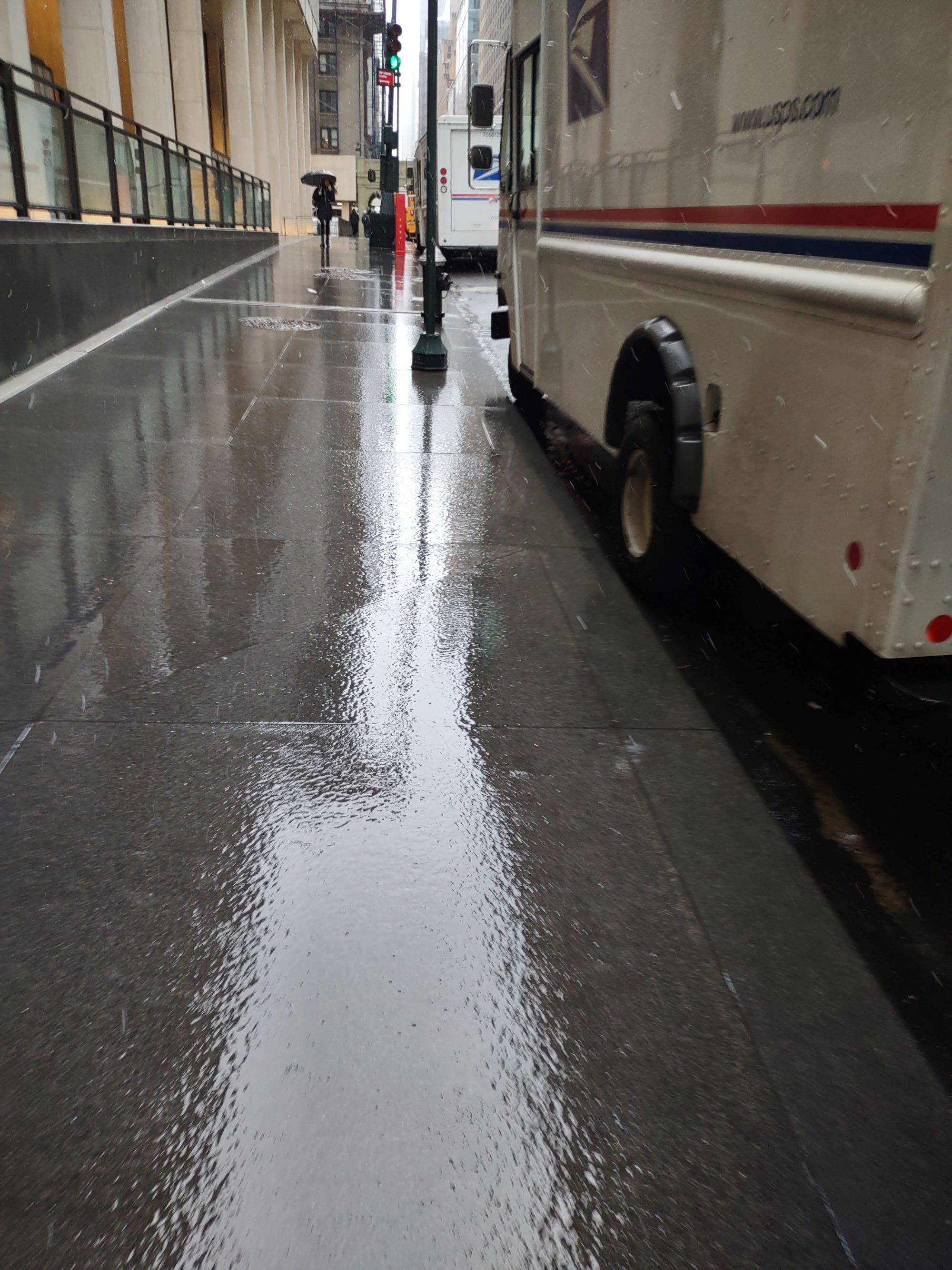
WOW. Totally different world downtown. NOTHING.
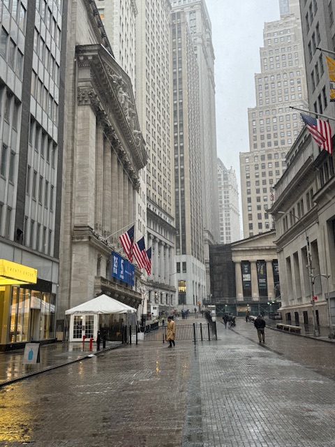
Concrete.
-
5 minutes ago, bluewave said:
Plus it was 40° when the precip started and the ratios weren’t the greatest so this would have been more snow if we had a cold air mass in place ahead of the storm.
I understand however I have to disagree to an extent. When all areas around are getting heavier banding it's bad luck. 33 is plenty cold enough. If the banding was a little east or west CPK would easily have 6 inches with this storm.
This is where records can be misleading. I would agree if CPK was 35 or all of LI had no snow.
-
3 minutes ago, kat5hurricane said:
Yep, the real heavy stuff will be reserved for you guys on L.I. and north and west of the city. You're in a prime spot to get blitzed.
It's truly shocking how even when everything lines up with temps/track somehow CPK misses out.
At least it's NOT A TEMPS ISSUE.
-
1
-
-
10 minutes ago, bluewave said:
Looks like Central Park getting closer to ending its under 2” streak.
Temps were colder than expected, unfortunately the heaviest banding so far was east of CPK otherwise CPK would likely be at 4.
-
2 minutes ago, SBUWX23 said:
um returns are fine, look at KDIX
Thanks. Channel 4 about an hour ago said the heaviest will be from 9 to 11 for NYC.
-
Just now, bluewave said:
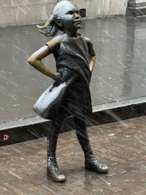
Pretty winter scenes from Queens Blvd.
Will the heavier banks make it back to CPK? Heaviest seems easy.
-
1 minute ago, MJO812 said:
Looks like bright banding is going towards LI.
Yeah if CPK under performs will be due to banding NOT temps.
-
1
-
-
Hopefully heavier snow gets back to CPK.
-
8 hours ago, LibertyBell said:
1958 - Snow blanketed northern Florida, with Tallahassee reporting a record 2.8 inches. A ship in the Gulf of Mexico, 25 miles south of Fort Morgan AL, reported zero visibility in heavy snow on the afternoon of the 12th. (12th-13th) (The Weather Channel)
1960 - A snowstorm in the Deep South produced more than a foot of snow in Louisiana, Mississippi and Alabama. (David Ludlum)
Wow there was heavy snow in the Gulf of Mexico as late as 1958? I thought this was something that only happened 100+ years ago.
Think 1993 as well.
-
Phase 1
-
1
-
-
Looks like we have till the 24th or so, not bad.

-
1
-
2/13 Significant/Major Winter Storm Discussion & Observations
in New York City Metro
Posted
Thats sad. Wish they took it more seriously.