NEOH
-
Posts
3,366 -
Joined
-
Last visited
Content Type
Profiles
Blogs
Forums
American Weather
Media Demo
Store
Gallery
Everything posted by NEOH
-
Thanks for posting. Definitely an interesting read.
-
CLE has definitely been in the rain jackpot zone. My yard is starting to dry, but still nice and green. We've had close to CLE's total in this area... but most of that fell over a short amount of time. It doesn't take more than a couple days of sun to dry out the clay soil around here.
-
CLE is currently at 6.58" for July.... currently #6 wettest. Could make a run at #5 if we get more rain tonight/tomorrow.
-
Definitely a wet start to July. Close to 4" of rain already. Can't recall my yard being this wet in early July.
-
CLE will be -6.1 for the month of April. After a -4.0 departure in March I'd say we are due for some warmer weather. There were a few flurries around yesterday morning before the clouds scoured. out.
-
Congrats on the new job! Sorry to hear that you will be leaving. I always look forward to your forecasts and input throughout the Winter. As DTA mentioned, we had over 100" of snow out this way so no complaints. We made a late rally which changed things dramatically. Good luck with the new job and take care!
-
Nice. I'm out of town so missed this one. Let me know what your final measurement is.
-
I was kind of hoping to be done with the snow. There's a surprising amount of glacier like snow still on the ground in the shady areas. Most of my yard is still covered.
-
Nice pics. That place is buried. Congrats on the new location.
-
Your new property sounds like a great spot for LES. Pretty much a jackpot area for multiple wind directions. I'm looking at buying property in South Ripley... hopefully this summer. It doesn't have the elevation of your area but should be a good spot for W and WSW lake effect snows.
-
Measured about the same here. The snow is fluffy and blowing around. Yeah, this has been an impressive March considering it is only the 14th. Snow depth in my yard varies greatly... with just a couple of inches in the wet areas that get sun, to 12"+ in the shady areas.
-
These squalls mean business. An absolute whiteout here in Chagrin right now. The next couple of days could put me close to 100" for the season which would be right around normal.
-
We need these favorable wind directions earlier in the season. There's a ton of snow out there... feels like mid-winter, but I would be content with closing the books on this winter.
-
Yeah, this storm definitely bumps it up a grade. A pic from around 5am when it was still ripping, then after sunrise.

-
Around 7am I measured an additional 12" since 6pm yesterday. What a nice surprise.
-
Picked up around 3" last night. Very fluffy snow. Thanks for the forecast OH Weather. Look forward to seeing what later today/tonight brings.
-
Nice! That's a lot of snow in a short amount of time. As DTA mentioned, just a coating here this morning.
-
Pretty crazy that Erie has a +76" snowfall departure, while CLE is -13" for the season... just 14" more than last year. I haven't see CLE's final snowfall total for the storm so that may be off somewhat.
-
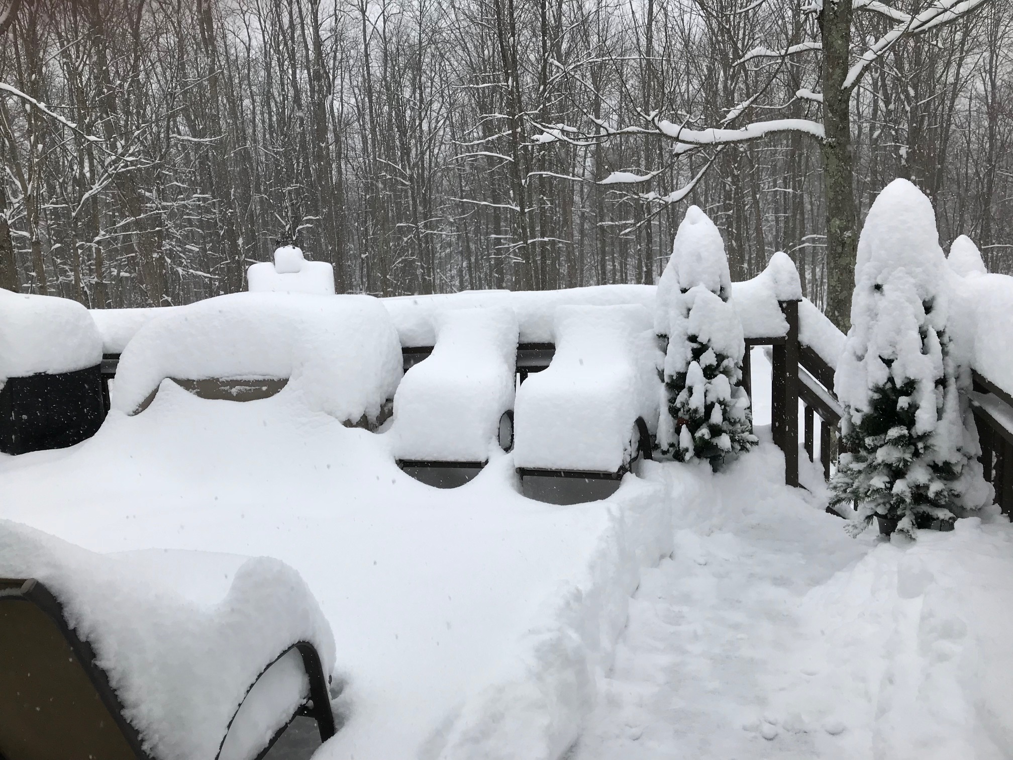
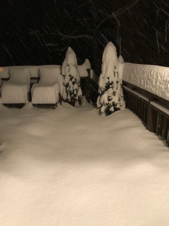
Been awhile since we've had paste job. I measured 8-9" on the deck. From 0 - 6" in the yard.
-
Flipped to snow around 7:20. Deck and grass are starting to get covered. We had so much rain today there’s standing water everywhere. It will be interesting to see the snow cover in the morning. The winds are really howling. Hopefully we’ll see a slow low transfer and maximize snowfall tonight.
-
Sounds good. CLE just jumped on board -- ..WINTER STORM WARNING IN EFFECT FROM 7 PM THIS EVENING TO NOONEST FRIDAY... * WHAT...Heavy snow expected. Total snow accumulations of 7 to 10 inches, with localized amounts up to 13 inches, are expected. * WHERE...In Pennsylvania, Crawford county. In Ohio, Cuyahoga, Lake, Geauga, Ashtabula Inland and Ashtabula Lakeshore counties. * WHEN...From 7 PM this evening to noon EST Friday. * ADDITIONAL DETAILS...Plan on difficult travel conditions. Tree branches could fall. Be prepared for significant reductions in visibility at times. Snow will be heavy at times with snowfall rates of 1 to 2 inches an hour. Once the snow begins to stick to surfaces, it will begin to pile up rapidly in the heaviest snow.
-
Looks like a mix showing up on radar over the lake, with snow starting around the islands. I wonder if we'll have a slow turnover for those of us south of the lakeshore.
-
I think you are in a great spot for this storm... snowfall should only increase as you head NE out of Ohio into PA. Edinboro seems like a good spot for terrain enhancement given the elevation. It has been a frustrating winter for those that rely on a WNW or NW wind direction... we know that all too well around here.
-
Pretty big temp gradient across the area. Similar to a few weeks ago. Temps are in the mid 30's along the lake and on the westside. Still in the mid to upper 40's southeast of the lake.
-
Looks like this has the potential to be our largest synoptic storm of the year. I guess we'll know tomorrow. The warm, wet ground with marginal temps may hurt accums somewhat. I noticed that CLE mentioned cracks and openings in the ice allowing for lake enhancement the other day in the AFD. I flew into CLE yesterday afternoon and had a nice view of the lake. Outside of a few icy patches in the western basin there was no ice at all east of there -- 100% open water. I wonder if they even check the visible satellite?!