Blizzard of 93
-
Posts
13,066 -
Joined
-
Last visited
Content Type
Profiles
Blogs
Forums
American Weather
Media Demo
Store
Gallery
Everything posted by Blizzard of 93
-
Central PA - Jan 31 to Feb 2 Winter Storm
Blizzard of 93 replied to MAG5035's topic in Upstate New York/Pennsylvania
???? Great Euro Run!!! -
Central PA - Jan 31 to Feb 2 Winter Storm
Blizzard of 93 replied to MAG5035's topic in Upstate New York/Pennsylvania
Accuweather has this latest snow map. It looks like 12-18 for many of us. DD213D30-0780-4CA7-AE75-B4BE8AD7EC38.webp -
Central PA - Jan 31 to Feb 2 Winter Storm
Blizzard of 93 replied to MAG5035's topic in Upstate New York/Pennsylvania
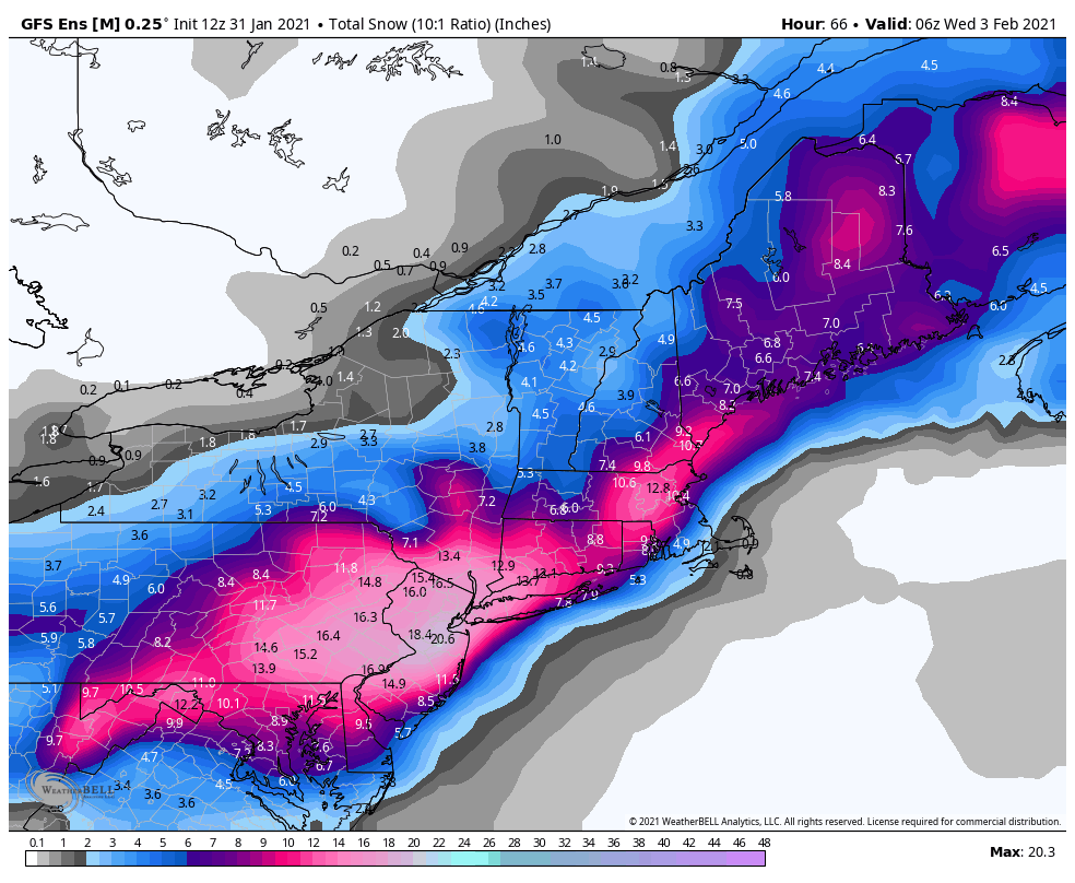
The 12z GEFS still delivers 12 to 15 inches of snow to the LSV, which is strong for an ensemble run.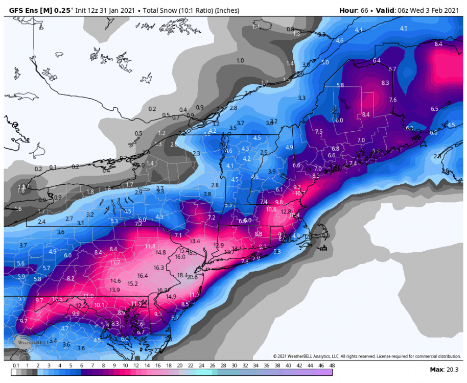
-
Central PA - Jan 31 to Feb 2 Winter Storm
Blizzard of 93 replied to MAG5035's topic in Upstate New York/Pennsylvania
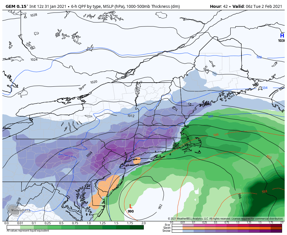
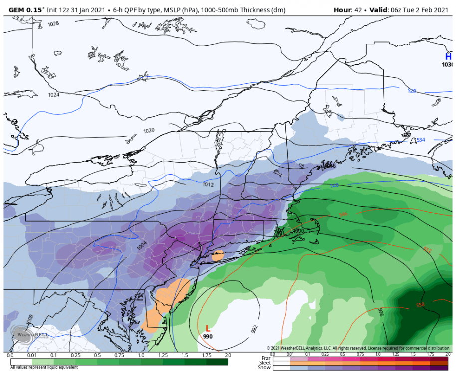
The hour 48 frame on the Canadian is what I was referring to in my post a few minutes ago about the banding & what @Itstrainingtime was just mentioning about lots of moving parts, etc. The location of the best bands will ultimately decide who jackpots with the higher amount and who “settles” for closer to 10 inches of snow. -
Central PA - Jan 31 to Feb 2 Winter Storm
Blizzard of 93 replied to MAG5035's topic in Upstate New York/Pennsylvania
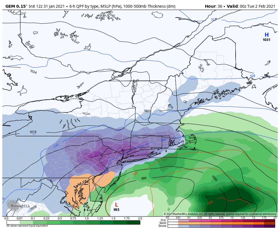
Here are a few frames from the 12z Canadian. We have a long way to go!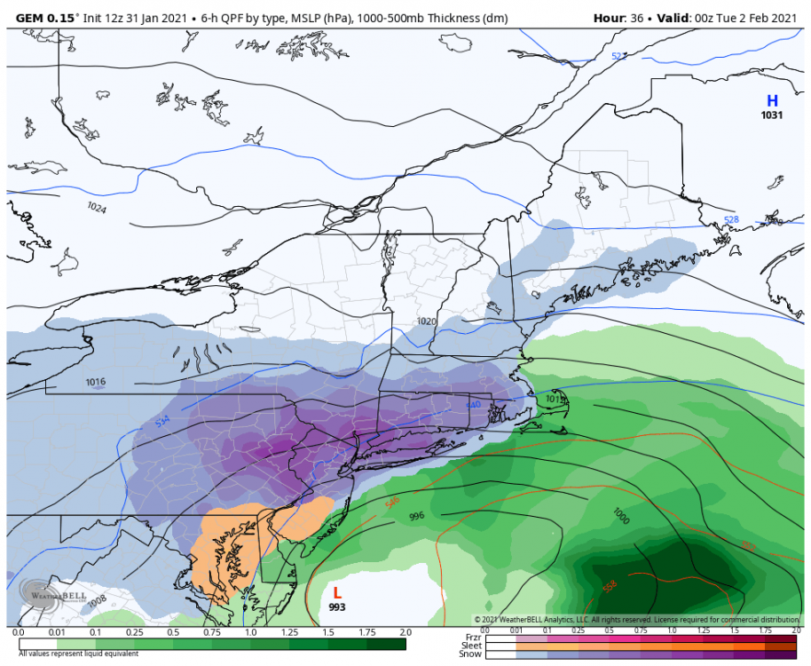
-
Central PA - Jan 31 to Feb 2 Winter Storm
Blizzard of 93 replied to MAG5035's topic in Upstate New York/Pennsylvania
The 12z Canadian low position & track is very good. The low stalls off of the DelMarVa and southern NJ coast. Notice the second precip max over State College back towards Latrobe due to the banding that sets up this run. This back could set up further east or west or maybe just fill in. The bottom line is that we are all still very much in the game. -
Central PA - Jan 31 to Feb 2 Winter Storm
Blizzard of 93 replied to MAG5035's topic in Upstate New York/Pennsylvania
We are all good, let’s move on! Storm Day! -
Central PA - Jan 31 to Feb 2 Winter Storm
Blizzard of 93 replied to MAG5035's topic in Upstate New York/Pennsylvania
Here is the latest from CTP updated 10:36 am. For the Harrisburg area, I could live with 13 Expected inches and a High End chance of 20! -
Central PA - Jan 31 to Feb 2 Winter Storm
Blizzard of 93 replied to MAG5035's topic in Upstate New York/Pennsylvania
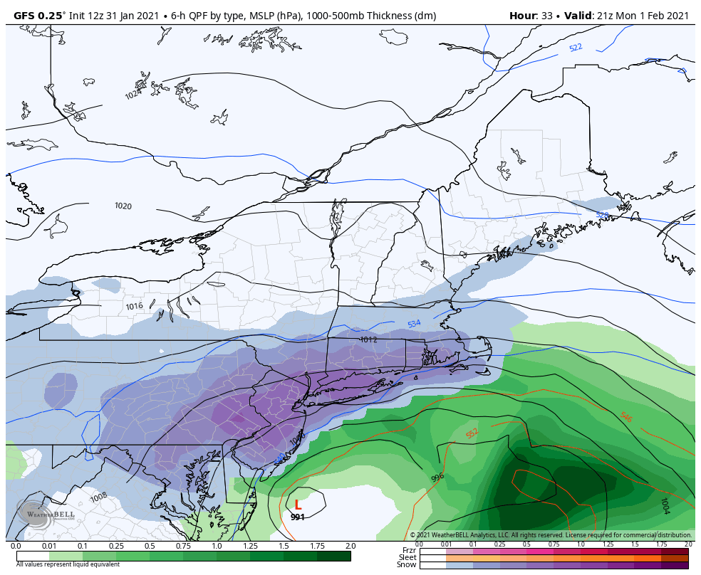
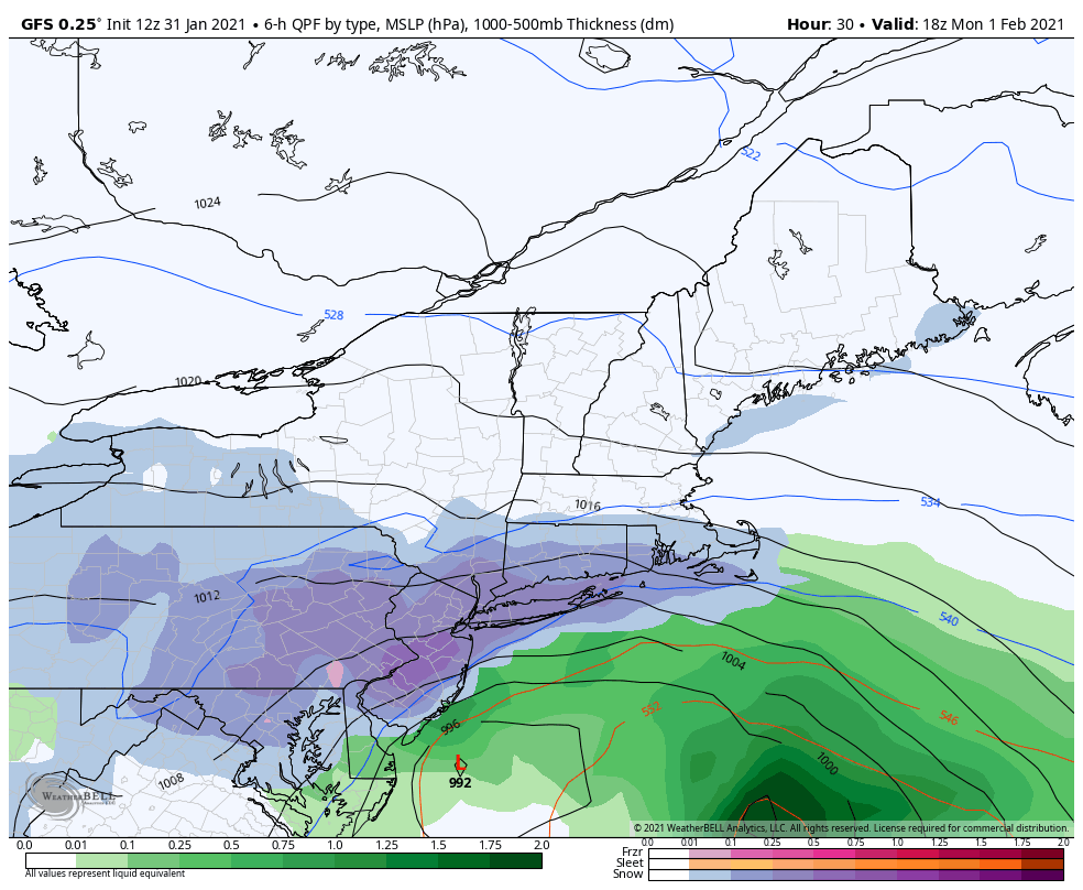
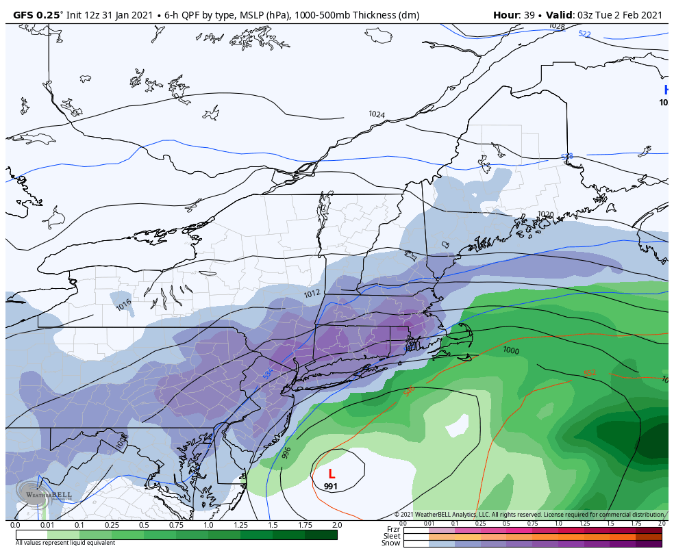
Here is the 12z GFS QPF -
Central PA - Jan 31 to Feb 2 Winter Storm
Blizzard of 93 replied to MAG5035's topic in Upstate New York/Pennsylvania
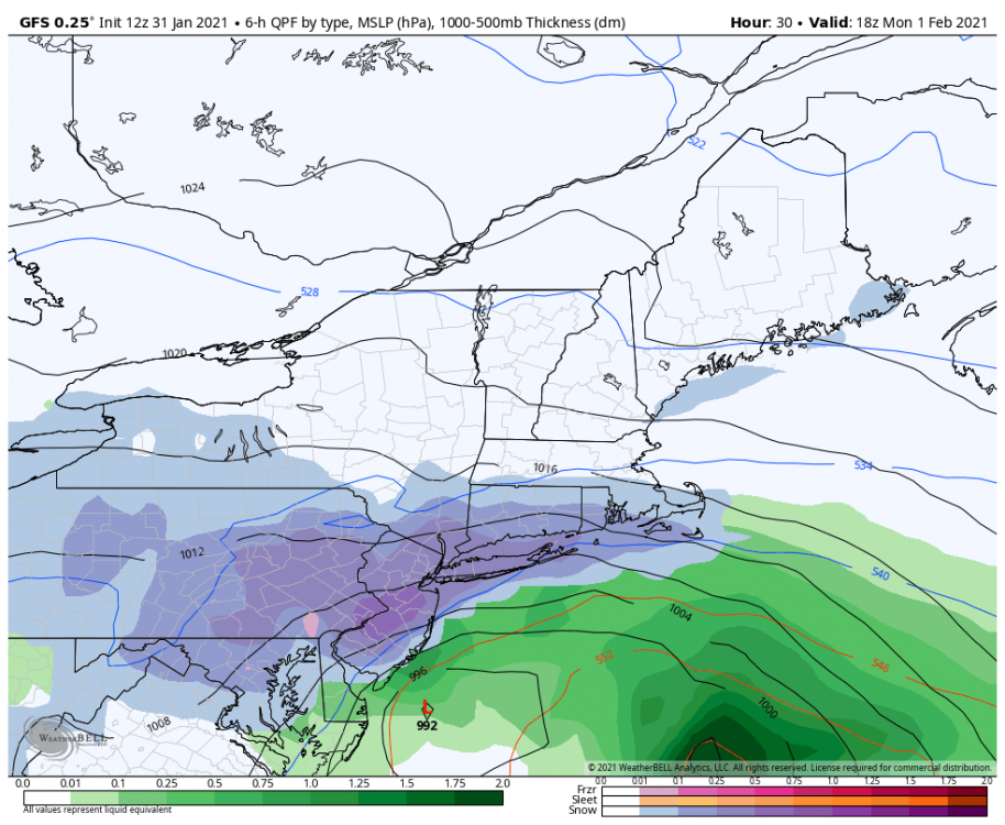
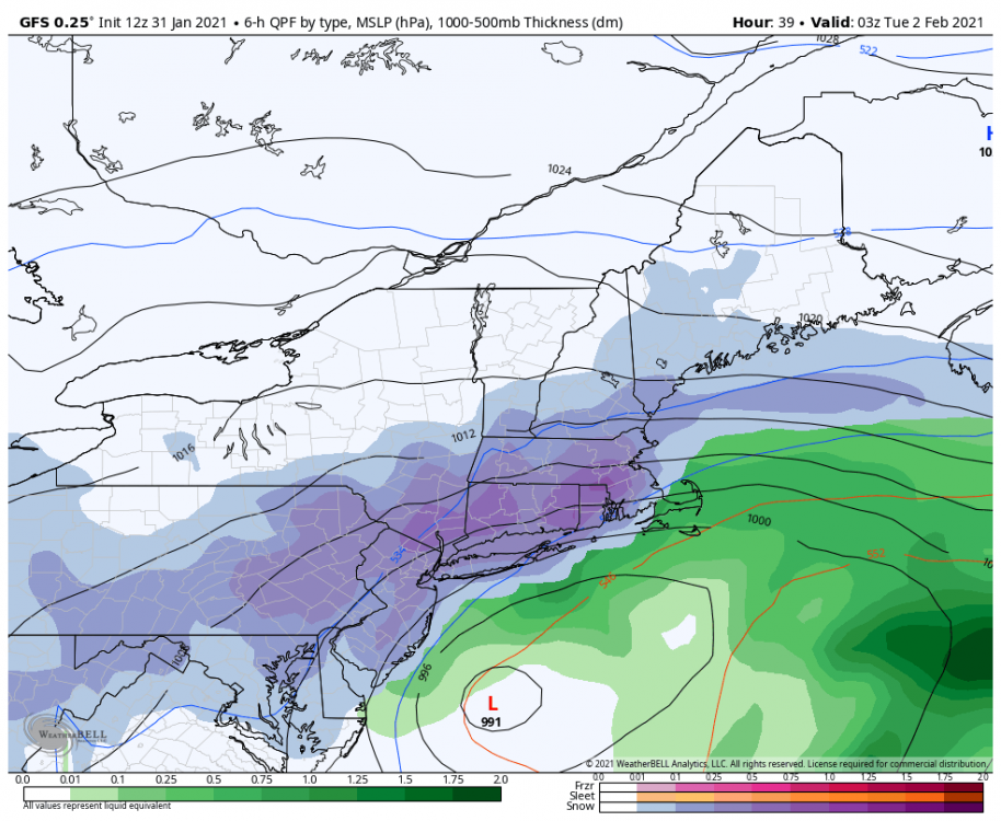
It will all depend on where the best banding sets up with the CCB tomorrow. Often times heavier precip gets pushed further to the west in this set up as there is usually a second max zone in the banding. I like the position of the low on the GFS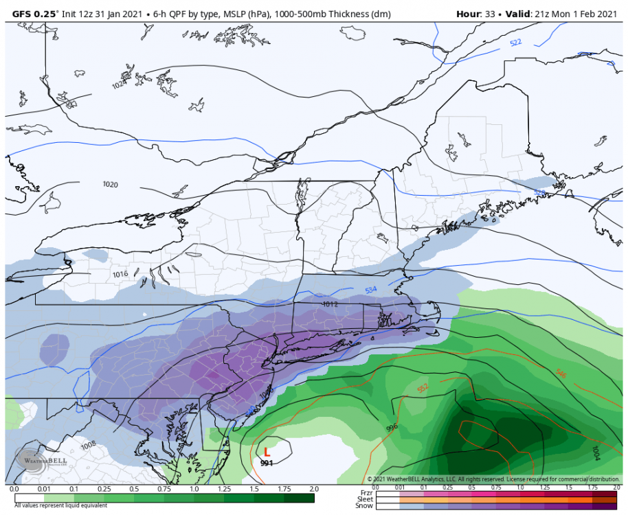
-
Central PA - Jan 31 to Feb 2 Winter Storm
Blizzard of 93 replied to MAG5035's topic in Upstate New York/Pennsylvania
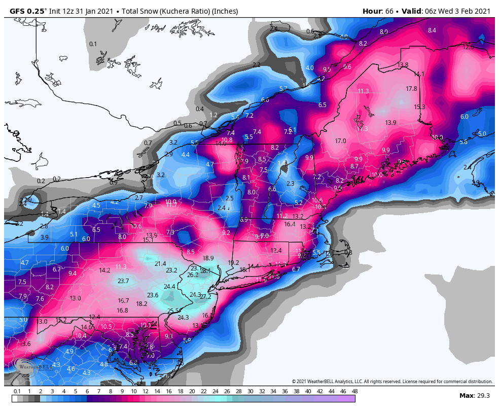
The 12z GFS followed the same theme and has jackpot in eastern PA, BUT, most of the Susquehanna Valley STILL ends up with over 16 inches of snow this run.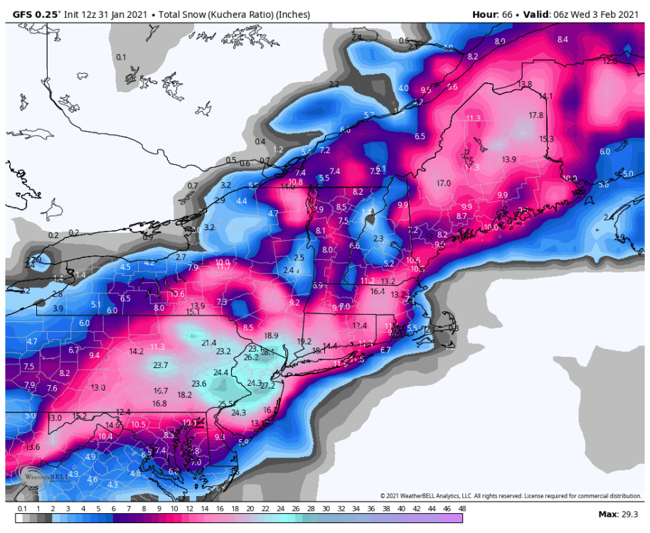
-
Central PA - Jan 31 to Feb 2 Winter Storm
Blizzard of 93 replied to MAG5035's topic in Upstate New York/Pennsylvania
All good, good luck to you out there! -
Central PA - Jan 31 to Feb 2 Winter Storm
Blizzard of 93 replied to MAG5035's topic in Upstate New York/Pennsylvania
Don’t they have a Pittsburgh thread on here? Asking for a friend.... -
Central PA - Jan 31 to Feb 2 Winter Storm
Blizzard of 93 replied to MAG5035's topic in Upstate New York/Pennsylvania
The “shift”, if it is even reality on some models takes the heaviest snow to the east, BUT.... the Susquehanna Valley & points west STILL get near a foot of snow or more. Most of us in here are NOT near Pittsburgh!!!! Here are the 12z RGEM & ICON( only available in 10-1 ratio) -
Central PA - Jan 31 to Feb 2 Winter Storm
Blizzard of 93 replied to MAG5035's topic in Upstate New York/Pennsylvania
No models except for the trash NAM are showing this....the storm is just starting. -
Central PA - Jan 31 to Feb 2 Winter Storm
Blizzard of 93 replied to MAG5035's topic in Upstate New York/Pennsylvania
The good snow today is not supposed to be until later this afternoon & evening. -
Central PA - Jan 31 to Feb 2 Winter Storm
Blizzard of 93 replied to MAG5035's topic in Upstate New York/Pennsylvania
Yes, steady light snow began in Marysville within the last hour! Every flake is sticking instantly! -
Central PA - Jan 31 to Feb 2 Winter Storm
Blizzard of 93 replied to MAG5035's topic in Upstate New York/Pennsylvania
Exactly! We should be well ahead of the game even if this event under performs a little bit. -
Central PA - Jan 31 to Feb 2 Winter Storm
Blizzard of 93 replied to MAG5035's topic in Upstate New York/Pennsylvania
That dry slot is over 1 inch of QPF for your county! -
Central PA - Jan 31 to Feb 2 Winter Storm
Blizzard of 93 replied to MAG5035's topic in Upstate New York/Pennsylvania
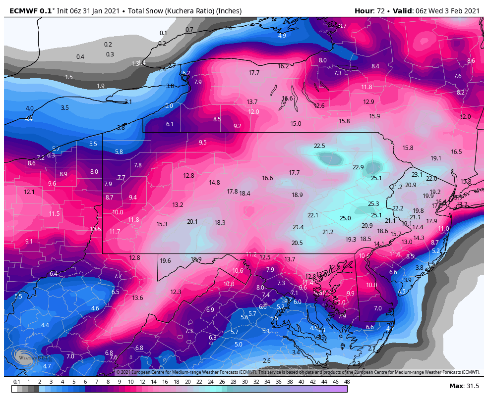
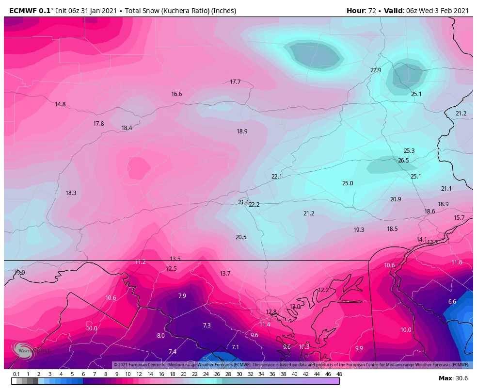
Here are the 6z Euro Kuchera & QPF for all of PA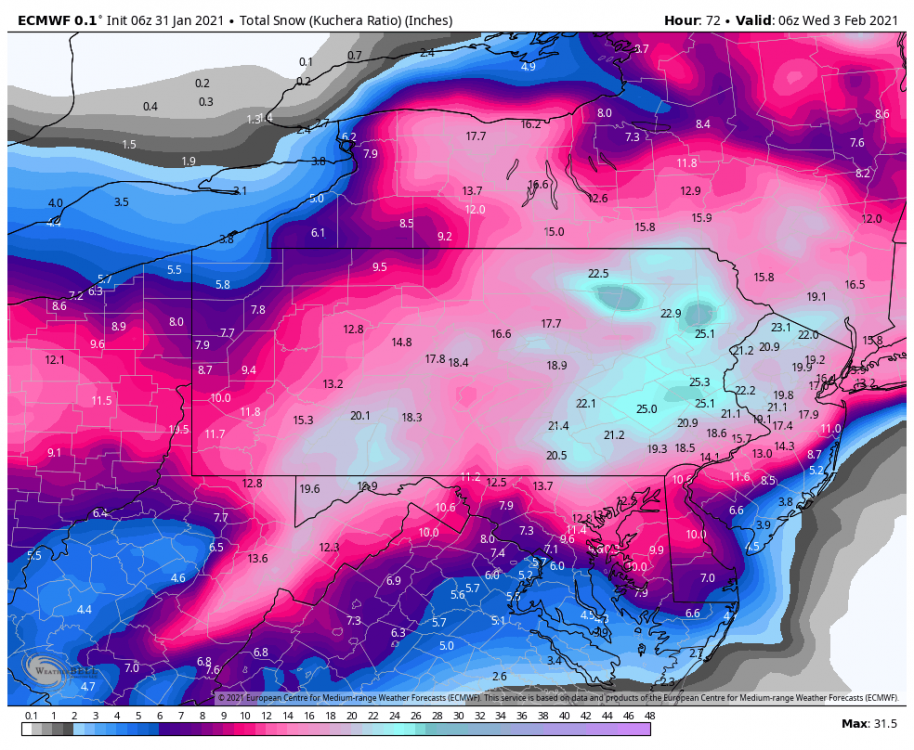
-
Central PA - Jan 31 to Feb 2 Winter Storm
Blizzard of 93 replied to MAG5035's topic in Upstate New York/Pennsylvania
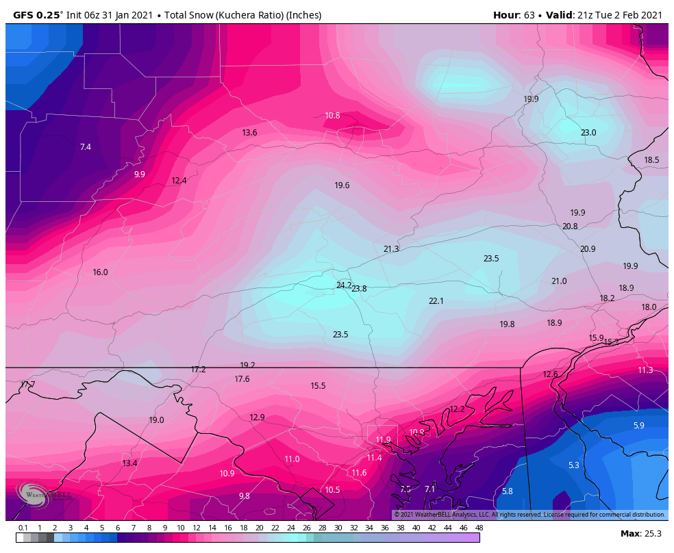
That’s the GFS -
Central PA - Jan 31 to Feb 2 Winter Storm
Blizzard of 93 replied to MAG5035's topic in Upstate New York/Pennsylvania
Here is the 6z EPS. Steady the last 4 runs! -
Central PA - Jan 31 to Feb 2 Winter Storm
Blizzard of 93 replied to MAG5035's topic in Upstate New York/Pennsylvania
The 6z Euro still looks great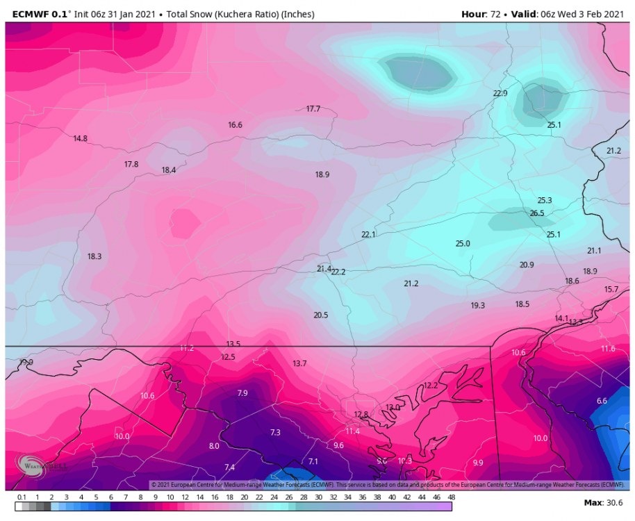
-
Central PA - Jan 31 to Feb 2 Winter Storm
Blizzard of 93 replied to MAG5035's topic in Upstate New York/Pennsylvania
The 6z GFS was another CTP crusher.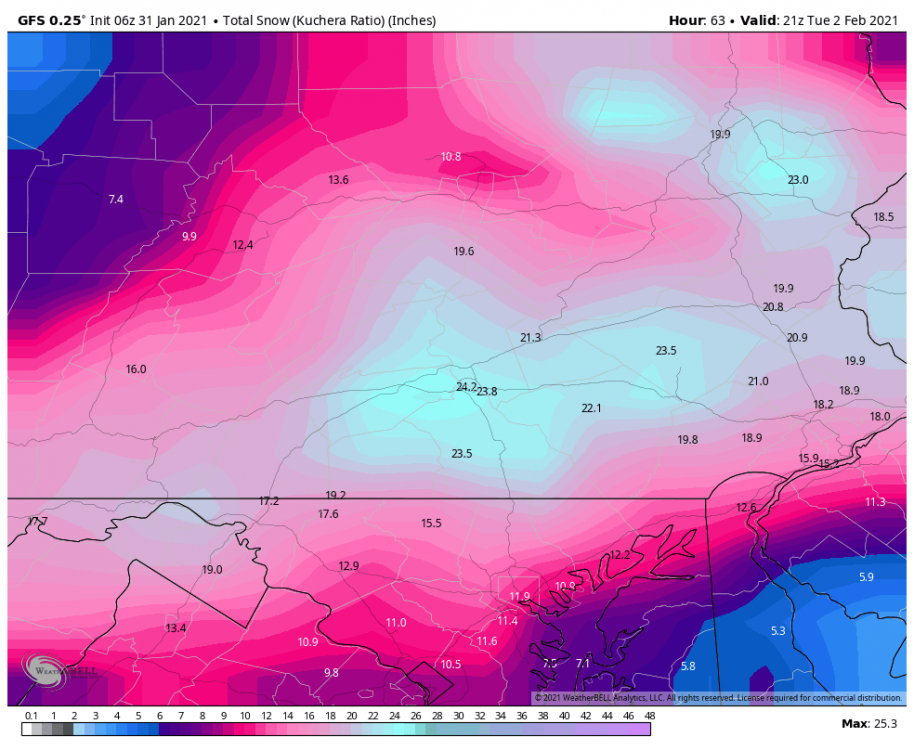
-
Central PA - Jan 31 to Feb 2 Winter Storm
Blizzard of 93 replied to MAG5035's topic in Upstate New York/Pennsylvania
Here is the CTP Warning for the rest of the counties including Lebanon & Lancaster. Winter Storm Warning URGENT - WINTER WEATHER MESSAGE National Weather Service State College PA 452 AM EST Sun Jan 31 2021 PAZ042-046-051-053-058-059-066-312200- /O.CAN.KCTP.WS.W.0002.000000T0000Z-210202T1000Z/ /O.NEW.KCTP.WS.W.0003.210131T1500Z-210202T1000Z/ Sullivan-Southern Lycoming-Montour-Columbia-Schuylkill-Lebanon- Lancaster- Including the cities of Laporte, Williamsport, Danville, Bloomsburg, Berwick, Pottsville, Lebanon, and Lancaster 452 AM EST Sun Jan 31 2021 ...WINTER STORM WARNING IN EFFECT FROM 10 AM THIS MORNING TO 5 AM EST TUESDAY... * WHAT...Heavy snow expected. Total snow accumulations of 10 to 14 inches, with the highest amounts north of Harrisburg. A light glaze of ice is likely south of Harrisburg. * WHERE...Portions of central Pennsylvania. * WHEN...Light snow will overspread the region late this morning and continue through tonight. The snow could become heavier on Monday and potentially mix with ice south of Harrisburg. Expect the snow to taper by late Monday night. * IMPACTS...Travel could be difficult today through Monday evening.