-
Posts
10,023 -
Joined
-
Last visited
Content Type
Profiles
Blogs
Forums
American Weather
Media Demo
Store
Gallery
Everything posted by superjames1992
-
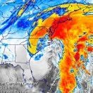
December 8-10, 2018 Winter Storm
superjames1992 replied to Orangeburgwx's topic in Southeastern States
Looks like some areas in the foothills (edit: I meant Sandhills, oops) accomplished this in 2010-2011 (Boxing Day storm and the January 2011 storm). Also, some areas of the NW Piedmont did so in 2009-2010 (12/29 storm and the 1/30 storm). I suspect several locations accomplished this feat during the winter of 1986-1987. -

Southeast Sanitarium - A Place to Vent
superjames1992 replied to Jonathan's topic in Southeastern States
I’m going to be in Greensboro, NC for Christmas. I need this. -

Southeast Sanitarium - A Place to Vent
superjames1992 replied to Jonathan's topic in Southeastern States
I think it seems to have done a decent job still, though? It still generally showed a good storm for GSO, but it seems to have nailed CLT’s sleet/ZR fest. At least the warm nose isn’t over performing this time. Seems like Durham is really doing better than expected, too. Anyways, looks like 10”+ there, which would have been my biggest storm since 2002. Quite possibly 12”+, which would have been the biggest storm I’ve ever experienced. Finally, a storm where the crazy QPF forecasts actually happen! I’ll have to talk to my parents later and see what it looks like there. -

Southeast Sanitarium - A Place to Vent
superjames1992 replied to Jonathan's topic in Southeastern States
The precip was supposed to have a hard time moving north. The mid levels are pretty dry (fortunately so or else they wouldn’t wet bulb low enough for snow). Things seem to be progressing as expected regarding the precip as far as I can tell. It should start to hammer later tonight. -

December 8-10, 2018 Winter Storm
superjames1992 replied to Orangeburgwx's topic in Southeastern States
Every NAM run for the last three days has been showing a problematic mid-level warm nose. Maybe it’ll be wrong (I don’t think so since it is usually good at sniffing those out), but it’s been pretty consistent. At least the NAM has a lot of QPF to work with. NW NC/SW VA are going to get rocked. -

December 8-10, 2018 Winter Storm
superjames1992 replied to Orangeburgwx's topic in Southeastern States
WebberWeather’s final call, FWIW: https://mobile.twitter.com/webberweather/status/1071584244286308353/photo/1 -

December 8-10, 2018 Winter Storm
superjames1992 replied to Orangeburgwx's topic in Southeastern States
Won’t take much of a shift to get the DC metro in the game. Roanoke looks to cash in as usual! The 00z NAM has a brutal warm nose, on first glance. It’s had this all along. -

Southeast Sanitarium - A Place to Vent
superjames1992 replied to Jonathan's topic in Southeastern States
You’re talking about the January 2011 system. The funny thing about that one was that it was mostly sleet/freezing rain in central NC. https://www.weather.gov/media/gsp/localdat/cases/2011/Snow%26FrzgRain_10 Jan11.pdf -

Southeast Sanitarium - A Place to Vent
superjames1992 replied to Jonathan's topic in Southeastern States
Hey, man, you're going to have a nice storm as long as you haven't bought into some of the "historic" storm hype (maybe for the northern mountains). Looks like a typical 6-8" snow/sleet/ice mixed bag for the Triad still to me. A front end thump of snow that's exciting followed by an infuriating length of sleet after that that makes you wonder what could have been. See: February 2014, December 2009, etc.... Wouldn't be surprised if the precip arrives earlier than expected, either, which seems common with these. The timing with regards to the time of day seems decent for the Triad, at least, not that the sun angle is any significant overriding factor this time of year, anyways. -

December 8-10, 2018 Winter Storm
superjames1992 replied to Orangeburgwx's topic in Southeastern States
Probably 750 mb or so, assuming it's on the same wavelength as some of the other modeling. There's not any good (public) charts at that level aside from soundings, though, generally. But the WB and SV clown maps won't pick up on this and show it as snow. On the flip side, I wouldn't be surprised if BL temps verify colder than predicted as CAD at ground level often takes longer to erode than expected. -

December 8-10, 2018 Winter Storm
superjames1992 replied to Orangeburgwx's topic in Southeastern States
I would just say the NAM historically has done a good job with 700-800 mb warm noses and the RAP/HRRR are dangerous to use in their longer ranges. I would also say that, in my experience at least, we often deal with the ~750 mb warm nose before the 850 mb level warms above freezing. But, of course, you never know what’s going to happen. It always seems like warm noses overperform as opposed to underperform, though. Anyways, I am getting prepapred for the rain storm down here. Good luck everyone! Looks like a big winter storm for many, even if a lot of it becomes IP/ZR (more likely IP with a 750 mb warm nose since there’s a lot of air under that to refreeze the droplets before hitting the ground). -

Southeast Sanitarium - A Place to Vent
superjames1992 replied to Jonathan's topic in Southeastern States
Friends don’t let friends get RAP’d or HRRR’d! -

December 8-10, 2018 Winter Storm
superjames1992 replied to Orangeburgwx's topic in Southeastern States
There’s a lot of virga out ahead of it and the mid-levels are really dry with the CAD, so it may take awhile for it to reach the ground in the NC Piedmont (which isn’t uncommon with these storms). -

Southeast Sanitarium - A Place to Vent
superjames1992 replied to Jonathan's topic in Southeastern States
Maybe a rain jacket and an umbrella? -

Southeast Sanitarium - A Place to Vent
superjames1992 replied to Jonathan's topic in Southeastern States
I gave up on this storm in May 2016. -

Southeast Sanitarium - A Place to Vent
superjames1992 replied to Jonathan's topic in Southeastern States
When the DC metro gets its first flake? -

December 8-10, 2018 Winter Storm
superjames1992 replied to Orangeburgwx's topic in Southeastern States
I was thinking the same thing, haha. I remember the 12-24" clown totals for a lot of us on the eve of that storm (from the Euro and other modeling). We ended up with 7.5" of SN/IP/ZR where I was, but I know upstate SC got majority jiffed. I think the NAM identified a warm nose in the 700-850 mb that we ignored and then it happened, IIRC. The SREF did a good job if I remember right. I was looking over some 12z NAM soundings over lunch for GSO and noticed a warm nose showing up around 750 mb, so we need to watch that. That's going to result in lot of sleet that 850 mb maps and clowns do not identify if it occurs. -

December 8-10, 2018 Winter Storm
superjames1992 replied to Orangeburgwx's topic in Southeastern States
FYI, I'm pretty sure a lot of that would be sleet/freezing rain, especially for areas on the S/E edge (like Raleigh). Still a significant storm, though. -

December 8-10, 2018 Winter Storm
superjames1992 replied to Orangeburgwx's topic in Southeastern States
Yeah, I agree the RGEM usually does a decent job. Regarding DPs, the DP is 36 this morning down here in the tropical panhandle of FL, BTW. -

December 8-10, 2018 Winter Storm
superjames1992 replied to Orangeburgwx's topic in Southeastern States
Looks like it, which is somewhat odd since Little Rock isn't under an advisory of any sort with only a chance of a little snow/sleet at the end according to NWS. I suspect that map is showing ZR/IP as snow, but even so... -

Southeast Sanitarium - A Place to Vent
superjames1992 replied to Jonathan's topic in Southeastern States
LOL, you guys always do this in SW VA, then after that last minute NW jog end up getting 8-16" all snow while the areas south of the state line turn over to a raging sleet storm. -

Southeast Sanitarium - A Place to Vent
superjames1992 replied to Jonathan's topic in Southeastern States
Feels a lot like that for the Triad to me. Usually mix with a lot of sleet in these storms. I think 6-8" is a good call. Or maybe I'm just vindictive and bitter since I live in Florida now and the Triad looks in line for a good storm. I don't know! -

Southeast Sanitarium - A Place to Vent
superjames1992 replied to Jonathan's topic in Southeastern States
The NAM looked pretty mixy to me. 850-700 mb thicknesses looked problematic outside the mountains. Maybe I didn't look close enough. -

December 8-10, 2018 Winter Storm
superjames1992 replied to Orangeburgwx's topic in Southeastern States
The NAM is good at spotting those and I've noticed a lot of our storms have warm noses in the 700-800 mb range that you won't pick up on the "normal" 850 mb 0C charts (or on the clown maps). Soundings are important. I think my call for the Triad at this point would be for 6-8" snow/sleet with freezing rain on top. A lot of storms end up in that range in the area. -

Southeast Sanitarium - A Place to Vent
superjames1992 replied to Jonathan's topic in Southeastern States
I'm betting rates will overcome all down here in Florida. The 10-15C low-level and BL temps shouldn't be an issue with the sick dynamic cooling we're going to get!!!!!


