

Orangeburgwx
-
Posts
2,592 -
Joined
-
Last visited
Content Type
Profiles
Blogs
Forums
American Weather
Media Demo
Store
Gallery
Everything posted by Orangeburgwx
-
Eye looks ragged, the storm size is about to explode after its EWRC... Still moving due west atm based off both the IR and visual aids
-
And a tick south of 0z
-
How about everything
-
That dropscond though....
-
Notice the doubled forward speed and the flatter track compared to 5am
-
Back in a bit, gonna see if I can stock up just in case ... Wish me luck
-
Hugo redux, it isn't turning yet
-
Finally correcting to the EURO
-

Hurricane Florence Catch all Thread
Orangeburgwx replied to Brian5671's topic in New York City Metro
You are not wrong (that is what drove the initial wave of shear that tore Florence apart), but there is another high pushing southeast from Canada that is building and will basically merge with the Bermuda High. That will strengthen it, and force Florence south, hope this explaination helps -
That speaks a lot right there...
-
Hurricane Florence Catch all Thread
Orangeburgwx replied to Brian5671's topic in New York City Metro
Location: 24.5°N 54.3°WMoving: W at 7 mphMin pressure: 995 mbMax sustained: 65 mph this is heading right for me -
It is just upper level sampling... Said so on TWC
-
Hurricane Florence Catch all Thread
Orangeburgwx replied to Brian5671's topic in New York City Metro
Since you want to talk about history... This is the strongest (or damn well near it) ridge IN HISTORY for this time of year, all those storms in the past have not had this kind of set up, so you are WITNESSING history -
Hurricane Florence Catch all Thread
Orangeburgwx replied to Brian5671's topic in New York City Metro
EURO is hellbent on a Hugo repeat (need the rain... But damn those winds) -
Where is Ukie heading right now?
-
Welcome back
-
Back to back runs of the EURO with a Hugo redux... It has its' target now the GFS is the chaser,other models are starting to side with the EURO so watch the GFS cave with a Cat 5 Hugo track
-
What wind speed at landfall?
-
No, it's a bit slower
-
I would not mind taking the hit for everyone on this board (have never been in a hurricane)
-
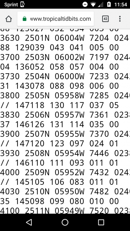
5am: W at 275 degrees, 25.1N 11am: W at 270 degrees, 25.0N Better watch that trend
-
Oh boy here we go... She's starting to look healthier on the IR with a possible eyewalk forming
-
Move 150 miles south, drop the mb by 40, and I will be happy
-
How much below normal temp is that darkest blue?
-
Calling it now, Hugo redux

