Maxwell03
-
Posts
266 -
Joined
-
Last visited
About Maxwell03

- Birthday July 23
Recent Profile Visitors
2,488 profile views


-

E PA/NJ/DE Autumn 2025 Obs/Discussion
Maxwell03 replied to PhiEaglesfan712's topic in Philadelphia Region
Gnarly storms for this time of year. Jumped at a couple of these sudden bolts. -
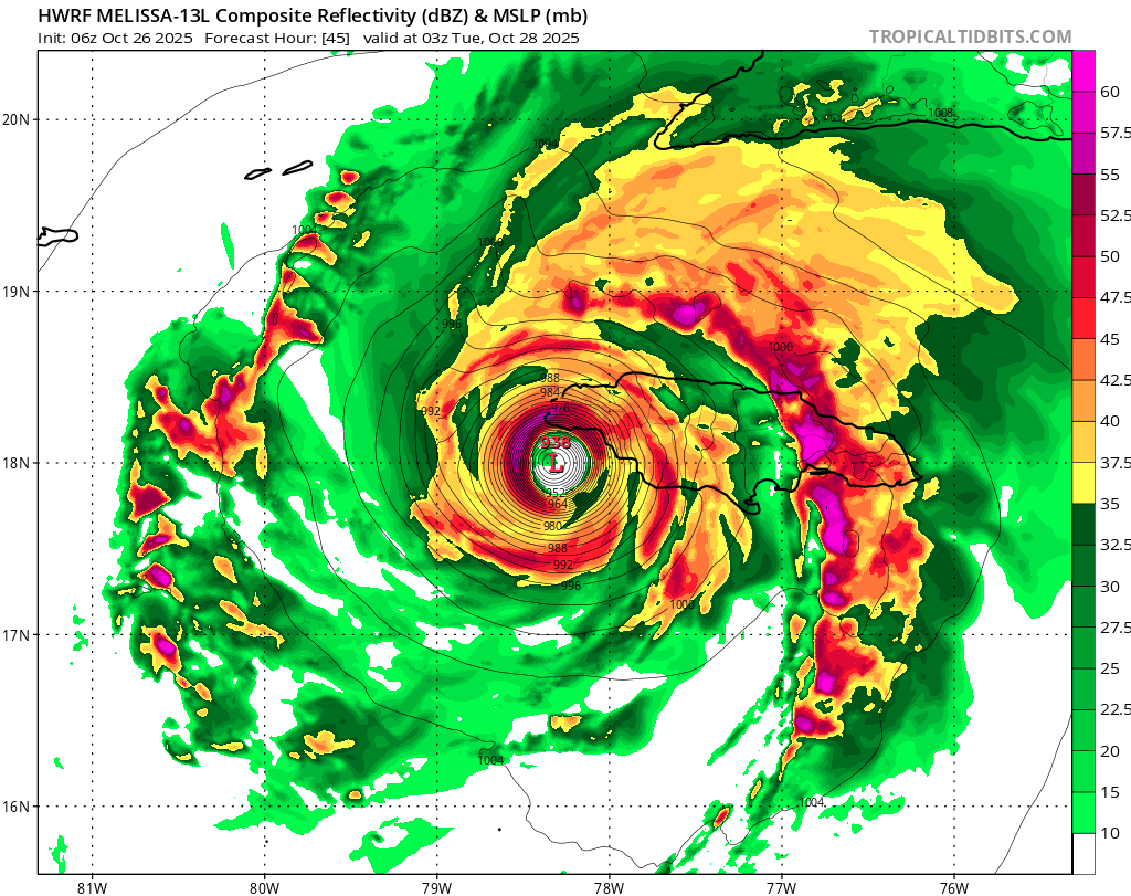
Major Hurricane Melissa - 892mb - 185mph Jamaica landfall
Maxwell03 replied to GaWx's topic in Tropical Headquarters
The western tracks by intensity models are easier on Kingston, but worse for tourist hubs Montego Bay and Negril.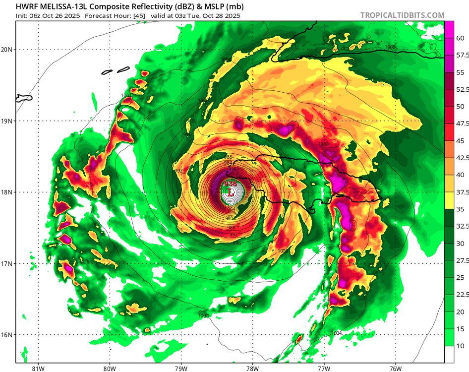
-
Major Hurricane Melissa - 892mb - 185mph Jamaica landfall
Maxwell03 replied to GaWx's topic in Tropical Headquarters
Fortuitously, their topography overall is well suited to absorb surge. From the NHC storm surge risk map for a Category 4, red being 9 ft AGL inundation: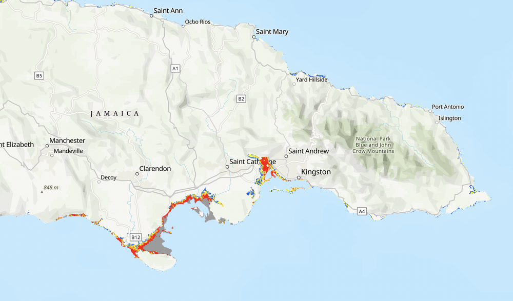
-
Major Hurricane Melissa - 892mb - 185mph Jamaica landfall
Maxwell03 replied to GaWx's topic in Tropical Headquarters
I am thinking the same unfortunately, possibly one of the defining natural disasters of the year. -
Indeed
-
2025 Atlantic Hurricane Season
Maxwell03 replied to BarryStantonGBP's topic in Tropical Headquarters
well he did say rarely -
E PA/NJ/DE Spring 2025 Obs/Discussion
Maxwell03 replied to PhiEaglesfan712's topic in Philadelphia Region
Shelf cloud on this thing looks gnarly, can see the city lights bouncing off it -
The GFS is starting to bend to the dark side.
-
Ida
-
It's a tricky forecast especially considering Milton's size and the open door for weakening near landfall. I understand where you're coming from here and think you're taking a little too much heat for it. If everything aligns perfectly, it will be an extremely impactful event. Still, someone on the Florida west coast is taking a nasty hit from this and they are not prepared to weather a storm so soon after Helene.
-
Yeah, throw that NS:H:MH ratio away. Five hurricane hits is an onslaught.
-
This went from a nothing burger to downright ominous at a rapid pace. Should note that even without a Tampa worst case surge event, Sarasota and Fort Myers aren't really well positioned to weather a big event either.
-
2024 Atlantic Hurricane Season
Maxwell03 replied to Stormchaserchuck1's topic in Tropical Headquarters
Maybe so, but you don’t have to be that old to remember the gap between Ike and Irene, plus the 2013-2015 downturn (especially 2013). And although they’ve delivered hits, these recent years have also delivered prolonged calm periods. -
2024 Atlantic Hurricane Season
Maxwell03 replied to Stormchaserchuck1's topic in Tropical Headquarters
I’m always rooting for a nearshore recurve, or a close shave a la Earl 2010. This way we get some excitement but don’t have to get FEMA involved lol. -
2024 Atlantic Hurricane Season
Maxwell03 replied to Stormchaserchuck1's topic in Tropical Headquarters
18Z GFS said go back to bed