

thunderbolt
-
Posts
821 -
Joined
-
Last visited
Content Type
Profiles
Blogs
Forums
American Weather
Media Demo
Store
Gallery
Posts posted by thunderbolt
-
-
-
6 minutes ago, snowman19 said:
You have absolutely no idea what you’re talking about. Please stop. The subsurface just under regions 1+2 and 3 is over +6C. You have been saying these regions are going to fall apart since the end of March and posting the wretched CFS over and over. 5 months in a row now. Give it up. You’re wishcasting
It’s gonna be OK maybe one of your predictions will come to fruition
-
 1
1
-
-
5 minutes ago, snowman19 said:
You have absolutely no idea what you’re talking about. Please stop. The subsurface just under regions 1+2 and 3 is over +6C. You have been saying these regions are going to fall apart since the end of March and posting the wretched CFS over and over. 5 months in a row now. Give it up. You’re wishcasting
Go back into your corner
-
 3
3
-
1
-
-
-
For those who are predicting this was going to be a eastbase come December might reconsider their thoughts
-
1
-
-
2 minutes ago, thunderbolt said:
Looks like we could put a fork in region 1/2 all downhill from here
-
1
-
-
-
1 hour ago, BBasile said:
Some. It mostly stayed in the clouds, though. Got soaked, however. lol
Godsmack, Staind, Mix Master Mike. Didn't get to see Godsmack.
Nice that blows you couldn’t see Godsmack
-
 1
1
-
-
7 hours ago, BBasile said:
Had a decent gust front and some cool crawlers, but other than that...weak sauce. Concert was delayed and then canceled.
.thumb.jpg.ac21ed6ab4bfb1d4e69ee2bf1eb4037b.jpg)
What concert?
-
-
-
56 minutes ago, MJO812 said:
I hope It pours tomorrow
I strongly believe that your hope will come to fruition
-
1
-
-
6 hours ago, olafminesaw said:
I nominate this one for strangest looking cyclone of the year

Is that dry air eating it up in the north western side?
-
-
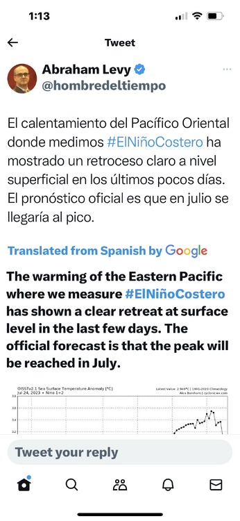
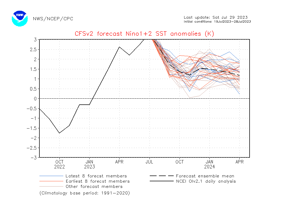
25 minutes ago, bluewave said:
It had 1.77 for July and the current weekly update is 1.10.
https://www.cpc.ncep.noaa.gov/data/indices/wksst9120.for
Model JJA JAS ASO SON OND NDJ DJF JFM FMA Dynamical Models AUS-ACCESS 1.77 2.23 2.57 2.73 Thanks blue
-
1
-
-
24 minutes ago, so_whats_happening said:
The JMA has been doing really well, even with the mjo.
Does anybody know how the BOM is doing?
-
Washington Crossing command reporting 3 fatalities at this time
-
 4
4
-
-
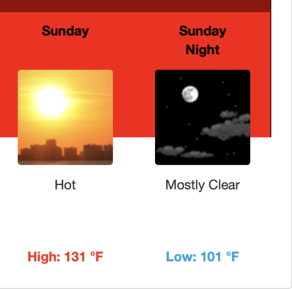
Just a little hot in death Valley but they say it’s dry heat

-
1
-
 1
1
-
-
-
1 minute ago, LVLion77 said:
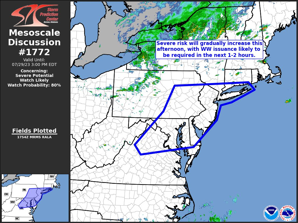
The action that persists over Berks County is absolutely unprecedented. I am wondering if some locales touch 12”.
I’m monitoring their 911 radios and they’re going absolutely nuts water rescue after water rescue
-
2
-
-
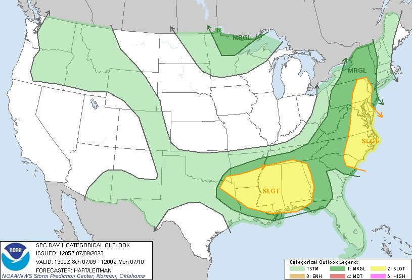
They expanded the slight risk a little farther east now
-
For tomorrow

-
1
-
 1
1
-
-
Just now, yoda said:
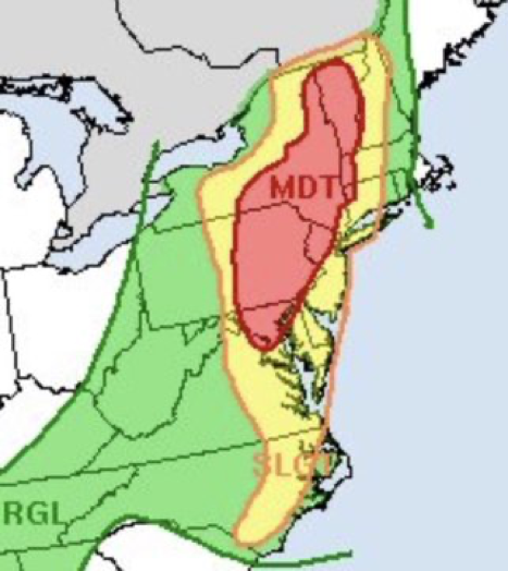
Excessive Rainfall Discussion
NWS Weather Prediction Center College Park MD
353 PM EDT Sat Jul 08 2023

Day 2
Valid 12Z Sun Jul 09 2023 - 12Z Mon Jul 10 2023

...THERE IS A MODERATE RISK OF EXCESSIVE RAINFALL FOR PORTIONS OF
THE MID-ATLANTIC INTO WESTERN NEW ENGLAND...

...20Z Update...

...Mid-Atlantic through New England...

In coordination with all the forecast offices from DC/Baltimore
north through New England, a Moderate Risk area was introduced
with this afternoon's update for portions of the Mid-Atlantic into
western New England. All guidance continues to hone in on a
corridor of heavy rainfall caused by numerous training showers and
thunderstorms developing across the Moderate Risk area Sunday
afternoon for southern and western areas, then progressing through
New England Sunday Night. Expect a widespread 2-4 inch event
especially from eastern PA north through VT. However local amounts
are likely to exceed 6 inches of rain, with the most likely areas
for the higher rainfall totals through the Catskills/Poconos of
NY/PA and also through the Green Mountains of VT. Much of this
area has been very hard hit in recent days with heavy rainfall,
with a large area over 300% of climatological normal rains per
2-week AHPS data. Adding a stalling front into the mix which will
allow for training of abnormally high moisture air on the order of
PWATs to 1.75 inches makes for a likely scenario for flash
flooding, especially when adding terrain influences into the mix.

With the full day's worth of HREF data first available at 12Z,
it's notable that portions of east central VT have a 30% chance of
exceeding 100-year annual return intervals for the amount of rain
expected, with the Catskills/Poconos and Green Mountains all over
70% chance of exceeding 3 and 6 hour FFGs Sunday afternoon and
evening. The steady signal of widespread rain and good model
agreement on both timing and areal amounts added enough confidence
to the forecast to upgrade to the Moderate Risk for this update.

-
1
-
1
-
-
Parts of our region got upgraded to moderate risk for flooding


2023 Mid-Atlantic Severe Wx Thread (General Discussion)
in Mid Atlantic
Posted