

TSG
-
Posts
742 -
Joined
-
Last visited
About TSG

Recent Profile Visitors
8,137 profile views


-
and we didn't drop below 100/99 until 7:20pm...
-
We've seem to be busting low on temps in Albemarle. Clouds stuck around for a while this morning and now we've got some wispy high altitude crud floating by as well. Forecast said 89 but we've only managed 84 as of 2:45pm. Same thing happened yesterday. Forecast was 82, high ended up being 77.
-
Still haven't hit 40F in Cville despite having full sun since about 9am. This is one of the coldest late March days I can remember
-
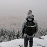
 Disappointed by the lack of snow pics!!
 -
81/54 at 9:30pm... I just turned the A/C on
-
CHO 79/55 at 3pm. Back down to 75 now
-
I'll be using that and the HRRR/NAM soundings to try and figure that out. This morning in Ablemarle the saturated layer looked to end around 950mb so I would think 2000ft is enough.
-
That's a great idea... I might do that too. You think the Afton Mtn overlook on 64 has enough elevation? Or need to be up in the park?
-
68 under full sun here
-
Smarch is back on the menu
-
Ripping SN/SN+ in Hooville 28/17
-
84hr NAM posters deserve the "weenie" tag /rant over
-
I noticed the GFS and Euro are considerably colder than the NAM3k. Are the mesoscale models going to be better at estimating this?
-
Headed back down after a high of 30 in Charlottesville currently 27/1 under full sun
-
Ice accreting quickly in Charlottesville... ready for the back end now

