Lookout
-
Posts
5,769 -
Joined
Content Type
Profiles
Blogs
Forums
American Weather
Media Demo
Store
Gallery
Everything posted by Lookout
-
Good post. I have No idea why anyone even looks at snow accumulation maps unless temps start below freezing and you know for sure everything will stick. Over ne ga, the hrrr showed too much sleet. It showed gainesvlle getting 6 hours of it but in reality they only got a little bit during the heavier rates. And it showed sleet making down to here and unless there was a little in the heavier showers, i never saw any. It was pretty obvious it was in error as it showed the max temp above ground getting to near 40 at the time it was showing it and the warm layer was deep. The fv3 over did the snow a bit a little bit but otherwise did an ok job as snow got down to cornelia and surrounding areas for an hour or two. Nam on the other hand failed to show it. Nam was too warm yesterday but in the end was about right as far as the lowest temps went. FV3 was actually a degree or two TOO cold. lol...What makes it worse is the best chance is further to the south AND the rich will get richer as those who got a lot today will get even more. So that means there could be a zone that has been exceptionally screwed and tortured where they watched areas to the north get snow last night/this morning and then watch areas to the south get some tonight/tomorrow morning. In my case, I fear i'm going to be in a situation where it's snowing a couple of counties over while it's dry here. I'd be happy just seeing a little bit falling through the air but will be lucky to even get that.
-
It looks like it. Across the board the models are colder from 925mb to the surface there. Essentially the models push the cold pool with the wedge to the south. Here is the nam's 925mb showing just that. Also here is the nam's 2 meter temps and as you can see, it has really warm temps over the ne corner/nw upstate. GFS is a few degrees colder and the hrrr is showing temps in the 32 to 34 range. although the gfs/hrrr are colder at the surface, they all show warming above it similar to below. That said, If precip develops and it's sort of widespread, i wonder if that would make it a bit colder than they are showing. the 18z nam was wetter than the 12z and it was a bit colder as a result at 925mb at least. A bit unusual but they have consistently showed this.
-
Although there is some question about depth of the moisture, Models stubbornly warm the lowest levels over north ga/upstate overnight which is why some of that is shown as rain. despite northeasterly flow, which is a bit baffling to be honest. That said, some of the recent runs are a touch colder. Nam especially seems bizarre, showing temps rising into the upper 30s and even near 40 over the northwest upstate. There could be some weak downslope over far ne ga/nw upstate late but otherwise flow is remains NNE to NE throughout the low levels and if this happens it will surely be a first. I can't recall a single time where the temp starts above freezing already and rises several more degrees during the night with NE winds/flow so i'm curious how this shakes out. HRRR is much colder, especially in the upstate, showing temps staying right where they are now which seems like a no brainer. Models were pretty damn close with temps in the end here...got only to 32.7 here, which is a degree warmer than i thought it would get. So I can't totally discount it. Hopefully Places that were screwed and missed out will get a little something out of it. I would expect i would see some here too but the hrrr is dangerously close to showing most of the precip missing here. naturally.
-
hmm..not sure why but my last post went missing so here it is again. I'll be honest, i'm having issues with the 3km nam. For starters, it's too warm at the surface. Second, i find it next to impossible to believe there won't be more sleet than it shows over northeast ga where it essentially has none. Never mind it is warmer than even the hrrr at the surface. Third, it seems too warm aloft compared to the hrrr. Here is the 12z 3km nam 6 hour 850mb temp vs the 0z analyzed hrrr at 18z...
.thumb.png.4f94580e5f9c92167a796d03bc832bc3.png)
-
I'll be honest, i'm having issues with the 3km nam. For starters, it's too warm at the surface. Second, i find it next to impossible to believe there won't be more sleet than it shows over northeast ga where it essentially has none. Never mind it is warmer than even the hrrr at the surface. Third, it seems too warm aloft compared to the hrrr. Here is the 12z 3km nam 6 hour 850mb temp vs the 0z analyzed hrrr at 18z. So imho, i'd be cautious about it right now imo. The hrrr has done well in the past few winter storms here in ga so i'd put more weight on it right now.
.thumb.png.080789d75eb7b9d9a4079f50d30e8ac1.png)

-
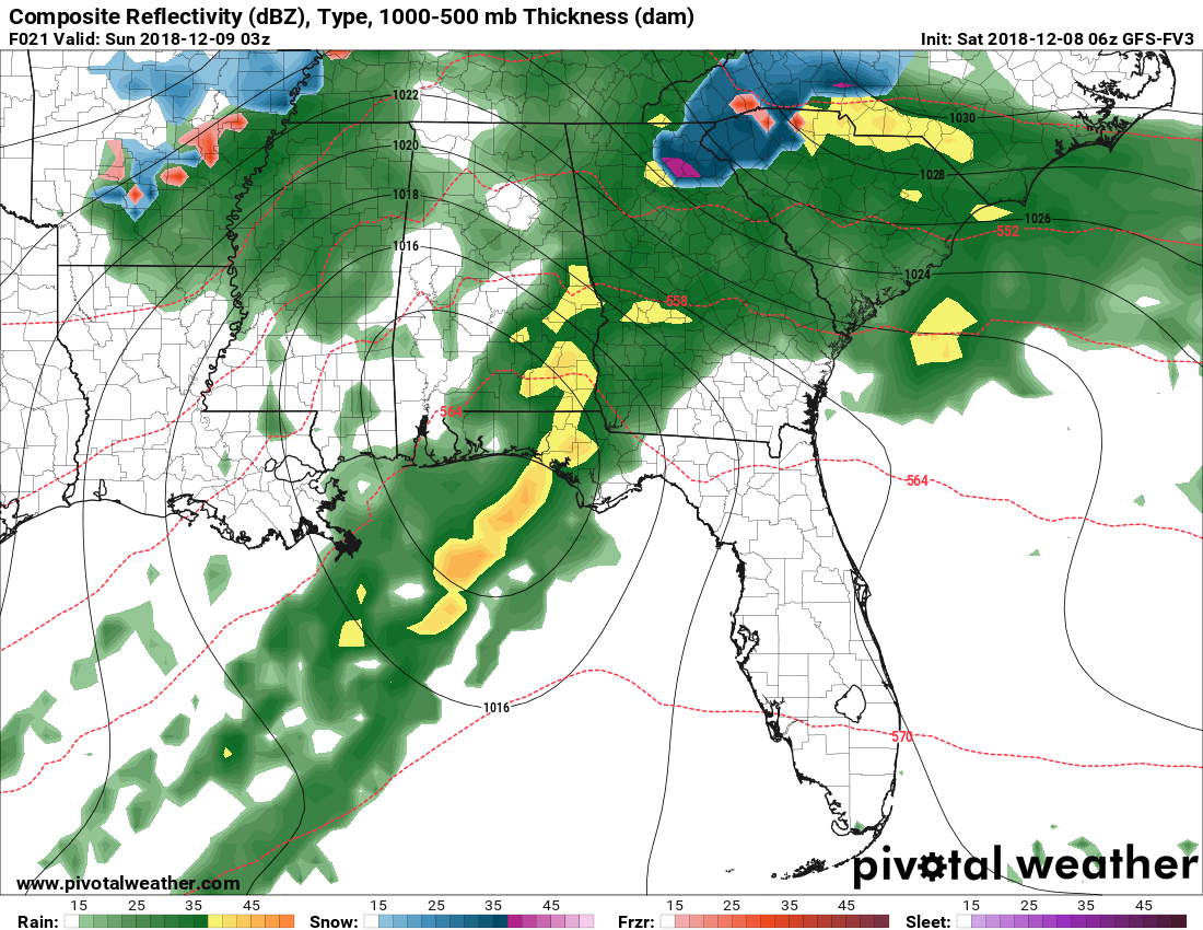
fv3 still showing a changeover to very heavy snow for a few hours down to gainesville. Nam still says no and only shows a change to freezing rain toward sunrise. Hrrr still showing a changeover to heavy sleet. Going to be fascinating to see which model, the fv3 or nam, wins this one.
-
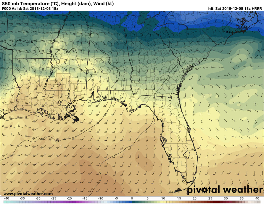
yeah the hrrr is always...always...too warm in these situations at the surface. With constant rain and the onset of cad, i don't expect any rise in temps across north ga which means by this afternoon the hrrr could end up being about 5 degrees too warm on average by this afternoon in spots. These 3 to 5 degree biases are right right on average in cad. I'm also think they are way too warm sunday night into monday at the surface and 950mb which is in part causing the models to spit out rain instead of snow. What makes it even more unlikely is the fact the models are showing temps rising into the mid to upper 30s at NIGHT with still NE flow. There is some downslope warming possible over parts of far north of ga but for everywhere else I'd be truly shocked if that happened. So don't be surprised if that is snow instead of rain monday in a lot of places.
-
a note on the 3km and 12km nam, currently it's running on average about 3 degrees too warm right now here in georgia and in a lot of areas seeing rain. If it held this average error into tonight, temps would get to freezing in gainesville/85 corridor between 0z and 03z where it gets these areas down to 34 by 03z.
-
Local temps are as low as 33 at sky valley and 38 at the dot station in clayton currently which is about where they should be. I haven't seen anything that has changed that would lead me to believe your changeover wouldn't be around mid day to early afternoon.
-
Well it's certainly by no means a lock and the chances are based on the fv3 and euro mainly...nam says no and the hrrr says it's sleet (or maybe some snow mixed in..it's hard to say since i'm near 100% positive it's surface temps are several degrees too warm as is usually the case in these situations and could be throwing it off). If it happens, it would be sometime between 01z/02z and 06z in ga and 09z in sc as the fv3 also brings the warm nose screaming in. it would be nice to see the nam come on board but the 12z run is holding firm.
.thumb.png.14973c5a0ee9a74068261f363288fda8.png)

-
I wonder if the intense precip rates could offset that warming somewhat or delay it? Speaking of those intense rates, most of the models are now showing enough heavy precip/cooling for a several window of very heavy snow or sleet across ne ga...maybe as far south as athens, before going back to sleet/freezing rain (mainly north of 85 until after 09z) overnight tonight as the warm nose aloft moves in. (just for reference it's all snow/subfreezing at 06z but warms to plus 3c at 750mb on the fv3 near cornelia at 09z). There does appear to be some dynamical cooling at play here with very intense precip rates and cooling occuring at the same time. ...in fact the 06z run it keeps it as sleet for areas like gainesville to hartwell for the duration of the storm after 03z. Would be quite the accumulation of it if that happens. i sure envy the upstate/western nc. The rates are going to be insane.
-
If i could have i would have took off to clayton again because i think they will do really well but unfortunately there are things going on keeping me from doing it. At any rate, i'd be excited if i was you. It looks like once mixed precip or snow starts mid morning tomorrow it shouldn't stop for a long time and It's just a matter of how much of which....although if that warm nose above 850 isn't as strong as advertised or rates are heavy enough it could very well end up being mostly snow...except the light freezing stuff after the dry air punches in aloft sunday.
-
this run of the euro sure gives hope that there could be quite a bit more snow/sleet in northeast ga than before. Now has precip changing over to all snow for a while down to places like gainesville and hartwell with a mix here before the warm nose aloft moves through. That snow would could help drop temps to freezing earlier by several hours which could mean more freezing rain, again especially along and north of gainesville to hartwell but that's hard to say yet. It's only going to one more small downward temp adjustment aloft to make potentially change things quite a bit...maybe even south of 85. Damn shame though that the warm nose is still there above 850mb....but given precip rates, makes me wonder if sleet will be more expansive. That said, this should be quite a hit for NEGA, rabun county, and those areas.
-
It will have an effect today...in fact it will be a lot colder....up to 15 degrees colder than all of them showed 2 days ago. Unfortunately it doesn't have much impact on whatever falls saturday. Sort of frustrating it can be 15 degrees colder the day before and not really matter lol You are in a much improved spot vs 24 hours ago. If the latest few runs of the fv3, euro, and nam are correct, you will get a lot more sleet/snow. You are right about the precip rates/freezing rain though...it's one reason why i haven't been too excited about it outside the higher elevations/your area and the rates/marginal temps would keep accretions down. That said, nam has 950mb temps dropping below freezing as early as late afternoon tomorrow over your area so you should get quite a bit of wintery precip.
-
yep....850 mb low and thus winds are more easterly than southeasterly in the upstate and north ga. it's very very close to snowing in much of ne ga by late in the day. The killer for north ga continues to be the warm nose the nam shows between 700mb and 850mb though but it's much cooler this run with it. Considering how heavy the precip is i wouldn't be surprised to see a lot of mixing though now just about area wide. Also, the trend in the models here lately is to be a little further north with that finger of precip. That has possible cooling ramifications for ne ga too as the air is colder over the western carolinas so after wetbulbing that air advects into north ga. It does north ga no good to have it so far south as the models have been showing until recently. Overall a much better look if one is hoping to see something other than freezing rain or rain in ne ga and a better overall snowy look for the upstate.
-
I was quite surprised the nam's profiles were dismissed as i'm sure many were because of that. Interesting decision. i love how he has athens being marked in elbert county instead of where it's really at, clarke.
-
not very often you see an upper low diving southeast into georgia...drops another 0.25 to 0.40 of mostly snow too. hopefully the fv3 is even more bullish. 0z canadian does the same thing btw.
-
yeah precip redevelops with it too...
-
Even for the gfs, that's pretty bad. That's more like the old avn type of busts.
-
well the 0z gfs holds in showing much warmer temps. If our suspicions are correct, this could be an epic bust on it's way out the door. Nam is up to 8 degrees colder than the gfs over north ga.
-
The 0z nam is a little slower than the 18z run in dropping temps but it happens very quick when it does. Interestingly the nam is showing the core of the cold air at 950mb instead of 925mb this run. I wouldn't be surprised to see it speed up by a number of hours again since i suspect the nam, nor any model, will be able to accurately get down the quick cool down over the western carolinas where the whole atmosphere is quite a bit colder/drier. Also, nam is showing quite a bit of mid level cooling and given the cold low levels i suspect there could be quite a bit of sleet over northeast ga....especially considering precip rates. But watch levels between 850mb and 700mb...warm nose there could screw the upstate's snow for a little while. Nam, not surprising is more bullish with it than the gfs.
-
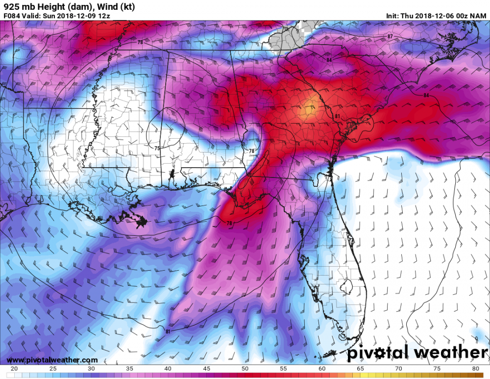
This is pretty crazy......925mb winds of 50 to 55 knot winds across damming regions of ga/sc by sunday 12z. 40 knot winds at 950mb. 10 meter 20 knots. It's Some serious wedging lol
-
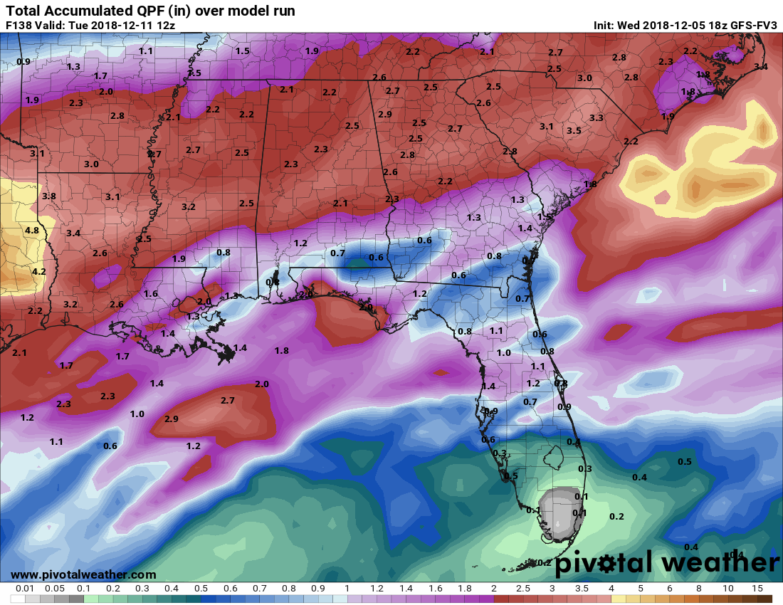
pretty fun looking run right into next week....although not much fun about damaging ice....although i'm hopeful that sleet might save the day for areas north of athens while snow could pile up north of 85 if this run is to be believed. very wet run though...nearly 3 inches of liquid close to here and approaching 3 inches in western nc.

-
yeah this run finally looks like it bought a clue. There have been times the models have shown some cooling of the mid levels over the heart of the cad regions and it's something to watch for as we get closer...could mean more snow/sleet further south than expected. I wouldn't be surprised to see snow/sleet mixing here at times. What i wouldn't give for just 1 or 2 more degrees cooling aloft.
-
I've been conflicted about this due to the lack of low surface dewpoints and the fact that most of our ice/winter storms don't have a long period of just plain rain before hand. (instead just a few hours as we wetbulb down) But every other major indicator i look for is there. Some of it is just general things i have noticed over the years...like it normally ices here if the 0c 850mb isotherm starts south of the nc/sc border, Not only does it do that but it touches ne ga as well. 850s never get above a few degrees above freezing, very deep east/northeasterly flow...all the way up to at least 875mb (which is higher than average)......indeed even the 850mb level has that wedge look which is an indicator of a really good one, tight pressure gradient, and strong boundary layer winds.... latest nam is showing 925mb winds at an impressive 45 to 50 knot across north ga by hour 84. The good news for north of 85 is that it might get could enough to make for more sleet than freezing rain because of the cold low levels and mid level temps actually cooling at times. It would be nice if that sleet makes it this far south. Earlier runs of the euro had it very close to doing that but i fear the odds are more likely it's freezing rain for the most part here unless 900 to 975mb temps trend colder or mid levels are a bit cooler.


.png.2b3053f05d75218d844dc64e493640ce.png)


.png.a5ca87bce0368bfa07f221ef71c783c7.png)
.png.de916964f655b0bd32a5c7d0dbd82248.png)