
Lookout
-
Posts
5,769 -
Joined
Content Type
Profiles
Blogs
Forums
American Weather
Media Demo
Store
Gallery
Everything posted by Lookout
-
after a ho hum run this morning, this run is pretty scary looking for northeast ga in terms of ice potential. 925mb temps plummet by sat evening....on the order -4 to 5c... with surface temps dropping below freezing by midnight or so,,,even down to the northeast burbs of atlanta with a lot of precip left to go.
-
lol...amen. Mine too...probably my top one. I understand it if someone is a noob but what's frustrating is you see people who have been around long enough to know better do it.
-
I'd be pretty excited if i was in the upstate because i think it's a given right now that most of the precip will be of the winter variety in some form or fashion. It's ok, i wasn't directing that at you but that being said just a little less banter/one liners and taking the gfs at face value with cad would probably be better. As i said above, i'd be happy if i was where you were. Of course my standards are a lot lower probably.
-
enough complaining. if you don't like it, leave.
-
The pressure gradient and packed isobars are impressive with this system. In general all show a 12mb pressure difference across ga and 20mb from west ga to nc at it's maximum. That's about as good as one can hope to see. Indeed you see it in the 20 to 40 knot low level northeasterly flow across ga/carolinas. If the nam is correct in it's depiction of lower dewpoints, surface pressures, and much colder low levels, you can pretty much toss the gfs surface temps in the trash.
-
I'm willing to bet a dollar that the gfs is full of **** for gsp/upstate. canadian is quite a bit colder than previous runs. a whopping 8 degrees colder in fact here.
-
i pretty much had the exact same thought in my head...the differences at 925mb for example between it and the nam are something over the carolinas. At hour 78 , nam has northerly flow and 925mb temps 5c colder while the gfs has southwesterly flow at 925mb over the carolinas. Nam is about 4mb higher with surface pressures over the mid atlantic than the gfs at 84 hours.
-
yes it's the 84 hour nam but fwiw, looks like precip would start as snow or snow/sleet/rain mix by the time it gets to the savannah river sat morning. Nam has temps into the mid to upper 30s, dewpoints in the upper 20s..with even colder/drier air and ne flow off the surface. Nam sure looks a lot more promising than the gfs still.
-
I know everyone is focused on snow but even the fv3 has surface temps near or below freezing for a lot of the storm in the northern upstate. And that is not taking into consideration it's warm bias with cad. I think the icing potential in the upstate is quite high.
-
That is the general rule of thumb, especially with respectable dewpoint depressions. Which again is the one ingredient that's been missing with this system south of nc on the models. Even so, it's almost a given that the models will be at least 1 to 3 degrees too warm even without much dry air to work with. Sometimes it's more though, like the last cad we had where models across the board were showing temps bottoming out in ne ga from 38 in the far north to as high as 40 and 41 here right up until it happened....in reality the temps dropped as low as 33/34 at cornelia and gainesville and 36 here. Much of that was thanks to some colder air just off the surface but it was with dewpoint depressions of just a few degrees. Regardless, it was quite a miss for the models. I've been watching this...and it would have ramifications obviously. I'ts not just at the surface though. the new 12z nam is much colder/drier in the low levels in general. Huge differences at 925mb between the nam and gfs over the carolinas. It's the long range nam so we should throw in the usual disclaimers but this is a big and notable difference and if right, the gfs surface temps are likely quite off in cad areas. Note the nam has northerly/northeasterly flow being established quite a bit sooner than the gfs over the carolinas/ga. Up to 7c difference over eastern sc. Also, Interesting to note gfs has winds quite high in the boundary layer...with surface winds up to 15 to 20 knots and winds up to 925mb winds increasing to 35 to 40 knots across ne ga/upstate by late saturday afternoon which is pretty impressive. Given the isobars, it's not surprising. One would think caa would be rather strong. We will see if the nam is on to something. nam first/gfs second
-
yep, if there was , this one would be a no brainer for big ice at least where im at but because there isnt im not too bullish on much yet.
-
It's frustrating that it keeps hanging on to the further north track of the low...i want to see it's profiles with the further south low track. As usual a lot of conflicting signs...the gfs has a decent low track but it's lack of high pressure over the mid atlantic results in little in the way of cad/caa. The canadian has a much better high but terrible low track and the end result is the same. Short of this low getting totally squashed, it seems like nc is likely to get something rather significant.....whether it's snow or ice. The same can't be said though for ne ga/upstate...especially ne ga. Biggest concern for areas south of nc is high pressure strength/not building in time and lack of any low dewpoints which means CAA will have to do the trick.....which we all know doesn't often work out. Really want to see that high building into the mid atlantic faster....certainly a lot more than the gfs.
-
yeah this run is awfully sleety looking for a lot of folks...including north ga...850s only marginally above freezing with a deep subfreezing layer....925s are very cold down to around -6c. I'll take that over 2 inches of freezing rain for sure. Freezing line gets into central ga but fortunately a lot of the heaviest precip is over by the time it does so freezing rain accumulations look marginal there...though i suspect we will see a band of fairly significant freezing rain still somewhere. Sc looks to do much better with snow. Interesting it also has the upper level system hanging around for a while too providing light snows afterwards. Rather impressively the fv3 doesn't have most areas getting much above freezing again until tuesday.
-
I'm wondering if convective feedback isn't an issue earlier on in texas causing the low to be too far north there initially. Euro has the heavy convection quite a bit further south near the tx coast. Gfs also seems to travel south of due east from there, which would be unusual. I think what this shows is that there is very little margin for error south of nc with any adjustments to the north likely resulting in ice or rain.
-
Although the nw trend is the norm, it can go the other way too. I can't recall if it was last year or the year before where there was good agreement on a major storm with lots of precip showing up for a few days around this range and in the end it got crushed and i don't think we even got a sprinkle.
-
Yeah, it's pretty crazy. Indeed, considering how far off this is, there is some remarkably good agreement among all the modeling. Considering that, Although the usual precautions should always apply given how far off it is, it's hard not to be optimistic of something significant..whether it's snow or ice. Still though, it's not unusual for a generally agreed upon modeled major storm turn to nothing even with good agreement at this range...but we are in a better than usual spot i would think.
-
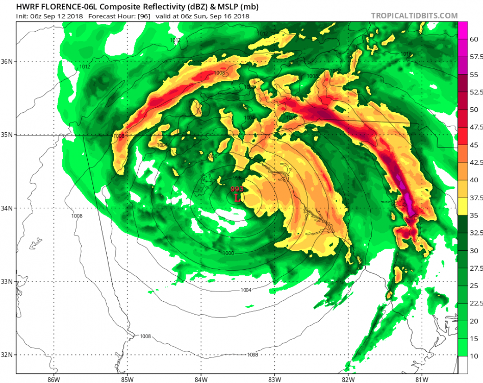
I am absolutely amazed at how quick the grass has died here. It looks like it's been dry all summer, which of course it hasn't..at all. last few runs of the hwrf would mean some impressive totals with tremendous upslope flow into the mountains and it would likely continue even as the storm moves into tn.
-
I would be too quite honestly as storms moving northwest through ga are incredibly rare and to have two storms in back to back years like that would be incredible. There have only been a couple ever recorded. But even if it makes landfall in sc and tracks west, it would be amazing. In fact, i can only find one which made landfall in nc and the remnant low ended up in north ga way back in 1913 but it was a cat one and went well inland before getting here.. ( https://coast.noaa.gov/hurricanes/). So i'm really curious what it would be like if it makes landfall say near charleston and tracks west from there. Even with that track, the mountains would help compress the wind field and winds across the western carolinas and north ga could be quite high. Of course if it goes inland in nc before the stall and southwest/west turn we wouldn't have to worry too much about winds. All i'm hoping for is some rain, it's actually gotten quite dry here. Do not want to go through all those hours of sustained winds, knocked down trees, and power outages. I got incredibly lucky i didn't lose power with irma and i sort of doubt i would be that lucky again if something similar happened.
-
yeah not good...the euro takes the core of whats left of the strongest winds right across here. Irma was such a unique case that it's hard to believe that we could do it again just one year later. Unfortunately a lot of people lost power for days on end and that was just a tropical depression/weak tropical storm by the time it got to the al/ga border. hopefully it will only be a minimal hurricane at landfall and it wont' be as bad.
-
then heads to atlanta. pretty wild to say the least. Who would have guessed georgia as a possible ultimate landfall a few days ago. Worried about widespread power outages and tree damage again in georgia as there Could be some funneling effect between the circulation center and the mountains similar to irma (helped by high pressure over new england too) with this type of track. Unlike irma though, the circulation will be much stronger as it crosses georgia. I lost 5 oaks because of irma.
-
I would think even in a weaker state, a track like that would pile up the water quite a bit as winds and the coast would work together to funnel/push the water up. Pretty astonishing change of events though given the incredible model agreement yesterday showing it heading into nc. Would be pretty wild to say the least to see a southwest moving hurricane along the southeast coast.
-
it will change over soon...just be thankful it's not daytime... I've been there though...a number of years ago, there was a bubble of warm air only over a 2 or 3 county wide area...with snow everywhere else. Warm bubble extended up to 850mb (which is just absurd) with zero chance of it eroding. Stayed heavy rain and 37/38 the entire time. Talk about being pissed off.
-
lol....i've always loved widre's complaining and pessimism. He's always cracked me up.
-
pretty horrible post. there is a real possibility areas further inland from the immediate coast see something noteworthy and attacking those who could be impacted is what is pathetic.
-
I sure am glad I saw that big snow a few weeks ago too. Also got to see about an hour and a half of snow/sleet Wednesday in gainesville...(didn't plan on being here but had to due to an emergency ) because Seeing the models showing these pretty big systems vanish with all this cold has been very frustrating but without that snow I'd be extra pissed off right now lol.