dseagull
-
Posts
615 -
Joined
Content Type
Profiles
Blogs
Forums
American Weather
Media Demo
Store
Gallery
Everything posted by dseagull
-
Extreme Cold, Snow & Sleet: SECS 1/24 - 1/26
dseagull replied to TriPol's topic in New York City Metro
Going to be a classic GFS vs Euro battle royale... -
January 25-26 Winter Storm Potential
dseagull replied to Ralph Wiggum's topic in Philadelphia Region
Thats an awfully strong HP, touting 1040mb or even slightly higher. I think all noteworthy models have a handle on how quickly is departs, and the extent of the arctic air. But is the Euro picking up on this transfer correctly? What data was ingested to show such a massive correction north? The Baja low? -
Extreme Cold, Snow & Sleet: SECS 1/24 - 1/26
dseagull replied to TriPol's topic in New York City Metro
Will be very interesting to see if a trend evolves through 06z and 12z today. -
Screenshot this, and look again next week. Helps keep things in perspective.
-
Ironically, I think you're going to see the highest QPF, just on the edge of rhe sleetfest. You're sitting pretty, brother. Trust me. This setup is going to offer a surprise.
-
Boxing Night Snow/Sleet/Ice Dec 26-27 Storm Thread/Obs.
dseagull replied to Mikeymac5306's topic in Philadelphia Region
They are broadcasting to an entire region of the country. They cannot sway back and forth. If the models continue to pull back for three consecutive runs, they will slowly reduce their forecasts. A bunch of weather enthusiasts call it "saving face," but it's actually been a standard for a long time. Public safety is their number one concern, so a bust isnt actually a bad outcome in terms of forecasting for a government agency. Agree though, this is trending wayyyyyy N and somewhat E. -
Id go for a boat ride, but water is low and icy.
-
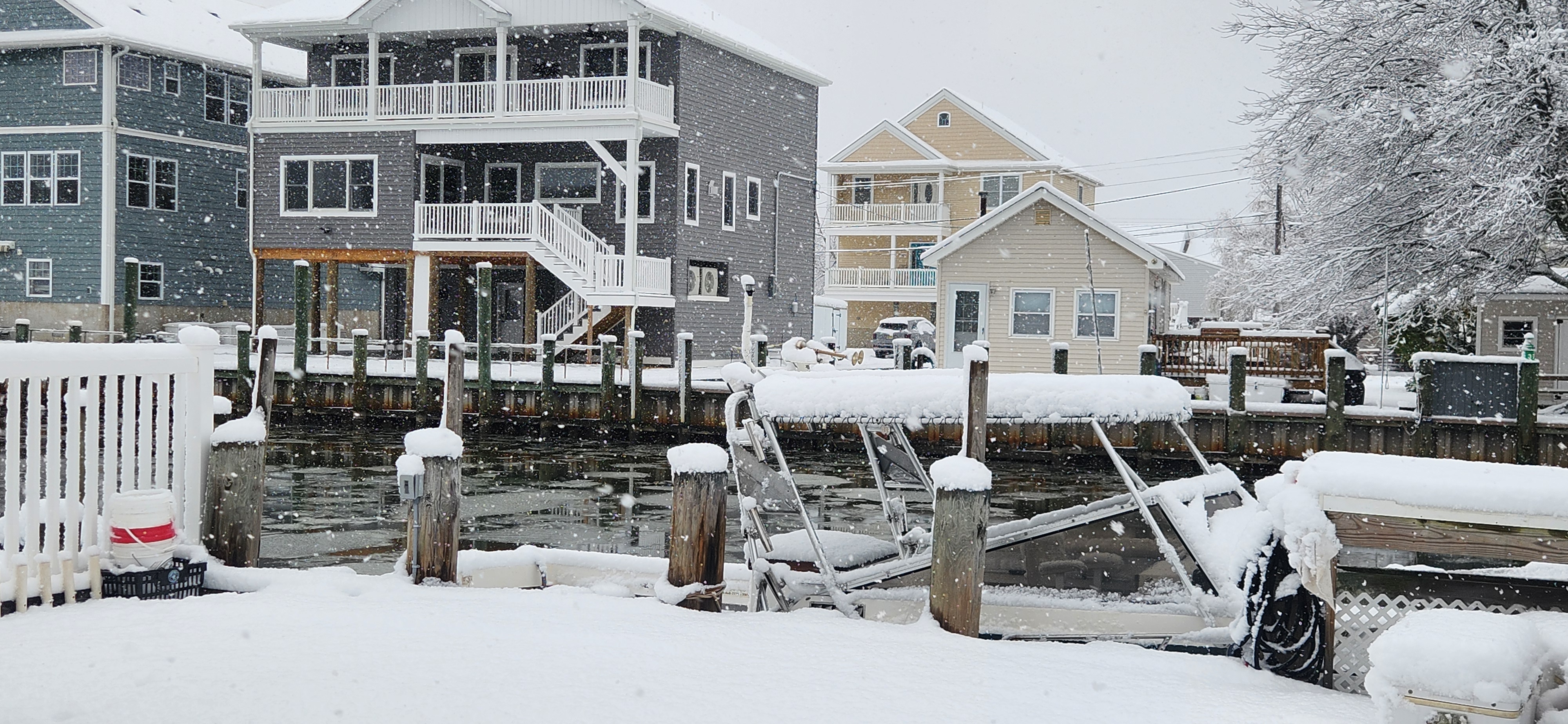
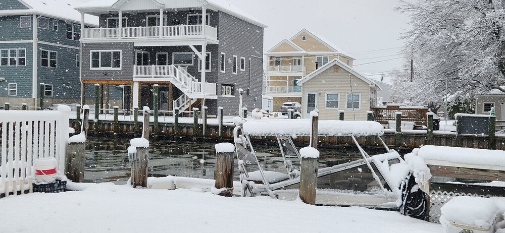
Absolutely stunning views down on the bay. Depending on the surface, I have measured anywhere from 4 to 7 inches. We had 90 minutes of legitimate heavy snow on barnegat bay, WITHOUT wind... which is my favorite snow down here. Its rare.... just vertical falling glorious flakes. Local spotter whom I friends with in the next town north, forked river, said he had 5.7 on his board about a half hour ago. Stoll coming down, but nowhere near as intense. Enjoy, everyone. Christmas spirit is here. Happy days...
-
Was a clear concern of mine and some others yesterday, when temps ahead of the system overperformed... Got more QPF, but cold air held back. Having said that, all surfaces caved around midnight. Eyeballing 2.25-2.5" now in waretown. Looks to be piling up now with the heavier rates. Had the temps been just 3 degrees cooler at onset, I think this would have overperformed for nearly everyone. Nevertheless, I think ill see 4-4.5 when all is said and done, which is well within the forecast. Beautiful day. Enjoy, all.
-
Moderate, almost Heavy Snow at times on Barnegat Bay. Temperatures are certainly limiting accumulation. We will see if the colder airmass can push down through the lower layers before the heavier rates are drawn to the East.
-
Moderate snowfall 12/14/2025 WWA up for most of the area
dseagull replied to WeatherGeek2025's topic in New York City Metro
Just flipped back to rain, after beginning as wet flakes at 1945, albeit, heavier intensity precip now. Would love to see a sounding to understand the column. This one isnt making much sense to me in real time. Time for a wet dog walk and bed. Hoping someone up north cashes in. -
Moderate snowfall 12/14/2025 WWA up for most of the area
dseagull replied to WeatherGeek2025's topic in New York City Metro
North trend is validating fairly quickly. Congrats to those in the metro. Have a feeling you will overperform in a big way from early morning guidance. Those south, tail end with this one. -
Moderate snowfall 12/14/2025 WWA up for most of the area
dseagull replied to WeatherGeek2025's topic in New York City Metro
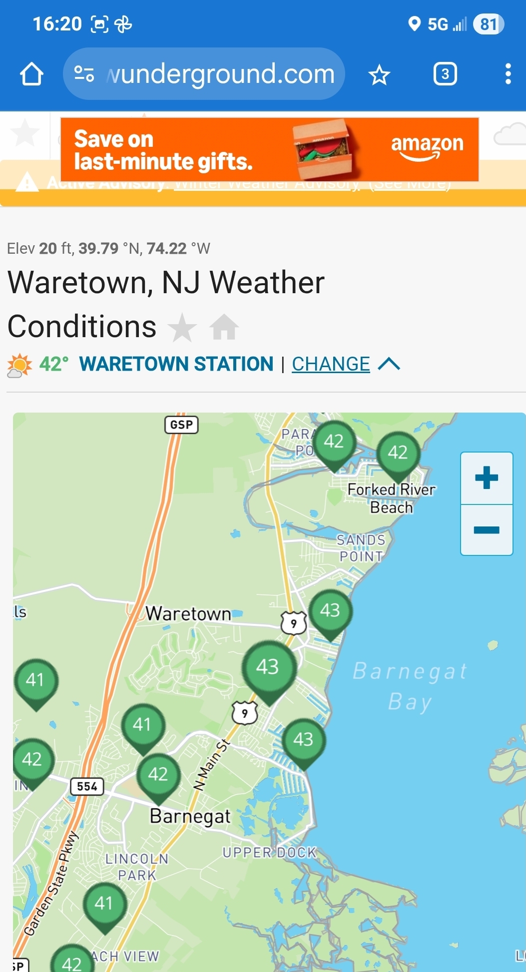
Waretown, temps actually climbing back up to 384 from 37.1 90 minutes ago on the button. Wet flakes and wet ground. Probably see the southern side of accumulating snow. Fully expect accumulation to begin somewhere between 4AM and 5AM. Should get a slushy inch to 1.5 inches by the time it tapers off around 9AM. Looking at the evolution of short range guidance, seems like Deptford NJ through Central Monmouth, through Islip, should be the winners. Im not seeing the predicted cold pushing down quickly enough to make the most of QPF. Would be happy to be wrong, but several decades of experience says otherwise. -
Moderate snowfall 12/14/2025 WWA up for most of the area
dseagull replied to WeatherGeek2025's topic in New York City Metro
Enjoy. Warmer and lackluster down here in waretown. -
Moderate snowfall 12/14/2025 WWA up for most of the area
dseagull replied to WeatherGeek2025's topic in New York City Metro
We certainly live in a different time. Had a banner striper season ourselves, but took a licking on many days. They closed BFT down insanely fast, but we continued to fight, tag, revive, and release. Had an insane morning do so today. Put a 3 man limit of tog together on the way in, and still have bass rolling all over the surface beyond the 3 mile line on herring, sand eels, and cupcake size bunker. Things are definitely on the downturn with some fisheries though. Bay Bay fluking, stellar, but not consistent. Anyway, back to weather. Gonna be a long winter. Pulling the big boat on Thursday. Hope all has been well. -
Moderate snowfall 12/14/2025 WWA up for most of the area
dseagull replied to WeatherGeek2025's topic in New York City Metro
...and just like that, the wind is now at 265 degrees and temp down to 39. 4 degrees in 20 minutes. -
Moderate snowfall 12/14/2025 WWA up for most of the area
dseagull replied to WeatherGeek2025's topic in New York City Metro
Cant ask for much more in terms of early season snowfall on the coast. Had 37 degree water temps inside the inlet. 42 one mile off, and 48 seventeen miles off where we were fishing. Friends that went deep dropping in the Tom's Canyon earlier in the week still touched 58-60 in several spots. Grateful this isnt an onshore wind setup, with the early season warm (relatively) warm water. Hope everyone gets to enjoy, and get some pictures with the snow and christmas lights/decorations. -
Moderate snowfall 12/14/2025 WWA up for most of the area
dseagull replied to WeatherGeek2025's topic in New York City Metro
Have no reason to BS anyone. That was at 1245. It is still at this moment 43. I never trust my vehicle for accuracy unless my marina office weatherflow and my handheld are the same. It got very warm this afternoon with the SW'erlies. Need wind to swing.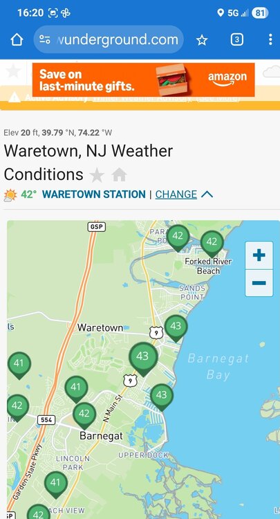
-
Moderate snowfall 12/14/2025 WWA up for most of the area
dseagull replied to WeatherGeek2025's topic in New York City Metro
BALMY 48 back bay barnegat, NJ. Sweating in my hoodie working on my boat. Doesn't feel like snow.
-
Duration under gradient. Thankfully, neap tides. Its bad, but ive been here for many decades, my entire life. I still havd visual tide guages from 40 years ago. Id love to blame my areas back bay flooding on sea level rise, but thats not the case. There have been tremendous man-made changes to the inlet and surrounding areas that are almost certainly responsible. To each their own.
- 731 replies
-
- 3
-

-

-
- heavy rain
- damaging wind
- (and 2 more)
-
It's been a F'n day.... will share pictures tomorrow of what really happened on Barnegat Bay. It was a good one....
- 731 replies
-
- 1
-
-
- heavy rain
- damaging wind
- (and 2 more)
-
And like I thought, boats are breaking free and sinking. This storm may not break any records or be remembered for long, but a significant amount of damage was done, considering tens of thousands of boats were still in the water.
- 731 replies
-
- 1
-

-
- heavy rain
- damaging wind
- (and 2 more)
-
Ill fix my post.... I understand its a gradient squeeze. Trust me, I do. Apologies, im about to watch many neighborhoods get exceptionally wet here, as this system doesnt necessarily deepen, but the net results worsen. If I didnt look at the surface map you posted, id describe an incredibly different situation.
-
I am a bit of a radiohead. I have 3 scanners going with trunked talk groups on custom settings. All of ocean county towns have too many calls for me to keep up with. Trees falling and lines arching are the most frequent. This thing is NOT bombing out (thanks, Omega,) but the net results of the gradient squeeze are impressive. Updated to reflect reality of surface maps, dated or not.
- 731 replies
-
- 1
-
-
- heavy rain
- damaging wind
- (and 2 more)