ariof
-
Posts
674 -
Joined
-
Last visited
Content Type
Profiles
Blogs
Forums
American Weather
Media Demo
Store
Gallery
Everything posted by ariof
-
Without naming names … I guess it's about which thermals you believe.
-
Euro verbatim is probably a net gainer for most anyone north of the New England Mason-Dixon Line (the northern Mass border).
-
It wasn't a big storm but it was quick, and when it snowed, it came down pretty hard, with nice C&I flakes. 26 so it wasn't slop, and not very windy. Wunderground history doesn't have vis, but it shows that the boundary layer saturated at about 1800, and IIRC that was a 6:30 or 7:00 game, so it basically snowed 3 or 4" during the game. The real highlight was Brady running for a first down on 3rd-and-6, spiking the ball, and then losing his footing and eating a face full of snow.
-
A bright spot in an otherwise abysmal winter (I think there was one storm in early Dec that pretty much melted on contact, too). At least the Pats were good that year.
-
The soundings look odd for sleet though. Not much omega in the DGZ, but no real warm nose, and only getting to 0C right at the surface.
-
--SHRA/SHSN in Boston a few minutes ago. Clear line to the north as front pushes through.
-
Congrats Yawgoo Valley on the 18Z.
-
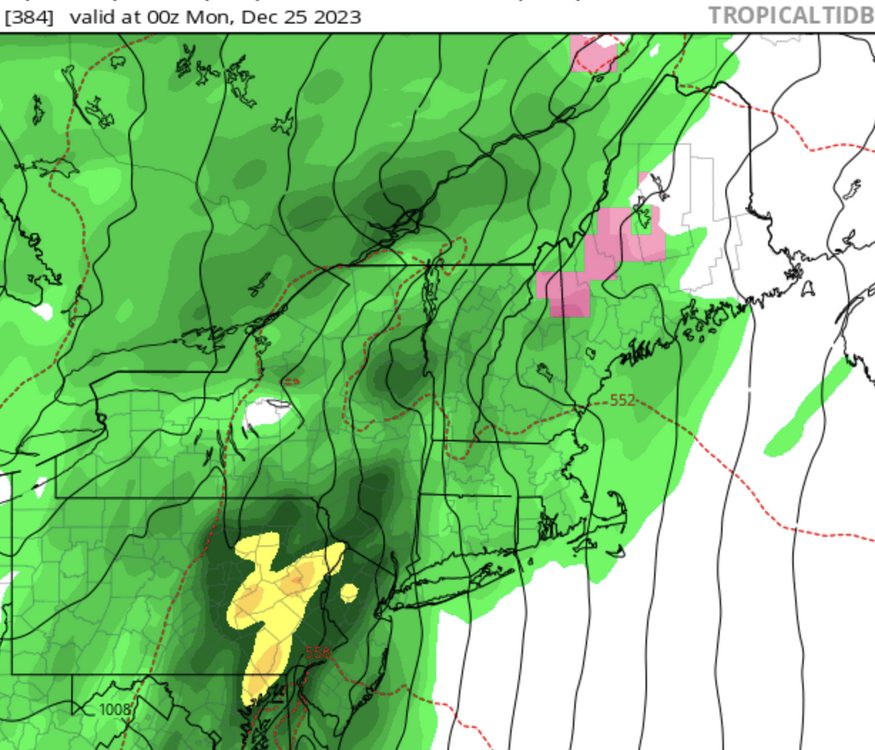
Through 330 the GFS puts Greylock at 48" and Wachusett at 40" at 10:1, Kuchera 59/44, pos change 35/26, depth 26/16 (ish). Pivotal is giving me all this for free for whatever reason. Anyway, what an absolute clown run for Massachusetts.
-
Without 51° two days before
-
I'm probably squinting/wishcasting way too hard but the 84h NAM (12Z Saturday) looks more like the 12Z Canadian than the 12Z or 18Z GFS.
-
Yeah. Highest snowfall last year on a single day was 2.3" NY and Philly media are making a big deal of the snow streak there (since they had 0.9" on consecutive days in NYC last year) but if you set the bar a bit higher it's the longest streak on record for Boston. 675 days since 2.4-2.9" of snow. 3" snow drought was over two years ending in 2013 (so that 2012 ratter). You need to go up to 4.4" to get a three year streak (ending 1909). Remember, we're spoiled. Between 1984 and 1992 there was one single daily snowfall over 6" (and it was only 9"). In the last 21 winters, only 3 have failed to drop half a foot in a day, and only 5 haven't cleared the 9" mark. Even counting consecutive days, no storm for those 8 years cleared a foot. Meanwhile single days have cleared a foot 9 of the past 21.
-
SFC low over KART vs KBAX. It's only 350 miles.
-
Who knows. If the op Euro verifies very little will fly out of KBOS.
-
I was in Jackson, NH that day, which got about 1" of snow, and the 12Z model run was the "it's on" run of the GFS and I got very excited. Took a run up to the summit of Madison on a packed snow trail that afternoon with some friends, and had this spectacular view: to the south it was dark and storm behind the summit of Mount Washington, to the north over Quebec it was a blue sky with just some cirrus.
-
11.6" in 2023 … outside shot at that in the next week.
-
0Z models to weenies: https://getyarn.io/yarn-clip/2ff35f48-51e2-4b25-a79f-182b358f368a
-
Particularly impressive since two of those days below 20 had lows of -10 and -8 (the 4th and 7th coldest since the station was moved to the airport).
-
I know "it's the 84h NAM" but at 12Z Monday the NAM has a 991MB low near ORF and the GFS 978 of BGM (CMC is close) … only about 350 miles apart. Looks like it stems from an H500 trough being centered over Minnesota for the globals and Lake Michigan for the mesocale. Not sure it makes a difference aside from, like, BUF anyway.
-
Gotta love the model consistency one week out. At 00Z on the 19th: GFS operational has a 987 low basically over ACK, with little cold and a storm looking like today (SN only over Vermont) Euro has two 1000 lows, one east of JAX, one south of MSY Canadian has a 996 low west of TPA Goofus is the outlier here, I guess?
-
And that was then followed by the coldest two week period in Boston's history. 7 days with max 20 or below (tied, longest), 13 days with a max 30 or below (tied, 3rd longest). I spent a week at Mont Ste Anne north of YQB and we didn't see anything close to zero; I think the car thermometer went below 0˚ (F) around Concord on 93 and didn't go above until we got back. 61˚ five days later, of course.
-
~10 years. In 2008ish, it was bought out by the family which owns Concept2 (and also has several Olympians, both rowing and skiing). They run it as a nonprofit and just heap money into the operation. Beautiful new buildings, low rates ($10 for a trail pass, not enforced), amazing food and ski operations. They have snowmaking operation and a snow storage operation (they try to store enough over the summer to spread out in fall if needed) and the trails, some of which are paved for rollerskiing, are kept in top shape (drainage, mowing). They also have comms conduit on their race courses for top-level racing and timing. It's quite the operation. Concept2 has more money than they know what to do with (Crossfit apparently has been a boon for them, they made crossfit-specific ergs, charged more for them, and it was pure profit) so they just throw it at Craftsbury. Now if they only paved the access road; it can get pretty rough getting in and out in winter!
-
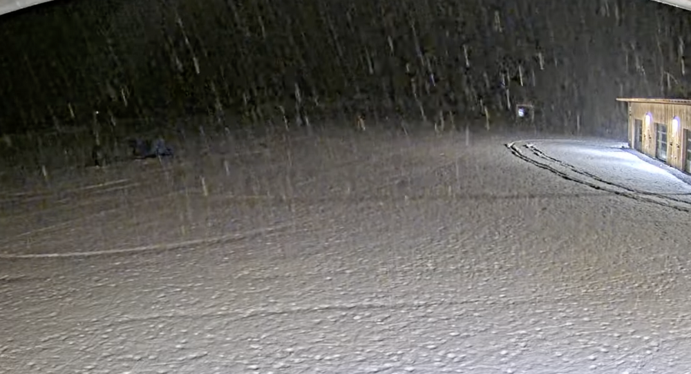
Craftsbury outdoor center webcam shows SN there. Was RA about an hour ago. (Some of the SN on the ground is manmade.)
-
Morch
-
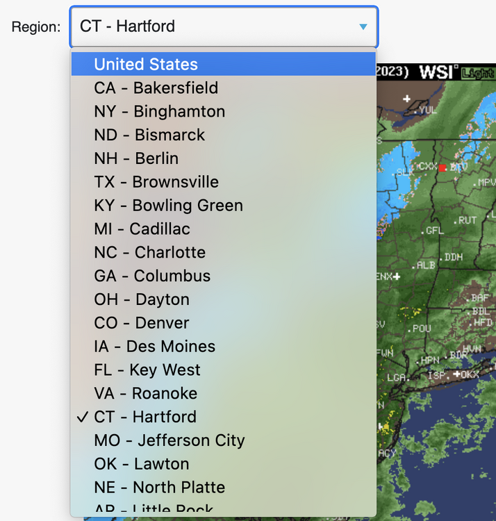
Yup. It was Intellicast before Wunderground and IDK what before that, although I talked with someone who helped to develop mosaic radar in the '80s and I think it might be a direct descendant. And, yeah, it has been breaking for a while. Even before Nov 6, it would sometime be hours out of date. Right now, even, the static image shows 0115Z, but if you click the "animate" the frames end at 2345Z. Plenty of UI deprecation. In the past the animated site had a separate URL, now you have to navigate to the main site and click "animate." Even worse is how their regional sites work. You have to select the list of sites from a list, which has two big UI issues. 1) The sites are pretty random. I happen to know that BGM, BML and HFD are the ones nearby here, as well as STC, DSM, DEN and RNO elsewhere (and others I knew when the site was … less frequently broken). 2) The cities are scattershot and they are alphabetized by city, not state. This is not helpful! There used to be a navigation panel to jump to a nearby site, now you have to use this list, which is, for all intents and purposes, unindexed. Simply alphabetizing the list by state and not city would be a big help. What I will say is that this site is very web 1.0. It loads jpgs and gifs. It uses dropdown lists. You can easily replace the site in the URL with a new site and it loads. If you put in an unsupported site, it loads to the national map. A lot of current designers could learn from this!
-
Merry Grinchmas!