mappy
-
Posts
48,107 -
Joined
Content Type
Profiles
Blogs
Forums
American Weather
Media Demo
Store
Gallery
Everything posted by mappy
-
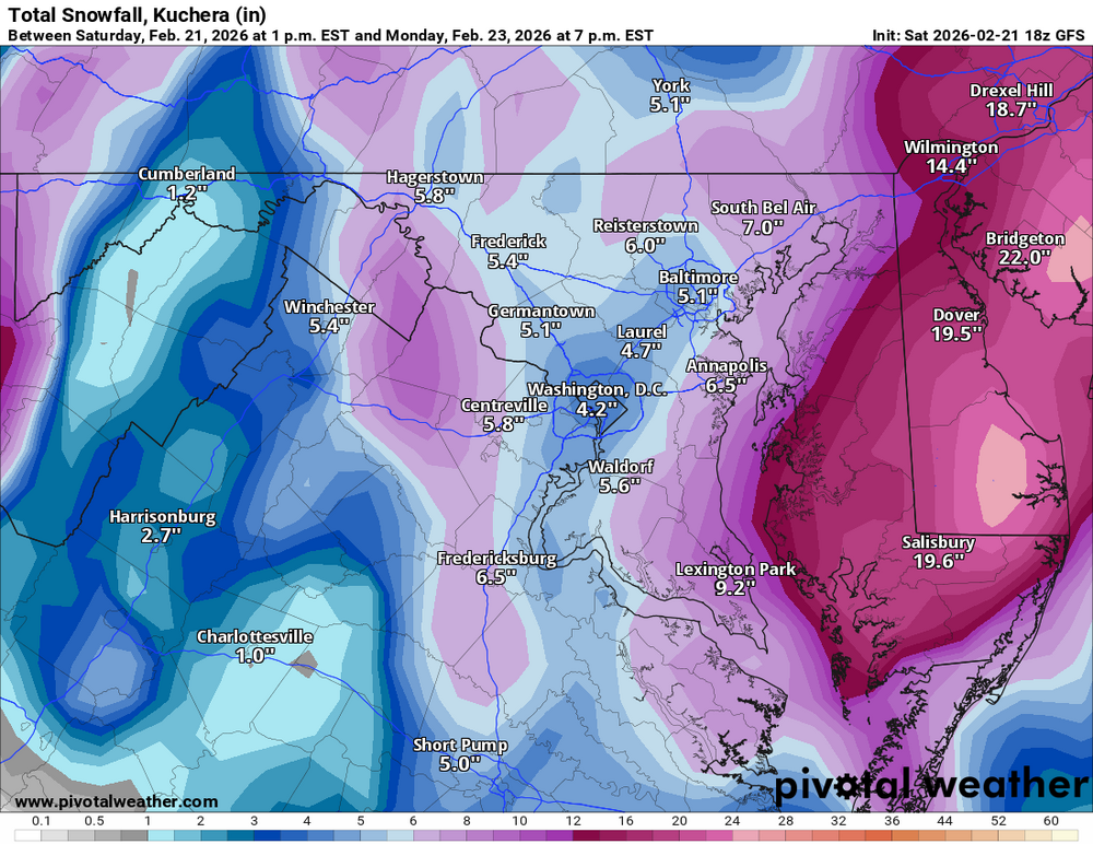
Probably because you’re just outside the CCB and getting the subsidence. My snow, at least per gfs kuchie, is a combo of accumulating daytime snow (thank you elevation) and being on or in edge of CCB later
-
-
About the same qpf wise compared to 12z. Taking climo and temps into account for snow totals
-

The February 22-23 Late Season Miracle: JV Disco/Banter Thread
mappy replied to bncho's topic in Mid Atlantic
50 for a high here as well -
Never been more grateful to have 700’ of elevation to help with accumulations
-
I’m not sure actually. We will have to figure out when/where. Maybe somewhere in the middle for us all?
-
The February 22-23 Late Season Miracle: JV Disco/Banter Thread
mappy replied to bncho's topic in Mid Atlantic
Ahh, got it. Well, sorry friend. Hope you enjoy what you do get to witness. -
So many little things that can boom or bust this forecast. Daytime temps/rates will impact total accumulations before sunset, then where the heavier band(s) set up overnight. It will be easy to get 12” if you’re under the CCB, while dry air will kill snow nearby.
-
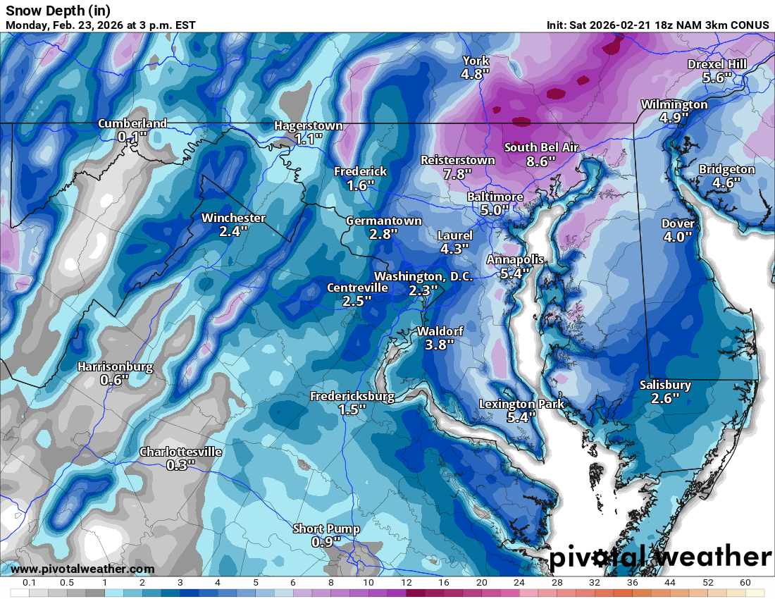
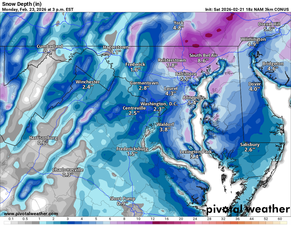
Yeah, I don’t look at them too much. Only shared to reply to snowfan who had mentioned depth.
-
Hard to say. I think @high risk said something earlier this week about downsides to snow depth but I don’t recall the details Rooting for you! Agreed! Yeah 12k just isn’t as detailed. 3k thermals are usually pretty good within a day. They did well 1/31
-
I honestly could not tell you the last time I actually looked at 12k
-
I feel for you. Most of your snow is completely dependent on where the bands set up tomorrow night
-
IMO 3k, it’s higher resolution
-
Whoever told you to go should be banned
-
Not complaining
-
The February 22-23 Late Season Miracle: JV Disco/Banter Thread
mappy replied to bncho's topic in Mid Atlantic
They won’t cancel classes Monday? -
Not hiding much but please do try to add more than just all caps posts and holy fck
-
The February 22-23 Late Season Miracle: JV Disco/Banter Thread
mappy replied to bncho's topic in Mid Atlantic
So the pool cover was about to tear. Managed to break thru top layer of ice to get a pump in there to remove some water, but the water under the cover that was left in the pool is frozen solid. Soooo we might lose the pool cover if it snows too much -
Just texted my sister and BIL who are in Selbyville, told them to send me videos
-
The February 22-23 Late Season Miracle: JV Disco/Banter Thread
mappy replied to bncho's topic in Mid Atlantic
Happy to report we actually got food for the week, and lots of snacks for the snow haha just made another drink -
The February 22-23 Late Season Miracle: JV Disco/Banter Thread
mappy replied to bncho's topic in Mid Atlantic
lol not a possibility. He’s been snipped for a while -
The February 22-23 Late Season Miracle: JV Disco/Banter Thread
mappy replied to bncho's topic in Mid Atlantic
Kid is at a friends for rest of day/night. Mr Map and I had a drinking lunch before we head to grocery store. Buzzzzzed -
I genuinely thought you moved and was happy for you to be out of the desert
-
You should update your location
-
Really? I just typed in Cross Junction, VA and it’s all snow after 4 and 2-5”