Stormlover74
-
Posts
24,215 -
Joined
-
Last visited
Content Type
Profiles
Blogs
Forums
American Weather
Media Demo
Store
Gallery
Everything posted by Stormlover74
-
Permanent DST passed the house
-
Only hit south jersey/ Philly and midatlantic
-
Yeah was surprised how quickly it got here
-
Supposed to be quite breezy. Not sure if that will help
-
Euro and gfs hinting at rain Saturday..Hopefully holding off til at night
-
Looks like no rain chances for at least a week
-
Definitely wasn't expecting that much
-
Pretty good downpour up in Warren
-
Keep saying we're going to look into a generac
-
Its crazy how this happened last July too only 10-20 miles to the north
-
Heavier stuff just clipping me now
-
That area by south brunswick must be getting hammered
-
Lots of flooding on Rt 1 https://www.threads.com/@collingrosswx/post/DalKt7HAeCP?xmt=AQG063ET6zrUBf4R0o9Ki_Et4xUnpTfIlhjB-qvK1v6Mdc_2vQ4aYhVas6KVpz_1iDhxXhA&slof=1
-
Surprised Mt holly hasn't put out anything Upton has for S.I.
-
That big cell is so close but probably won't make it here Lots of thunder for sure
-
Its coming
-
88...above forecast
-
Borrow a hoodie from nycwinter? Although he's probably using it today
-
Yeah we'll see
-
Quite dark to the southwest
-
Yeah we don't need another repeat of last July
-
ACY 106. Seems high
-
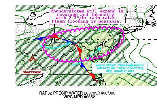
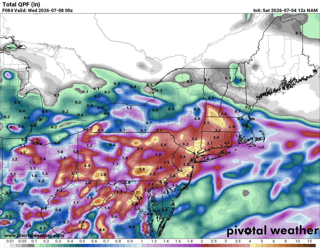
Nam is a deluge

-
Yeah hardly any rain but the wind did its damage