

Yeoman
-
Posts
3,179 -
Joined
Content Type
Profiles
Blogs
Forums
American Weather
Media Demo
Store
Gallery
Posts posted by Yeoman
-
-
2 hours ago, NorthArlington101 said:
Regarding Tuesday's storm (threat), seems like our best chance is definitely something weird happening on the backend -- not sure exactly what that is (CCB might be the term I'm looking for) but it's how the ens members that do, both EPS and GEFS, get us somewhere. For those with GEFS access, p29 looks nearly identical to the 12z EURO run 2 days ago.
Probably a 1-1000 shot, but why not keep an eye on it anyway?
We always get screwed on the backend.. hurts just thinking about it
-
 1
1
-
-
32 minutes ago, SnowenOutThere said:
Why are you posting about the first week of December on the 17th? The patterns aren't even set in place, yet alone a storm.
He had some free time between PE and Social Studies
-
 6
6
-
-
1 hour ago, TugHillMatt said:
That's pretty much what I'm saying...why even include Pittsburgh, and an embarrassing call at that, if it's not even in the area. It might look odd to cut it off at the end of their viewing area, but to me that would be better than putting some junk call out for that area. It doesn't make a big deal to me personally, of course...but I'm all about presentation and as a teacher, I would expect a professional to not make such a careless map.
Shouldn't you be teaching at 1pm rather than picking apart a random snowfall guess from some second rate local TV station? There are plenty of other educated guesses out there from actual meteorologists that would be far more worthy of your time.
-
1
-
-
10 minutes ago, WinterWxLuvr said:
That map is awful
Sue Palka drew the numbers out of a hat at the recent Fox 5 happy hour.. so no less likely than any other random seasonal guesscast you'll find, including NWS..
-
2
-
1
-
-
4 minutes ago, H2O said:
Dude, I grew up when squirrels would do this.
Me too, then some areas figured out it might be a good idea to bury power lines.
-
1
-
-
Sad commentary about our infrastructure when a 20mph wind gust and some showers takes out the power.
-
Horrendous snow cover for NA.. good thing it's meaningless
-
1 hour ago, high risk said:
There will absolutely be potential for FLASH flooding in the DC-Baltimore region. It's going to be a roughly 6 hour period late tomorrow with several bands of convection (with potential for TORs) that will have torrential rainfall. I can certainly see some localized 3-4" totals that will create major problems for the evening rush hour. Things will be worse if the warm advection rain later tonight ends up overperforming, which is always a possibility in this type of environment.
We had that almost every day last week and didn't even need a tropical system!
-
12 minutes ago, high risk said:
But that's not what the guidance shows. There is a lot of consensus that much of the area along and southeast of an IAD-FDK line will stay mostly dry tomorrow until the convection rolls in during the mid to late afternoon.
But a coupe inches of rain over 12 hours is so exciting
-
 1
1
-
-
1 hour ago, GaWx said:
Does Josh add a new ring to his hand with every successful chase?
-
2
-
-
9 minutes ago, H2O said:
Let them walk.
They probably don't know how at this point.
-
1
-
-
-
10 minutes ago, bch2014 said:
It will be less. Less than Harvey and Sandy too.
You have any good lottery numbers?
-
1 minute ago, KPITSnow said:
This jokko williams clown is full of garbage. He does NOT have 156 MPH sustained winds and gusts to 200.
Was just going to post this.. nice video but a BS artist
-
1
-
-
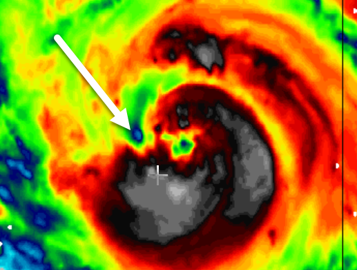
Eye showing up on KLIX radar
-
5 minutes ago, Prospero said:
OK who agrees?
My wish:
Ida gets her eye and RIs into a Cat 5, reaches near the LA coast to justify evacuation but not that bad and shifts east staying offshore bringing fun and excitement to the Florida Gulf coast (not too bad, but thrilling even for Tampa Bay), then moving west to the Texas coast giving everybody a taste there maintaining a perfect eye, then going east through the channel between Cuba and Florida allowing the Keys and Miami to have some fun, up the eastern coast brushing Cape Hatteras intensely (they are used to it, can handle it, and love it) then drifting up the east coast past VA and sitting for a day or so off NJ becoming a Cat 5 sub-tropical Hurricane and slamming NJ so nobody will ever mention Sandy again.
A perfect eye the entire week long adventure.
Right?
")
As long as it permanently disables your internet, I'm in..
-
3
-
-
4 minutes ago, Rjay said:
Usually that leads to very hot towers and RI
I hope the AF planes don't burn up
-
1
-
-
16 minutes ago, Prospero said:
Ida, she/it is trying like hell to get that hot energy from the Gulf into the atmosphere where it belongs.
What is the the cool spot? Dry air??
Flock of birds
-
2
-
-
19 minutes ago, Eskimo Joe said:
GFS dives Ida' remnants well south of us, which is on par with climo. We lose again.
Good - the last thing we need is more rain
-
3 hours ago, turtlehurricane said:
Seems like the track has shifted east with every model run. I'm starting to wonder if it might go due north into Florida. Probably not, but kind've looks like that on satellite.
Anyone here have any theories why the track keeps shifting east as this comes into focus?
Who does the red tag vetting around here? Don't quit your day job..
-
1
-
5
-
-
Hopefully it gets to a cat 5 right before landfall
-
2
-
 4
4
-
 2
2
-
4
-
-
7 hours ago, H2O said:
It means that the gulf and tropical ATL will be conducive for storms to develop
Must be late August
-
I hope the fish don't get too wet
-
1
-
-
11 hours ago, WxWatcher007 said:
Absolutely. Love me some HWRF, but when it’s not in its wheelhouse it can be hot garbage.
Wheelhouse being an hour before landfall?
-
1
-
2
-
December 2021 Medium/Long Range Discussion Thread
in Mid Atlantic
Posted
His tea leaves are stuck on a container ship