jbenedet
-
Posts
7,567 -
Joined
-
Last visited
Content Type
Profiles
Blogs
Forums
American Weather
Media Demo
Store
Gallery
Everything posted by jbenedet
-
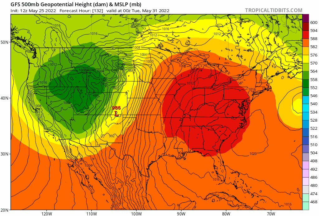
90% of winter: +NAO 2/3 spring: -NAO
-
Anyone ever see a brown recluse in the region? Something very similar? Could have sworn I saw one the other night on my back door. Almost shit my pants. No web. Just hanging out on the lower portion of the door. Should have snapped a pic. I usually leave spiders that are outdoors as a means to kill all the other pests. But this one had me thinking it’s an exception. Warm basements due to oil furnaces can make for microclimates…
-
That’s what I’m noticing. My tomatoes and peppers exploded in June. I believe late May was also much warmer. Granted it came with a lot more watering. I feel like they’re 60% - 75% growth of last year ytd.
-
I know I’m slightly warmer than you but that helps explain why my vegetables are all behind vs previous few years despite the copious rainfall. I should start taking soil temps. Doesn’t help that the vegetables I like, and already planted outside all prefer the warmest conditions—tomatoes, squash, cucumber, peppers, and I have eggplant starting inside.
-
This is gonna be pretty cool. I believe this gets pushed forward ~24 hrs to Monday given the guidance trends.

-
Can have a beautiful mid spring weekend on a Canadian airmass in late May. At this point, after looking at the tele’s, hoping the block flexes to send the door down to the mid Atlantic. We avoid the rain, and have dry mid 70’s. Not summer, but great for BBQ’s, hiking and camping. Best chances for a nice weekend with this setup are further north and east into NNE. Pretty damn remarkable timing. I mean, it’s probabilistically rare to muck up a 4-day window this time of the year. But here we are. Again.
-
We’re going to bake this weekend. Even the EPS is showing 90 in SE NH already.
-
Many shades of Persistence. Really hope we shake the dry and hot pattern come June though. Scorched with the high sun angle. It’s brutal for the young plants. Had several casualties last year.
-
Coastal SNE is surprisingly chipper given the latest guidance. The seabreeze front going to push well inland everyday through Friday looks like with strong surface HP hanging out over the GOM. 50's more likely than 70+. OOf.
-
This is the first year I’ve grown full vegetable plants indoors prior to planting. Should have started earlier, but coming along nicely now. Fortunately I get plenty of natural light. Would suck if I had to rely on a grow light. With 1st half springs like this, this is the way. Miserable otherwise. Even if you miss the late frosts/freezes these persistent marginal air masses cause everything to grow at a glacial pace. Not worth early planting. Period.
-
The persistent, exceptionally low dews is what I believe has set all the vegetation so far back ~ 1 month vs the calendar. This year was a great test case. I mean it makes sense for the plants and trees to key off this more than anything else—frosts and freezes are close with dews <35F. Not worth the risk to put in all the energy to budding/leafing with that around.
-
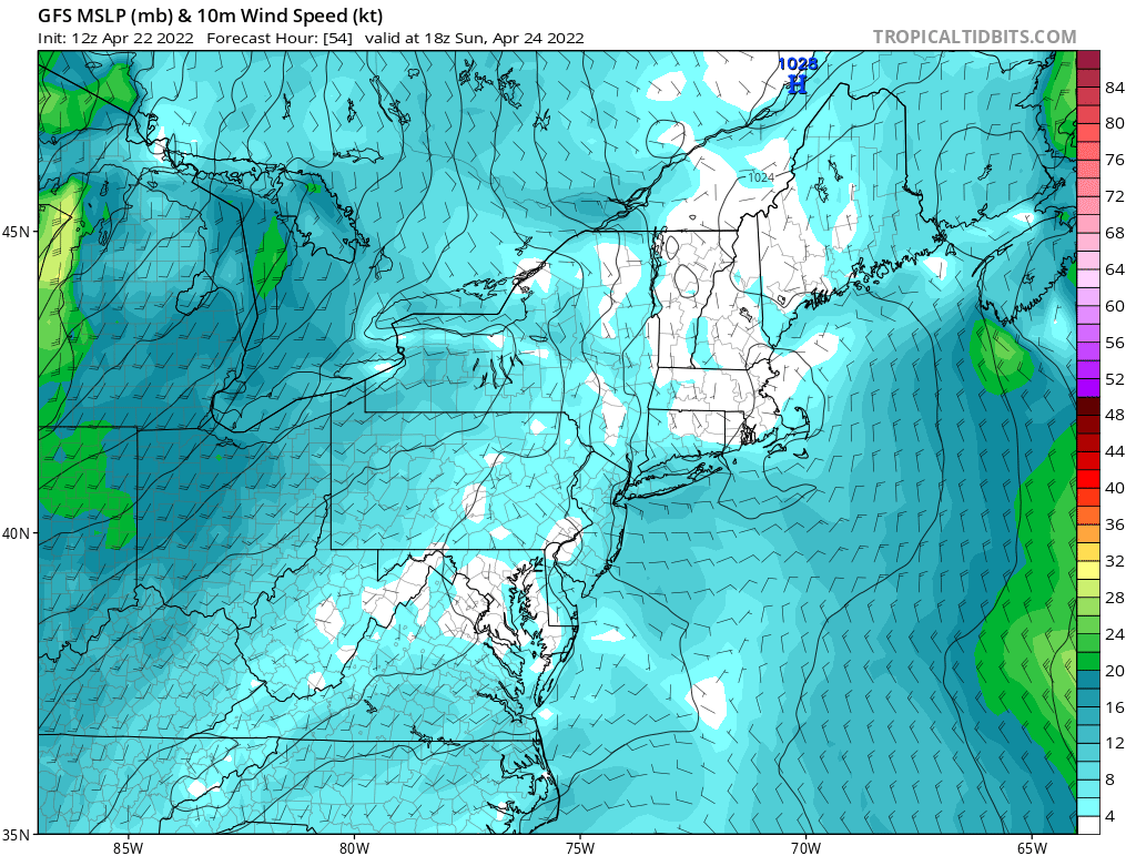
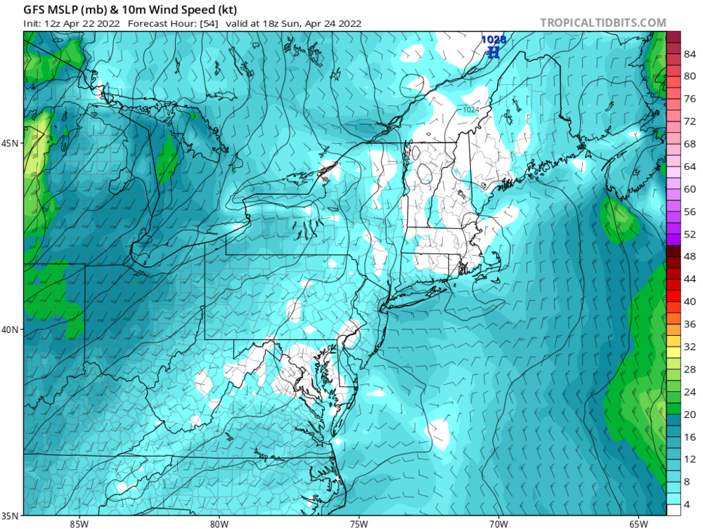
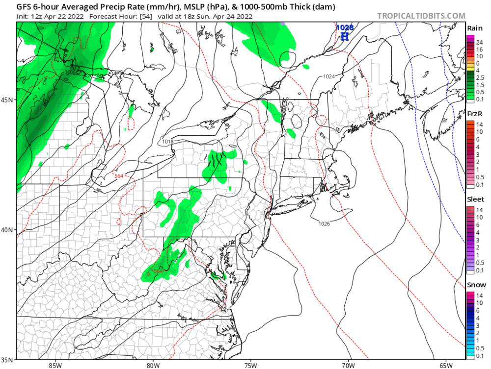
Quite the cut-off in sensible weather Sat/Sun- NNE vs SNE. 45F and windy, with showers in Providence RI, 60F in Portland ME, mostly sunny light winds., gusty in afternoon. Best in Maine. Looks like the cut-off for decent weather is right along the NH/MA border.
-
Climo the past 7 years - increasingly emphasizing the "England" in New England.
-
The BN stuff is done. But… Below normal is nice from mid May through summer. Saying “spring is here” on May 10th will get you punched in the face. We got no help when we needed it.
-
Clicked the heat on again this morning. It will be needed through at least Wednesday. Trip home from NY, leaves look a month behind, broadly. Stick and mud seasons last too long. Been a brutal stretch. No tropical air masses, really stymies vegetation growth, of all kinds. Key ingredient under-appreciated.
-
Wedding season April 1st to October 31st. Premium vs November.
-
We Scootlund. Catching on…? I had my wedding Nov 18, 6 years ago. The weather was mid 60’s. Gorgeous day. Heading to a wedding this weekend in Long Island and it will be colder than that. April 30. And they paid a hefty seasonal premium for that date.
-
It’s been pretty damn awful and continues. The persistent dryness (not rainfall, but air masses) is also stunting all plant growth—especially in the garden beds. Hands still cracking as if it’s winter. Sucks. I’d much rather more rain and clouds if it came with high humidity and full green up.
-
Nicer than yesterday now.
-
Parting the sky like Moses did the Red Sea.
-
Suns out guns out for the milfs?
-
Today looking a lot like yesterday here. Even the surprise afternoon jump once the sun gets to flex and the light winds shut off. 60 attainable. We take.
-
I only see upside when GFS is outputting upper 40’s with 850 temps >0C. Biggest error bars on modeling is that of clouds. My bet is that output is wrong. South of I84 will be tough though. Best in Maine, worst south of 84.
-
TMI. Time for some manscaping
-
Sunday looks the worst down to Joisey and LI. Big sell on 40's here with surface HP overhead.