jbenedet
-
Posts
7,815 -
Joined
-
Last visited
Content Type
Profiles
Blogs
Forums
American Weather
Media Demo
Store
Gallery
Everything posted by jbenedet
-
Yea guy, modelology FTW.. Better off listening to the 12z CMC over the 12z GEFS. Right? That cohort of modelololgists wasting everyone’s time. Verification scores; easiest thing to check but let’s look at more garbage output because, well, we’re lazy and can’t think for ourselves. Good luck.
-
Yes Jan 4 threat is real. I’ve made that clear. It’s a small window before the large scale pattern reasserts. But I think this window is dry for our subforum.
-
Yea that’s what I’m feeling.
-
Yea first time since last winter season. Add it to the growing list of signs pointing to a big warmup in coming weeks.
-
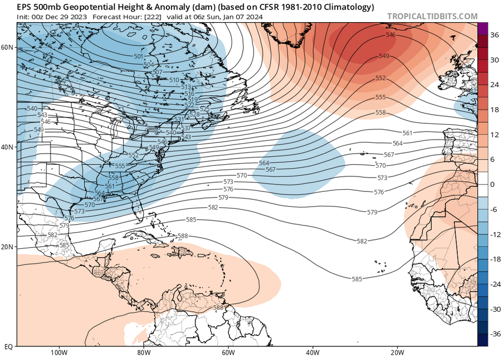
The 2nd week of January, beginning Jan 7th-ish, looks like torchiest (?) period so far this season. Whoever gains a pack prior will be wiped out during this window. Very strong signal for significant +T anamolies with duration. Thinking this will be weenie cliff-jump period.
-
To be sure, I think Jan is going to torch. The grass has greened up and it will stick for the next couple of weeks at least. That’s what all signs are pointing too-observationally, MJO, global guidance, and even the guys at the CPC. I’m not saying it will never snow again, but we are in a very poor synoptic pattern for snow at the moment, and it actually looks like it gets worse before it gets better. First week of Jan looks slightly AN, but then we’re back to +AN. I do think it makes sense to wait until that analog consensus for El Nino’s —very late Jan into February period which tends to have a large scale switch to wintry conditions. Although, before getting more enthusiastic for a big comeback we need that timeframe to come within view.
-
We tried to tell em.
-
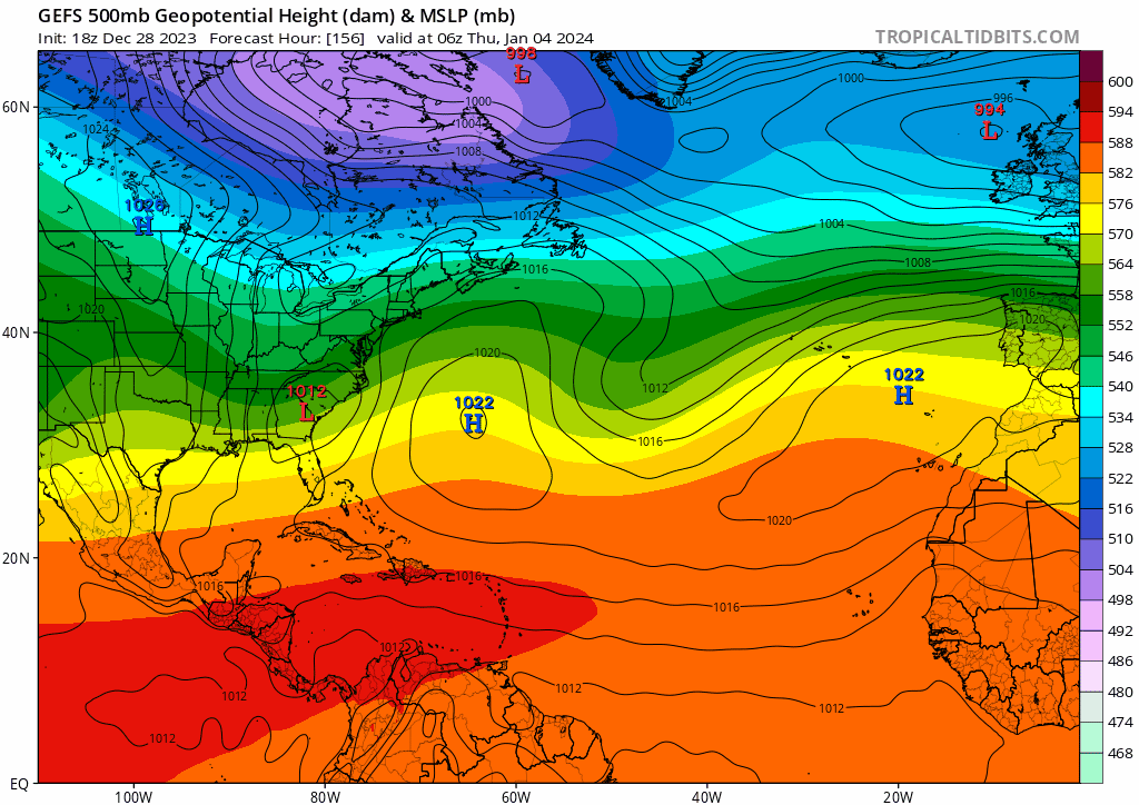
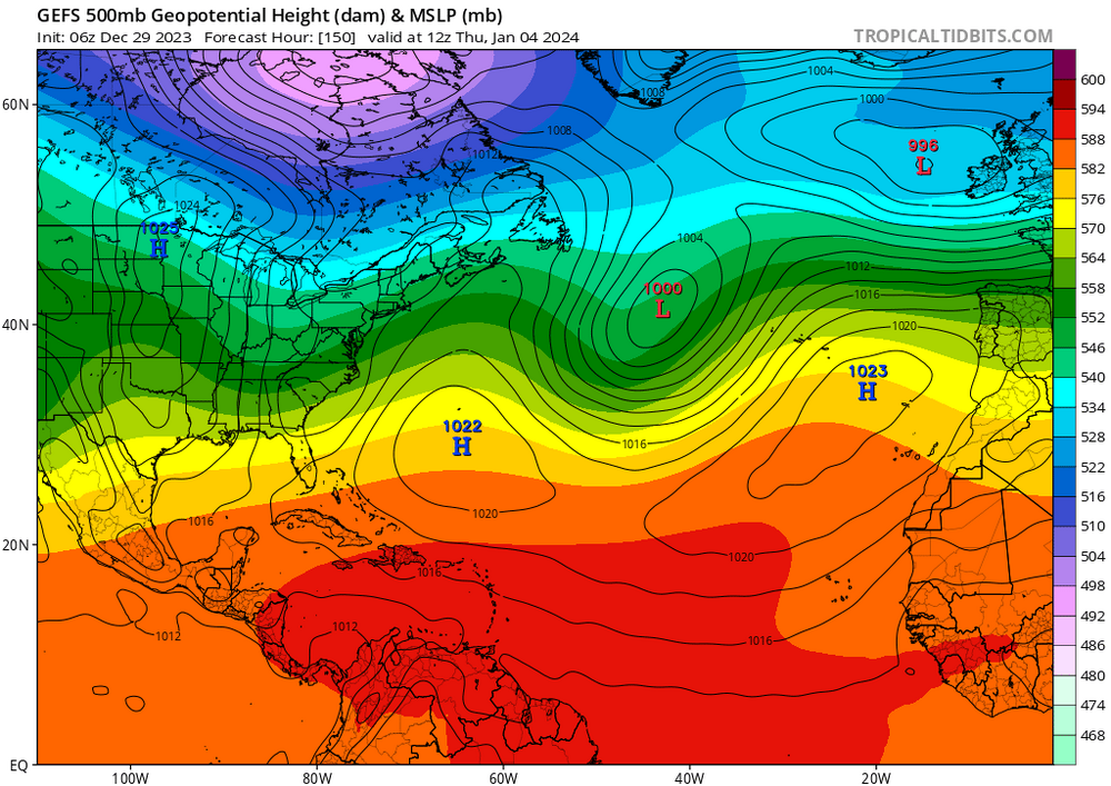
RE Jan4: The northern stream is improving but the southern stream is deamplifying over the western Atlantic. That’s the trend on guidance; and it’s supported by the teles. My thoughts are still that the northern stream will dig for gold; and it can hook up with the southern stream shortwave much sooner, over the SE CONUS; but —despite this—the downstream UL height amplification over the western Atlantic will remain muted and therefore not allow enough latitude gain to bring SNE into the game. Still think south of mason Dixon more interesting than Nova Scotia but both are very much in the game. At the same time, Portsmouth NH 40, sunny and dry. My best guess.
-
Epic flock of geese spotted in Newington. Close the shades to February.
-
I’m very interested to know how many El Niños had strong comebacks due to wholesale pattern changes vs taking the p anomalies and existing storm tracks and throwing them into peak winter climo. If —and that’s a big if—it’s most of the latter, we’re in big trouble.
-
I’d get excited about a comeback if the warm/wet storms weren’t so goddamn warm. I mean, the calendar won’t help us when it’s been 5-10 degrees above freezing, generally. You need wholesale changes. You overlay what has happened storm-wise (take a mean) at peak winter climo and it’s still trash. Maybe this changes in a month, but right now the persistence forecast is near as bad as it gets for winter-weather.
-
I mean with the El Niño backdrop it makes sense to have the high precip amounts; but we’re at record levels. I see it differently- El Niño conditions will persist, we know that. We can’t get every 2”+ rain producer on the continent and also expect the cold interludes to consistently track the big snow producers over our heads. The p anomalies in this regard would be insane. It’s a bad bet. The very stormy pattern for us is when it’s warm. Very warm. That continues to be the case. That’s balanced by brief periods of seasonal cold and dry.
-
We can’t get every storm guys. We gonna blow every precip record away? Lol. Dry has to happen some time; unfortunately it’s with the cold.
-
Check out the trend in New Brunswick. Surface HP. But that trend is still in early innings…

-
I mean, that would happen but confluence is building in the western Atlantic at this time. It’s going to offset that correction, imo.
-
That is def the trend.
-
I am skeptical; I think it’s one of these that occludes around Virginia’s latitude and slides ENE. Worth watching though.
-
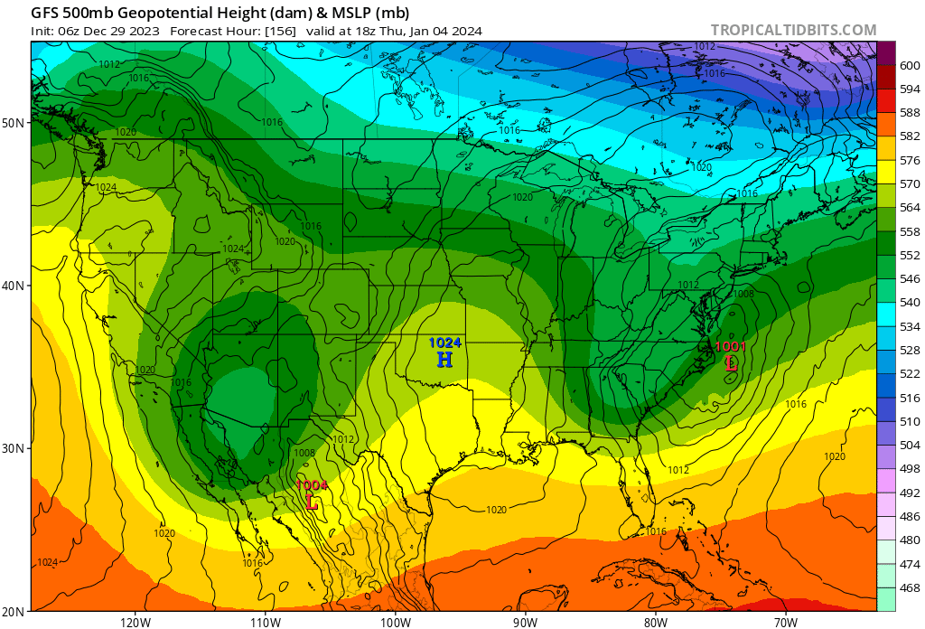
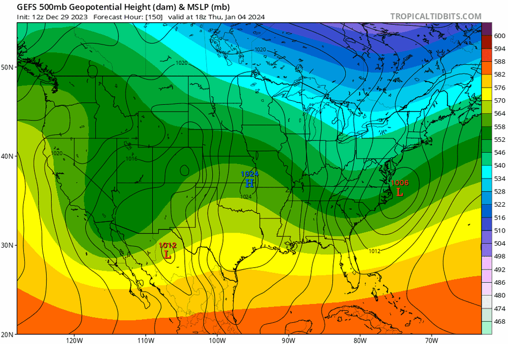
That’s a well timed Canadian surface HP showing up on the 6z GFS. Watch this trend. Pay attention Mid Atlantic/extreme southern New England.

-
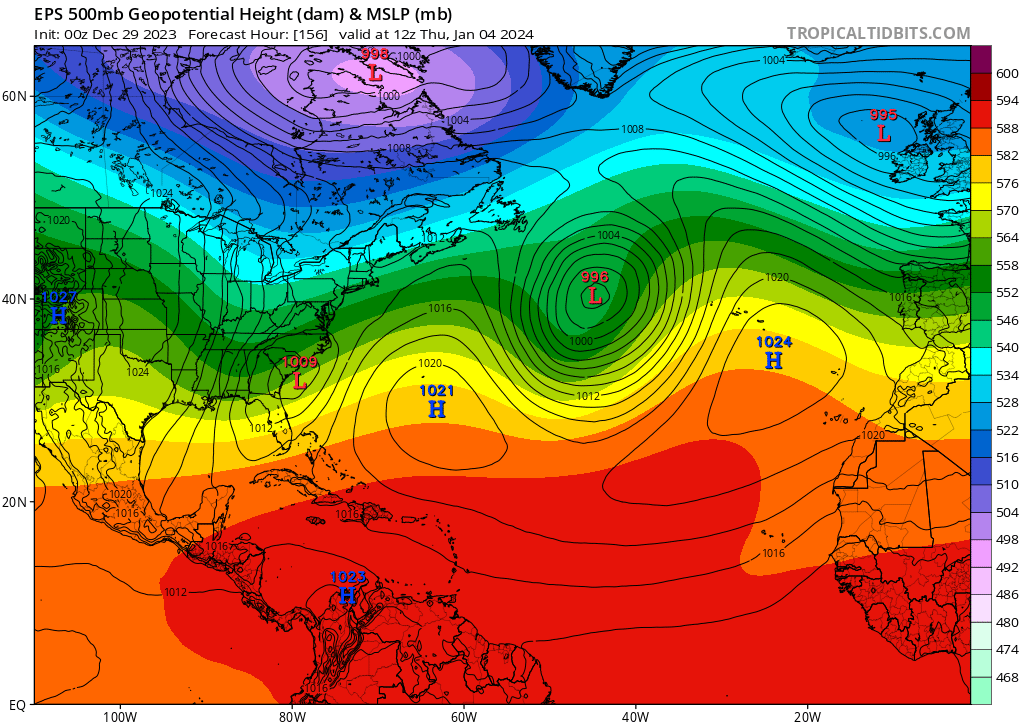
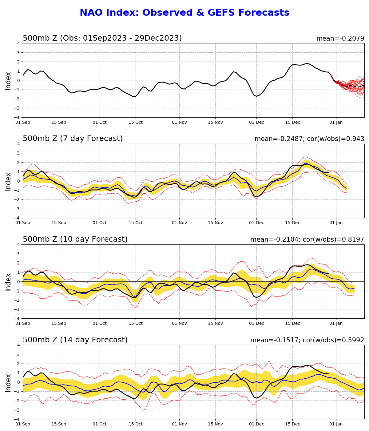
I’m in general agreement with all of this. But just want to highlight surface highs can make sneaky appearances. For one, this map doesn’t at all align with -NAO look in the western Atlantic which is forecasted in the teleconnections out ahead of the Jan 4 disturbance. The 6z GFS op is starting to pick up on it… I believe that trend is real. Too much of a good thing for us northerners, maybe not for the south coast. Heads up Mid Atlantic.

-
This is kinda my point all the time; makes no sense to use calendar climo if the world around you doesn’t match it. We have Dec 29th sun, that is all. If the landscape is similar by mid Jan, better off using Nov climo as a guide until/unless winter makes a sustained run to take us back towards mean conditions.
-
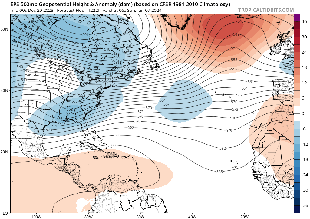
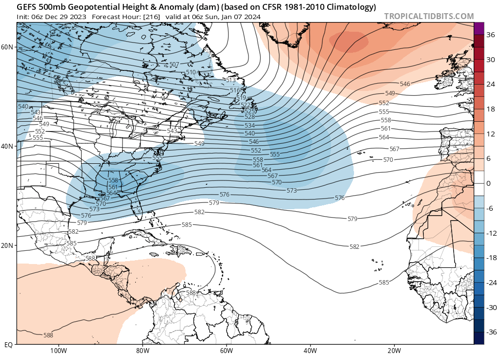
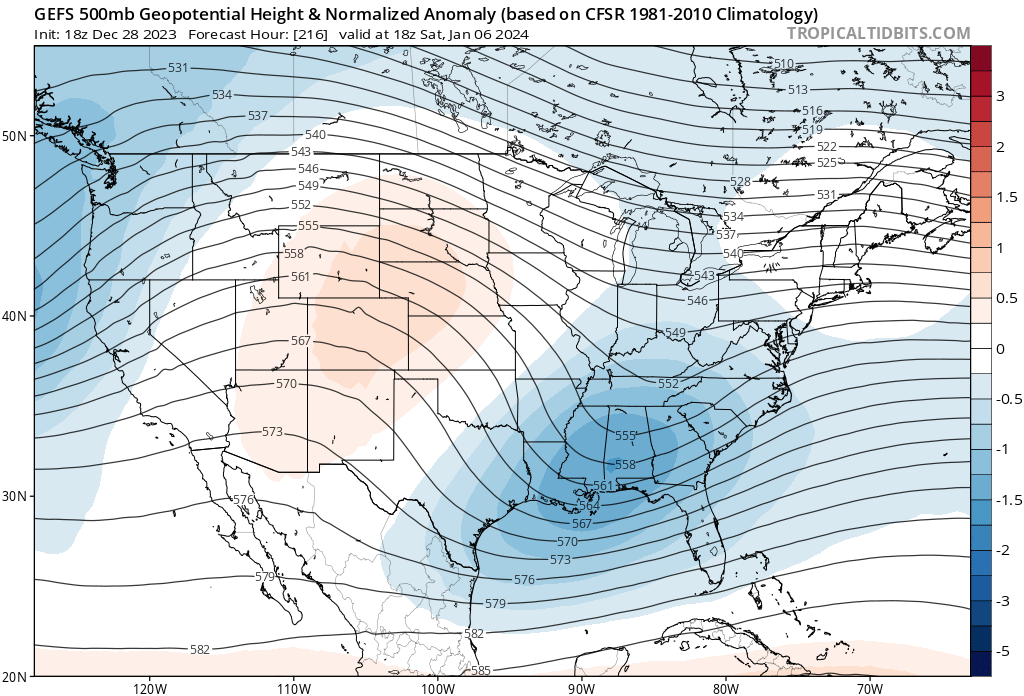
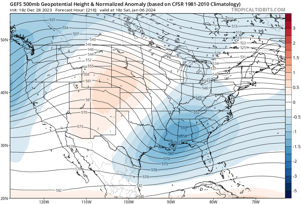
The 6th-7th threat looks gone to me; no way to get this up to our latitude until further notice. Focus is on the prior shortwave; around the 4th. I think this one trends south too, but it will end up a much closer threat, than the latter. Worth tracking. My guess is first shortwave is centered around the Mid Atlantic, the second the southeast. The snippets below are concerning the Jan 7th disturbance.

-
No upper level ridging in the western Atlantic. Not a hiccup; it’s the sticking issue for this one, I’m afraid. Congrats Asheville.
-
I mean it looks like a big system. Tearing a hole in the upper atmosphere has no problem yielding sufficient cold in winter, generally. That’s a given. The general tapestry at the surface looks BN in the south; N to slightly AN to the north. Common layout for Southern snowstorms.
-
Gonna be cut-off happy, me thinks. It’s generally colder so it does mean snow wherever that happens. I like south better than north right now. Gonna take some time for guidance to come around to it though. Big changes in the NAO still have to materialize.
-
Yea I’m not worried about ptype with this, as I believe it hooks up with the mid levels. The +temp anomalies I’m seeing on guidance in the north has me thinking the real risk is in missing out is that it’s a southern snow storm—>mason dixon on south. That’s what is being hinted at. The Teles will also be primed to phasing during that window—early phase/cut-off,