Tullioz
-
Posts
2,469 -
Joined
-
Last visited
Content Type
Profiles
Blogs
Forums
American Weather
Media Demo
Store
Gallery
Everything posted by Tullioz
-
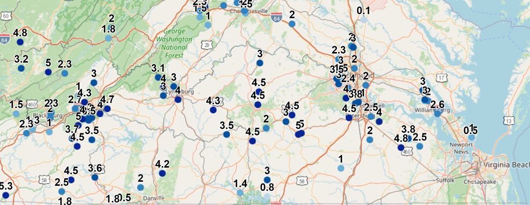
Looking at some of the early snow totals from the warned area in Virginia, it appears like many locations were able to meet warning critera. With a few hours to go before the snow ends, some may exceed what was expected by quite a bit.

-
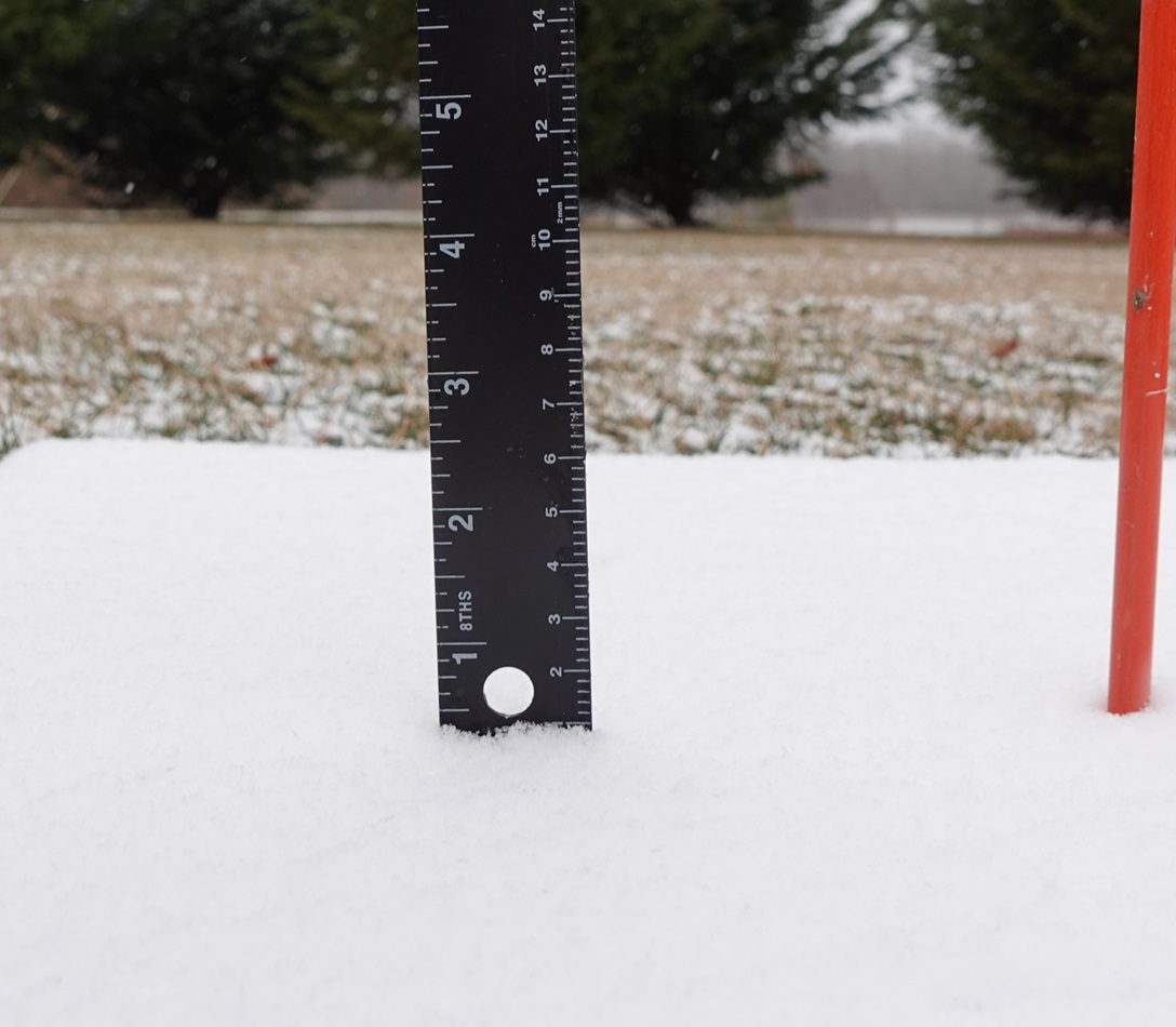
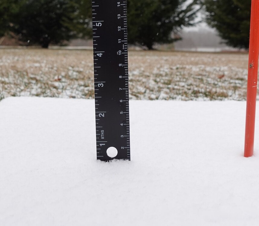
An additional 0.8" of snow accumulated since my last measurement of 1" at 1pm for a total of 1.8". It's still snowing lightly with occasional moderate bursts, so I might make it to 2" before all is said and done. 31.3°/31.0°
-
After hovering around 32.2° all day, the temperature has finally dropped below freezing to 31.8°. I measured 1" of snow at 1pm, but it doesn't look like much has accumulated since then despite the continuation of steady light to moderate snow. Looking at radar, once this steady snow ends, it looks like flurries and snow showers will continue into the evening.
-
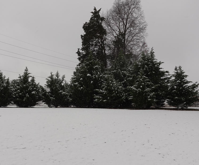
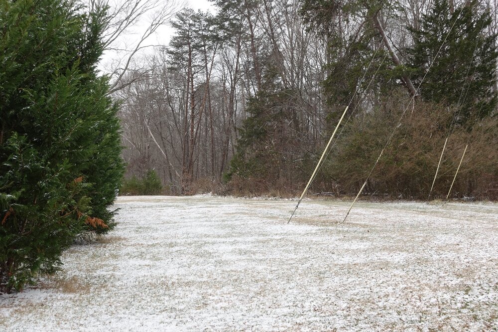
There does seem to be a significant difference in temperatures sometimes. Snow has started to accumulate on the road in front of my house now.
-
That temperature rise is strange, it continues to fall here and it's currently 32.4°. Starting to get a light accumulation now.
-
The switch from rain to all snow was quick at my location just west of Eden. At 9:00 it was all rain, and now its all snow and coming down at a pretty good rate. The temperature has fallen from 35.8° at 8:10 to 33.6° currently.
-
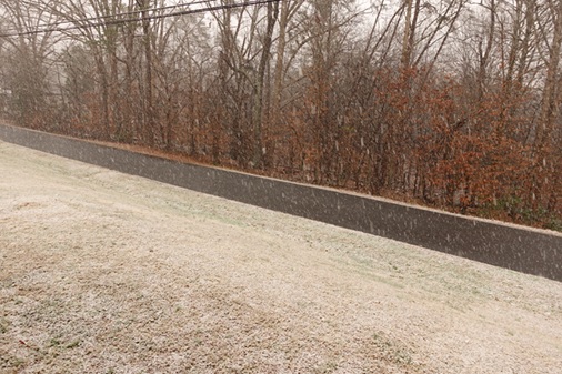
I ended up with only a light dusting, .2" to be exact. There continues to be off and on periods of very light snow, but it's not heavy enough to bring any additional accumulation. The current temperature is 31.1° woth a dew point of 30.9°.
-
I've got the snowboard ready. I'm expecting 2 to 3 inches here along the NC/VA border in Rockingham County.
-
The temperature dropped to 16.7° in my backyard just west of Eden. The coldest temperature I could find in Rockingham County was near Madison where a station recorded a low of 15.8°. KSIF dropped to 17.6°.
-
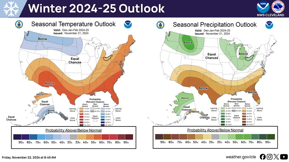
This was last year's outlook.
-
Had a low of 29.7° this morning.
-
It was pretty cold in the North Central Piedmont of NC along the VA border this morning. The temperature at my location just west of Eden was 31.6°. There were also several other stations measuring temperatures below freezing, with one in Caswell County down to 29°.
-
So sorry to hear about the loss of your father. I always enjoyed reading his posts, and I'll never forget the epic photo he often shared of his back deck and grill from the February 2004 snowstorm. He will be missed.
-
I was able to find this Tempest weather station near Carthage that recorded 9.3".
-
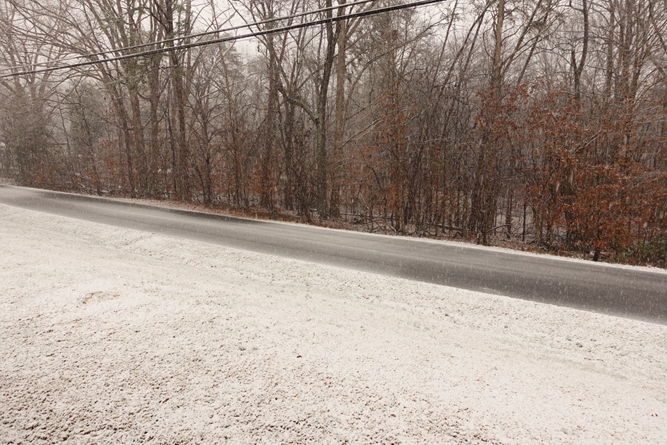
I measured .4" yesterday and .8" today for a two day total of 1.2" just west of Eden.
-
I measured right at 1 cm/0.4" of snow at my location just west of Eden. Light snow continues, but looking at radar, it should be tapering off in this area shortly.
-
Flurries in Eden. 28.2°/15.4°
-

February 19-20 Major Winter Storm Threat
Tullioz replied to NorthHillsWx's topic in Southeastern States
I always look for the GRAF on X, and there are usually one or two local or regional meteorologists sharing it there during significant weather events. -
February 19-20 Major Winter Storm Threat
Tullioz replied to NorthHillsWx's topic in Southeastern States
If the Euro is correct, the cold temperatures during and immediately after the storm could rival what we saw in January in the western piedmont. -
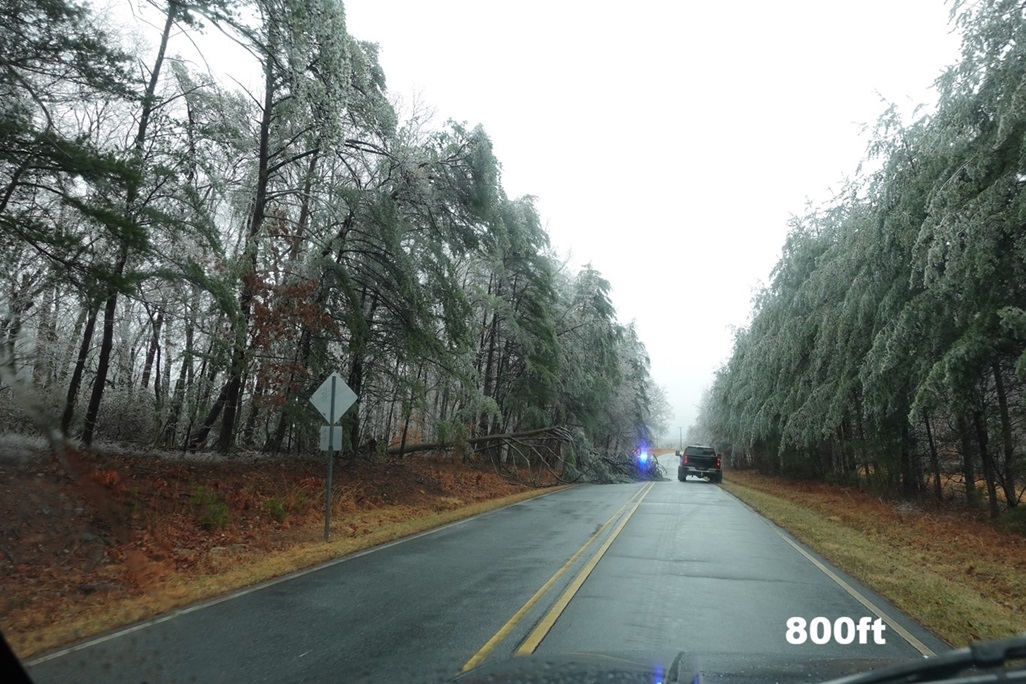
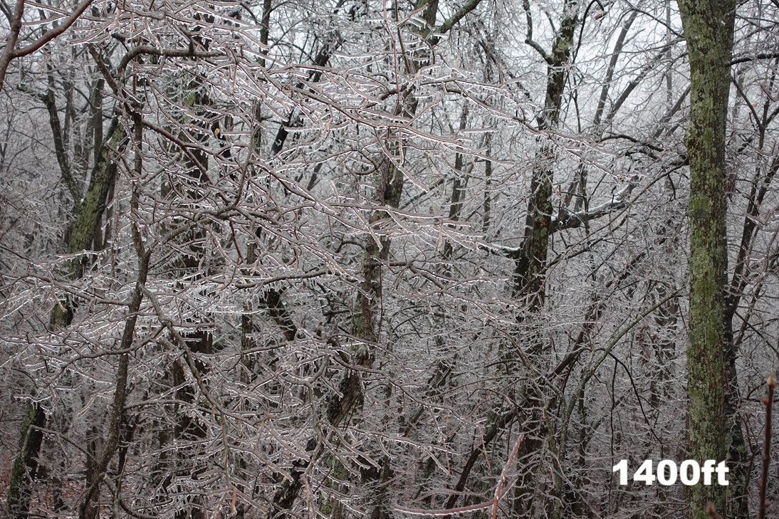
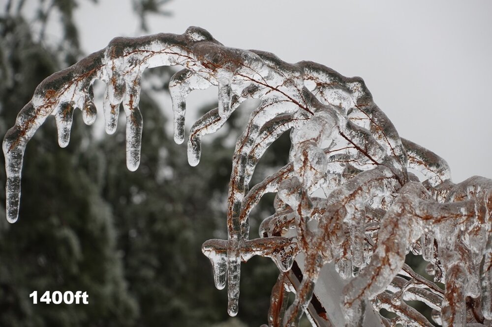
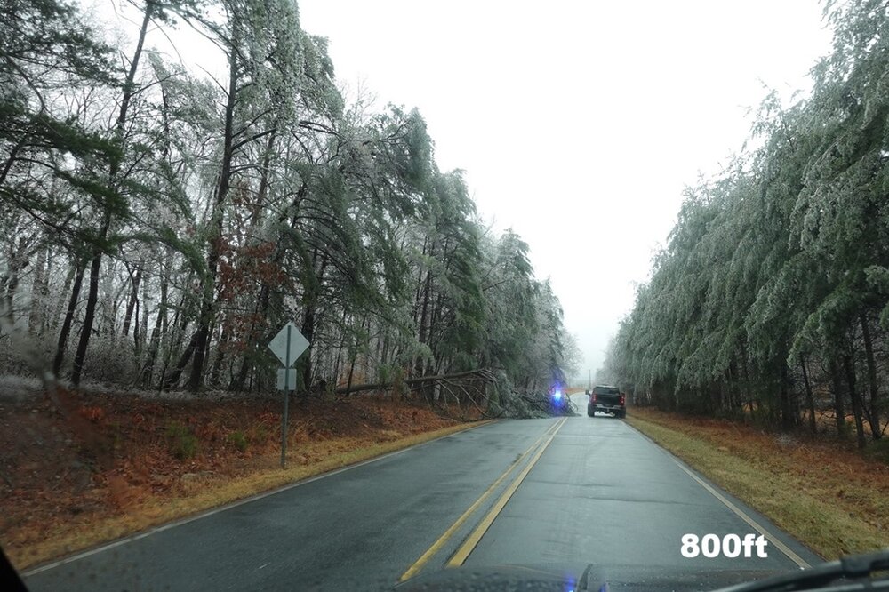
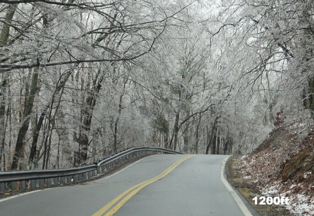
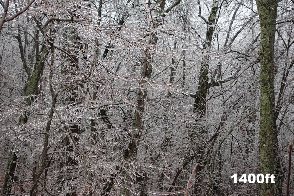
Ice accumulations were elevation-dependent around my area. The elevation at my location is 700 ft, and there was only some light icing in the tops of the trees. I drove around and found that roughly 800 ft was the cutoff for decent icing. Areas above 800 ft saw around .10", and once above 1000 ft. 25" to .50" accumulations could be found. The highest accumulations I found were near Chestnut Knob in Ridgeway, Va., at an elevation of 1,400 ft.
-
My current temperature is 31.8° after a daytime high of 33.8°. The dew point is 31.6°. Both the temperature and the dew point have been slowly falling since 2pm.
-
Received a light coating of snow and sleet overnight. Precipitation has ended for now. 32.4/32.1
-
30.4° at my location just west of Eden. The dew point is 28.6°. A few stations are reporting 28° along the NC/VA border in Stokes and Caswell counties. I expect the temperatures to rise a little once clouds start to roll in.
-
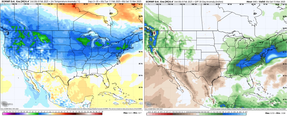
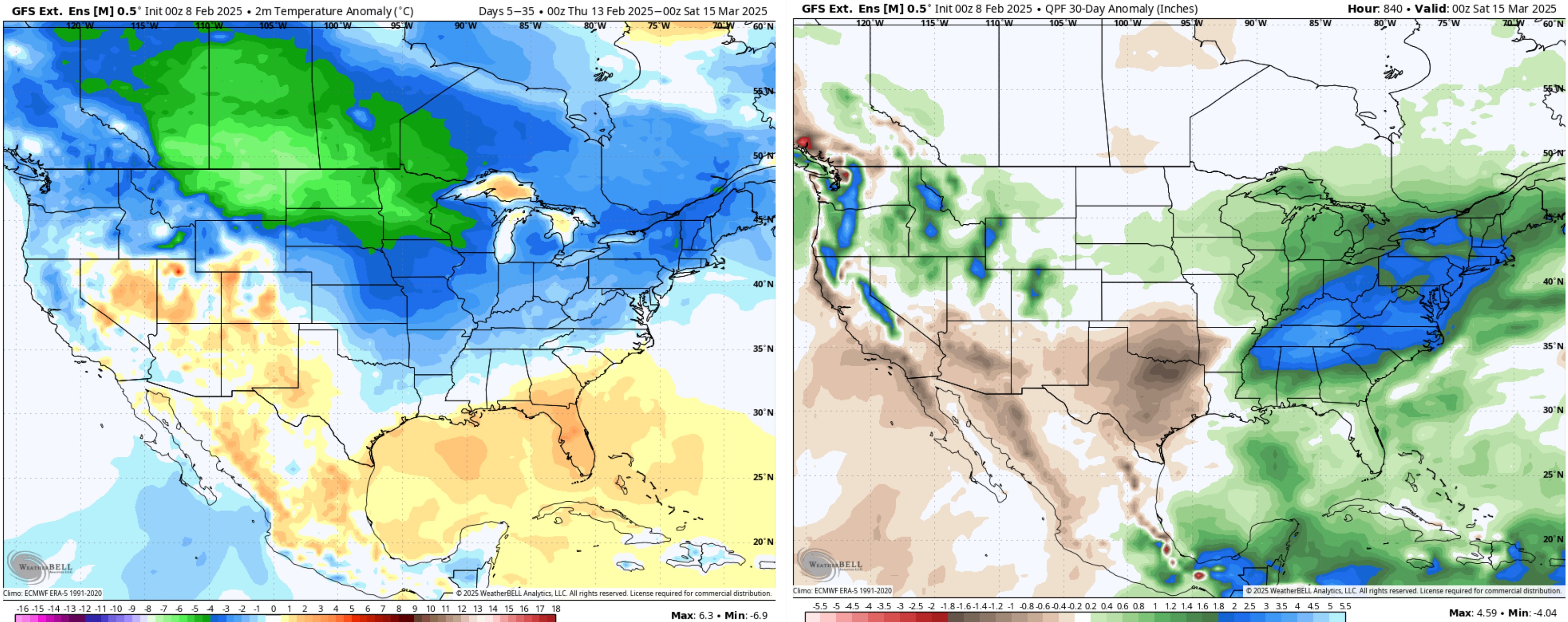
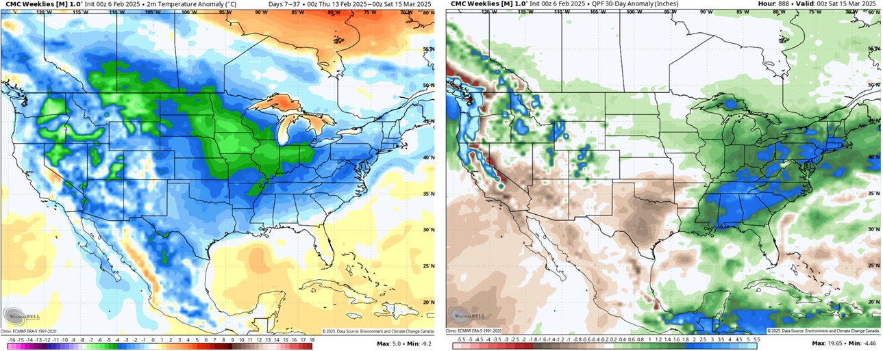
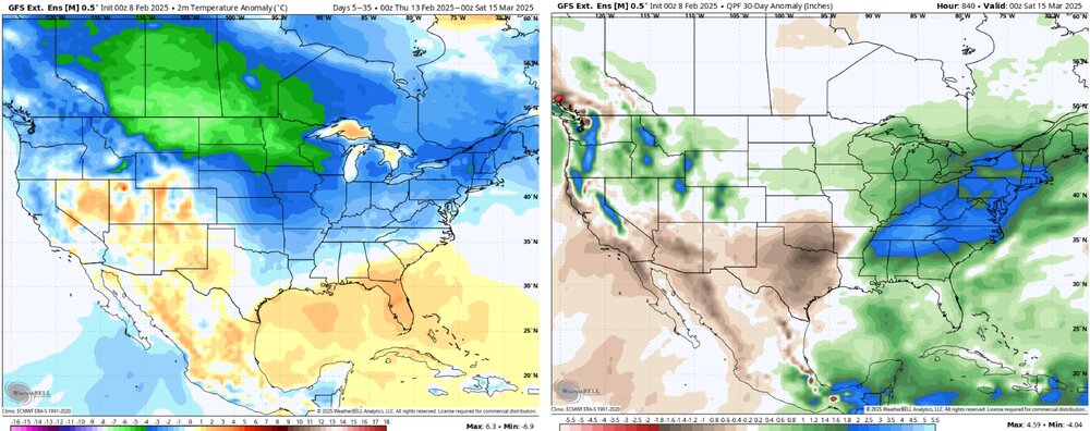
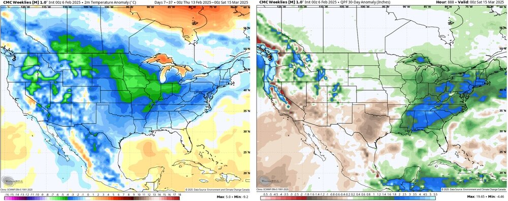
Not everyone. Outside of the mountains, I think the northwest piedmont and foothills will see at least two chances at seeing accumulating frozen precipitation between now and the end of the month, and the extended products look encouraging going into mid-March. I'm almost as excited today as I was heading into early January at the prospect of seeing a significant winter storm at some point over the next two weeks.

-
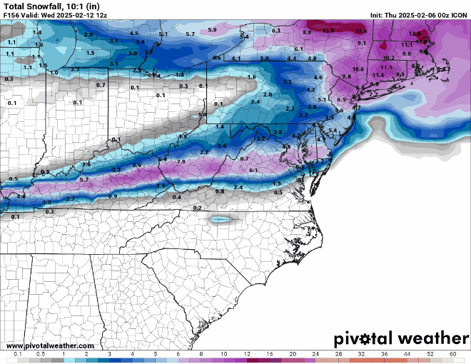
The 12Z ICON came in quite a bit south compared to the 00Z run.