J Paul Gordon
-
Posts
1,791 -
Joined
-
Last visited
1 Follower

About J Paul Gordon

Recent Profile Visitors
4,433 profile views


.thumb.jpg.aec747d13df1d95d5fed34574f74d4fd.jpg)

-
48F/40. High today 54, Low 41. Started out foggy, cloudy most of the day with maybe a half hour sunshine around 4. Dews and mild temps are eating up the snowpack--as expected. We'll be down to mud by Tuesday. Let's see what happens when the last gasp of winter arrives next week. I'd love to see another good snowstorm before the end, but no complaints this year. It felt like winter from early December on. We had our first snow on 12/5 and had coverage on and off for much of the rest of the month. January and February felt like winter did when I was a kid--not earth shattering, though 24" of snow on 1/25-26 and 15 on February 23 (plus the 2-4 inchers in between and reliable cold kept 20" on the ground in my back yard for the better part of a month. Until today we still had a foot plus in the yard. So, no complaints.
-
35F/30 here in Clinton and going down.
-
"Don’t do it" 2026 Blizzard obs, updates and pictures.
J Paul Gordon replied to Ginx snewx's topic in New England
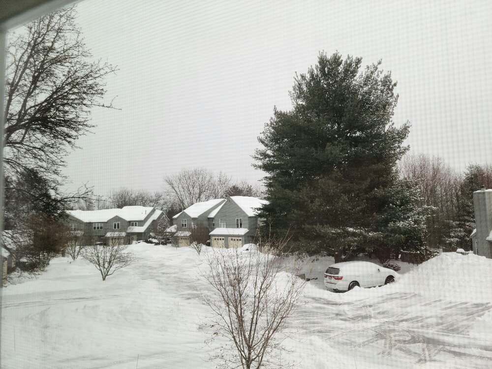
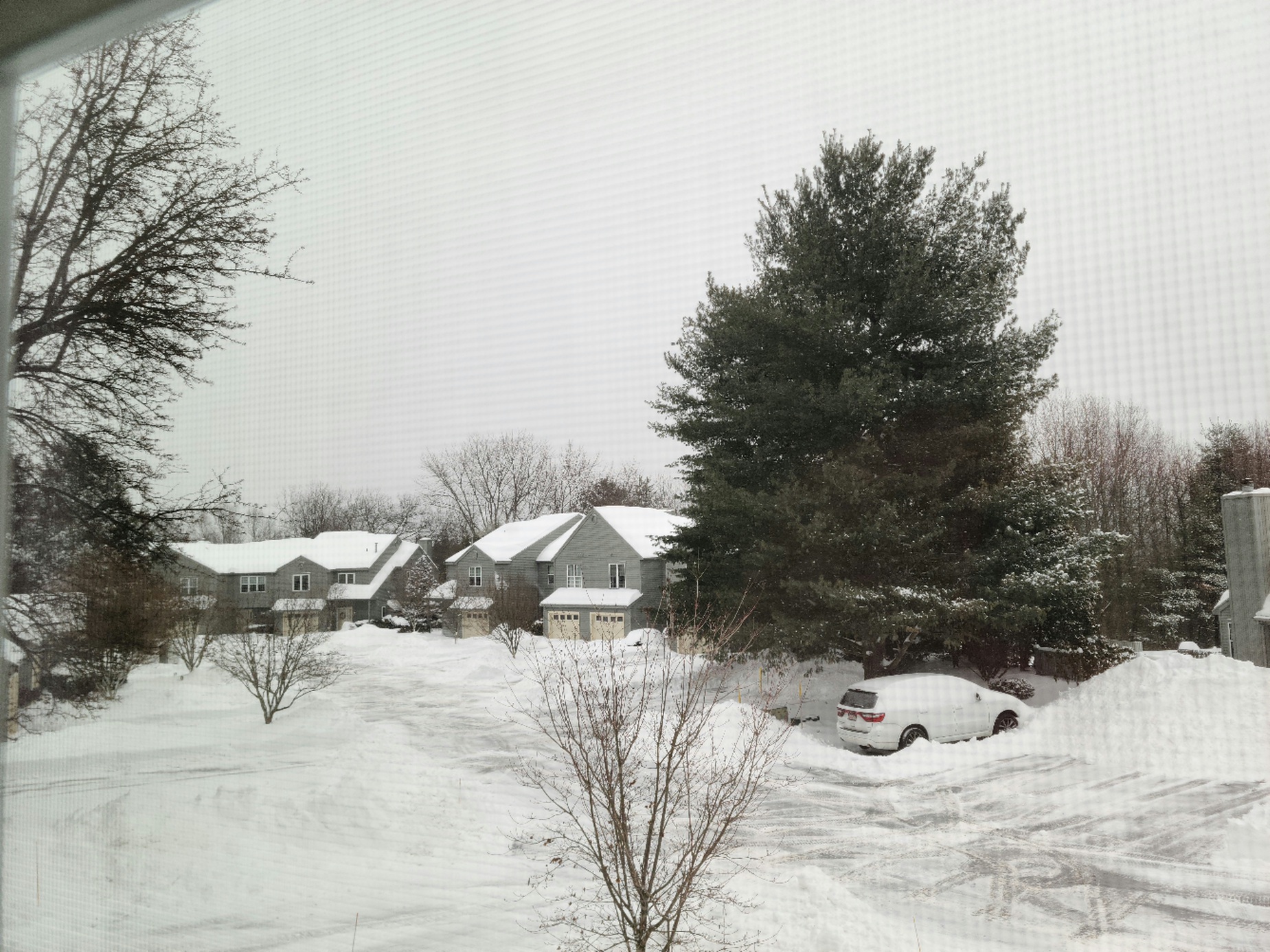
Moderate snow right now here 23F. Even at the lower end of predictions here we have well over 2 feet otg. It's a beautiful winter scene out there. Msybe a little more during th4 week and perhaps more than a little more early next week after a mild weekend. Not too shabby as March comes in, especially after a few lean years. I'm playing my grateful card. Picture taken a couple hours ago another inch or two in moderate snow since. Don't expect a whole lot more now.
-
"Don’t do it" 2026 Blizzard obs, updates and pictures.
J Paul Gordon replied to Ginx snewx's topic in New England
Moderate snow right now here 23F. Even at the lower end of predictions here we have well over 2 feet otg. It's a beautiful winter scene out there. Maybe a little more during the week and perhaps more than a little more early next week after a mild weekend. Not too shabby as March comes in, especially after a few lean years. I'm playing my grateful card. Picture taken a couple hours ago another inch or two in moderate snow since. Don't expect a whole lot more now.
-
"Don’t do it" 2026 Blizzard obs, updates and pictures.
J Paul Gordon replied to Ginx snewx's topic in New England
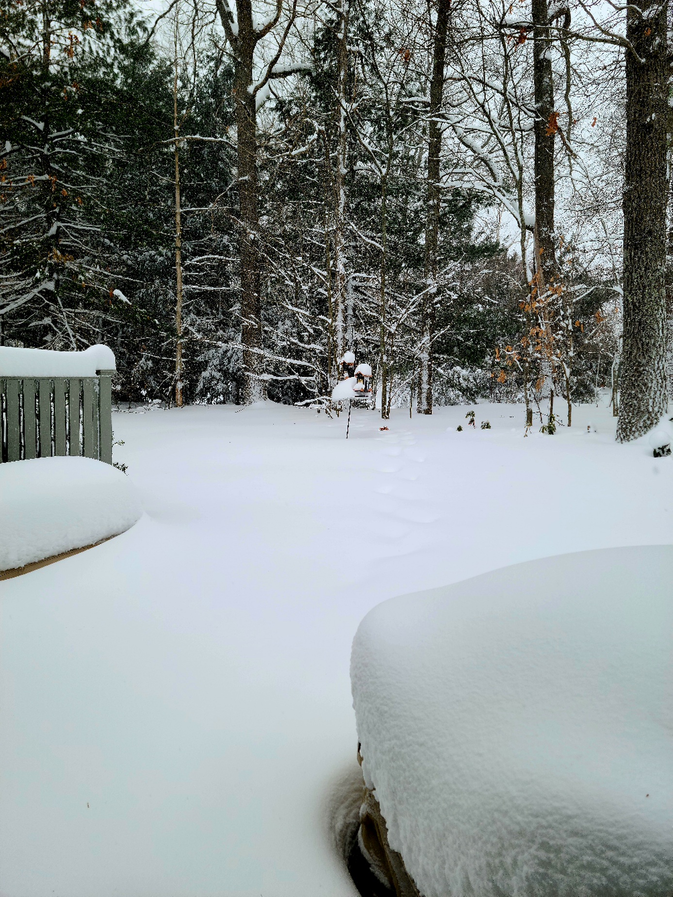
23F/23 Light to Moderate snow now, after a half hour hiatus. Seems to be getting heavier as I write this.. Lots of blowing. Went out to the birdfeeders to shake off the snow. Snow was up to the top of my boots yesterday and is mid thigh out there now. Possibly a foot new, maybe even 14"; it's hard to tell with the blowing and drifting. I'll put up some pictures later. Most of the windows are plastered from earlier in the storm when it was wetter. Extremely dense snow. -
"Don’t do it" 2026 Blizzard obs, updates and pictures.
J Paul Gordon replied to Ginx snewx's topic in New England
Same here in Clinton MA. 15"+ otg in my back yard. Went out to put food in the bird feeder and snow came over the top of my boots. Was walking on packed snow underneath. Should have 3 feet plus otg even if we end up on the low side of our forecast. Blizzard Warning up. Didn't expect that this far inland. -
“Cory’s in NYC! Let’s HECS!” Feb. 22-24 Disco
J Paul Gordon replied to TheSnowman's topic in New England
In Clinton, MA. 12 - 18 here? Are we in a good place for banding? This is our 4th winter here and the first with serious snow. So, still new to the microclimate here compared to Worcester Burncoat. Only a few miles away but we seem to consistently do better at least in terms of snow depth. BTW Lived in Belchertown MA in 78. The drifts came up to the roof on the windward side of our 2 story apartment building. It was amazing even that far inland. Amherst got 12 from that storm, if I remember correctly. We got considerably more to the east and a few hundred feet higher up. Don't ever recall seeing drifts like that before or since. The apartment complex looked like it got caught in a storm at sea. -
“Cory’s in NYC! Let’s HECS!” Feb. 22-24 Disco
J Paul Gordon replied to TheSnowman's topic in New England
I was wondering about that. How will we compare for amounts with the January 25-26 event? -
“Cory’s in NYC! Let’s HECS!” Feb. 22-24 Disco
J Paul Gordon replied to TheSnowman's topic in New England
In Clinton, MA. 12 - 18 here? Are we in a good place for banding? This is our 4th winter here and the first with serious snow. So, still new to the microclimate here compared to Worcester Burncoat. Only a few miles away but we seem to consistently do better at least in terms of snow depth. -
J Paul Gordon changed their profile photo
-
Mostly sleet, some snow and freezing rain. 31F/28F. Looks like it will go back to all snow around 7. Good news is that the Sunday night-Monday storm may be ramping up for our area.
-
“Cory’s in NYC! Let’s HECS!” Feb. 22-24 Disco
J Paul Gordon replied to TheSnowman's topic in New England
SE Mass and Cape/Islands storm? Haven't been paying it too much attention. -
Friday February 6 FROPA / WINDEX small event
J Paul Gordon replied to HoarfrostHubb's topic in New England
About five inches here in Clinton, maybe a few tenths of an inch more. Going to be another bright night under the waning moon. -
Looked this morning to 3.5 or 4 inches of new snow on the car and fences that wasn't there yesterday afternoon. I must have missed something. It snowed all day but lightly. Was there a heavy burst after dark?
-
really beautiful image!
-
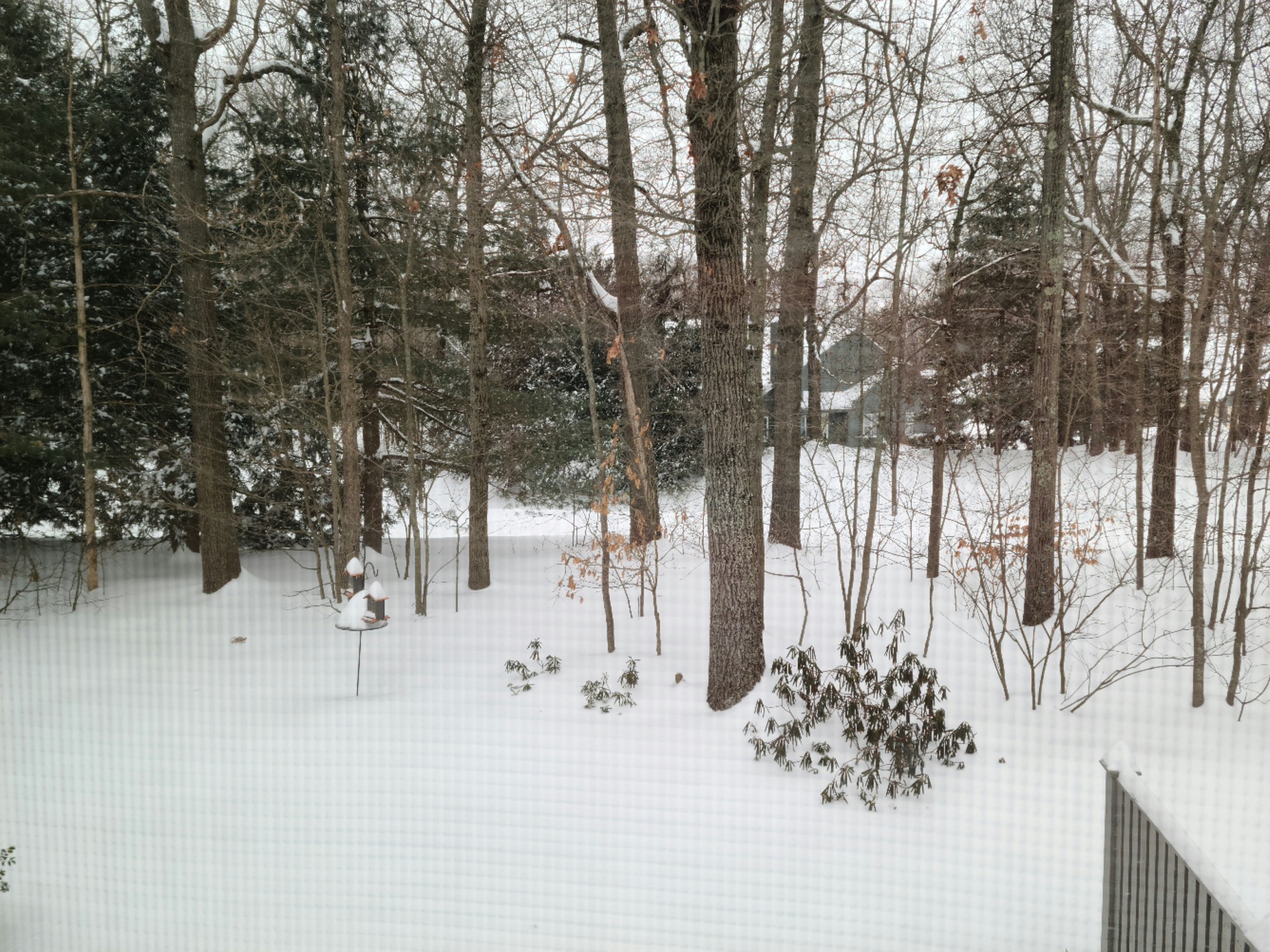
16F/12F Very light snow. 20" based on nearby surrounding reports (Shrewsbury 19, Sterling 22). My 3' St Francis in the back yard is up to his nose in snow. We had some wind and drifting last night. Biggest surprise is how heavy and dense it is, but not wet at all.