jjwxman
-
Posts
343 -
Joined
-
Last visited
Content Type
Profiles
Blogs
Forums
American Weather
Media Demo
Store
Gallery
Everything posted by jjwxman
-
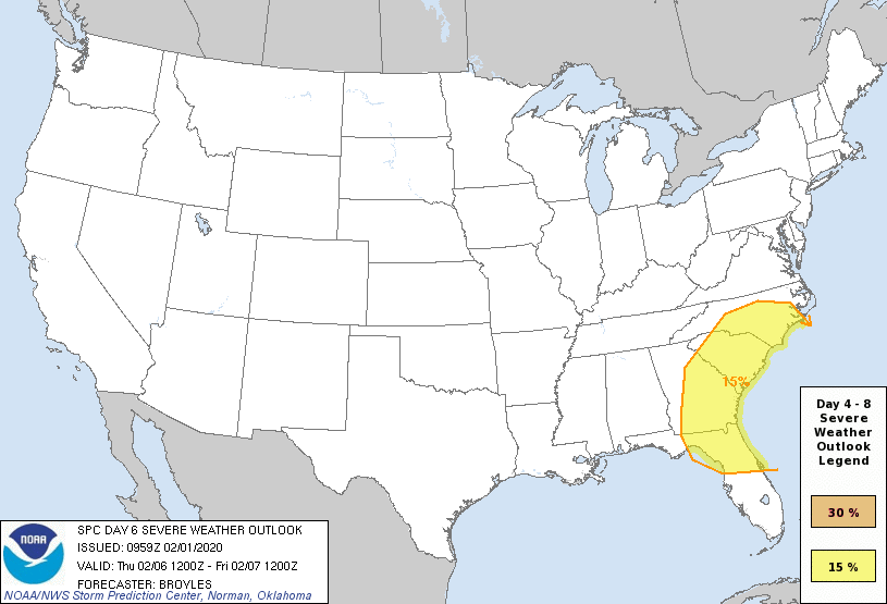
The SPC doesn’t throw out Day 6 outlooks that often. The wind shear parameters are off the charts over the region late next week.
-
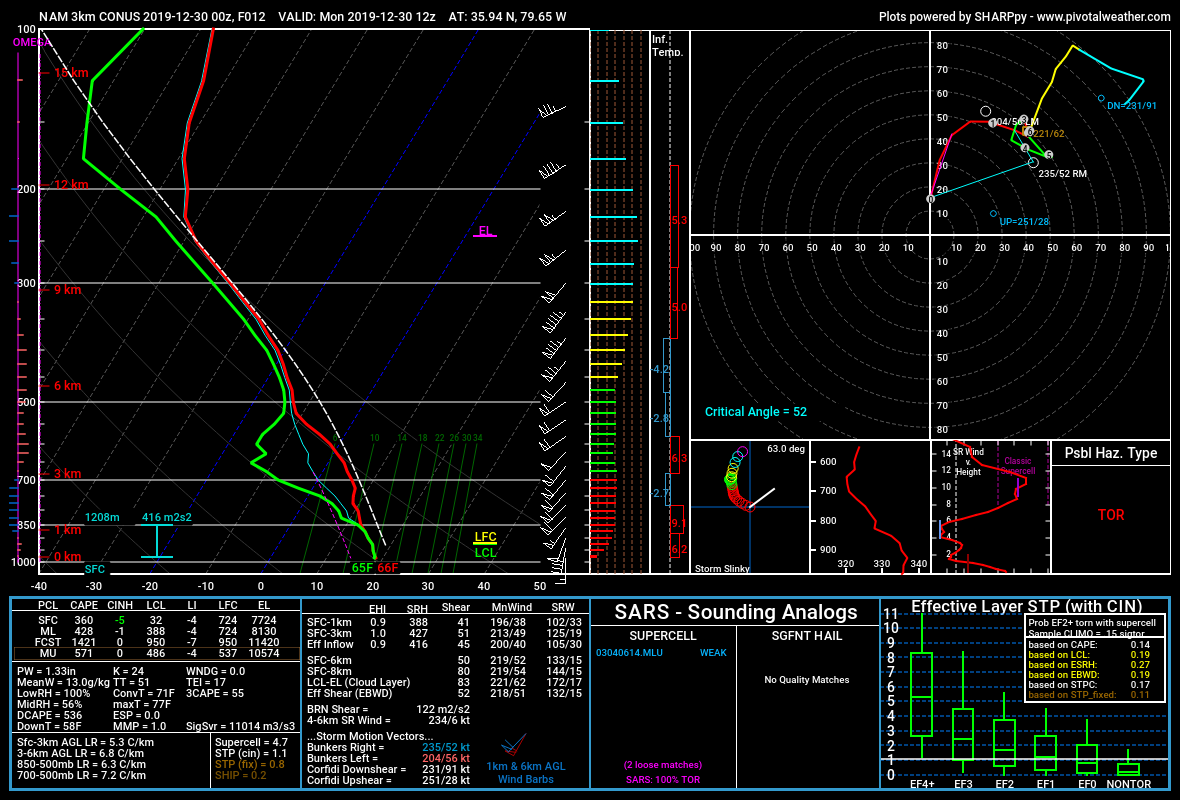
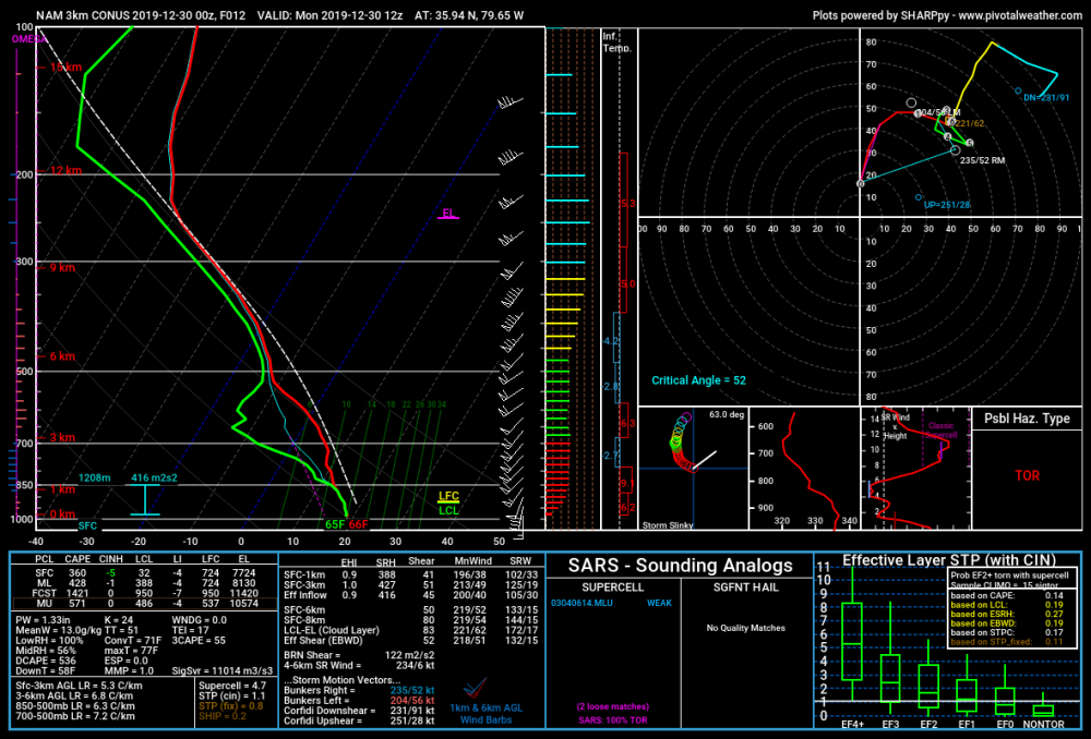
The NAM and HRRR both support an isolated severe event on Monday 12/30. Another HSLC set up. Maybe we’ll fit in one more lightning bolt to wrap up 2019.
-
Regardless, I'm not sure if I've ever seen wind speeds this high above the surface over NC. Incredible. Lots of potential, but like @downeastnc said the bust potential is high as well.
-
The word "Historic" should only be used during or after an event IMO. 4/16/11 was historic.
-
But the 12z NAM suite just made a case for the moderate risk... Geez look at those backing SE Surface winds. Increased surface cape as well, slower with the system.
-
For the Carolinas: I don't think we'll see a Moderate Risk. (but what do i know ) There are few things that will plague this forecast. 1st. The influx of tropical moisture will likely cause a warm layer around the 700-500mb level, this will weaken the mid level lapse rates. 2nd. The whole column looks very tropical, there will likely be a lot of cloud cover so CAPE will be limited. 3rd. PW values will likely be at record territory for this time of year, and with the slow progress of the system west to east, flooding will probably be the forefront of this event from training storms. I wouldn't be surprised to see some 2-4" rain totals in some areas. 4th. If we do see some sun and decent destabilization then this could turn out to be a significant severe weather event, particular for damaging winds, the hodographs are more elongated than curved, so the tornado threat should remain isolated in nature unless we get more backing from SE surface winds. A lot to decipher over the coming days.
-
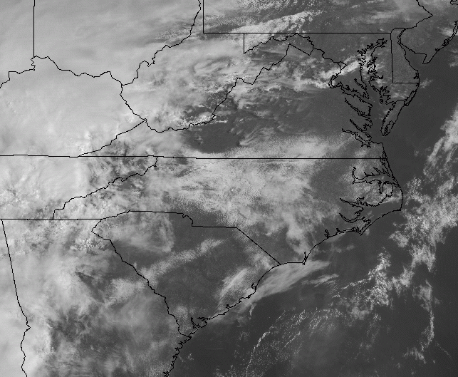
That's good analysis from RAH. The sun is beginning to break through now in south Greensboro, seeing some blue sky finally.
-
It want be long until the sun starts to break through.
-
Here's the 12z HRRR sounding over central NC at 20z. Storms begin to initiate shortly after this sounding at 21z. Damaging winds, and hail seem to be the main threats. Wouldn't rule out a spin up on the more discrete cells that form ahead of the main line of convection.
-
Shocking isn't! Glad I held on to my big grain of salt! Ha!
-
Ha, the Euro now has temps in the mid 60's over central NC with thunderstorms Sunday evening/night. Ugh..............
-
12z HRRR...
-
Pivotal Weather has a better simulation than TT (and snow maps). It just light precip, based on the sounding it should be a rain snow mix in GSO at hour 36.
-
NAM definitely trended south with the higher snowfall totals since 18z yesterday. Here's Thursday's 18z and this morning's 06z run.
-
Wow! That’s approaching Dec. 2002 type of Ice Storm. All in all, this run was colder than the 18z. More snow in the Piedmont this run. Verbatim the Triad got 2-3” Kuchera on the 18z Run, on the 00z run the Triad got 5-6” of snow before the switch. So maybe slowly the NAM is begining to adjust cooler. Fingers crossed.
-
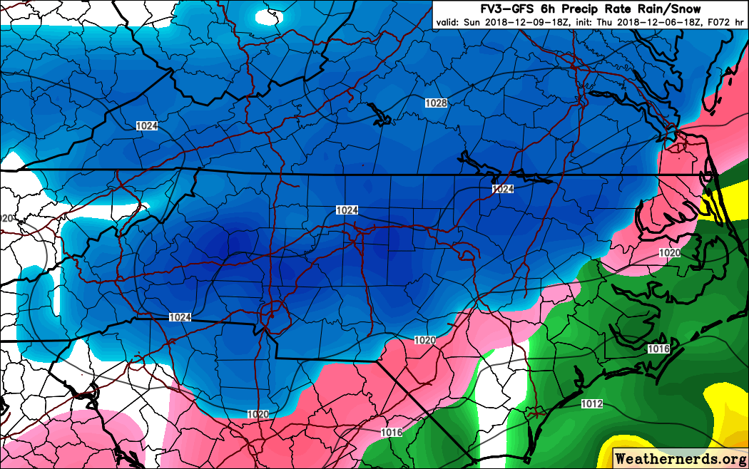
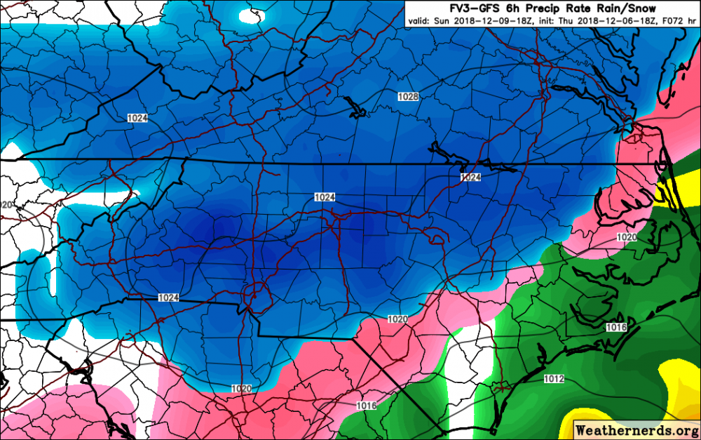
18z FV3, hr 72.
-
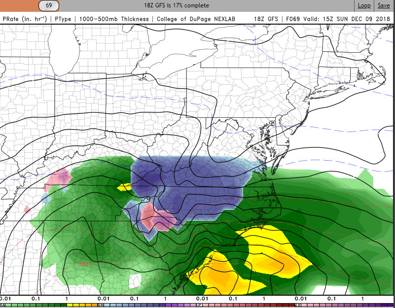
GFS 69:
-
Here we go! RAH is on board. 6+" for the Triad is a good starting point right now. Should see some WS Watches coming within 12-24 hours.
-
Stokes County 2-4 and Surry County gets 12-24. Now that would be one crazy cut off!
-
Geez... The FV3 looks AWESOME. But the 12z NAM definitely took the air out of the room. #NAM'd
-
Who blames RAH for being too conservative now? Even if the 12z NAM was a crap run, and the 18z comes in super cold, this is why Nick P and the Raleigh forecasting team is waiting to pull the trigger. Good job guys.
-
My thoughts this morning: To much focus on snow maps, not enough focus on who is going to be with out power for 2 weeks because of an inch of ice accrual.
-
This is a very complex storm system and many players are involved as we all know. When there are uncertainties involved, RAH always errs heavily on the conservative side of caution. With that said, I think that if the models hold through 12z today or 00z Friday you will see them change there wording to a more serious tone. RAH does a great job, they will jump on board soon.
-
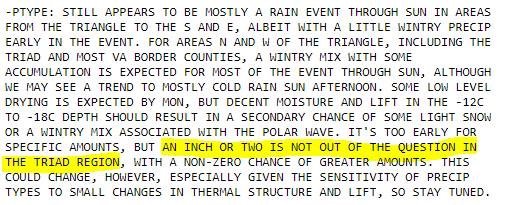
Safe to say RAH is on a different planet. I don’t understand. Regardless of p-type, liquid equivalents could range from three-quarters of an inch NE to around an inch SW. And this:
-
They favored the GFS on the 3am discussion. Lol.