

PivotPoint
-
Posts
714 -
Joined
-
Last visited
Content Type
Profiles
Blogs
Forums
American Weather
Media Demo
Store
Gallery
Posts posted by PivotPoint
-
-
2 minutes ago, BristowWx said:
The question is has the HRRR ever scored a coup. It shows me 8 inches Kuchera. I’d give up drinking for 3 hours for that.
I saw hrrr do well with 2016 storm. But even my goldfish got that one right, so eh
I don’t own a goldfish, actually
-
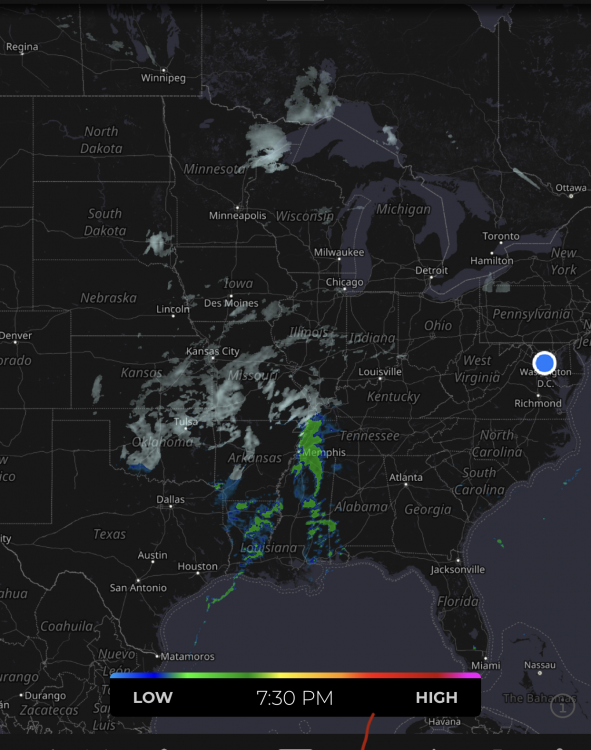
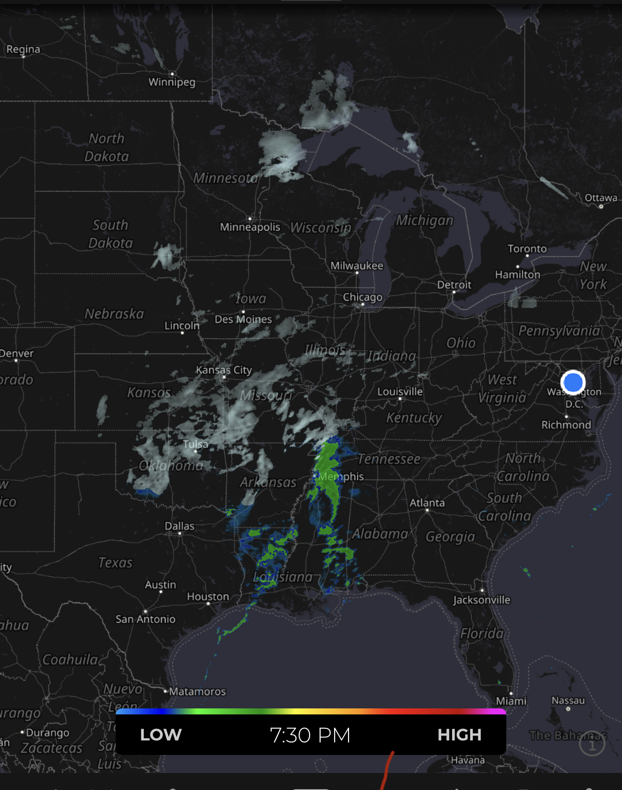
Here come the radar hallucinations:
Way more moisture then depicted this hour... look at that moisture convection to the gulf! (This is a bingo card, right)
-
 3
3
-
-
3 minutes ago, PhineasC said:
Best case scenario for those east of I-81 is a thump of a couple inches, dry slot drizzle/sleet, then a couple inches on the backside.
100%. That’s it
-
Good news is I think many of the models have been hinting at least some sort of backside love, albeit not very significant. Even 1” would at least make the ground white (for most). I’ve seen the 3k have it, hrrr, hrdps, and a some of the gfs runs. I dunno. Trying to find a silver lining
-
34 minutes ago, Weather Will said:
I picked the worst panel for each level. Between 7-10pm. WB


That’s not horrible for Leesburg if that’s the warmest panel, surface might be a bit above freezing but banding would take care of that. Not as bad as I thought.
29 minutes ago, Weather Will said:Sure. Should show the surface temps too. I’m afraid anywhere DC proper SE is literally toast. I’m sorry.

I call bs. Basically top corner of dc is 47 and ffx county at 32. That’s like maybe 30 miles in a straight line. No way it’s a 17 degree difference. No way
-
 2
2
-
-
Just now, H2O said:
Goddamn you have an ax to grind. One person seems to cause you great angst. It’s too bad. She’s a great person and friend.
That’s a great story. Tell us more about your kinship with Mappy lol
StormTrackers right.
-
2 minutes ago, H2O said:
Every year the passive aggressives have to come out for winter. This is why tropical weather is better.
To make this a weather obs for this thread
33.3° 187’
I’m not passive aggressive I say exactly what I mean. You of all people should know that. Or learn what the phrase actually means brother
-
4 minutes ago, stormtracker said:
Look, I know you got a thing with Mappy, that's why you're all over this. Just relax man. We're working this out.
I got you. You’re right.
Sorry, It’s just almost like sometimes it seems like she’s jumps at the chance to create issues. Then if she doesn’t like what you have to say back, she “edits” you. It’s bs man. People don’t like that. It’s not cool-
1
-
-
34 minutes ago, stormtracker said:
Or...and hear me out...don't leave and just adjust your delivery? This isn't a binary choice here.
Why should he have to adjust his delivery. Maybe others shouldn’t be so sensitive. Or the mod (shall remain Unnamed) that takes issue with anyone that’s less than sugary sweet to her. Come on
-
2 minutes ago, BristowWx said:
I’m going with that one. Seems legit
60% of the time, it works... every time
-
 1
1
-
-
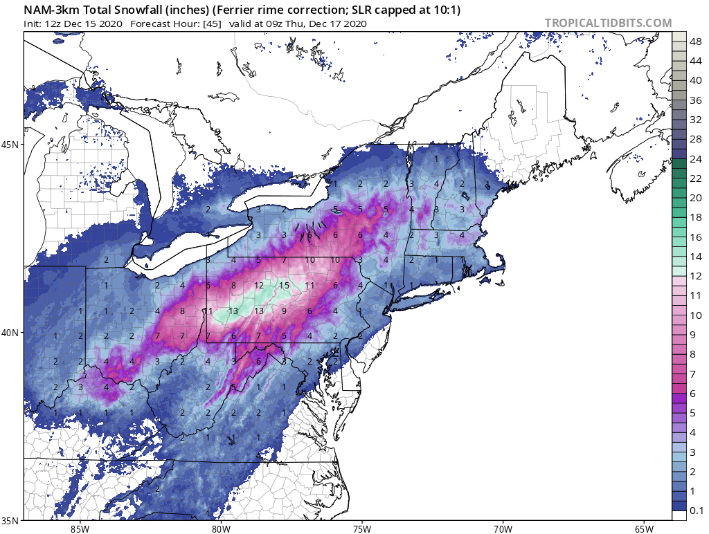
And at least we have the WRF-ARW2, lol

-
1
-
2
-
4
-
-
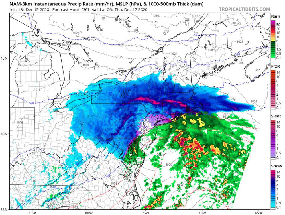
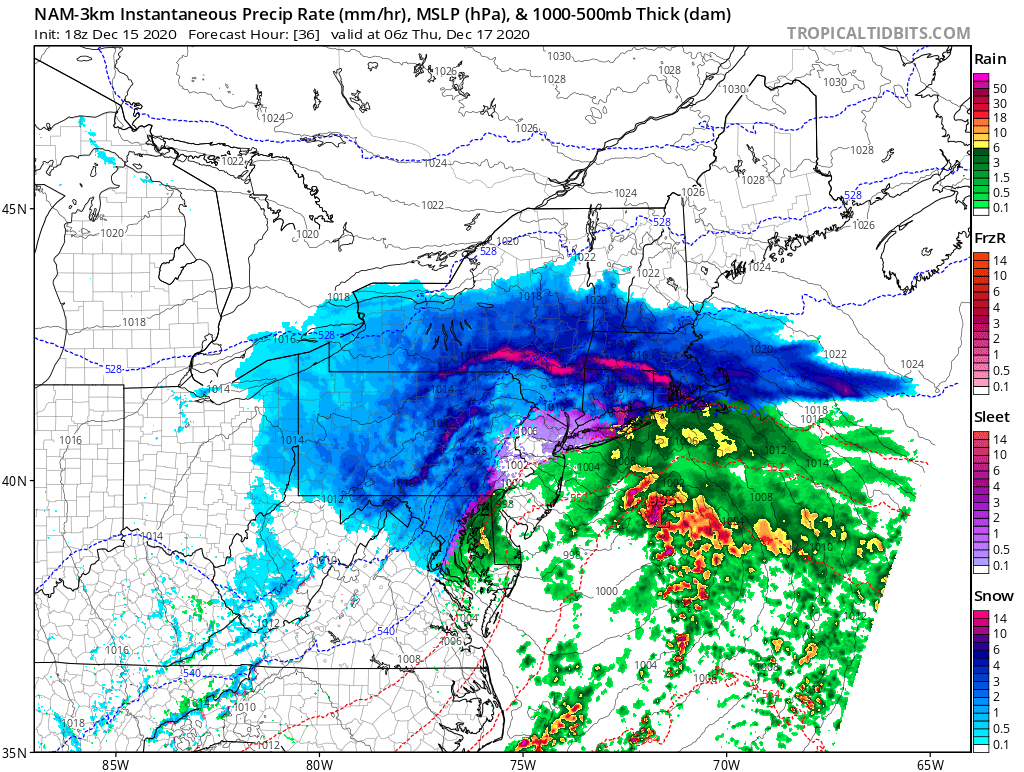
11 minutes ago, Kleimax said:
Isn’t the 3k superior to the 12k? 3k not nearly as good for us.
9 minutes ago, DDweatherman said:Yes the 3k is not as good as the 12k depiction. However, take a look at the sounding here in DC which is well into the rain depiction on the frame shown. Column is not far off from being isothermal. Additionally, the low is I'd estimate 50-75 miles east of last run.
PSU, keep me honest on that (I'm using TTB)
3k is an improvement for dc
positive snow depth
18z
12z

-
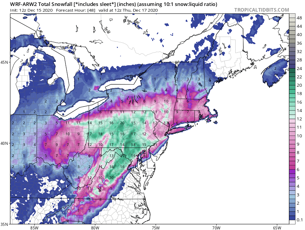
15 minutes ago, Snowchaser said:
Seems solid. Most of us are inside 6”+
I wouldn’t go so far as to say “most”, ugh
-
3
-
-
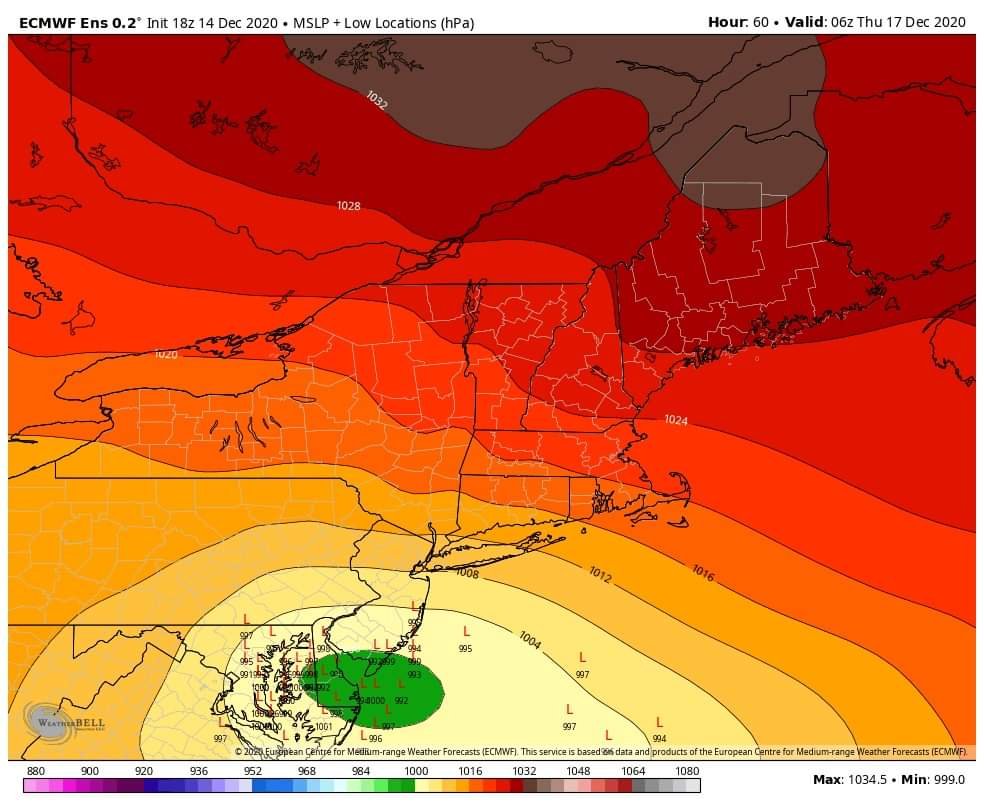
19 minutes ago, psuhoffman said:
Gem products shifted west and warmer this cycle. That’s all I’m taking away.
LP track did shift a bit west. But I feel like the thermal profiles didn’t really shift west with it like I thought. Making me feel like the slight track shift is having a marginal effect. Maybe the fact the system is becoming more progressive means less warm air is advected at 850/925 with no rapid deepening like earlier runs?
-
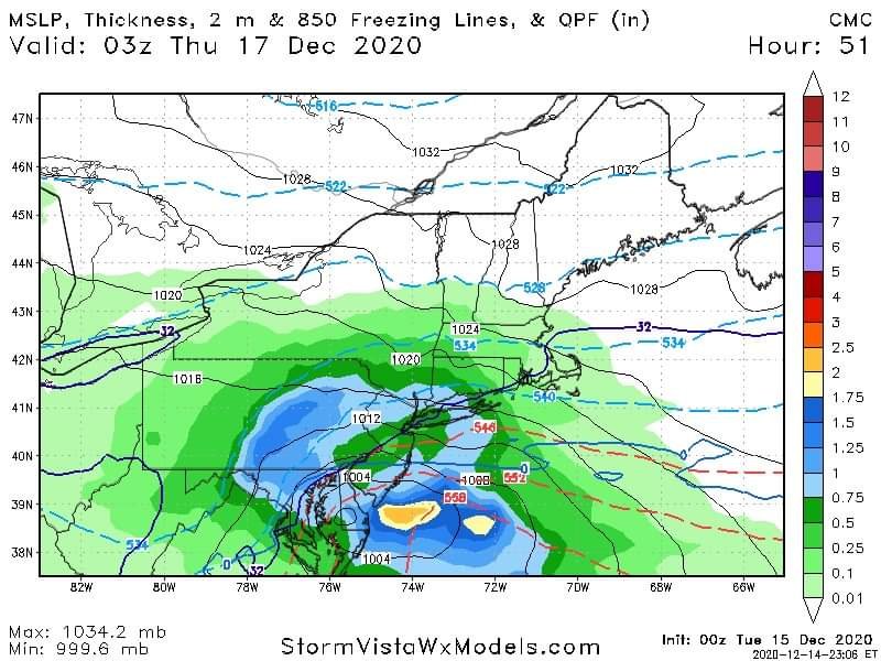
CMC wasn’t a great run but models are kinda jumpy right now. I still feel like there’s some wiggle room with temps. Tonight lows and any cloud cover tomorrow to keep temps low would help. Won’t help mid levels but will help possibly keep a little more frozen action longer
-
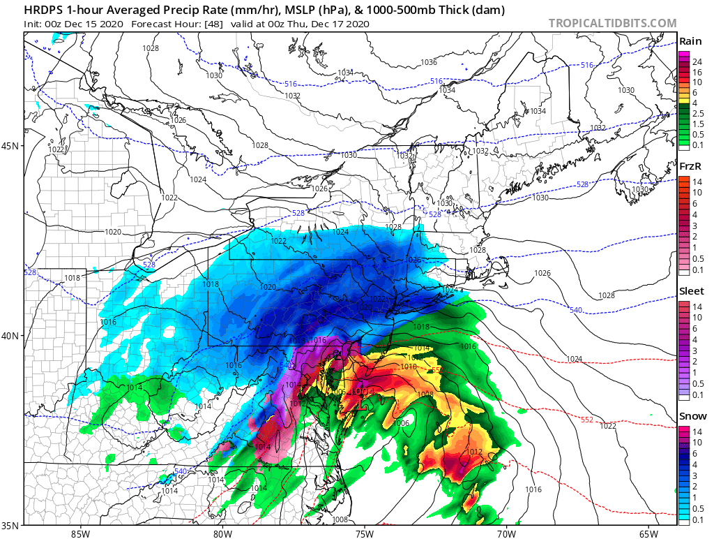
Hrdps stops here but nice deform band, possible follow-up on the back side for dc area. Maybe not a lot but decent run. Still a lot more to come for norther folks after this, obviously

More to come for northerns, perhaps wrap around or trailing follow-up

-
1
-
-
Next panels even better but we might start mixing here...

-
For what. It’s worth hrdps starts out hot and heavy, but most area loses 540 off the bat

-
1 minute ago, NorthArlington101 said:
man, this is something.


I guess I'd lean GFS here... will be interesting to see what it looks like 8pm tomorrow.
I feel like the Gem is always colder. Canadians are like “ayy, what’s a couple degrees, jee golly”
-
1
-
-
3 minutes ago, AmericanWxFreak said:
Better than 12z? Seems like it but can’t recall. 540 seems better with good returns overhead dc/md line
-
Rgem and gfs technically ticked the snow line back se a bit. Didn’t check soundings but it was at least better not to see it continue to eat away at the fall line. Hope the euro delivers for us
-
2 minutes ago, WxMan1 said:
Hello all...
A note from NCEP Central Ops, as I am just spinning up at work...
There's an issue with one of the supercomputers...which is currently causing a delay in the 00Z model production. Certainly the 00Z HRRR and RAP have been delayed, and the NAM will likely be as well.
Sorry folks...just passing along what I know..
Thanks for the update. Otherwise we all would speculated the storm must of trended so well that it broke the computer

-
3
-
-
9 minutes ago, AmericanWxFreak said:
Gross. A couple over Balt and a couple headed for Bermuda...
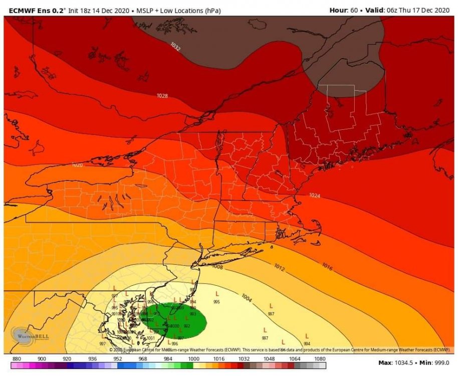
The ensembles still have a quite a bit of variance. This track is not set yet for sure. I would still err on the side of a east solution, however there’s is not definitive consensus here. Hope, I guess
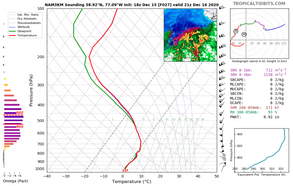
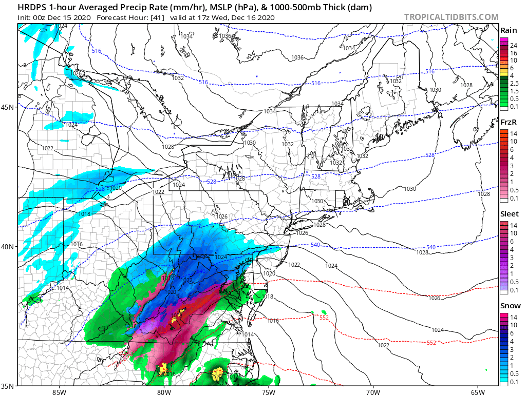
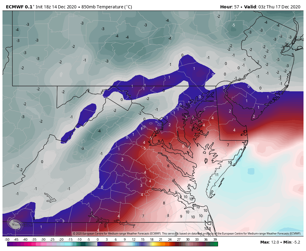
4 minutes ago, psuhoffman said:This is where our area starts to lose the thermals on the WAA side of the storm. It's a step back on this part. The red line is the 850 but like you said at this point the layer is isothermal from 850 down so its pretty much the rain snow line there...you can see what qpf came before the transition...you can estimate how the area did...northern zones hold on 1-2 hours longer...south of DC gets very little snow before going to rain.

1z here is about the worst look for the thermals. This is the NW extent of both the surface and mid level warmth. I have estimated the rain and sleet lines here by tracing the 925 and 850 0 lines.

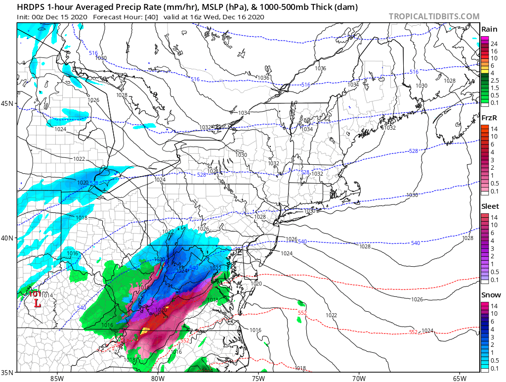
2 hours later by 3z the temps are crashing and I would estimate everyone NW of 95 is going back to snow or has already. There are some pockets in the zone of subsidence NW of the developing banding of warmth but if they are between heavy bands at the time your not missing out on much accumulation anyways...point is I think we can assume from 3z on anything that falls is snowfall from 95 NW

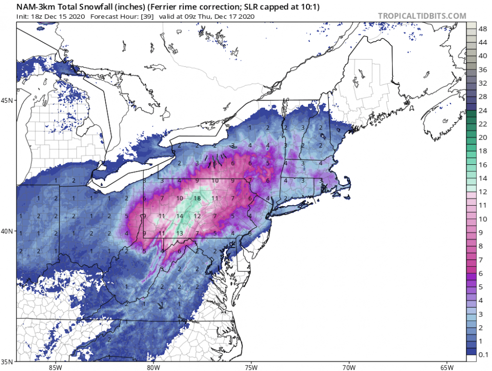
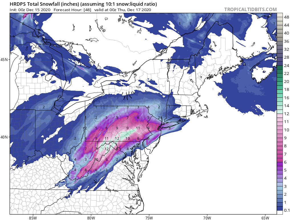
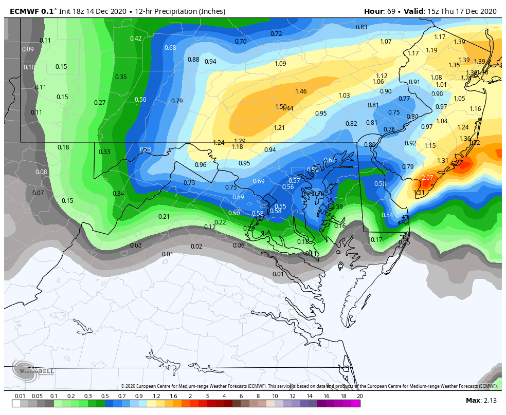
SO this last plot is the qpf that falls after that...and this is where the bulk of the snow comes from. This looks great...I would sign up for it...but I do NOT like living on the deform love as 90% of the storm. That can disapear real quick if things don't come together right. But the euro has been remarkably consistent with that in our area so maybe... so there is good and bad here...but again I am nervous relying almost entirely on the back side. Even up here its only about 3-4" before a flip to sleet...the other 14" if gives me is from the deform. If that happens GREAT but my rule is usually to treat that as bonus.
Anyways... hope that helped.
Great explanation. And if your last qpf map is close to accurate and that sounding is snow, then yea, dc can get 2-4”. But to your point it would only pan out this way with a back end solution. That’s a low percentage play usually speaking around here
-
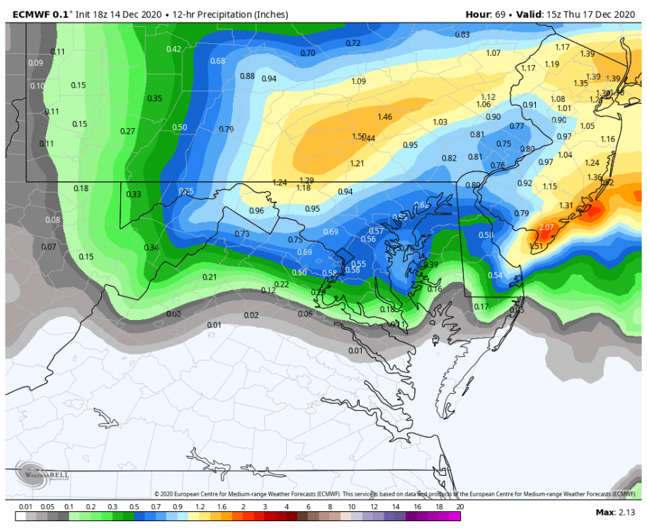
1 minute ago, LP08 said:
Adding the surface which looks above freezing in and around dc for the duration.


Man look at those 70s off the coast of Carolina. I have a feeling this thing is going to be juiced at the very least. Whoever keeps temps is going to get a qpf walloping
-
1
-


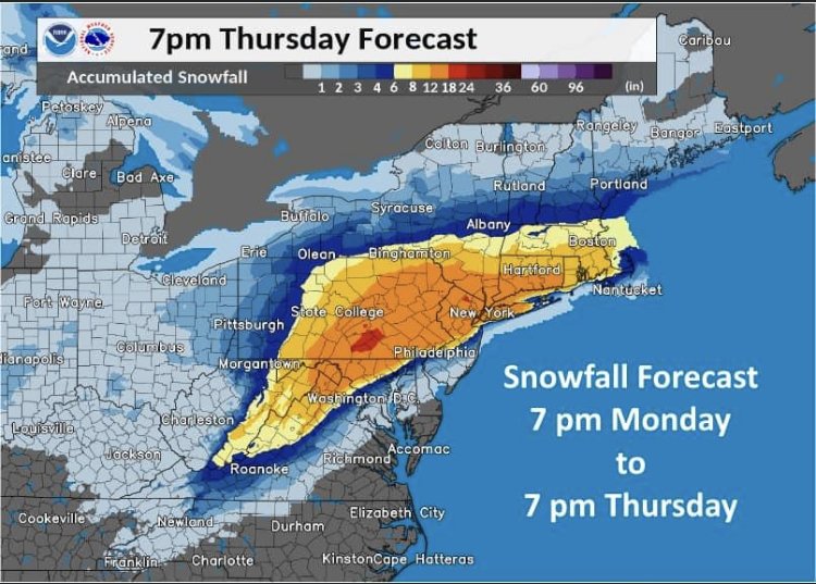
December 16-17, 2020 Winter Storm Obs/Nowcasting
in Mid Atlantic
Posted
Might want to check that. Not looking great. Warm pushing west. Pretty different from last run