Stormlover74
-
Posts
24,040 -
Joined
-
Last visited
1 Follower

About Stormlover74

- Currently Viewing Forum: New York City Metro
- Birthday 12/02/1974
Recent Profile Visitors
19,122 profile views


-
34 years ago yesterday there was a fatal plane crash at LGA during a snowstorm. Last night saw another crash also at LGA
-
Its the trade off for more snow
-
Made it to 70
-
67 and sunny
-
Apparently we're getting a quarter to an inch of rain tonight. Models all over the place
-

-
Yeah I dont get wanting that. if its not going to snow let it be 70.
-
Nothing in my immediate area but looks like alot of damage around town. Trees and power lines
-
Wow he posted on the same day
-
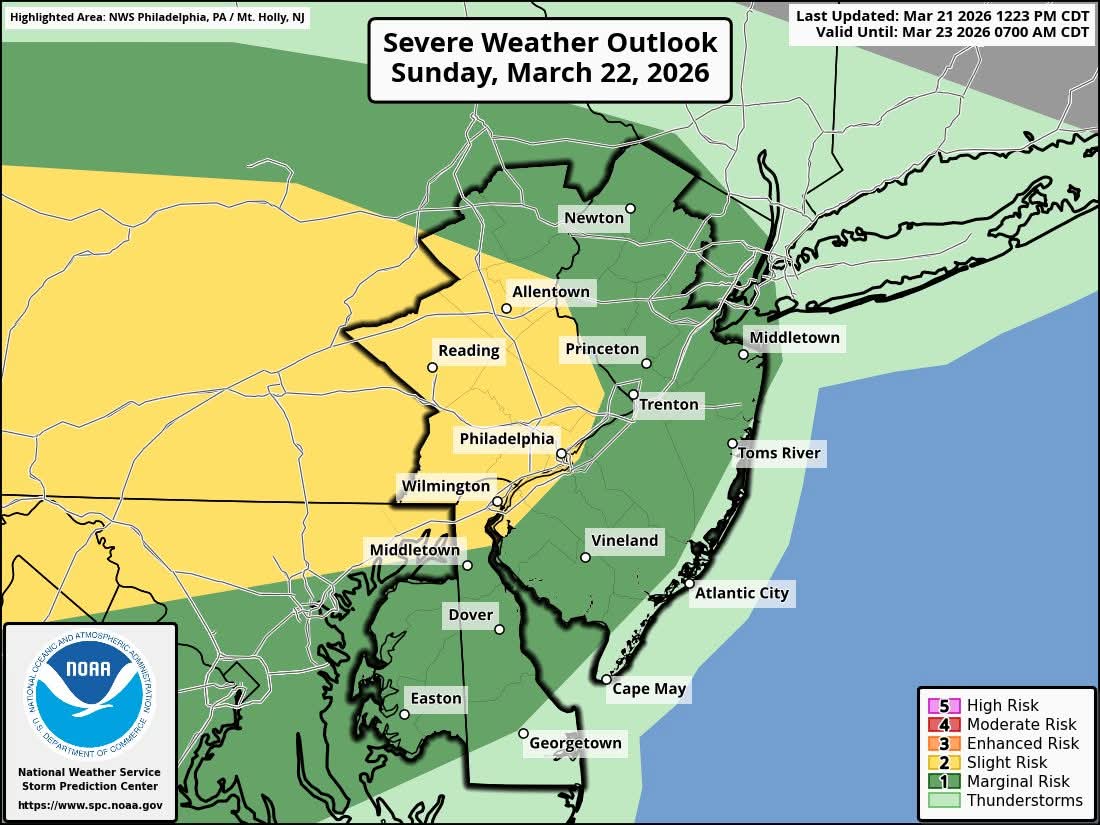
Squall line approaching. Severe warned over western nj
-
-
Slight and enhanced adjusted north and east
-
Euro continues to be super wet for Monday
-
Winds gusting past 40. Surprised no advisory
-
Up to 80 mph winds in Ohio. A blizzard to the north and record breaking heat in the west