All Activity
- Past hour
-
Are we talking about watches or warnings? Seems to me watches are often issued in our area with marginal parameters in place and don't result in an actual confirmed tornado anywhere. Warnings are issued (mostly) based on radar indicated rotation within an ongoing severe storm, for localized (county level) areas. Case in point the cells that were warned on the eastern shore last evening, apparently all produced a tornado. The results from the survey team should be available on Friday.
-
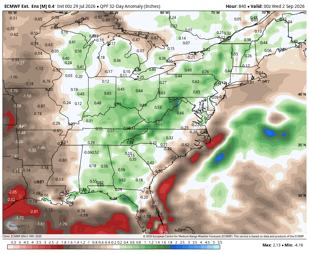
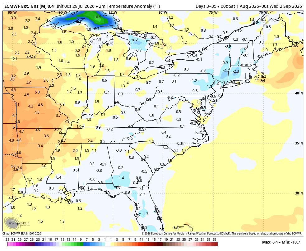
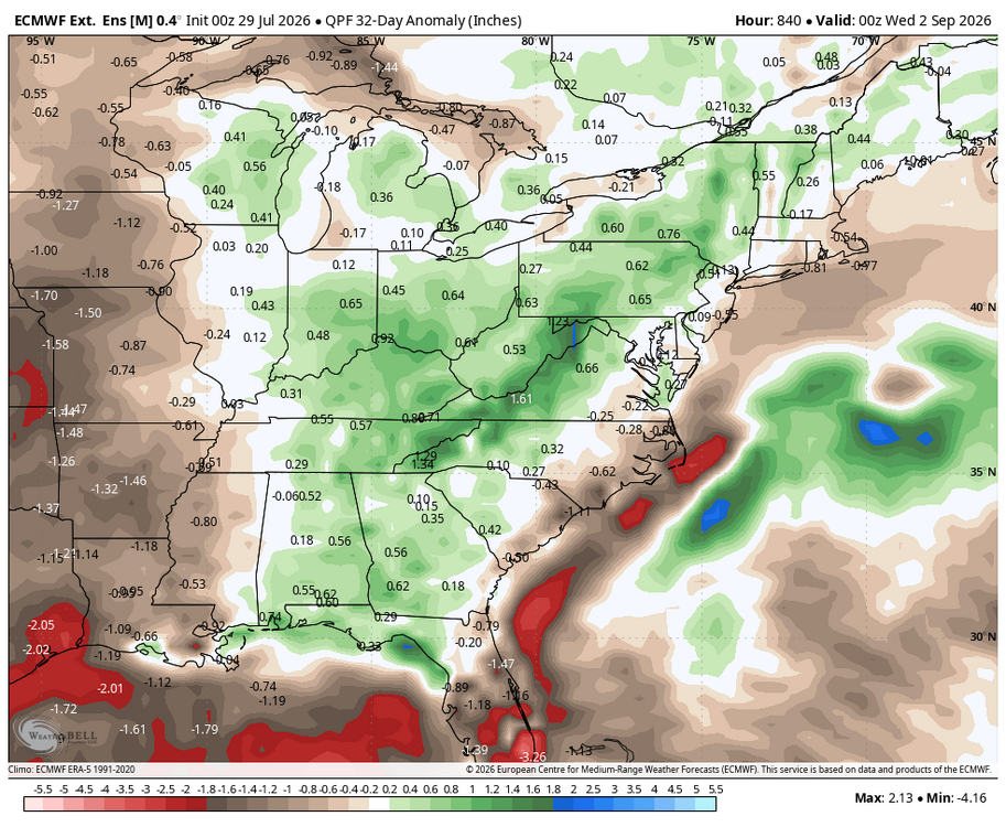
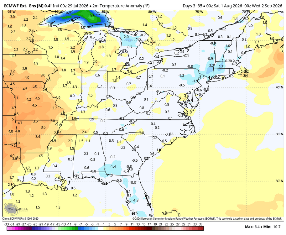
WB latest EURO weeklies for August.
-
 On the subject of lobster, does anyone here actually go to Red Lobster?!
 -
 The first 15 days look very warm and AN. That’s been obvious for awhile now. Not overly hot but 1-2 AN. What the month will be remembered for will be the consistent humidity
 -
 For a few days. Then it cools off. I don’t see anything that changed.
 -
This explains some “things”. As promised….
-
 Go for it. I doubt 10 billion gallons of floodwaters from Springfield, Hartford and Middletown would do much damage.
 -
Picked up another 1/2” with that cell in central suffolk
-
“Medium confidence”, and “low grade”. Who has the “agenda” here?
-
Do they come with a fresh salad and prune juice to wash it all down?
-
That’s about half a mile from where my folks have a place. Go there all the time.
-
Do we really get bad air quality anymore? Also if its warmish around Xmas but we get a blizzard in late Jan/early Feb, is that ok? Nino winters generally aren't very cold around here. The historic Modoki of 2009-10 was just cold enough to produce big snowstorms multiple times. The beast of a -NAO had a lot to do with that. The one legit cold powder storm occurred in late Jan after 5 weeks of no snow, and kicked off the pattern that resulted in back to back blizzards.
-
The few ACATT were posting cold and BN maps in the Augdewst thread today . It’s been obvious for a week plus now of a big humid WAN month . You really have to wonder how high they are and what their agenda is
-
 No water to boil them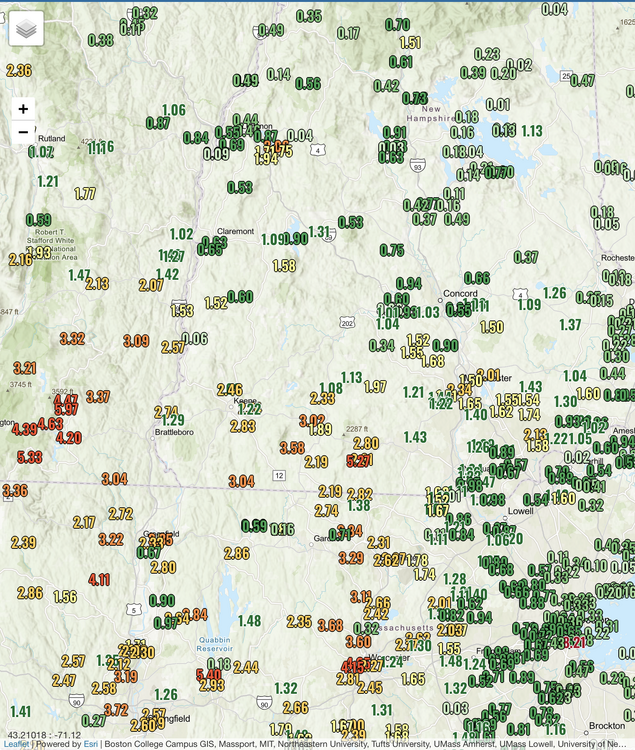
-
 Barf
Barf -
Then milling next year.
-
Hard pass. Fresh from a closed clam bed in Old Saybrook today.
-
Dammit!
-
Crossbow!!! Small area.
-
Mundane event here.
-
https://tenor.com/search/oh-yeah-sure-gifshttps://tenor.com/search/oh-yeah-sure-gifs
-
You'll never win. Only thing that kind of works is if you keep mowing whatever comes up.
-
Cleared the growth behind the shop at work at the beginning of June. Sumac trees already 2 feet tall. Vines are relentless!
-

Texas 2026 Discussion/Observations
Stx_Thunder replied to Stx_Thunder's topic in Central/Western States
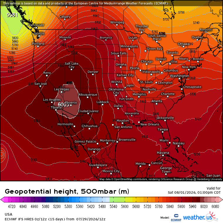
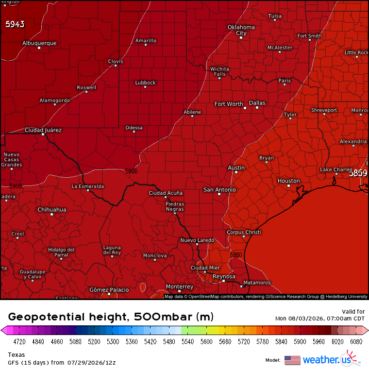
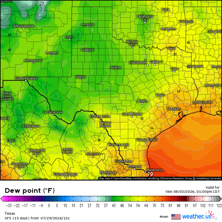
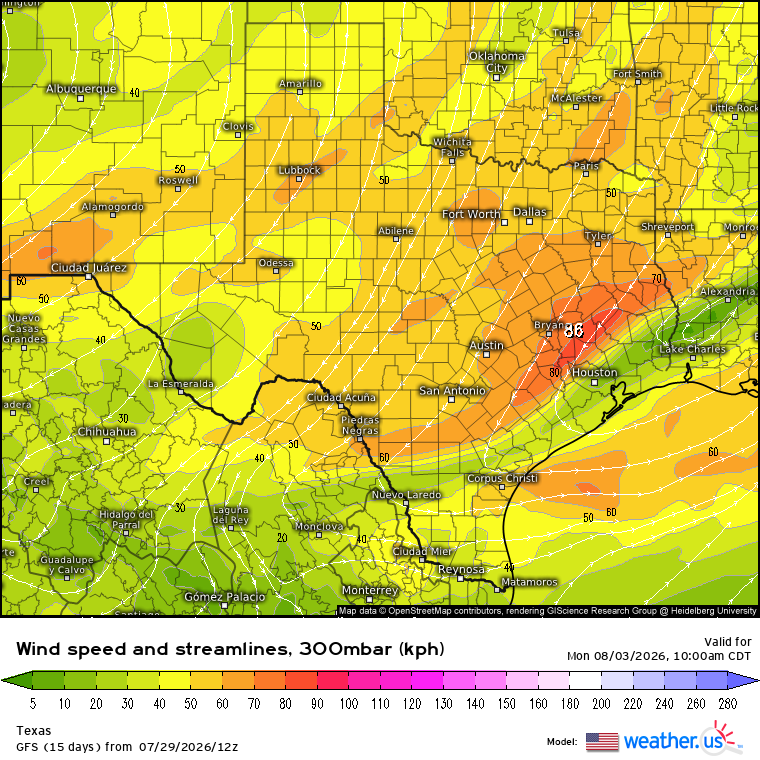
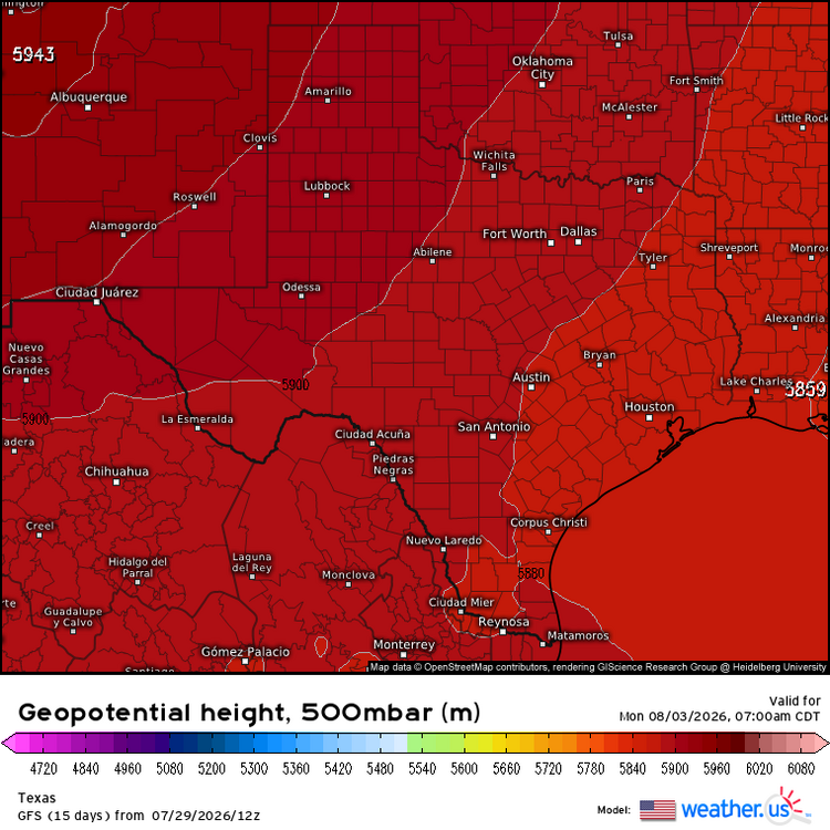
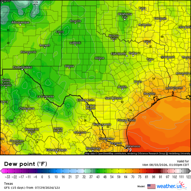
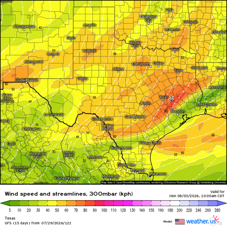
If things can't get any more unusual this time of year, there looks to be significant UL troughing moving well into the state this weekend to start August. Which has been an ongoing trend the past several years with most notable being last year in 2025 around August 5th. Where NTX ended up with 45 knot flow at H5. Which is basically off the charts for August. Models have not been making a lot of sense lately with convective/severe parameters (and there will likely be sufficient moisture in place over the southern half thanks to pooling ahead of a sfc front), but GFS has been showing the Eastern UL trough this weekend extending all the way southwest even over STX with quite unusually low H5 heights < 590dm. It's been trending further and further south over the past week, pushing the sfc front well into the state with significant dew point drops in the northern half. While NTX might be mostly dry, definitely would not rule out some supercell activity further south with this very unusual UL troughing setup extending so far south in the state for early August. Especially with EN influence back in play. And the subtrop H5 High departing (but intensifying) way out west near southern CA. Which could really deepen the Northerly upper flow in the state and open the door for more significant mid - upper level shortwave energy to curve south through the state as GFS has also been reasonably indicating into early next week.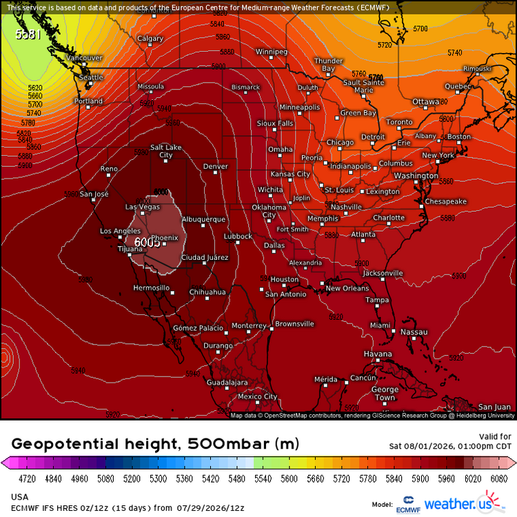
-
I’m like the girl on the couch with 5 ‘s standing behind it waiting