All Activity
- Past hour
-
-
you said the soundings were snow... could you pull them up?
-
If the ukmet was stupid with thermals that run the snow amounts would have been pretty
-
Sweeping 00z suite so far… euro next?!
-
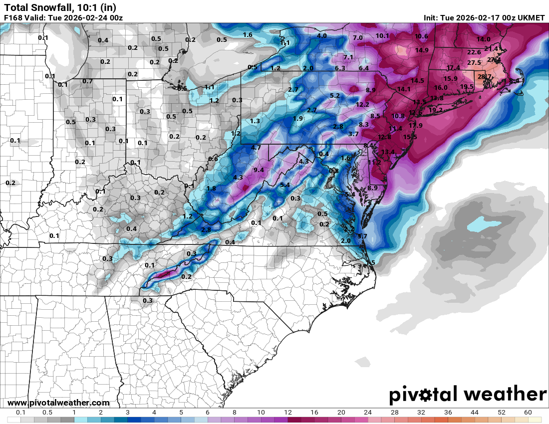
This is Ukie storm qpf.
.thumb.png.b8a632824458306fb8714449a5a922e2.png)
-
Time to lock the thread. It's only downhill from here.
-
If BOX gets 2' while I get .8" the year I move down here I'm leaving for spring break and never coming back
-
Well things escalated quickly tn....lol
-
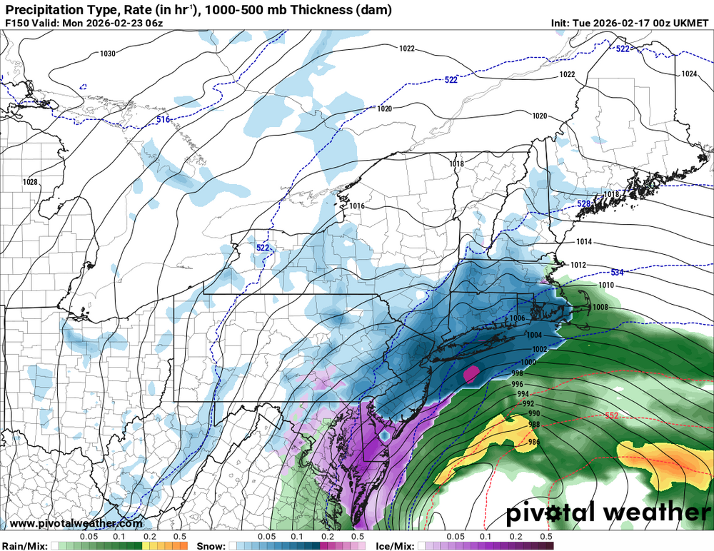
UKMET
-
UKMT Total QPF
-

Late February/Early March 2026 Mid-Long Range
Solution Man replied to WxUSAF's topic in Mid Atlantic
He been on the team lately -
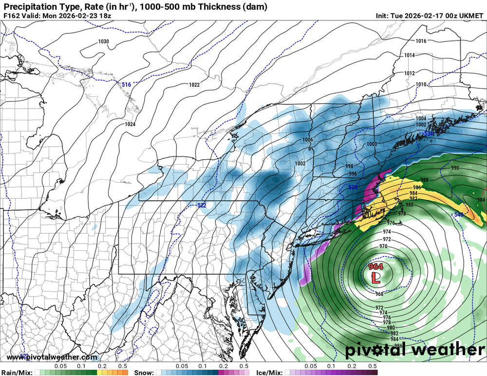
UK rain to hvy snow
-
Like I said, I can see where this is going, and it's east with the goodies in keeping with Niña tradition.
-
Late February/Early March 2026 Mid-Long Range
Solution Man replied to WxUSAF's topic in Mid Atlantic
You stay up for Dr. No and report back -
I'm trying to get him annexed to the Philly forum ..I mean technically he already is .
-
Soundings show snow on ukmet
-
Ukie is 1-2 feet Philly to Boston
-
@AlexD1990gets a foot on the UKMET, also features DC snow anus
-

Late February/Early March 2026 Mid-Long Range
stormtracker replied to WxUSAF's topic in Mid Atlantic
Sorry, it's dry according to greyhat -
Late February/Early March 2026 Mid-Long Range
Solution Man replied to WxUSAF's topic in Mid Atlantic
An unsettled pattern is likely Friday and through the weekend. This is in response to the initial trough and deep surface low which move toward the Great Lakes on Friday. Eventually a cooler post-frontal air mass ensues by Saturday morning. At the same time, the southern stream begins to undergo some degree of amplification across the southern U.S. How this system tracks on its eastward trek toward the Atlantic coast will dictate any notable impacts to the local area. Random deterministic models show a wintry precipitation scenario for the second half of the weekend. However, there is still plenty of uncertainty in this complex pattern that these random signals will likely show up here and there. Will continue to monitor though. Arctic high pressure builds across the middle of the nation by early next week. This sets the stages for a cool start to the next work week. -
-
Dear God
-
-
well you just jinxed us lmfao
-
Ukie


.png.7a15353c0d847c3149c4d81a05ea1cd7.png)