All Activity
- Past hour
-

"Don’t do it" 2026 Blizzard obs, updates and pictures.
WxWatcher007 replied to Ginx snewx's topic in New England
Wind is impressive here. Tree tops swaying. -

"Don’t do it" 2026 Blizzard obs, updates and pictures.
NeonPeon replied to Ginx snewx's topic in New England
I can't remember seeing the entirety of ri under three sorts of radar returns in the winter. -

"Don’t do it" 2026 Blizzard obs, updates and pictures.
CoastalWx replied to Ginx snewx's topic in New England
I love a man storm. -
"Don’t do it" 2026 Blizzard obs, updates and pictures.
CoastalWx replied to Ginx snewx's topic in New England
At least 2/hr now. Near zero vis legit. -

"Don’t do it" 2026 Blizzard obs, updates and pictures.
Kitz Craver replied to Ginx snewx's topic in New England
This is INSANE! I’m just glued to the window, holy crap -

"Don’t do it" 2026 Blizzard obs, updates and pictures.
Pennfisherman replied to Ginx snewx's topic in New England
Just a quick 4-9” over then next few hours! Wild -
"Don’t do it" 2026 Blizzard obs, updates and pictures.
CarverWX replied to Ginx snewx's topic in New England
Just insane rates -
2/23 9z hrr'r from 4am - 1pm monday
-

"Don’t do it" 2026 Blizzard obs, updates and pictures.
RCola replied to Ginx snewx's topic in New England
Long time lurker here, but this blizzard finally pushed me over the edge to post. It’s an absolute crush job here in PVD. I’ve never seen anything quite like it. It’s how I imagine those massive blizzards in the Upper Midwest would be. -
Things barely moving on surface analysis charts wow 972 mb
-
Dude I just woke up to. This is epic stuff outside
-

"Don’t do it" 2026 Blizzard obs, updates and pictures.
OrangeCTWX replied to Ginx snewx's topic in New England
Measured around 14 inches but with the wind I have no idea if that’s fully accurate lol -

"Don’t do it" 2026 Blizzard obs, updates and pictures.
Baroclinic Zone replied to Ginx snewx's topic in New England
Holy shit. It keeps ramping up. Can’t see building across complex. 100yds -
"Don’t do it" 2026 Blizzard obs, updates and pictures.
NeonPeon replied to Ginx snewx's topic in New England
It looks like the western two third of the island though. Nassau county West so far looking out of the best stuff? -
Its merged over nyc with the jersey band. Intense snowfall rn up and down the city.
-
"Don’t do it" 2026 Blizzard obs, updates and pictures.
NeonPeon replied to Ginx snewx's topic in New England
Btw. Re: lbsw. Sometimes a storm is more like highly precise bukkake and not your run of the mill adventure in the back of a 91 Toyota previa. -
"Don’t do it" 2026 Blizzard obs, updates and pictures.
Baroclinic Zone replied to Ginx snewx's topic in New England
Pretty damn cool to witness. -

"Don’t do it" 2026 Blizzard obs, updates and pictures.
MegaMike replied to Ginx snewx's topic in New England
Haven't seen wind/snow like this since 05'. This feels like a true blizzard. Lights are flickering here too. I would like no work today (remotely), but I also need power to film a time lapse. I have two going: One in Wrenthan and one in Norton. Both should look great assuming snow doesn't coat the windows :waves fist: -
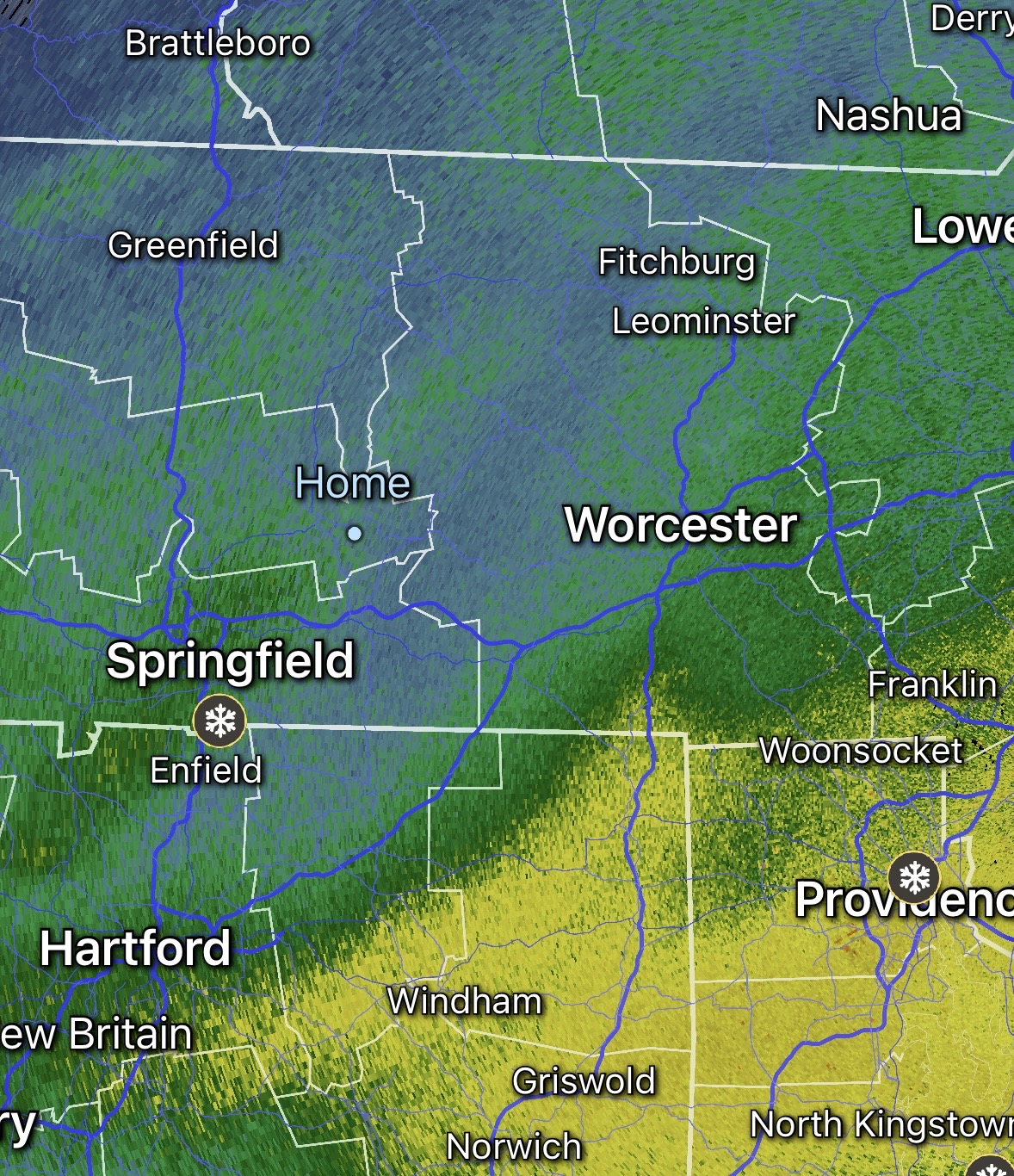
Long Island band seems to be weakening
-
"Don’t do it" 2026 Blizzard obs, updates and pictures.
CoastalWx replied to Ginx snewx's topic in New England
LI always finds a way. -
Any power outages?
-
"Don’t do it" 2026 Blizzard obs, updates and pictures.
OrangeCTWX replied to Ginx snewx's topic in New England
This is Nemo 2.0 outside. My god -
"Don’t do it" 2026 Blizzard obs, updates and pictures.
WxWatcher007 replied to Ginx snewx's topic in New England
Still on the edge, but starting to rip again. HFD FZFG and 1/2mi viz. -
"Don’t do it" 2026 Blizzard obs, updates and pictures.
Pennfisherman replied to Ginx snewx's topic in New England
Pretty underwhelming up here so far, I’m envious of you guys down south/east. Im hoping this band can make it to me.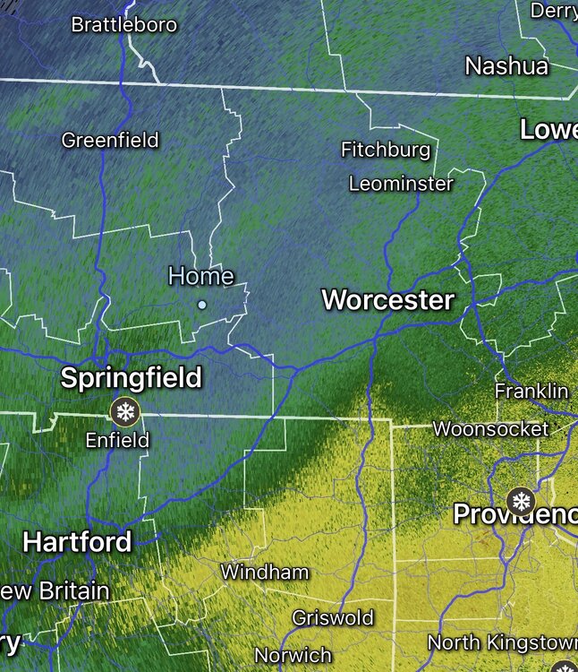
-
I caught a transformer blowing and the power going out (other side of our street...we're still on for the moment) at 5:21 am: https://www.instagram.com/p/DVGObqykfDt/?igsh=NWl2N3VwYTczZWVj The second video was a few moments before.