NCSNOW
-
Posts
4,430 -
Joined
-
Last visited
About NCSNOW

-
White ground Gboro, nice event. Snowing mod/heavy all the way back to mtns
-

2021-2022 Fall/Winter Mountains Thread
NCSNOW replied to BlueRidgeFolklore's topic in Southeastern States
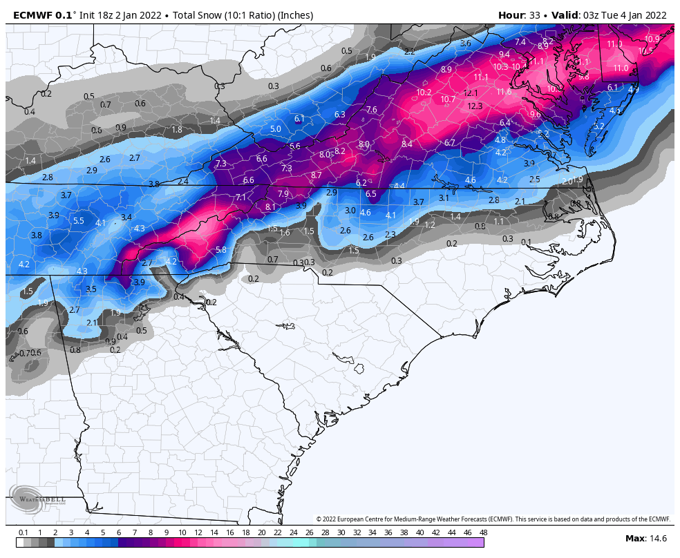
18z euro
-
2021-2022 Fall/Winter Mountains Thread
NCSNOW replied to BlueRidgeFolklore's topic in Southeastern States
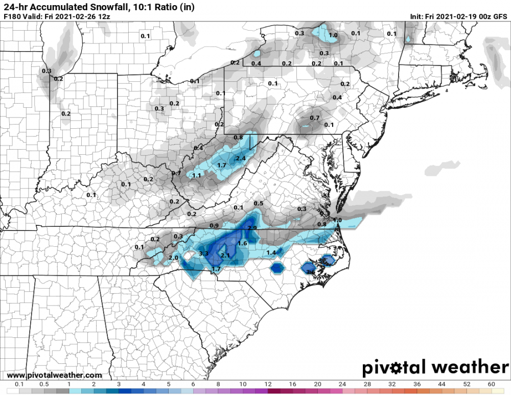
Because they cut off at hr 18,more to come if you keep going Heres the nam. Caution its 10:1 ratio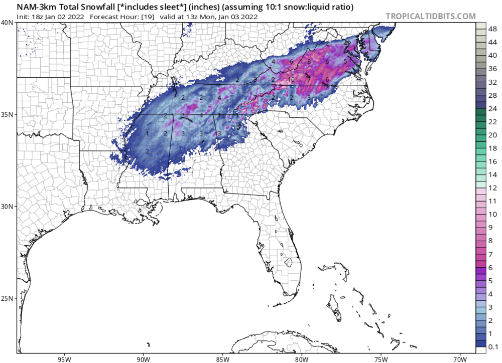
-
Try 51 in Charlotte
-
Nice job. Wish we had all this technology,wxboards from Jan 2000-March 2004. Those would be awesone to go back and see. Crusher,2002 epic ice storm and the Late Feb 2004 ULL mega dump.
-
12z GEFS looks Good for next Th/Friday. Hopefully EPS will continue its stellar 0z look
-
Both 0Z Gfs back on for next Thurs/Fri
-
Yea and its cold tonight. Wind chill isnt mia like last night I can assure you. Car feels icy as moisture is starting to spit again in the wind.
-
Everything is on schedule here. Coated up and heavy bands getting ready to roll through 9-12pm. Then anoyher round in the early morning tommorow.
-
Ive noticed this alot on models past couple of days. It makes sense,cause the artic air is shallow,why we cant tap east of the blue ridge. But it will no doubt seep all the way to the western escarpment. Has no choice and might dam up high enough. Was very discernable.
-
Most of the Ice is Friday Deal east of Raleigh area
-
ROUND 2 FRIDAY KEEPS POPPING UP: Keep an eye out
-
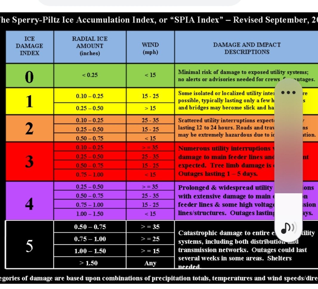
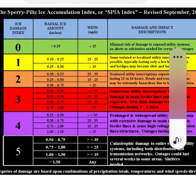
Watch the wind gust maps. Do the math. Seeing wind gust map , ne winds mid- high 20s. You get.5-.75 and those winds , with our sponge ground. Its cat4-5 on this chart.
-
world Famous 18z GFS comes south/Lines up with the Canadian Suite now
-