

tim123
-
Posts
6,682 -
Joined
-
Last visited
Content Type
Profiles
Blogs
Forums
American Weather
Media Demo
Store
Gallery
Posts posted by tim123
-
-
4 minutes ago, sferic said:
Wish that LES would take a trip to Onondaga too
Sw onodaga looks best bet
-
Just now, DeltaT13 said:
We must have added 2-3 inches today. Definitely a solid finish to this one.
Mat get a couple more tonight with lake snow.
-
Looks like totals come tomorrow am will be 12 to 20 monroe wayne county.
-
Seeing evidence of lake snow on western end of lake.
-
Snow advisory for us vort 3 to 6 overnight.
-
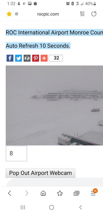
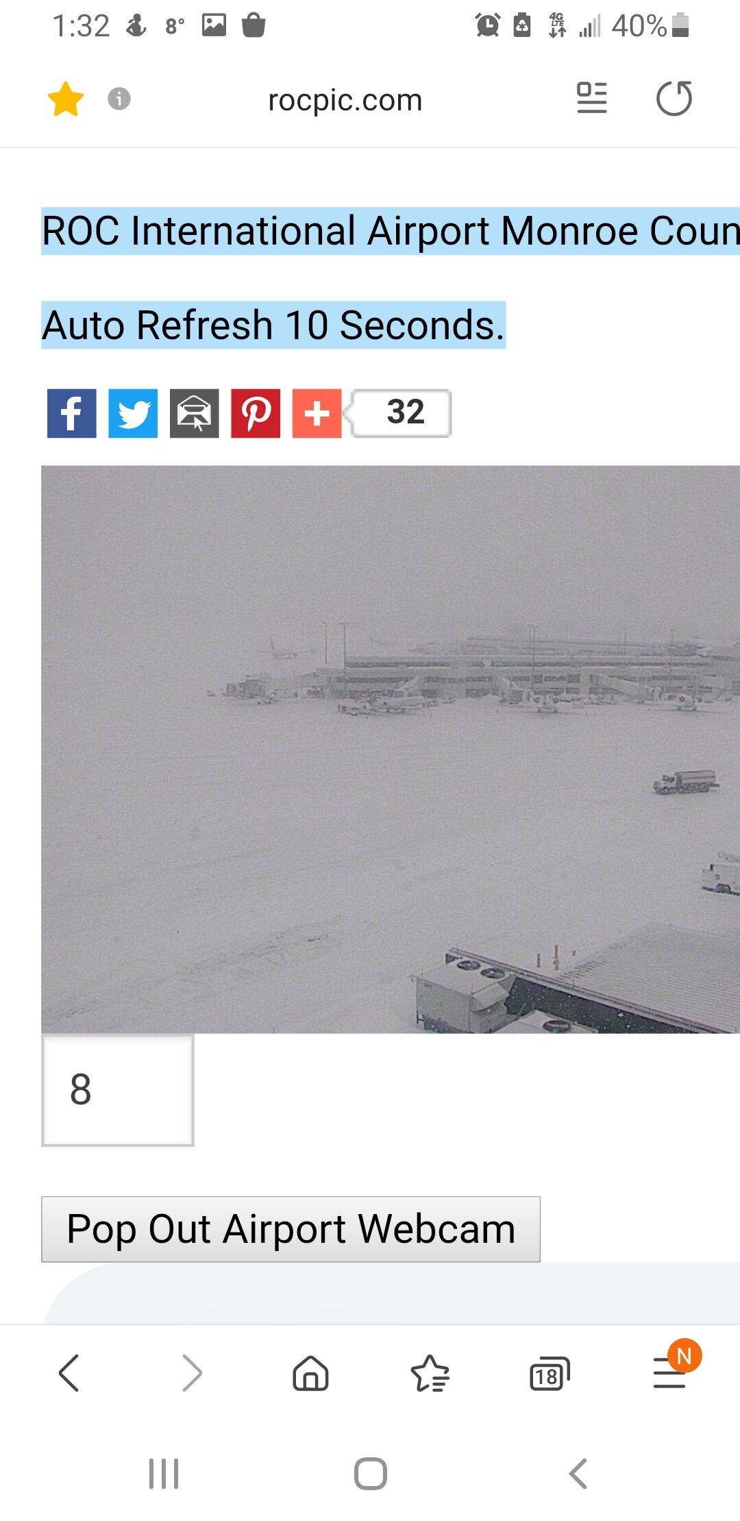
I know you all love the airport pics.
-
 1
1
-
 1
1
-
-
Stuff falling now is 18 to 1 probally. Dumping in roc
-
4 minutes ago, 96blizz said:
See this is why I post unrealistic Kuchera maps during the tracking. It’s a sliver of happiness before we have to measure and melt the snow and actually be honest.
It’s like seeing analysts pick your favorite NFL team to win. You know it don’t mean shit but you still smile in the moment.

12 13 to 1 ratio is about what we had.
-
1
-
-
Kevin Williams fb page. Local legendary met
-
3
-
-
16 minutes ago, vortmax said:
My P&C forecast (aligns with mesos, but not their snow map)...which to believe?? Yet the WSW only goes until 1PM.
This AfternoonSnow before 5pm, then snow showers likely after 5pm. High near 21. North wind 11 to 17 mph. Chance of precipitation is 100%. Total daytime snow accumulation of 2 to 4 inches possible.TonightSnow showers likely before 8pm, then snow between 8pm and 4am, then snow showers likely after 4am. Low around 12. North wind 5 to 13 mph. Chance of precipitation is 100%. New snow accumulation of 3 to 5 inches possible.I find point and click is better. Updated more often than the stupid maps.
-
1
-
-
17 minutes ago, vortmax said:
Check out the cool sat view of Superior. The loop is even better. Multiple mesos...

Its like a colidascope. Ha
-
Don't look like much on radar but its coming down.
-
11 minutes ago, vortmax said:
The mesos (HRRR, FV3, and 3k NAM) seem to think we've got another 3-8" to go along the South Shore over the next 24hrs. I used Kuchera as the ratios are certainly above 10:1.
How much you get vort?
-
Looks like a foot in walworth. Was hoping for more. Looks like areas near Lake did get more. Reports are spotty but seeing 11to 13 inch from Greece to Marion
-
Can see wave 3 developing in Indiana and Ohio on radar
-
10 minutes ago, Syrmax said:
There were reports of English flags in the Turkish trenches at Galipolli. Didn't mean it was true.
Also reports from you its raining in a snowstorm.
-
1 minute ago, Syrmax said:
-2 sp. -1 grammar. #fail
Why don't you go home and get your shine box
-
1
-
-
7 minutes ago, Syrmax said:
There were reports of English flags in the Turkish trenches at Galipolli. Didn't mean it was true.
Your a idiot. We all don't sizzle like you bro
-
1
-
-
Highest near Lake.
-
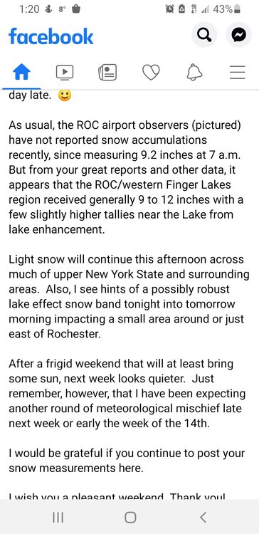
Sure does. Reports of 9 to 12 inches in monroe county from social media.
-
About 10 inches here in walworth.
-
1
-
-
21 minutes ago, Syrmax said:
Could you post a close up of a random model Kuchie for Rochester area? Asking for a friend...
Could you tell me why syracuse weather sucks and why its so warm? Asking for a friend. Lol
-
Just now, TugHillMatt said:
Tim is picking him up on the way.
Could you imagine THAT car ride???
Yes flakes getting bigger. May be a case of lighter returns but Fluffier snow.
-
Flakes much bigger now. Pounding out
-
1
-


Feb 2-4th Snowstorm- Observation Thread
in Upstate New York/Pennsylvania
Posted
You at a foot yet?