

tim123
-
Posts
6,682 -
Joined
-
Last visited
Content Type
Profiles
Blogs
Forums
American Weather
Media Demo
Store
Gallery
Posts posted by tim123
-
-
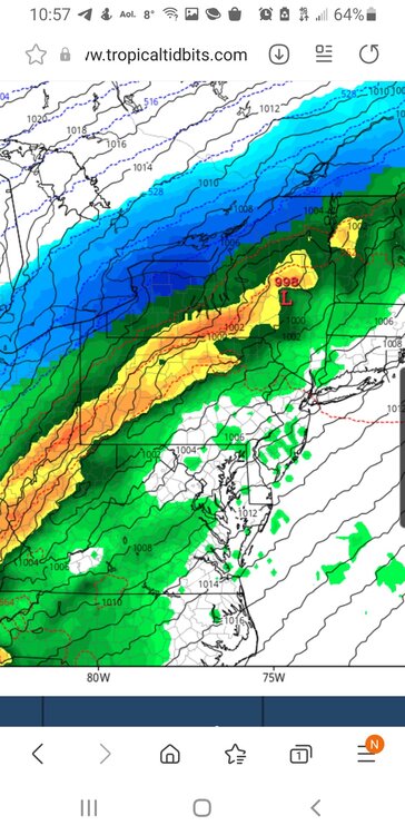
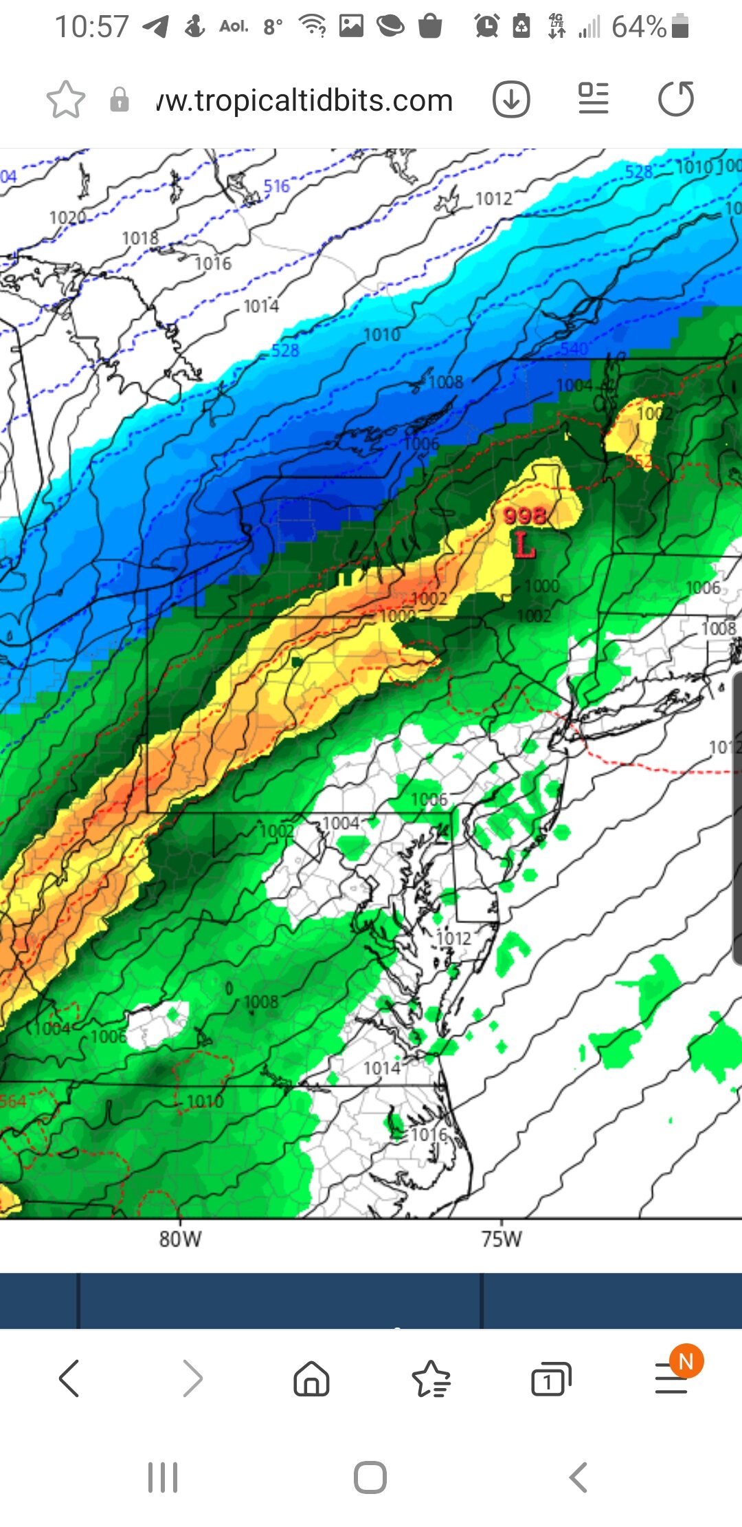
Getting pretty close in and pretty big difference between American and foreign models.
-
Icon misses us to the se. Lol
-
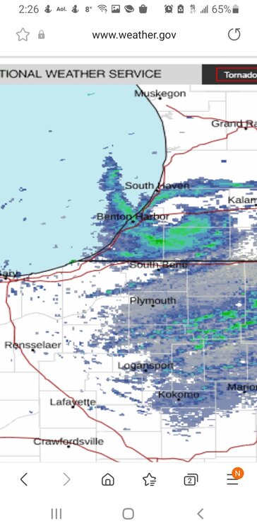
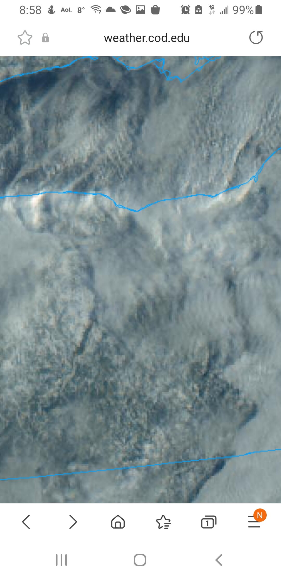
Nice meso southern lake michigan
-
Now thats a meso.
-
 1
1
-
-
2 minutes ago, vortmax said:
Beautiful winter day.

What you up to for snow today?
-
Gfs ensembles farther se than op. Buy a good bit
-
2
-
-
Absolutely Pounding out. Wow.
-
-
Snowing moderate again in walworth
-
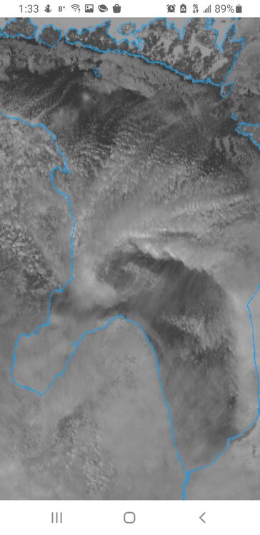
Look at satellite of lake Huron if you wanna see a huge meso low forming
-
Ggem did the best with last storm. Interesting battle between gfs and german and canadian
-
Icon. Sleet freezing rain to snow
-
1
-
-
16 minutes ago, rochesterdave said:
Diurnal effects will shut these down. Tonight we go again?
I think so. May be more nw monroe. Nne flow. But obviously ya never know.
-
1
-
-
About 5 inches in walworth. Stopped for the moment. Think or will start again soon.
-
Wrf indicating 30 to 1 ratios tonight
-
1
-
-
1 minute ago, lakeeffectkid383 said:
Heaviest snow I’ve seen all year at Sweet Farm road and Culver Road. Gotta be 3-4” hour pure fluff just pouring down.
Rochester area can get hammered with the light northerly flow
-
 1
1
-
-
4 minutes ago, rochesterdave said:
6”
May get another 6 come tomorrow morning.
-
Told you advisories should have been up. I Called for 4 to 8.
-
Just now, rochesterdave said:
Getting whalloped in Irondequoit
How much you got since last eve?
-
Wrf again hammers niagara peninsula tonight. Over a foot. Be interesting to see if it verifies.
-
15 minutes ago, tim123 said:
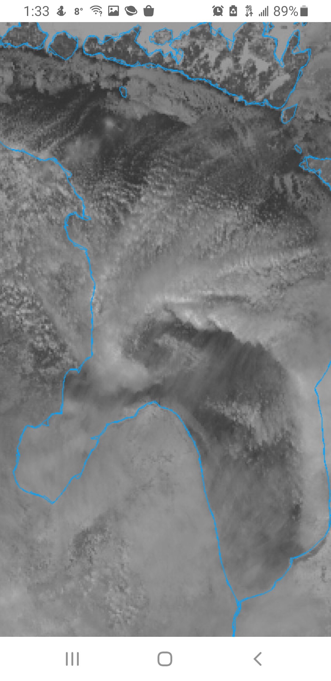
Definitely a meso low over ne monroe county per satalite. First vis of day. Actually counted 3 one over orleans one over monroe and a real spinner over wayne county
-
1
-
-
Definitely a meso low over ne monroe county per satalite. First vis of day. Actually counted 3 one over orleans one over monroe and a real spinner over wayne county
-
Been getting hammered on in walworth since 630 am. Probally 3 inches since then.
-
1
-
-
Snowing nice past couple hours 3 inches since last eve most past couple hours.


Upstate/Eastern New York-Pattern Change Vs Tughill Curse?
in Upstate New York/Pennsylvania
Posted
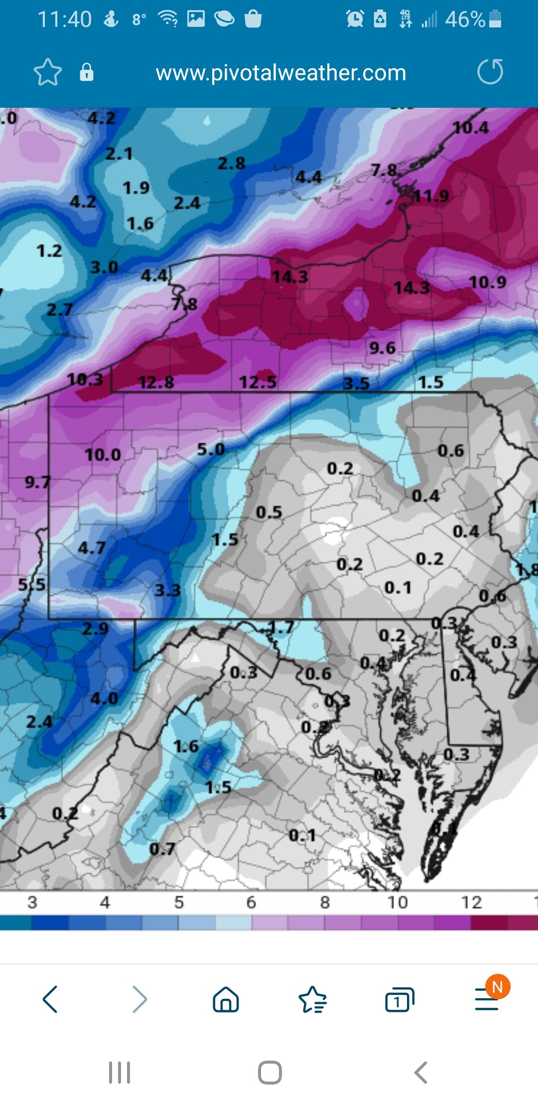
Gfs shows 20 inches in Central Michigan. Canada euro 6 to 10 in western ny. Rgem looks like it would be a hit