BoulderWX
-
Posts
1,314 -
Joined
-
Last visited
Content Type
Profiles
Blogs
Forums
American Weather
Media Demo
Store
Gallery
Everything posted by BoulderWX
-
I have never seen a 20-30” official forecast. And honestly wouldn’t be surprised if some places surpass that. Incredible. Even if the worst case doesn’t pan out, which it hopefully won’t, this one will be historic in its own right.
-
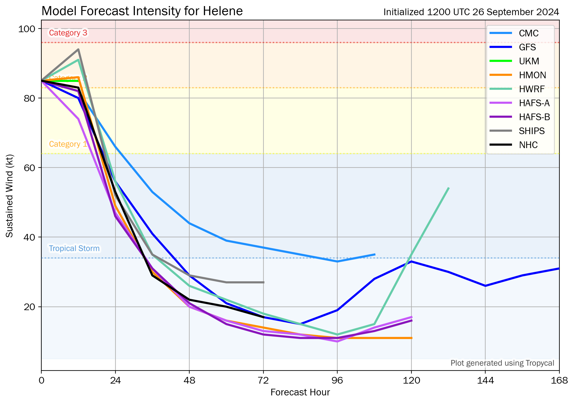
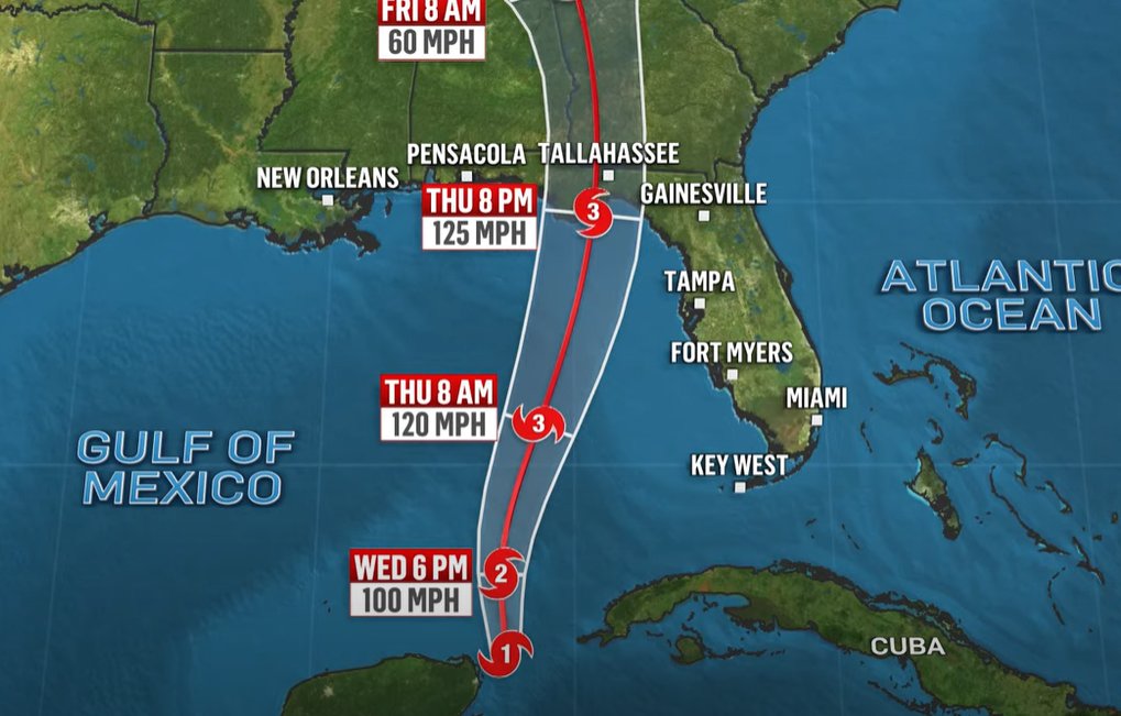
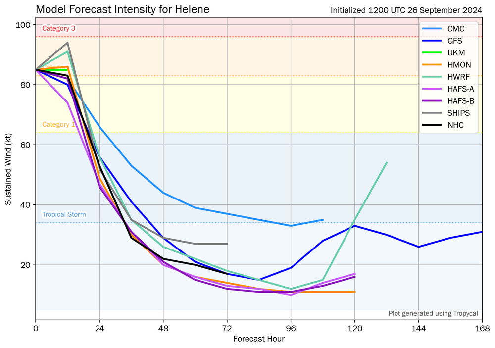
Model guidance honing in on high end cat 2 at landfall. Still think we can see low-end cat 3
-
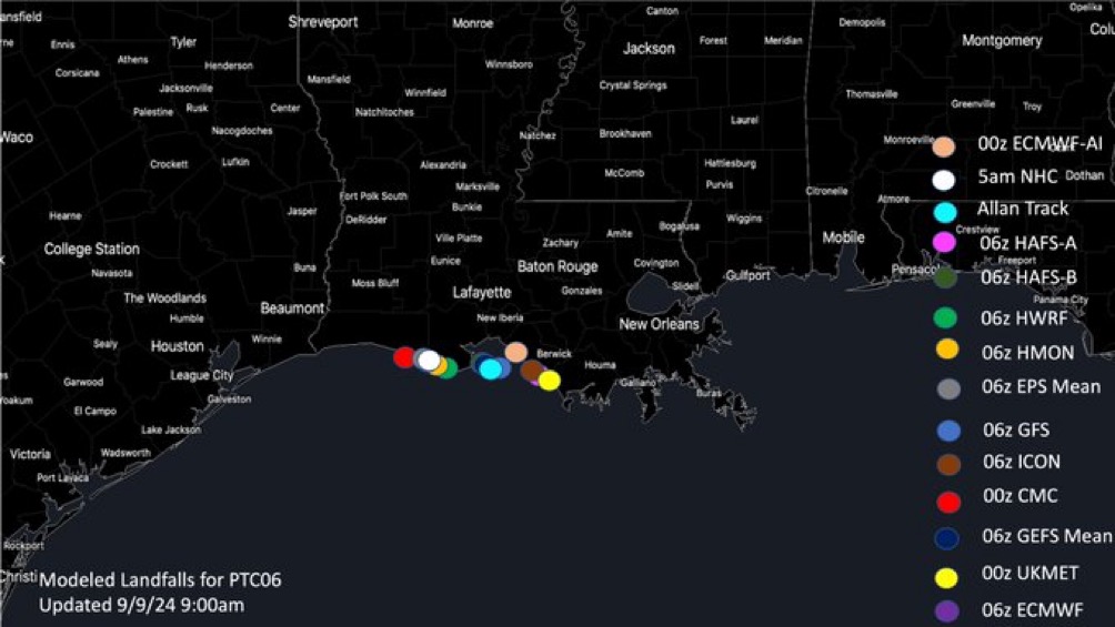
In terms of location, that would be best case scenario placing TLH and ATL on the western side. If it were to be closer to Panama City or Port St Joe, the impacts would be significantly worse. Will be interesting to see the details ironed out over the next 6-12 hours but hopeful this stays far enough east to mitigate some of the impacts for the most populated areas in the cone.
-
Meanwhile on land…
-
Really hoping this is the case because as of yesterday it looked like a worst case scenario for both areas. Way too early to tell but if they can remain on the west side, that would be a saving grace. Regardless, I think it’s way more than a nuisance either way, but will be *less* devastating if the can remain on the western side.
-
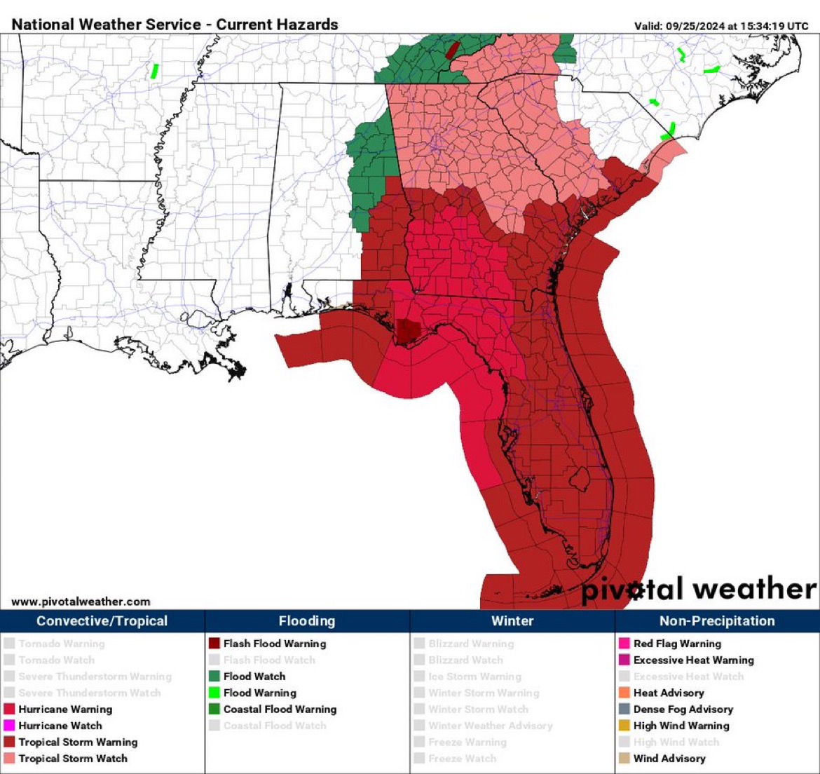
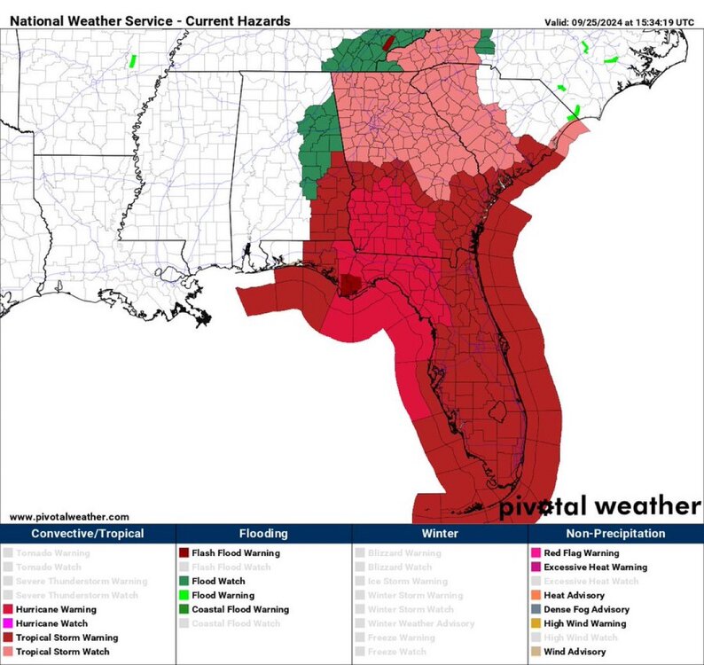
Wild advisory image.
-
Glad to see this didn’t explode overnight but seems like it’s getting its act together this AM. prayers and best wishes for all in its path. Will be a fascinating day of tracking.
-
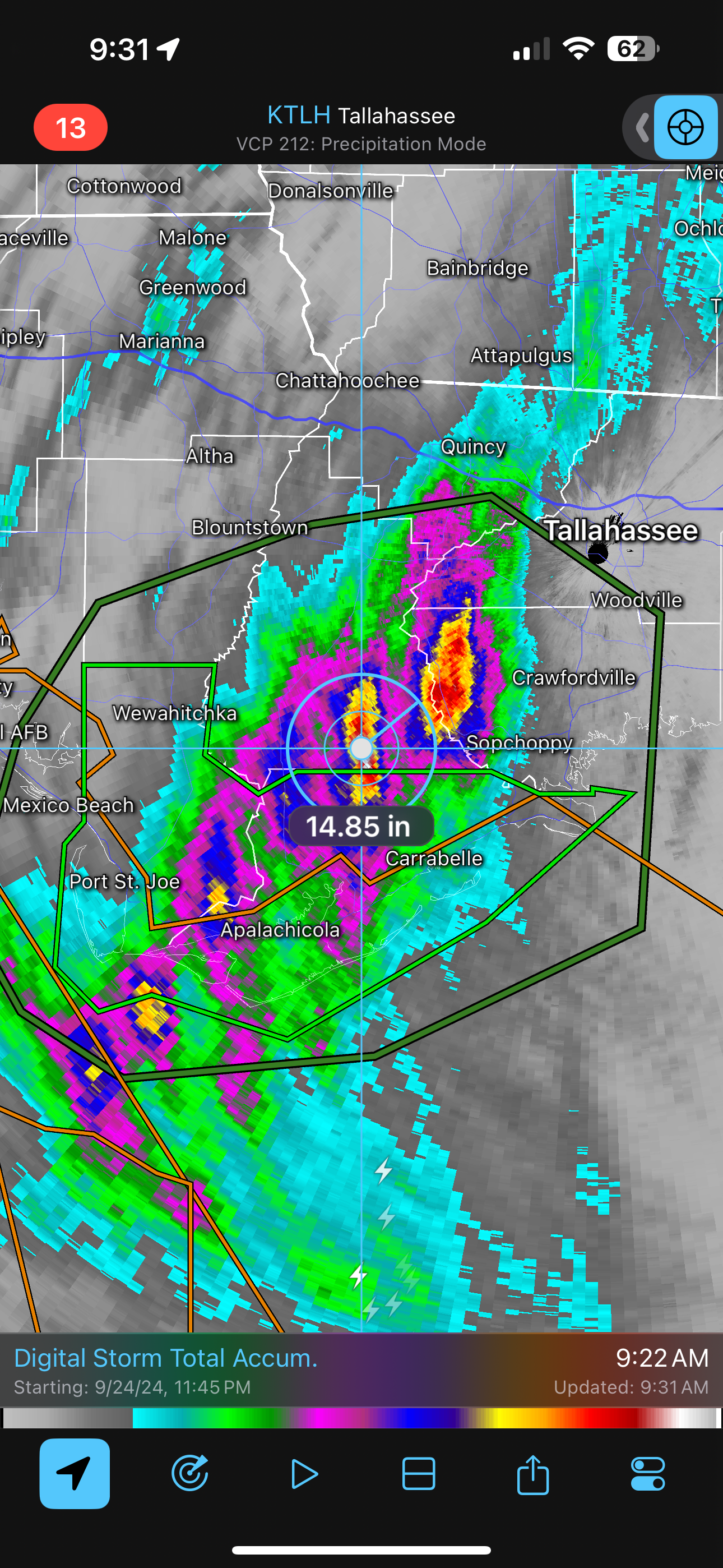
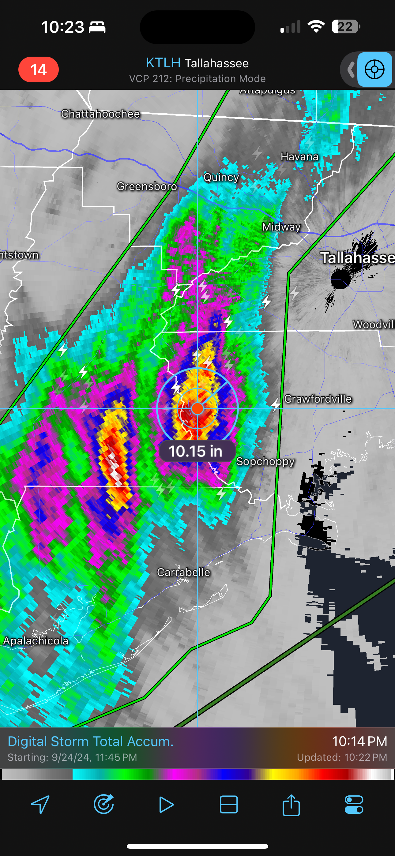
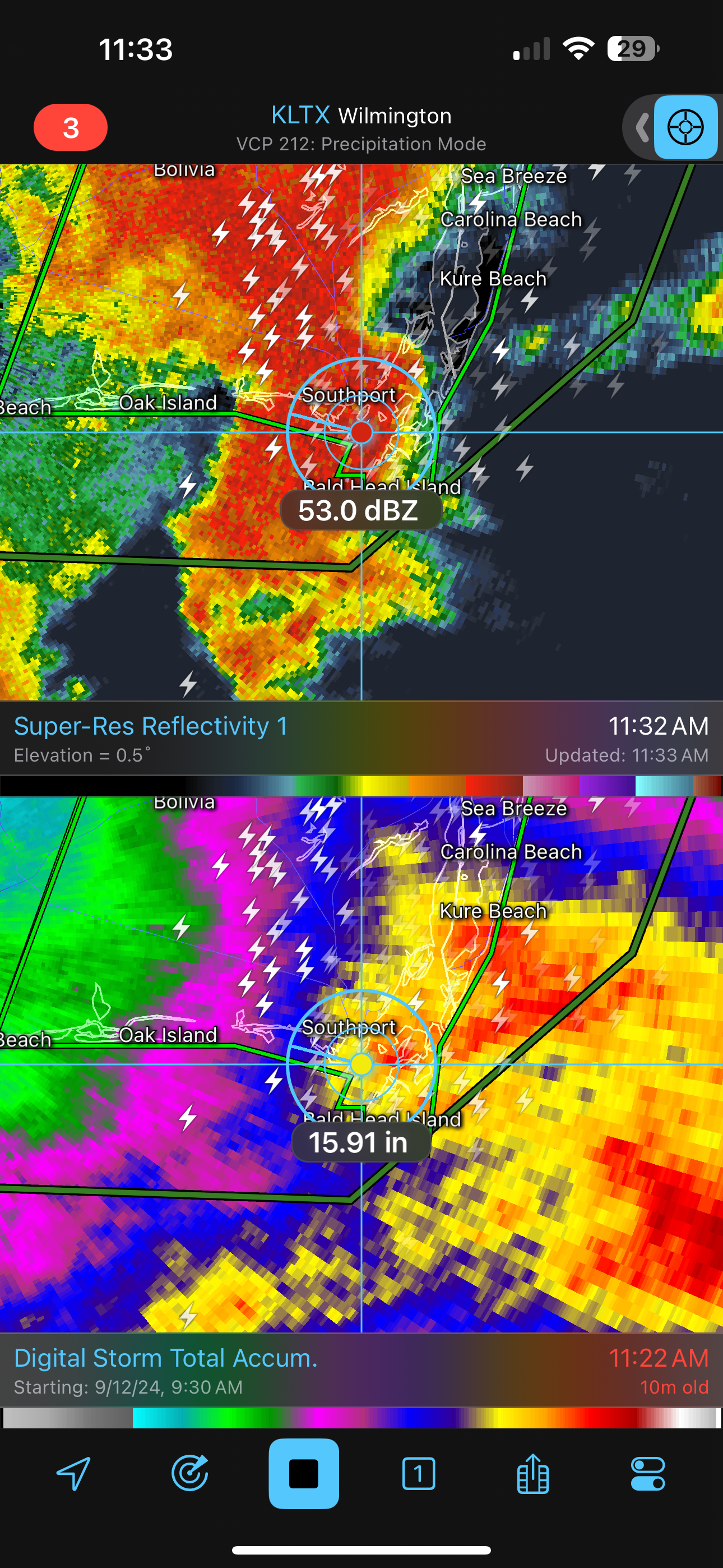
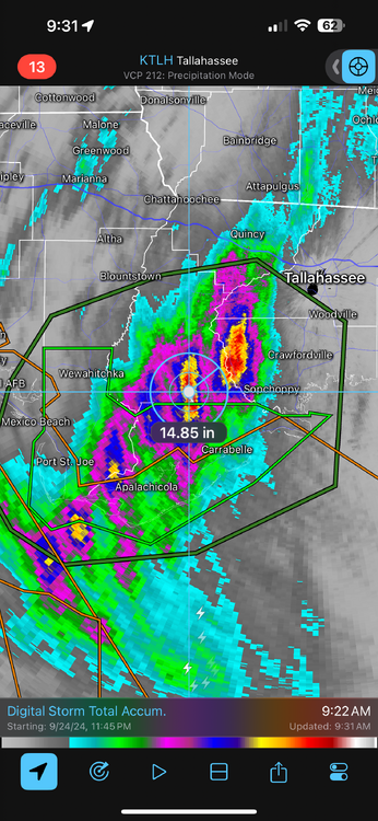
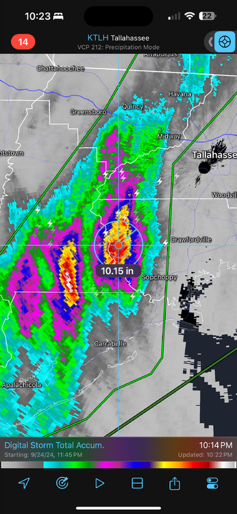
Can this be close to accurate?! A few local spots of 10” of rainfall based on radar estimates. I know these can be off, but they weee very accurate for the coastal areas of North Carolina with the TS a couple weeks ago.
-
Praying we continue to see these drops in anticipated max winds and RI, but sadly a storm of this size coming in at this trajectory is going to cause major problems whether it’s a 2/3 or 4.
-
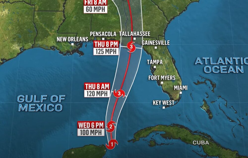
Yup, horrible look for TLH with the center projected to pass just to the east.
-
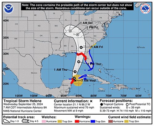
Up to 70mph - we should have Hurricane Helene by the 11am advisory
-
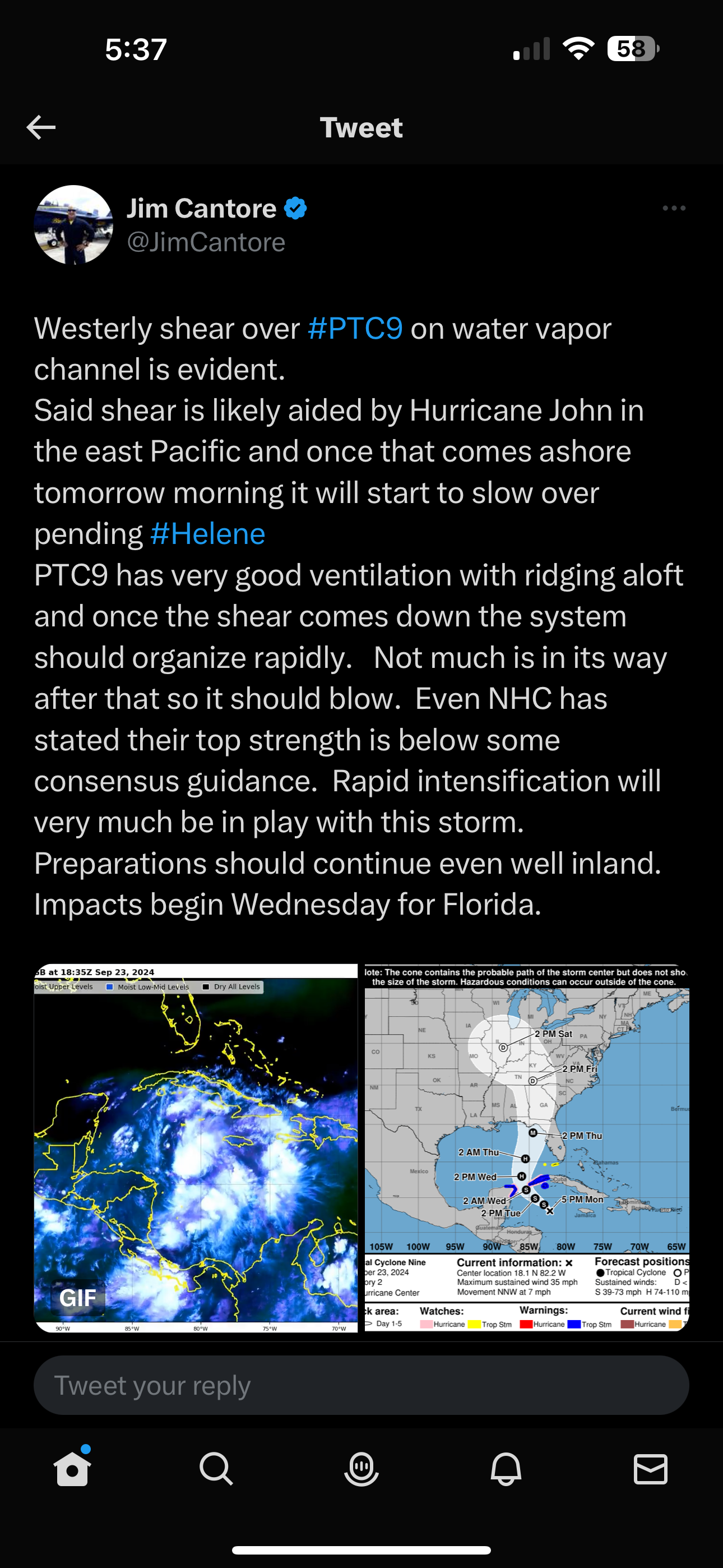
Good write up from Cantore
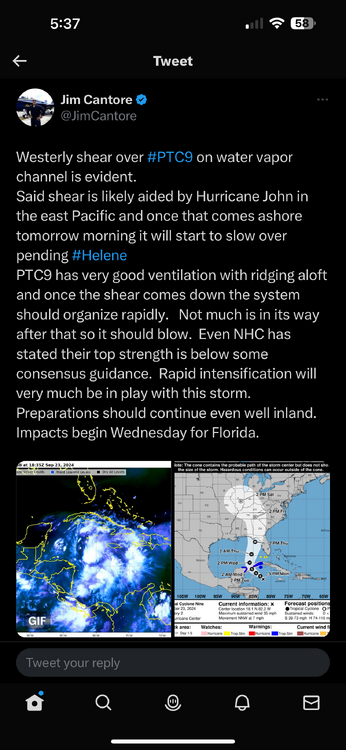
-
Honestly, this is on the Mods at this point. It’s one thing to let a few random posts go, but to allow him to continue posting, degrades any sense of meteorological posts. It’s getting embarrassing for the forum at large.
-
Potential Tropical Cyclone Eight—50mph/1006mb
BoulderWX replied to WxWatcher007's topic in Tropical Headquarters
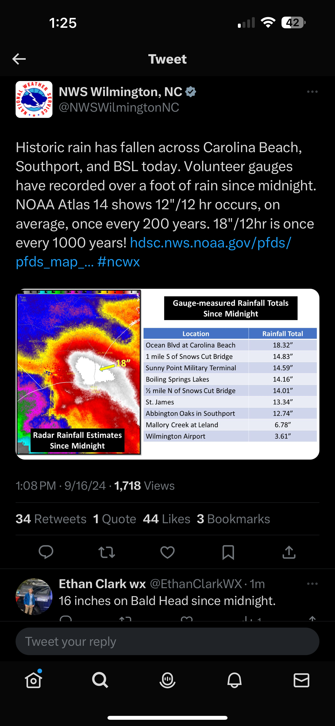
Unfortunately for coastal areas, the high radar estimates are being confirmed on the ground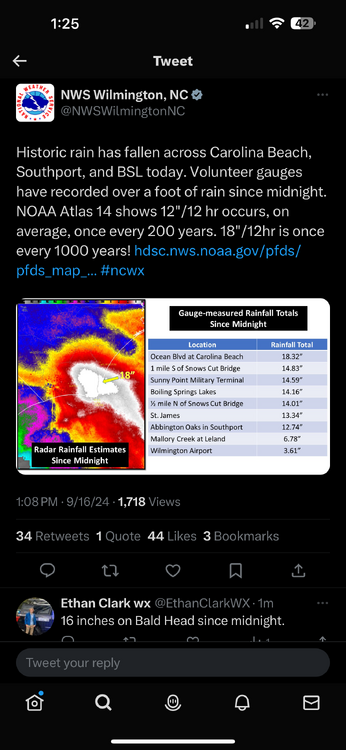
-
Potential Tropical Cyclone Eight—50mph/1006mb
BoulderWX replied to WxWatcher007's topic in Tropical Headquarters
Insane - localized 20+ by time all is said and done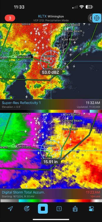
-
Potential Tropical Cyclone Eight—50mph/1006mb
BoulderWX replied to WxWatcher007's topic in Tropical Headquarters
Agree but rainfall exceeding expectations along the NC coast. Radar estimates already showing 6-11” -
Fair enough, there was also no data point directly before landfall so it was a bit of a gray area but your point is taken. Most of what I have seen is a forecast of cat 1 at landfall which I agree with. Certainly possible it hits cat 2 at some point in its journey but inhibiting factors as it approaches land has always capped upward potential.
-
Yeah… I’m wondering the same since I got weenied for essentially posting facts (path shifted east and it’s 65mph currently), and then saying it looks on track to hit as a cat 1 lol. Would love to know what he took issue with.
-
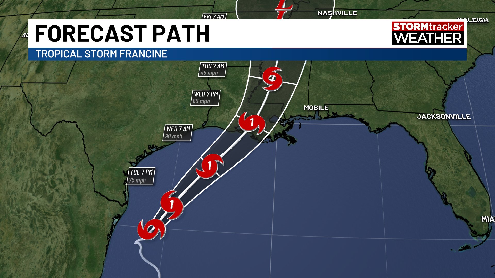
Official forecast shifts east and continues to be progged as a Cat 1 at landfall. Everything seems to be on track intensity wise. 65 mph at last update
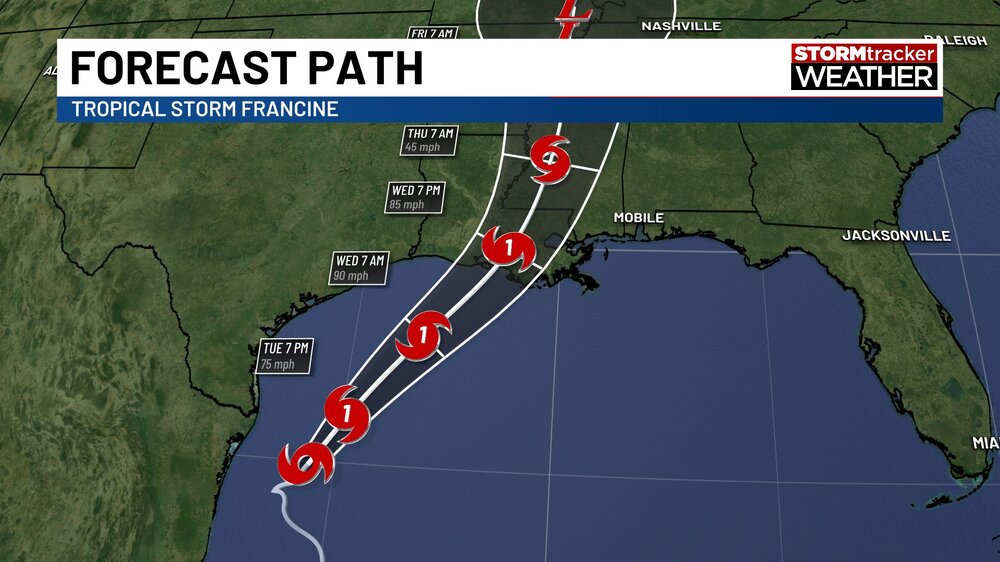
-
Almost all prognostications have kept this a cat 1, around 85mph. I still think it has a good shot of becoming a hurricane which would be in line with the expectation. Could be wrong, but if it reaches hurricane status it’s not a bust. just because some people speculate, doesn’t mean that’s what the official forecast was. And we all know model guidance varies widely with every storm. Most topped it out as a cat 2 and I didn’t see one official forecast going to cat 2. Highest was 100, which may end up too high, but again, not by much.
-
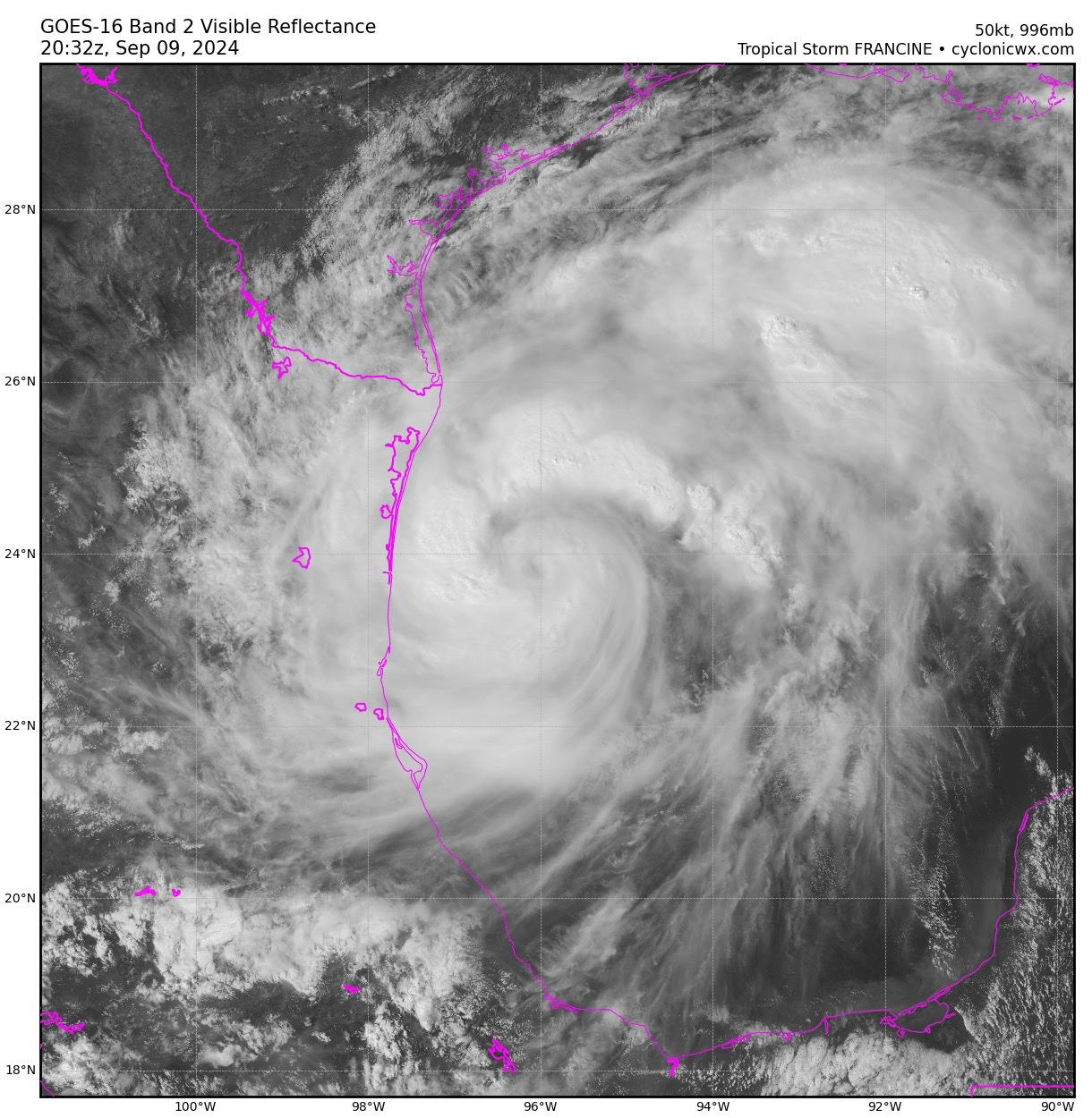
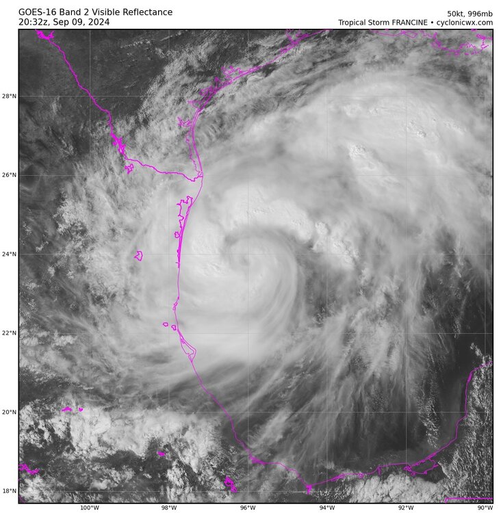
Another view…
-
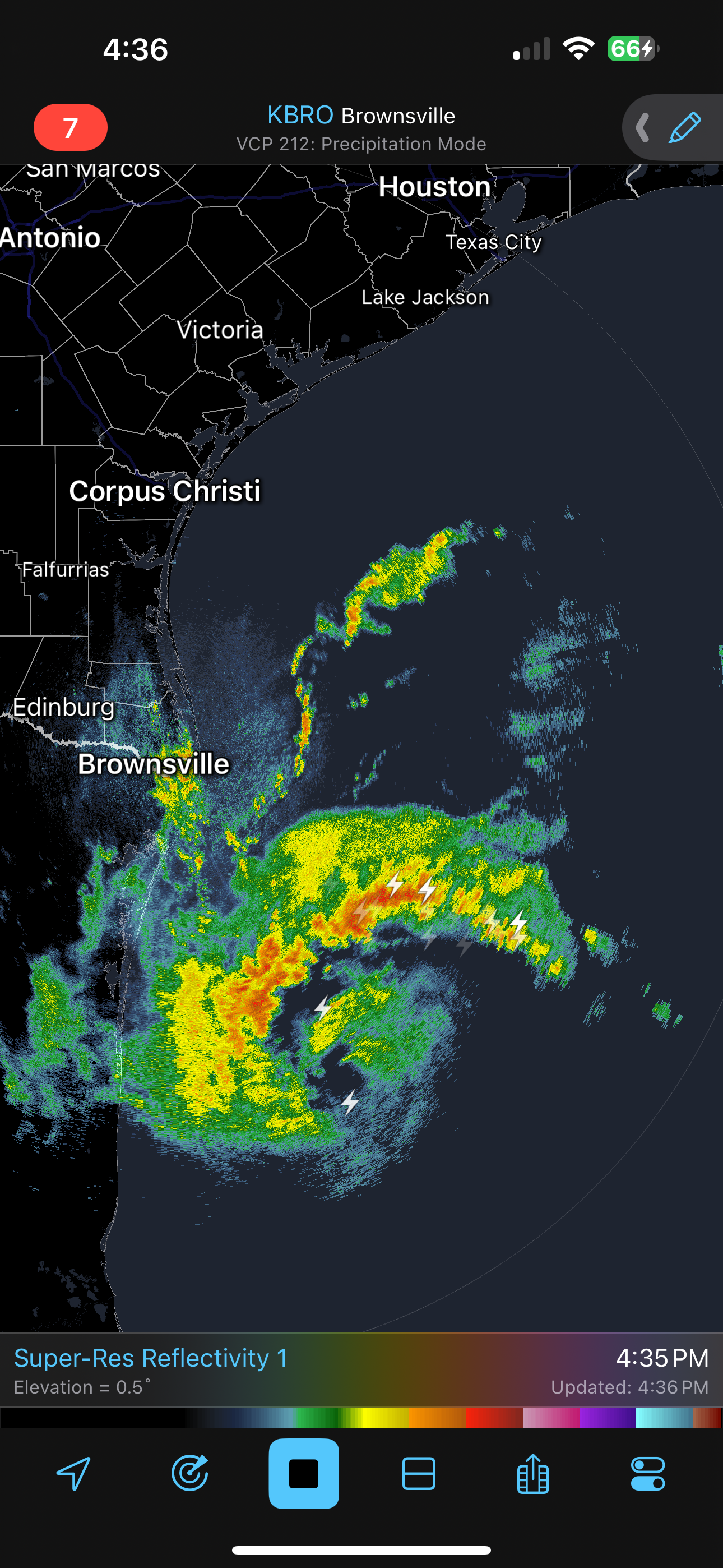
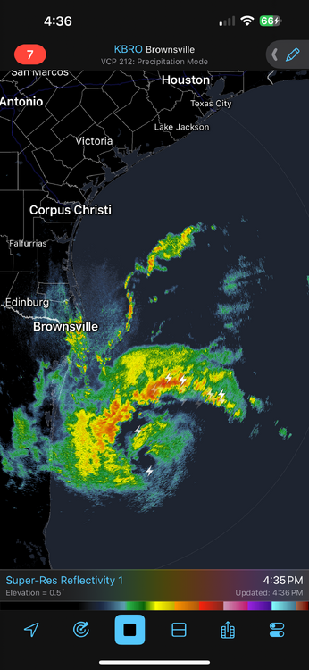
Eyewall looks to be forming with some lightning strikes around the center. May not matter downstream but seems to be ahead of schedule.
-
Circulation becoming more evident on Brownsville Radar. I think she tops out around 90mph before weakening before landfall due to some pretty strong shear
-
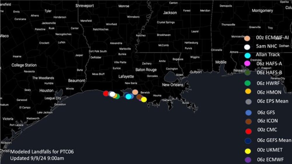
Plots by Model via Allan Huffman
-
Not a garden variety storm for many…