BoulderWX
-
Posts
1,260 -
Joined
-
Last visited
Content Type
Profiles
Blogs
Forums
American Weather
Media Demo
Store
Gallery
Everything posted by BoulderWX
-
I’ve seen a lot of interesting/crazy posts on this forum but “fake cold” may be the funniest. Thanks for that, I legit laughed out loud.
-
Not great but I’ve seen flakes four of the last five days and will most likely have a white Christmas. Been cold much of the month and leading up to Christmas. December’s a win in my book.
-
Picked up another half inch and snowing heavily. Have about 30 minutes left here in morris county. What a great way to start Christmas Eve with everything freshly whitened.
-
Several models showing another half inch tomorrow AM for much of the area, with the HRRR showing up to an inch for some.
-
Well this is awesome. Woke up middle of the night to an overperformer in my backyard. Probably close to 3” and looks like one more moderate band to push through. Another inch or so and a white Christmas may be on the table.
-
1” in Morristown Overall the even we expected with everything from “just flakes” to a couple of inches. boston doing well and Philly looks to do well as they’re currently under 30dbz bands and may get under the IVT. I think someone in Philly or south central NJ will see 4” very nice
-
Under a moderate band but only producing light flurries. Returns vs reality has been interesting so far. Just under an inch.
-
Yeah. I was clearly premature with that statement. It’s picked up and under a moderate band for last twenty minutes that’s covered all surfaces.
-
Moderate snow with large flakes firing back up!
-
Snow showers coming to an end in morris county area but loved the mood flakes and dusting on colder surfaces.
-
Best radar returns of the day over me (17 dbz) and barely flurrying. Was heavier earlier under 5dbz
-
Very light flurries in Morristown. If I get an inch I’ll be happy.
-
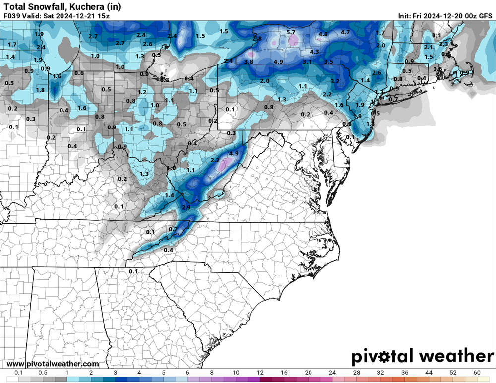
This would make some happy. NAM @ 24 Edit: won’t let me post but LI, CT and SNE get a legit storm.
-
GFS coming in a little more robust (relatively speaking).
-
Everyone or most everyone who has read through the thread knows this “isn’t much to write home about,” however it would be nice to see flakes and for some, the ground whitened up on the weekend before Christmas.
-
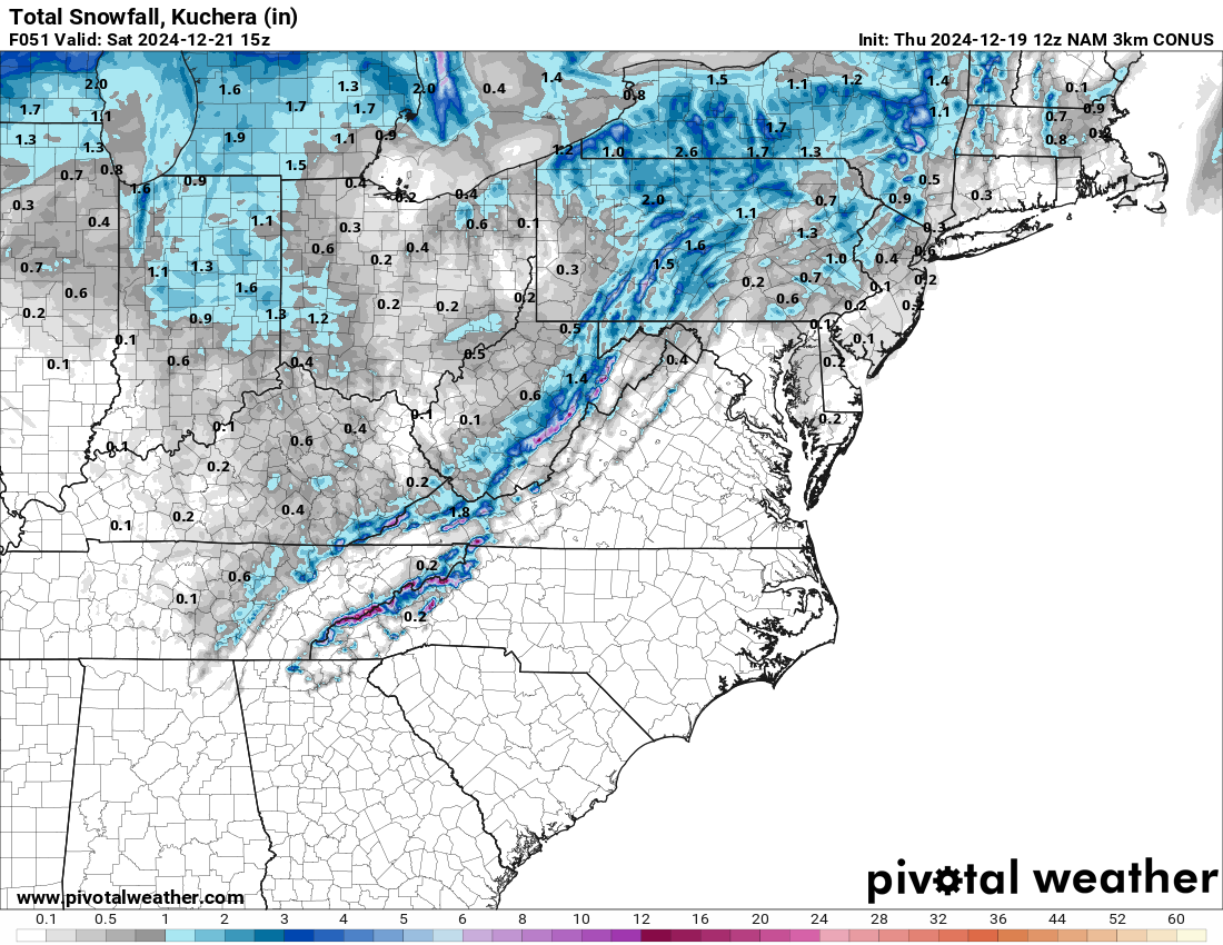
3k NAM - seems reasonable with more localized amounts, albeit low ones

-
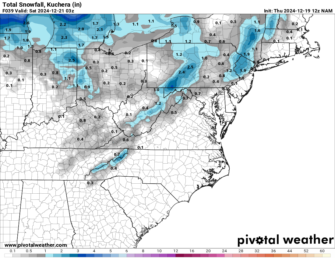
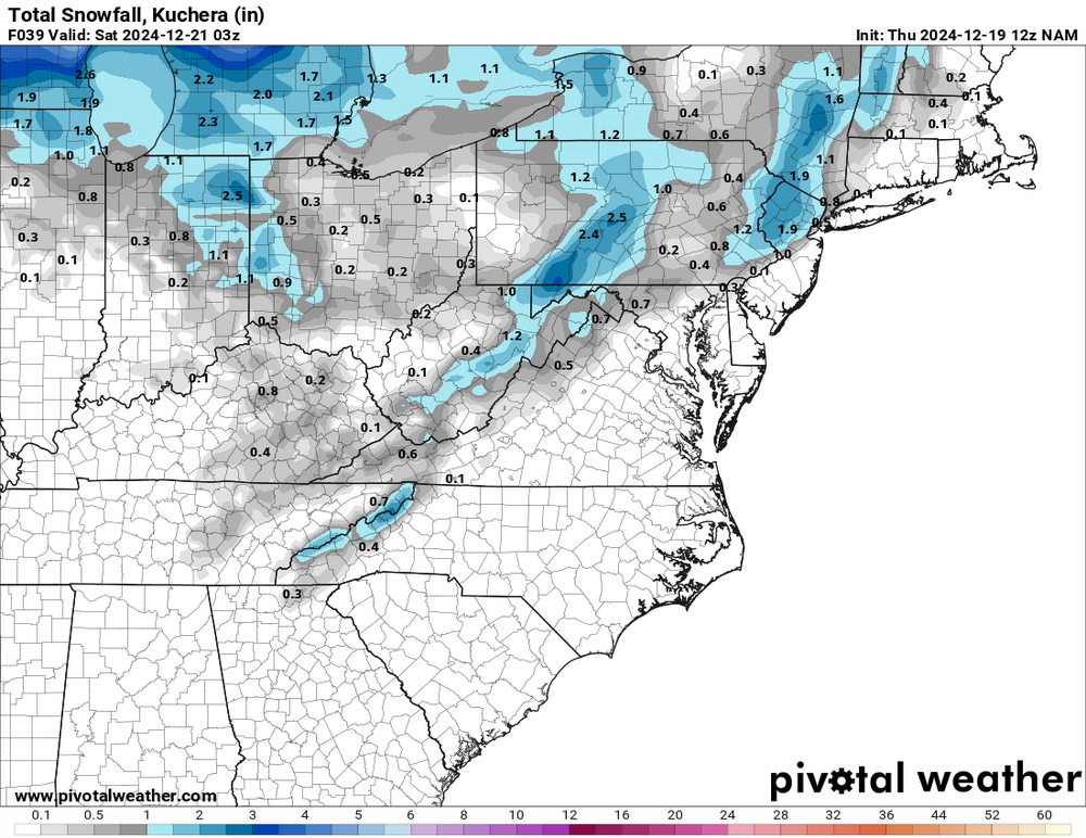
As expected NAM much different with the handling of the coastal on this run. IVT event still there but weaker. Would still take it and run.. through 39
-
I’m well aware, was just stating verbatim it would make most happy.
-
Think the entire sub forum would be pleased with this so clearly no shot it happens lol
-
Moderate snow in Morristown area. Really hope we get one decent storm this year, but this is festive in the meantime
-
All rain still in Morristown. Glad to see others getting in on some snow!
-
.57” - less than I was expecting at this point but enough mitigate the dust that’s been around the last month +
-
Siesta Key @ 115 was my call from two days ago. Wishing all those in harms way the best. As many have stated the backside of this storm has some of the strongest winds associated with it. This is just beginning for many.
-
More on this here - south of most guidance *for now*