

radarman
-
Posts
13,203 -
Joined
-
Last visited
Content Type
Profiles
Blogs
Forums
American Weather
Media Demo
Store
Gallery
Posts posted by radarman
-
-
14 minutes ago, codfishsnowman said:
exactly, we do
it was a horrible bust valley wide and if it makes some weenie feel better to say we had 6 inches when there is 3 otg to cheat his/her way to the very low end of a forecast well then he/she can have at it
yeah. At any rate there is no reason to pollute a historic snowstorm thread with further negativity here. My sis and young neices live near Ray and I am totally stoked for them. Snowforts are the best as a kid... literally the BEST. Amazing pics coming out. We'll enjoy the random 2-4" jackpots and maybe we'll get another Feb 2001 someday or relocate.
-
Pretty sure we understand measuring techniques as well as any other part of the state
-
 1
1
-
 1
1
-
-
Just now, OKpowdah said:
Maybe they were *forecasting* snow including what's on the ground in Amherst...?
0-1" of snow on the ground going in
3" new
-
we've busted bigger snowtotal forecasts
we've seen sharper gradients
we've missed in more directions simulaneously
but at least there was a good reason
-
1
-
-
eff the pivot
-
1
-
-
30 minutes ago, met_fan said:
Up to about a 1/2” here
after a few more hours of this we might not be able to see grass poking through.
-
8 minutes ago, codfishsnowman said:
yup....way overdone
Tend to agree. Thinking advy stuff for E Hampshire/Hampden counties. Being on the far eastern edge I could see eking out 6".
Good news is that with low expectations, it's mostly upside. Unlike with so many others...
-
Localized but significant straight line wind damage overnight in Godley (Johnson County). Decent line today through the metroplex and maybe one more round coming later on with the fropa.
-
IIRC the northern stream was a little bit late arriving on 3/5/01 which kept the totals on the western side on the lower end of the range. Even today that would be relatively hard to model
-
29 minutes ago, ORH_wxman said:
12/30/00 kind of sucked in ORH too...not because we changed to rain, but because we got blitzed for several hours and then a horrific dryslot that went all the way into S VT, which effectively ended the storm. It never really gave much as it collapsed back east, maybe another inch of currier and ives snow. The forecast for for widespread 10-16" or so...but most were in the 6-10 range...with a few lucky 12" lollis. I thought 10" was unlucky at first but then found out I was actually fortunate to get that much. The first 4-5 hours were pretty fun though...very heavy snow.
I'm sure it was a great storm for the greens.
18"+ type stuff. Hardly unprecedented, but certainly not a bad way to close out a millennium.
-
I have some equally blown out (sweet) pics of 12/31/00 but every time that storm is mentioned here someone drowns a kitten in eastern MA. At any rate, we've seen things on that order here plenty of times recently. March and April 01 stand alone however.
-
4 minutes ago, OceanStWx said:
Looks like these were taken in the 60s or 70s. A little sepia quality to them.
")
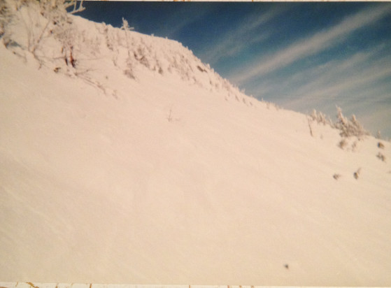
lol. Those are digital pics of faded prints from a CVS disposable wind up cam. If they weren't so epic they'd be tossed a long time ago. Hopefully we can make them obsolete some day soon.
-
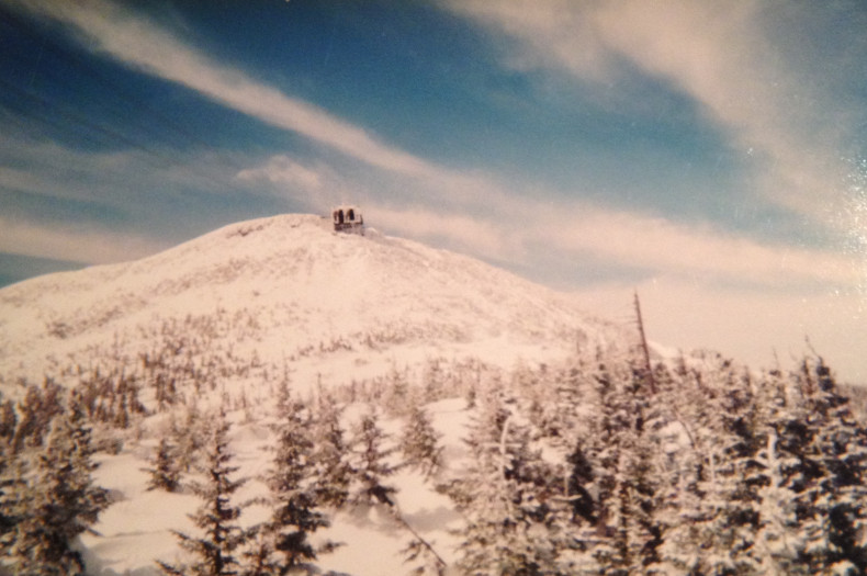
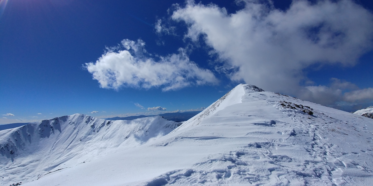
I can never pass up a chance to wax about 3/01... Jay Peak summit looked like something from way out west. Sorry for the horrific pic quality.
-
On 10/11/2017 at 7:01 PM, raindancewx said:
We've had some really nice days here lately - down to the 30s the other night, with highs in the 60s, and then low 70s today.
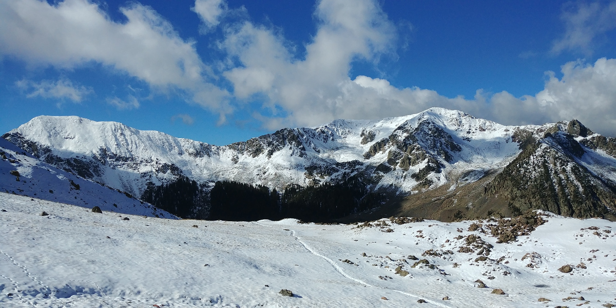
Some of you seem interested in skiing, and others talk about "snow fixes" so I included some snow data for the high country in winter outlook if any of you are interested. I'm expecting a pretty decent season up by Chama & Red River against their long-term averages.
nice job, and GL
As an aside, hiked Mt. Wheeler on 10/1... snow began to appear around 11.4k', ramped up sharply above about 12.2k'. Stray post holes might swallow up your whole leg in places... And the wind was out of control near the peak as the late Sept trough finally ejected.. Beautiful, incredible place.


-
 1
1
-
-
On 9/26/2017 at 1:27 PM, Roy said:
Does DFW have any good years with La Nina? I am basically thinking that's going to kill winter and if it lingers lead to drought next year, but sometimes you can get good cold out of it at times.
We are getting screwed on the rain though after it looked promising last week.
some decent and much needed rainfall this afternoon and evening in parts of the metroplex. Ft Worth got in on it earlier. Grapevine and Irving on the north side of DFW airport had nuisance level street flooding. Even Garland and Mesquite had a nice cell move through. We'll take it at any rate.
-
50 minutes ago, mfgmfg said:
What are the options to replace the San Juan site permanently or temporarily?
1) Repair if spare parts are available
2) Produce new 88D (restart the production line, unlikely isn't it)
3) Move the phased array radar from Norman
4) Borrow some radar unit from the military (SWR-250 or another phased array unit?)
5) Doppler on wheels?
UPRM has a radar program and X bands in hand that will play in AWIPS2, but infrastructure was an issue before Maria and she certainly won't make it easier to keep things online without some funding.
-
If only we could put this NAM run on layaway for 6 mos
-
FWD just tweeted out that Arlington Municipal Airport picked up .85" in 8 minutes. Good to see the metroplex cashing in here in the first couple days of June after a relatively dry May and before the ridging takes hold. I would say that the DFW airport totals for the month (4th dryest May) is a bit fluky and are not totally representative of conditions around the metro as a whole, but no doubt it was dry, particularly on the western side. Areas further east did a little better... also north up by Denton.
-
Seriously heavy rain over N Ft Worth and Denton and may move over Dallas in a bit.
approaching 4" in the last hour in places.

-
25 minutes ago, ORH_wxman said:
#wheelofrhea
Poor NH peeps... I blame these threads and of course the wx
most misspelled words by state
2016
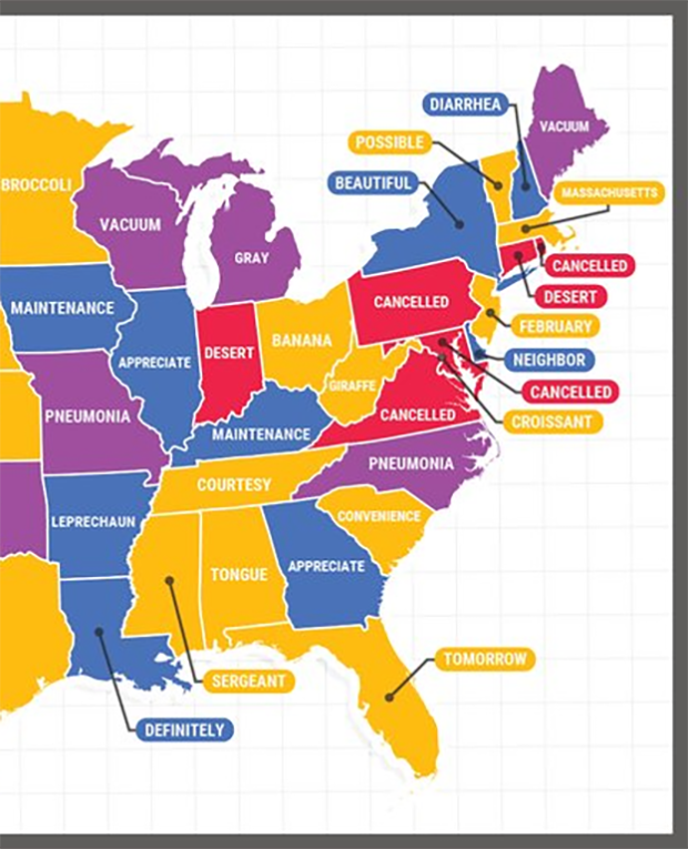
2017... everything changes, except in NH

-
Some low end straight line wind damage was recorded NW of Denton last night (Slidell, Krum), and some planes were damaged. There was a leading edge rotation signature on the UNT radar though it skirted the SW edge of the airport and started to dissipate.

-

From the Furuno X band radar at Univ of North Texas
-
5 minutes ago, cstrunk said:
The storm between Fort Worth and Hillsboro looks a bit ominous on radar.
Spotter reports of quarter size hail+ near downtown Cleburne.
-


March 12/13/14 Blizzard/Winter Storm/WWA etc
in New England
Posted
sorry. I was talking about myself not others. That is all.