

radarman
-
Posts
14,474 -
Joined
-
Last visited
Content Type
Profiles
Blogs
Forums
American Weather
Media Demo
Store
Gallery
Posts posted by radarman
-
-
15 hours ago, bch2014 said:
Ironically, never been to my childhood state U’s stadium (UMass).
You don't know what you're missing
")
-
Valley floor ponds in typically warmer spots are primo black ice right now. Get it before the snow flies tomorrow.
-
 1
1
-
-
Might as well change the name now before selling hats and t shirts.
I'm gonna have to get rid of all my Squaw Valley gear, which is ample.
-
13 minutes ago, HIPPYVALLEY said:
I am always amazed at how less than an inch of snow can create disaster roads.
Was dumping fluffy cottonballs at Berkshire east. Nice little topping for the surfaces.
1.5" at the house in Btown.
And yeah... saw 4 accidents on the ride home.
-
1
-
-
12/25/02 was absolutely pounding white out snow on 128 until flipping to heavy rain somewhere near the stupid 93 intersection where you're going north south east and west at the same time.
-
1
-
 1
1
-
-
9 minutes ago, PowderBeard said:
That 600' base and 1,500' summit always bite them. Upper half of the Thunderbolt should be great.
This.
Unrelated to this event, but it's also almost like the east west running valley funnels in warm layers aloft sometimes. It'll be pinging there and snowing north and south. I suppose it probably relates to some relative lack of orographic lift locally such that cold air is not dragged down through shallow warm layers. It's weird though. Have always wondered if somehow the channel could extend off the ground.
At any rate I'm not too bullish for them. S VT peaks moreso. Glop for the base.
-
New England has a million great places to live. Just ask MPM.
-
2
-
5
-
-
Fairly chilly day here. 26/16 OVC.
-
1
-
-
9 hours ago, radarman said:
Yeah I was gonna do my first examination of elevated, shallow ponds today. We're getting close.
Ice in Petersham was plenty safe. 4-5". Several skaters although the surfaces were partially snowcovered and a bit less than ideal. Some warm rain would help. Ice fishermen on some of the bigger ponds.
Gorgeous afternoon up at Stone Cow too.
-
47 minutes ago, HoarfrostHubb said:
I did see people ice fishing and playing pond hockey in Rutland and Spencer. That’s ballsy
Yeah I was gonna do my first examination of elevated, shallow ponds today. We're getting close.
-
Back half of a nina isn't generally promising for the MA, hopefully they can score an event or two here in the next few weeks. And climo is favorable enough locally to slowly build the icepack even with boring, slightly AN temps. Light winds too. Reason for cautious optimism from the models last night. Hounds may be starting to stir.
-
35 minutes ago, CoastalWx said:
One of the worst model fails I have ever seen. Up there with the NAM back in mid Feb 2014 when it had like 12-18" for me on the 18z run and I got 6".
We've lost track of how many times that sort of thing has happened
-
Just now, CoastalWx said:
I honestly don’t think I’ve ever seen a radar so shredded like this. It’s not meant to poo poo or anything like that. From a met standpoint, that’s hard to do. Usually you have a solid band of rather moderate or greater echoes.

-
1
-
-
20 hours ago, GCWarrior said:
What a glorious winter that was! Freshmen year at UNH, massive piles of snow everywhere in Durham.
The best
-
2 hours ago, dryslot said:
This includes today's, And still going up here at hr90.
 This
This
The way those snowholes appear over this area on every model for every event it's surprising we average more than GON
-
3
-
-
Nice to see some arctic air show up in Euro fantasy land. Folks can have their blocking I'll take a cold air mass and my chances from there. Hopefully it's onto something.
-
2
-
-
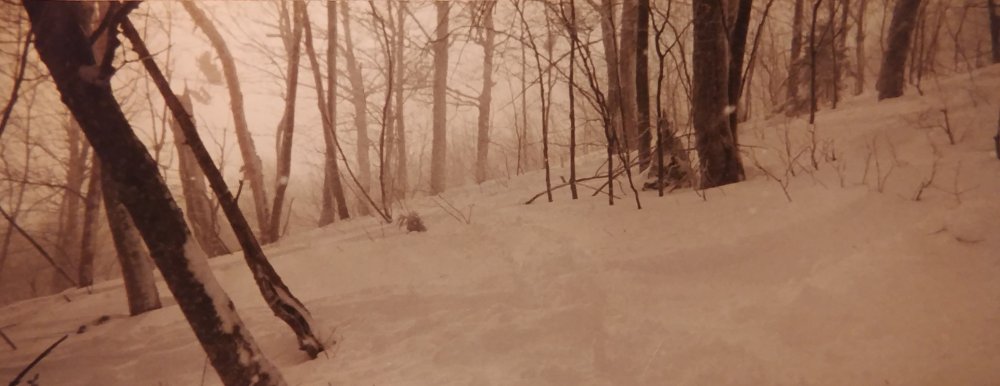
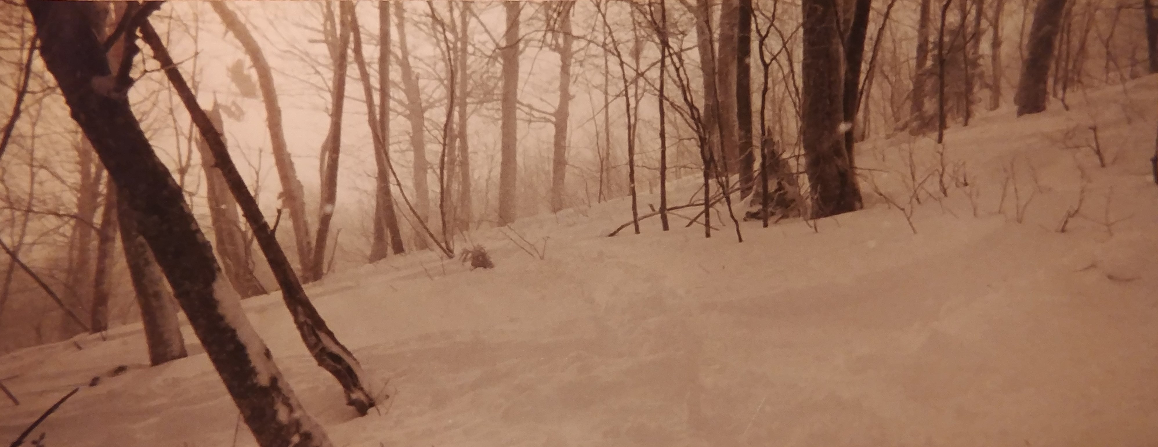
Took this pic 20 years ago. 18-24" fresh on 12/31/00 @ Stratton on a disposable panoramic camera. Hell of a way to close out the millenium.
-
3
-
-
19 hours ago, MJO812 said:
Wow the west will be a winter wonderland with the roaring jet

JanuBURIED part deux?
-
Even if arctic cold is not likely with a lousy pacific and AN heights in E Canada, maybe the heart of climo can deliver enough cold air for some decent pond ice. 09/10 was a good skating year.
-
52 minutes ago, Ginx snewx said:
Wet avy on 12/25 is less than ideal
-
1
-
-
Is there anything on earth better for kids than a snow fort? I say no
-
2
-
-
I posted this in the New England thread, but let me show an example of what I'm talking about above...
https://emmy7.casa.umass.edu/umaxx/nexrad.html
This is just BOX and ENX data and granted I am not generating large composites or all the dual pol products, but from a pure browser speed perspective, note the difference between generating/overlaying full PPIs vs tiling on the weather service page. You don't have to have 'map move' event listeners, nor handle tons of tiling queries.
-
2
-
-
Color maps and user interface aside, the biggest single issue is that the tiling service is slow af. And the thing about it is for single radar stuff, there is almost no reason you need to have a tiling service these days. Modern browsers, normal connection speeds ( even on mobile), do just fine handling the full images overlaid on a map. The single quickest way to get the popcorn gallery to simmer down at least a little bit would be to toss that and just generate the full radar images.
-
December 2011 might have been pretty awful up there, I don't really recall however. Was certainly awful down here. Maybe they scored some upslope or something.
edit- Dec 2015 too maybe?


The 2020-2021 Ski season thread
in New England
Posted
Super premium soft cord on Competition at the Beast this morning. Get em on edge, way on edge.