

radarman
-
Posts
13,221 -
Joined
-
Last visited
Content Type
Profiles
Blogs
Forums
American Weather
Media Demo
Store
Gallery
Posts posted by radarman
-
-
4 minutes ago, Ginx snewx said:

Not sure whats up with that hole in S Quabbin. I posted a pic showing over 7. That looks more like a low end, post sleet compacted measurement.
-
13 minutes ago, Ginx snewx said:
Nice E. 2.75 here with .5 sleet now rain 33.
Seems like we're flipping to mixed precip now. A little over 7".

-
5 minutes ago, PowderBeard said:
The question is...does UMass close so I can skin the range? lol
I say yes. Berkshire East is opening for the powder day, fwiw.
-
 3
3
-
-
7 minutes ago, PowderBeard said:
Gone wild! Just under 7" and pounding.
Yep. 6.25" across town at slightly lower elevation. Nice and fluffy right now.
-
1 minute ago, powderfreak said:
Yeah it was a 2-3 footer straight into Canada for the mountains though. Top 10 storm for BTV I think?
That one was much of a beast over a larger area.
Several years ago I posted an AFD on that beast that I found on a UVM wx chat/archive from those days. I actually looked for the UVM site a few days ago but couldn't find. Do you know if it still exists?
-
1 minute ago, Greg said:
I think it meant 2001ish with the biggest swath right around the Northeast Mass /New Hampshire boarder west to the southern Monads/ Southern Vermont area.
Not sure folks realize just how crushed NNE mts got in March 01. 3-4'.
-
2 hours ago, snowgeek said:
Anyone ski today? Icy or nicey??
got reports that Ragged was really nice today and almost springlike. Also that SR was very busy and got bumped up quick on trail... Which some mind more than others.
-
One year ago today... Almost unfathomable for Novie


-
2
-
 1
1
-
-
Thank goodness for folks out here that the WAA frontogenesis in part one of this system looks far more robust than Boxing day ever was, where many picked up less than 3" total. Almost like we get a SWFE to start and then we'll take any bonus we get from mid level magic thereafter, along with the caution flags associated with downsloping and banding that we're used to in the valley. Give us the relatively high floor, evenly distributed, and the usual favored spots for dynamic systems can do their thing after that.
-
20 minutes ago, dryslot said:

That's like the bizarro canadian for this area
-
9 minutes ago, moneypitmike said:
Congrats, Quabbin!

Poutine for lunch, my goodness.
-
1
-
-
2 minutes ago, CoastalWx said:
Absolutely positively sell that snow map. Good God. It completely ignores thermodynamics.
Sneaky warm layer?
-
18 minutes ago, Ginx snewx said:
Yep wrong storm you are correct. I was thinking of the storm that was captured too late and nailed CNE to NNE in the early 2000s.
I think you mean March 01 but even though the capture was a bit late, we still did pretty well out here for that one.
After like a foot on the front side we picked up several more on the back with lingering convergence snows
-
Hopefully we get a series of transient blocks to help moderate any pacific airmasses in the LR. It'll get stale pretty quickly and favor elevation, but get us on the board while we're semi fresh and then we can sacrifice one to base building up north.
-
1
-
-
14 minutes ago, HIPPYVALLEY said:
We are either going to hug or suppress I’m not sure I’m buying a benchmark track.
Skiing aside, give us either one over 12/92
-
Perfect day to get those dahlia bulbs out of the ground now that they've seasoned for the winter.
-
15 minutes ago, dmillz25 said:
You know this is a weather forum right?
When blizzard24 chimes in we take note. Wish he'd chime in more often
")
-
2
-
 1
1
-
-
23 minutes ago, mahk_webstah said:
Can someone translate this?
Raindrops falling are more wide than tall as they get bigger. (Pancake shape if updrafts get strong in convection)
As they get smaller and/or freeze they become more spherical, so the horizontal polarized radar beam and the vertical polarized radar beam start getting closer in their returned power.
-
1
-
1
-
-
2 hours ago, HIPPYVALLEY said:
It must've come down pretty good here in the wee hours because I measured almost 1.25" on the picnic table at 6am. That was completely unexpected in the valley. (400')
Congrats
Down here we had a coating on mulch, which I enjoyed looking at even as it rained. We're a strange bunch.
-
1
-
1
-
-
On 11/13/2019 at 10:21 PM, Sugarloaf1989 said:
Berkshire East is opening on Saturday, with Deer Run, Outback, Mohawk, Chief and Bobcat. $45 tickets. I'm going for my first day of the season.
That's a fantastic job by them getting that much top to bottom open already. Beautiful day for skiing too.
-
9 minutes ago, HIPPYVALLEY said:
Top 10 fall day! Greenfield looks tiny from the hills.
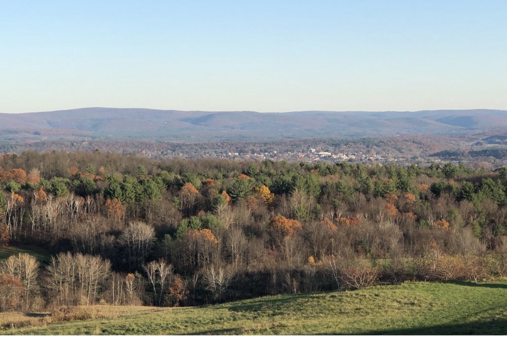
Nice. Has been a fantastic day out there. 27 for the low here, which was the first hard frost, though we'd tickled freezing a few times already.
-
Trick or treater record smashed like high mins, nearly doubled actually. Maybe it's a good sign for winter.
-
1
-
-
1 minute ago, Damage In Tolland said:
Can you hear the eggs hitting the house?
You mean those aren't sticks and branches falling?
-
Is there anything worse than running out of candy on Halloween? Group of 15 kids comes marching down the driveway and I have like 12 chocolate bars left and find myself quickly scrambling around for protein bars and bags of sunflower seeds.
Who's an a-hole? This guyyyy
-
1
-


Happy Birthday Old Man Winter storm obs
in New England
Posted