

MillvilleWx
-
Posts
4,968 -
Joined
-
Last visited
Content Type
Profiles
Blogs
Forums
American Weather
Media Demo
Store
Gallery
Posts posted by MillvilleWx
-
-
1 minute ago, ers-wxman1 said:
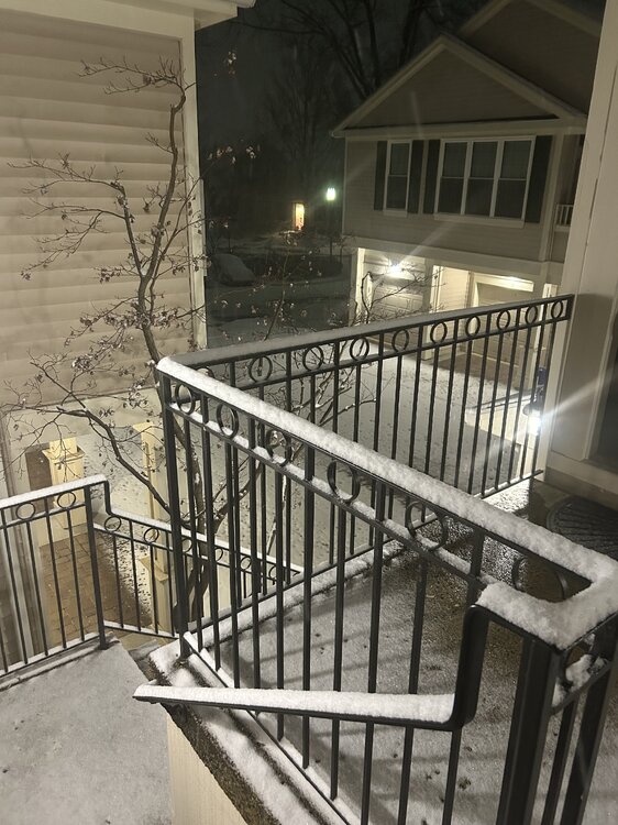
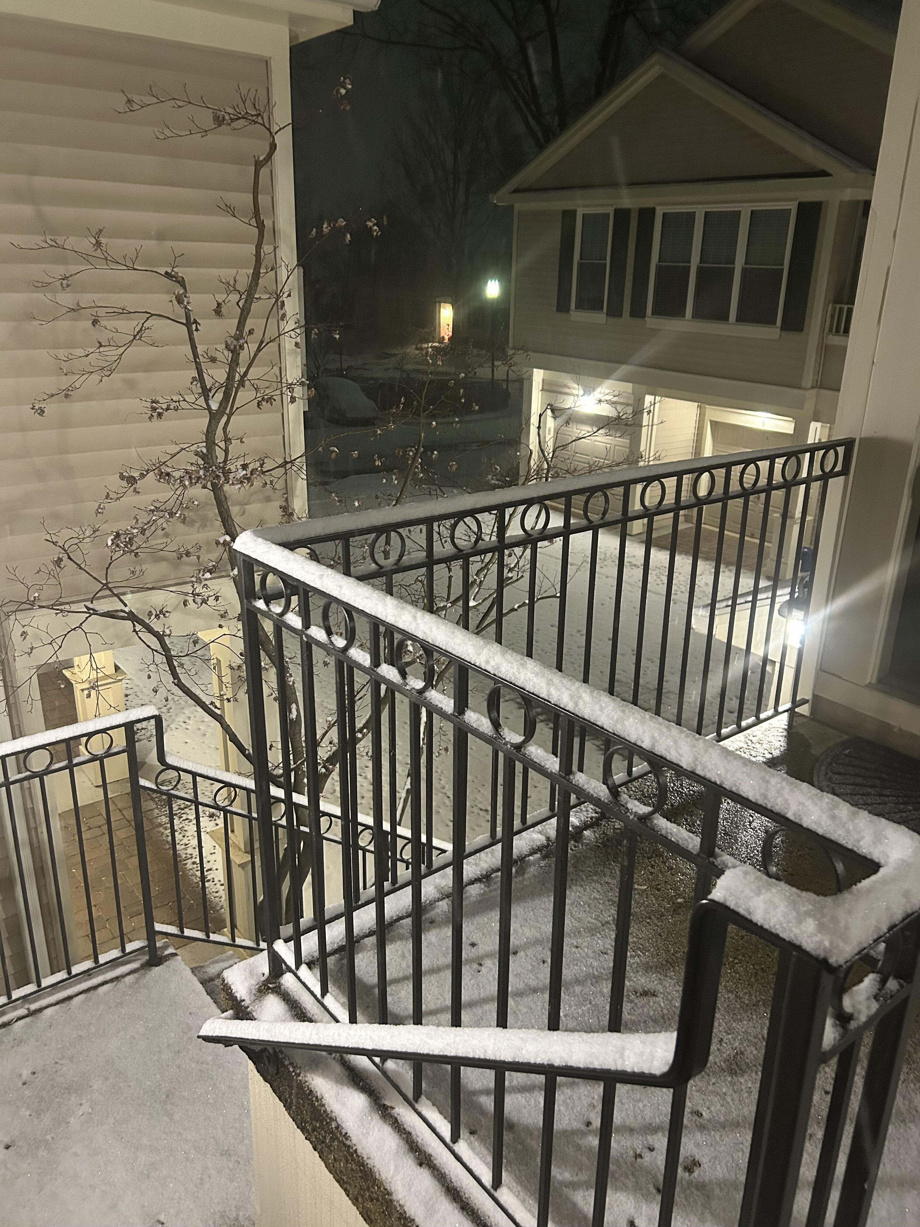
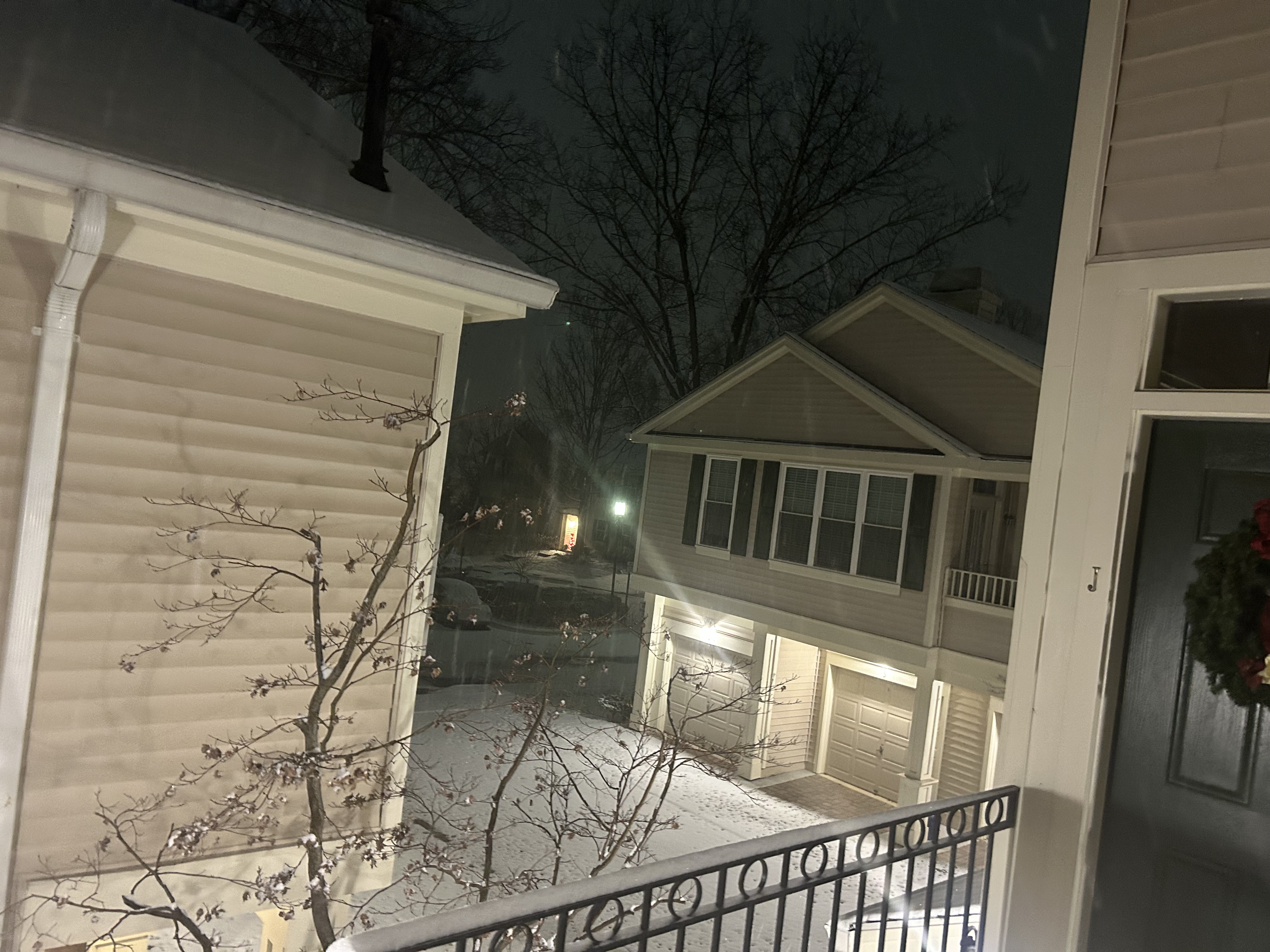
1.5”, snow picking up. All surfaces covered.

Let's go!!!!
-
 3
3
-
-
2 minutes ago, yoda said:
Its here -- https://www.spc.noaa.gov/products/md/md0019.html

Mesoscale Discussion 0019
   NWS Storm Prediction Center Norman OK
   0112 AM CST Mon Jan 06 2025

   Areas affected...eastern West Virginia and northern Virginia into
   the DelMarVa

   Concerning...Heavy snow

   Valid 060712Z - 061215Z

   SUMMARY...1+ inch per hour snowfall rates are expected early this
   morning.

   DISCUSSION...A band of moderate to heavy snow has developed across
   northern Virginia amid strong isentropic ascent and frontogenesis
   early this morning in response to a strengthening low-level jet.
   Evidence of this can be seen on the FCX VWP where 1.5 km winds have
   strengthened from 50 to 65 knots in the last 90 minutes.   These
   conditions favorable for heavy snowfall are expected to shift east
   through the early morning hours with the expanding low-level jet,
   and heavier snowfall rates expected to impact the DelMarVa within
   the next few hours. Maximum snowfall rates of 1 to 1.5 inches per
   hour are expected.

   ..Bentley.. 01/06/2025

   ...Please see www.spc.noaa.gov for graphic product...

   ATTN...WFO...PHI...AKQ...LWX...RLX...
I've been waiting for that MCD to come out all day lol
Thanks Yoda for the share! Let's keep it rolling

-
3
-
 1
1
-
-
17 minutes ago, Deck Pic said:
Can you give me unlimited reactions. I'm in permissions purgatory rn. I get like 5 reactions a day.
Same lol
-
Just now, Terpeast said:
Radar looks beefy to the WSW!
Yeah. It's really impressive down there. The system has a long way to go. We just started the goods for the area. Let's keep this party going, shall we

-
2
-
-
Snow is a steady light variety but picking up in intensity slowly. Everything is completely covered with a solid coating. Storm just begun too. Great start with the heavier returns still off to the southwest with a ways to go.
-
3
-
-
4 minutes ago, wxmeddler said:
I have to say I’m a bit disappointed in the flake quality. Not nearly supersaturated enough upstairs to get the dendritic growth. This is mostly looking like plates. The kuchera stan’s are gonna get a surprise when they stick their ruler in for this part of the storm. 8:1 to 11:1
The modeled Kuchera ratio for this part of the storm is 8-10:1 with 12:1 all the way into Carroll County. It doesn't improve until after 10z when the better forcing arrives, and even then 9-10:1 for DC and 10-11:1 for an average unless under better banding. 12-15:1 for areas along and north of I-70. Kuchera is doing fine so far and the model algorithm snow from the HRRR is also fine. I don't see anything wrong the forecast right now.
-
7
-
-
Just now, Terpeast said:
26/23 mod snow, ashburn.
Beautiful!
-
Officially light snow in Edgewater. Every single flake sticking as expected. Temp 29.5/16.3
-
3
-
-
10 minutes ago, Random Chaos said:
SN- where I am near Annapolis. Just started.
Sweet! Good to hear. I know it's basically on the doorstep. Gonna step outside soon and take a peek myself
-
1
-
-
3 minutes ago, dailylurker said:
Still in a dryslot with not a flakes yet. So frustrating lol
We might not start until after 2am according to the HRRR for the last several runs. So far everything is going according to plan. Every run for you and I has us in 8-12" before the second batch even comes through. We're good!
-
2
-
 3
3
-
-
7 minutes ago, csnavywx said:
Light snow commenced here at 11:15pm. Started as tiny flakes with small aggregates mixed in. Quickly picked up in intensity and is now approaching moderate. Good coating already.
Good luck down there Navy. Should be a great one for you guys down there!
-
2 minutes ago, Jebman said:
Thank you very much. I appreciate your input. I appreciate your time.
I apparently ran out of likes and stuff, so I wanted to say thank you
")
-
1
-
-
1 minute ago, caviman2201 said:
Do you think the bay will have that much of an impact on totals given how cold its been? I noticed today driving around that most of the creeks are nearly frozen over
Probably not. Just along the immediate coast, so like right on the water at sea level. All you have to do is live a football field away from there and you'll be totally fine. I wouldn't sweat anything tbh. It's going to snow really good tomorrow morning around these parts.
-
1
-
-
20 minutes ago, Jebman said:
Millville how much snow are the AA lowlands possibly going to get? According to the 850mp FGEN proposals?
Hey Jeb!
I'm thinking 7-12" with up to 15" is pretty good call. 7" is for right along the bay, but even a small touch away from the bay will likely see 8+". Should be pretty! I'll be sure to get in a snow Jebwalk for you
-
2
-
-
6 minutes ago, yoda said:
Wish we could take the 03z RAP...
Honest to God cannot get over these 850mb FGEN proposals on the models for my area and basically the US50. It is absolutely insane and has not budged in its presentation for the last 12 hrs. If that comes to fruition, the lowlands here in AA are going to get absolutely smoked.
-
5
-
 1
1
-
-
1 minute ago, clskinsfan said:
First flakes NW of Winchester. Here we go.
It's time! Good luck out there my man
-
1
-
-
26 minutes ago, Maestrobjwa said:
How unusual is it to see that kind of a range in a WSW? 5-10" with isolated 16 inches (whoa) is awesome but sounds crazy at the same time (like saying 5-15", lol)
That was quite a jump for the max, but I think that's a case of the potential rates within banding for this one. This has a shot for 2-3"/hr in a few bands during the height of the FGEN regime. That could easily take a total and take it way above the 75th percentile, which is likely what the range was created by (1st and 3rd quartile outcomes).
-
2
-
1
-
-
26 minutes ago, mappy said:
To be fair, each of the warnings say “isolated” and “if heavy banding sets up”.
True! Mainly the totals aspect. Not often we see 16" on a WSW. Handful every 4-8 years. Good luck up there in Northern Baltimore Co. I'm hoping a nice band setups up and the northern tier cashes and everyone gets the goods!
-
2
-
-
4 minutes ago, yoda said:
URGENT - WINTER WEATHER MESSAGE
National Weather Service Baltimore MD/Washington DC
954 PM EST Sun Jan 5 2025

MDZ016>018-VAZ036>040-050-051-055>057-502-507-508-061100-
/O.CON.KLWX.WS.W.0002.000000T0000Z-250107T0600Z/
Charles-St. Marys-Calvert-Nelson-Albemarle-Greene-Madison-
Rappahannock-Orange-Culpeper-Stafford-Spotsylvania-King George-
Southern Fauquier-Northern Virginia Blue Ridge-Central Virginia
Blue Ridge-
954 PM EST Sun Jan 5 2025

...WINTER STORM WARNING REMAINS IN EFFECT UNTIL 1 AM EST TUESDAY...

* WHAT...Heavy snow expected. Total snow and sleet accumulations
  between 5 and 10 inches, with amounts of up to 15 inches possible
  in isolated spots if heavy banding sets up in this area. Ice
  accumulations up to one tenth of an inch south of Interstate 64.

* WHERE...Portions of southern Maryland and central, northern, and
  northwest Virginia.

* WHEN...Until 1 AM EST Tuesday.

* IMPACTS...Conditions will rapidly deteriorate tonight with
  untreated and unplowed roads becoming impassable for the Monday
  morning and evening commutes. During the times of heaviest
  snowfall, even primary roads may be impassable. It is highly
  recommended to postpone non-essential travel.

* ADDITIONAL DETAILS...Snowfall rates between 1 to 3 inches per hour
  are possible between midnight and mid-morning Monday. A second
  round of heavy snow is likely Monday evening before precipitation
  ends Monday night.

PRECAUTIONARY/PREPAREDNESS ACTIONS...

If you must travel, keep an extra flashlight, food, and water in
your vehicle in case of an emergency. The latest road conditions for
the state you are calling from can be obtained by calling 5 1 1.

Persons should consider delaying all travel. Motorists should use
extreme caution if travel is absolutely necessary.
Damn....What an event this is gonna be. Don't see WSW's like that too often
-
4
-
-
38 minutes ago, wxmeddler said:
Correct. The models had this pretty well outlayed. Euro especially. Those wishing for a 9pm start time were in for a disappointment.
Totally agree on the cold to start! Rather have instant stickage than waiting for rates to overcome.
Yeah. I wasn't expecting anything for a while yet. This will be a case things moisten up, start out light and then begin to pick up in earnest once the LLJ cranks into Central VA and the 85H FGEN advances north. I don't think some realize the type of wall that is approaching. Our best ascent is still way to the south. Hi-res hasn't wavered one bit. The only change, and was expected was the tightening of the northern gradient from the confluent area to the north. That's why the maxima is showing up where it is and there are secondary mini-maxes to the south of the primary confluence where the convergence of 7H FGEN and the orographic enhancements north of I-70 will help those areas despite the lower QPF output.
Ratios will likely be 12-15:1 on average for those zones. 10-12:1 across the district and locally higher pending positioning in bands from the 85H FGEN. That area seems to lie between I-70 down to just north of I-66 and points east. One interesting note is the primary spot to be with this could end of being a place like Easton or Cambridge, MD over into Sussex Co. DE. That area is right in the crush zone, imo. This is going to be a nice storm. I know it's dry, but it'll be fine. Wet bulbs into the low to mid-20s for many in here. Snow will fall and it will stick instantly. Let's enjoy it!!
-
9
-
1
-
 1
1
-
-
42 minutes ago, CoastalWx said:
@MillvilleWx 8-12 for ANP? Can’t really argue with NWS.
Awesome. Right in line with my thoughts. I have the max potential at 14" if we get lucky with banding. Going to be a great storm!
-
2
-
-
2 hours ago, MillvilleWx said:
Well y’all, it’s finally here. We’ve been tracking this thing down for over 10 days and it all comes down to this. A small shoutout to NWP for being able to pick up on a threat this far out with n/s energy playing a role in it all.
Currently 32/9 at my place. If you’re in the lowlands of AA county, this one is for us. The 25th percentile on the NBM as of early this morning for DCA/Annapolis/Crofton/Bowie/ @usedtobe hoods are ~7” and I don’t see that waver. My forecast for Annapolis and my area is 7-12” w/ local to 14”
DC area: 6-10” w/ local to 12”
Baltimore: 5-9” w/ local to 10”
WV Panhandle: 5-10” w/ local to 11”
NoVA north of EZF: 6-12”
EZF south: 3-6” w/ some sleet
Area between Frederick-Baltimore-Silver Spring-Poolesville: 6-10” w/ local to 12”
Catoctins: 7-12”
Rt15 corridor down to I-66 VA: 6-12”
West of Rt15 in MD: 5-10”
Western MD: 8-14”
North of I-70 between Frederick and Baltimore: 5-8” w/ local to 10” (Trickiest area due to confluence signature to the north)
Far Southern PA: 3-7” w/ local to 8” near the M/D plausible. Less further north you go.
Eastern Shore North of Rt50 in MD ( @CAPE country): 5-9” w/ local to 10”
Eastern Shore along and South of Rt50 until south of St Mary’s Co latitude: 4-8” w/ local to 10”
Delaware North of Dover: 4-8” w/ local to 10”
Delaware South of Dover: 5-10” w/ local to 12”
Jackpot Zone between MD32 down to Calvert County and over to Sussex Co DE: Storm max of 14”
Tried my best on these and hopefully I’m in the ballpark. Woke up from my night shift slumber not long ago and ready to stay up the next 20-24 hrs. I will be working telework tonight and tomorrow night for safety reasons. Winter is here, and judging by the model guidance…it ain’t going anywhere anytime soon. Enjoy everyone!!
After some assessment, no major changes to my forecast. I do feel a secondary jack across NW MoCo, Western HoCo could occur when looking closely, but I’m gonna let chips fall. It’s gonna snow and snow heavily. I still can’t believe my luck where I’m at. Didn’t think my 16ft elevation would be in this spot, but here we are!
Im so stoked y’all. I’ll be up all night for my WFM shift and then staying up till about 9/10am for the peak before some sleep during the lull.
I’ll be here all night. Let’s rock!
-
16
-
1
-
 1
1
-
1
-
-
25 minutes ago, clskinsfan said:
Dont think anyone mentioned it. But the RGEM did tick north significantly

Finally got a clue. Congrats to it lol
-
1
-
 1
1
-
-
1 minute ago, CoastalWx said:
Thank you for the kind words,man. I really appreciate that. I just enjoy this stuff, but unfortunately I don’t forecast professionally anymore. I’m doing some other stuff, but damn I do miss the forecasting. I have not looked in that area. I’m just kinda casually looking and just giving my thoughts without putting my you know what on the line lol. I can look a little later and let you know.
No worries, Scott!! I appreciate any forecast you could offer. I truly meant everything in my last post!
This will be my biggest snow event since I moved back to MD from TX. Pretty stoked. Now we just need a I-95 KU from Richmond to Boston so we can all sing kumbaya and toast to an east coast victory. Cheers

-
6
-
January 5-6 Thing Storm Obs
in Mid Atlantic
Posted
Love to hear it my man! We are solidly racking up the snow here. Haven't measured yet, but got to be pushing towards that 1st inch already. Steady light to moderate snow with heavier echoes starting to push up towards our hoods. Life is good!