

FXWX
-
Posts
834 -
Joined
-
Last visited
Content Type
Profiles
Blogs
Forums
American Weather
Media Demo
Store
Gallery
Posts posted by FXWX
-
-
3 minutes ago, radarman said:
Kathy Hochul made the call fwiw
Like most major decisions, it was made in conjunction with NWS folks and emergency management leaders... It really is not even about the game perse; it's about the safety of having thousands of travelers on the road and no way to get to them... Folks have short memories about how many people died last year in the Buf blizzard. I'd love to see a game in blizzard conditions, but it's the big picture more than the game....
-
 7
7
-
 2
2
-
-
20 minutes ago, 40/70 Benchmark said:
Funny how the compression and velocity doesn't impact the cutters...they phase just fine.
That's what I think of all the time... I don't doubt Tip's velocity / compression issues, but I do wonder why there "appears" to be less of an impact on the Midwest bomb events. Now I may be completely wrong,and I've really studied it, but it's just a general sense I get from watching multiple potent Midwest cutters over the last few years.
-
2
-
-
6 minutes ago, WinterWolf said:
The pope’s warm up lol…the guy can’t forecast his way out of a paper bag. That’s a long ways off..just enjoy the potential of what’s in front of us the next 10 days or so.
What I find a bit distressing and it's happening more and more, is the small number of posters who have no desire to enjoy the meteorological setups right in front of them, but instead look for ways to post negative predictions about what it looks like 10 days to 2-weeks down the road. I'm ok with general pattern comments about the extended range period, but for a small handful of folks it's a constant harang of negative ball-busting vibes...
-
5
-
8
-
-
Just now, WeatherX said:
March 1993 Champ
.It was a great storm... Forecasting was excellent... But sleet was a limiting factor for some... Great triple phaser...
-
1
-
-
39 minutes ago, WJX231 said:
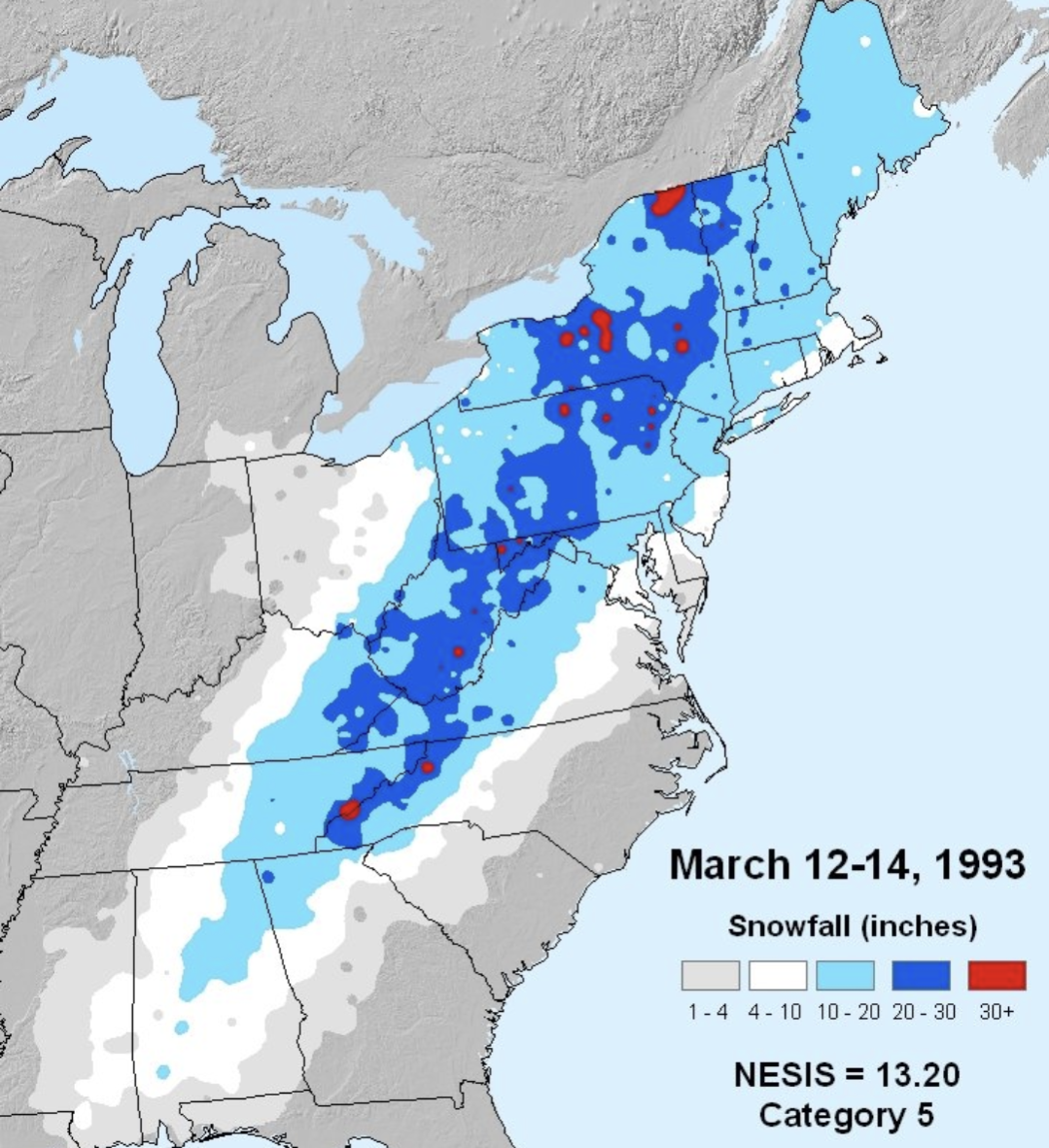
March 1993?
Again.. you said 2+ feet!!! The vast majority of the "Northeast" did not get 2+ feet... Pretty obvious on the graphic below...

-
12 minutes ago, WJX231 said:
How often do we get a monster system that drops a widespread 2+ feet for the whole northeast? January 2015 was the last one that I remember. I wish they weren't so rare.
The "whole Northeast" is a non-starter! The nature / structure of Northeast winter storms makes that almost impossible!!! Region-wide 2+ snowfalls are literally impossible to pull off...
-
1
-
-
Road closures across Fairfield County in CT causing delay issues with some districts...
-
5 minutes ago, Damage In Tolland said:
I have a sickness .I fully admit it and that scenario you described is very true . There is nothing more that I covet than extreme weather .
First step to recovery is admitting you have problem... Good first step... Lol
-
1
-
 3
3
-
-
After a burst of early afternoon snow and sleet, freezing rain has been ongoing since 2 pm in the high elevations of Burlington, CT... 1,100+ ft. driveway a sleet of ice; icicles handing from the mailbox... 31 degrees
-
3
-
-
8 minutes ago, Ginx snewx said:
Yea what do you think Mike
Looks a bit breezy. lol
-
9.5" here in Burlington, CT... 1,140'... Some 2' drifts.
-
7
-
-
8.3 Burlington CT
-
1
-
-
2 hours ago, weatherwiz said:
models shomdels...its now casting time.
This will be one of the most fun maps to watch the remainder of the evening

I have it up and auto refreshing on one of my monitors. By the Walt emailed me this morning to let me know banding page was back on...
-
1
-
-
6 minutes ago, jbenedet said:
Thanks for the detailed analysis...
-
3
-
-
2 minutes ago, TauntonBlizzard2013 said:
Oddly silent for a run that drops 12+ on the majority of folks in SNE.
there was more discussion extrapolating the 84 Nam this morning
Shows you the negative tilt / mindset of some posters... Lol... Who wants good news... It's more fun complaining...
-
2
-
-
6 minutes ago, weatherwiz said:
Unfortunately no. Sent a message to Walt. They're aware but it's a low priority fix right now but hopefully soon.
crap... thanks Wiz... if GFS is close to right that banding signature would be glowing on that product...
-
2
-
-
Quick question... are the NAM banding products still available? My url takes me to March 2023???
-
1 hour ago, ineedsnow said:
seeing a few flakes starting on Westfields webcam.. might be Kev's snow band starting
coated the ground in Norfolk, CT... light dusting here...
-
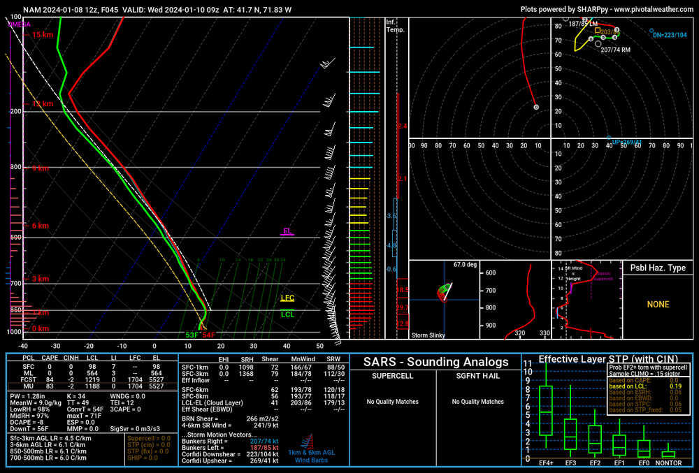
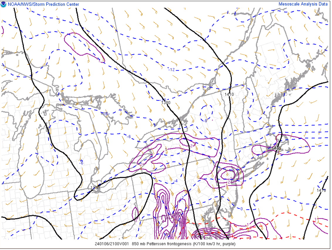
2 minutes ago, Typhoon Tip said:
Looks like the Euro's superior grid spacing may be tapping into the local baroclinic field.
The 925mb and 850 mb thermal gradients are rather packed from the mid Jersey coast up toward the Cape; that's an indication of the rather upright frontal structure extending sky were where where the pressure bends back NW.
IF/when the wind max noses over that, the inflow (synoptic scale) that it induces below will then be forced to ascent in a very proficient manner - enhancing the rate of QPF generation being one result. But also, the enhanced UVM lowers the surface pressure more.
That's all likely why we are beneath 990 mb.
I think you have it actually right... Like so many big qpf producers we have seen over the past several months, the potential for heavy rates is certainly enhanced given the setup; this time snow, not flooding rains! While the banding signal looks good, this might be a situation where the banding max zone is wider than we might normally expect? Still time to tinker with trends, but goal posts are narrowing...
-
3
-
1
-
-
29 minutes ago, CoastalWx said:
I literally was about to post that lol. It might be.
This setup is going to be very noisy for at least another 24 hours... The variety of ENS member solutions are probably related to the differences in speed and or intensity of the 2 short waves. Folks are going to go crazy trying to figure out what is a true trend or just blip...
-
2
-
-
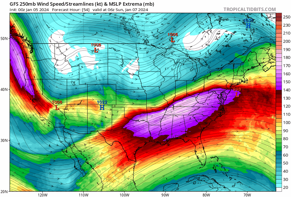
3 hours ago, ORH_wxman said:
This current 1/7 storm def is more of an El Niño flavor…I was more referring to the pattern that follows. Very La Niña as we start building SE ridge and western trough. Hopefully blocking is good enough to keep us on the cold side most of the time.
That said, Euro doesn’t want to cooperate much with the 1:10 threat. Not nearly as CADish and cold as the other 12z guidance. We’ll see what EPS says in a bit.
Basically on the same page... I think some folks a dismissing the possible -NAO impacts on 1/10 storm; given the time range I would be careful that wintery impacts won't occur further south into parts of interior SNE...
-
1 hour ago, ORH_wxman said:
La Niña pattern. Looks like 07-08 or 08-09 on some of these progs with that gradient.
Just looking for a bit of clarification as to your thinking... I might be completely wrong (good chance), and assume you are talking about the entire NA upper level construct having a La Nina vibe. But in terms of storm tracks, isn't this system's snow / rain layout pretty typical of El Nino winters? I've always thought El Nino winters favored some big interior Mid Atlantic / SNE events with the typical coastal plain precip type issues. The Pacific sst anomaly is clearly in El Nino mode but there appears to be a disconnect with some of the more typical El Nino atmospheric features / indexes? But in terms of East Coast action this kind of fits the mode... Am I wrong about that???
-
1
-
-
16 minutes ago, ORH_wxman said:
Yeah this one is gonna reach a certain point and then slide ENE most likely unless the shortwave mechanics change a lot.
The good thing about that is it will likely prolong the CCB snows where that happens so it could give us a higher ceiling. The bad news is that it could be frustrating if you’re just north of the goods. You’d keep expecting the heavy bands to get to you but they never quite reach or they weaken by the time they do.
Second paragraph is perfect! That's exactly what I am expecting, and something that is fairly common. Of course, it is going to produce an outcry of "I was screwed" or "another meh storm" from folks sitting just north of the east/northeast hvy snow axis. Barring any over amped short wave trends, the large scale flow should limit the northward extent of the best snows.
-
3 minutes ago, Damage In Tolland said:
Another aggrieved 30+ or 40+ guy complaining about how bad life is!!! Lol. Give me a break...
-
1
-
1
-

Monitoring some form of significant ( to be determined more precisely) impact winter storm, Jan 16/17th. Moderate seems to be the upper limit - for now
in New England
Posted
Yes!!! Not very enjoyable recently and getting worse..