

FXWX
-
Posts
1,105 -
Joined
-
Last visited
Content Type
Profiles
Blogs
Forums
American Weather
Media Demo
Store
Gallery
Posts posted by FXWX
-
-
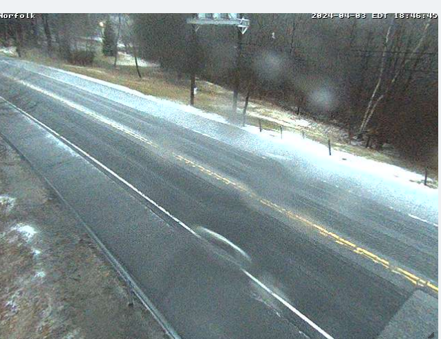
Sleet cover on Rt 44 in Norfolk, CT
-
 3
3
-
-
30 minutes ago, TalcottWx said:
Same here in Weatogue, CT. Temp has dropped to 37.
Crews heading out in Burlington as sleet cover on high elevation roads are causing slick conditions...
-
1
-
-
Mix of hvy rain/sleet in highest elevations of Burlington, CT...
-
1
-
-
Sleeting in Burlington, CT
-
1
-
-
50 minutes ago, ORH_wxman said:
Go back to the pre-clown map era when you have marginal temp profile….esp under 800-1000 feet
1. Look for 6 hourly QPF greater than 0.50”…preferably 0.75”+. The heavier the better, but 0.25 or 0.37 over 6 hours isn’t gonna cut it. That’s mostly white rain.
2. Look at 925 temps. Typically want -2ish or colder to avoid total slop though -1 will work if youre pounding with good snow growth aloft.
If you aren’t satisfying both of those criteria, then you’re looking at something significantly under 10:1 ratios.
Nocturnal timing for max precip can help a bit too, but it’s less significant than the two factors above.
Agree completely with your caveats; I think you can survive the marginally cold at 925 with modest rates in mid-winter, but not in early April... Some of the past monsters being thrown around either excessive dynamics or much colder profiles. And 1982 had both with pure Arctic cold... I will get more interested if the consolation process appears likely to be perfect...
-
1
-
-
27 minutes ago, Damage In Tolland said:
It’s possible it flips to snow towards the latter half, but the good damaging heavy snow is going to be at elevation north of 90.
Agree... In this setup at this time of the year I'd be wary of hvy snows in the southwest quadrant of the snow shield...
-
1
-
-
5 minutes ago, dendrite said:
Those size flakes build up quick
-
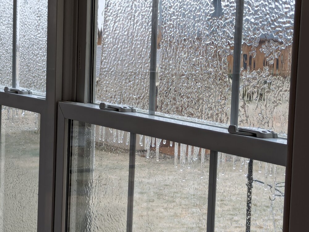
4 minutes ago, ORH_wxman said:
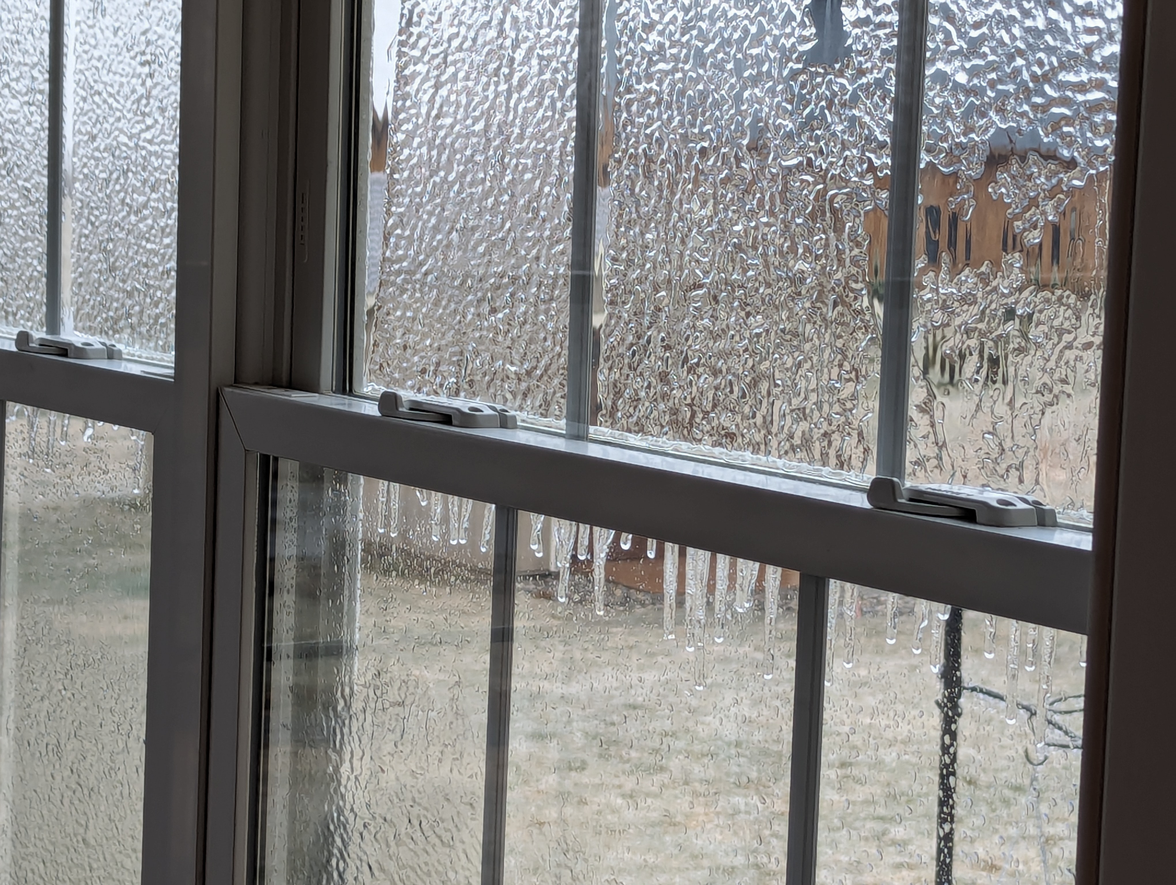
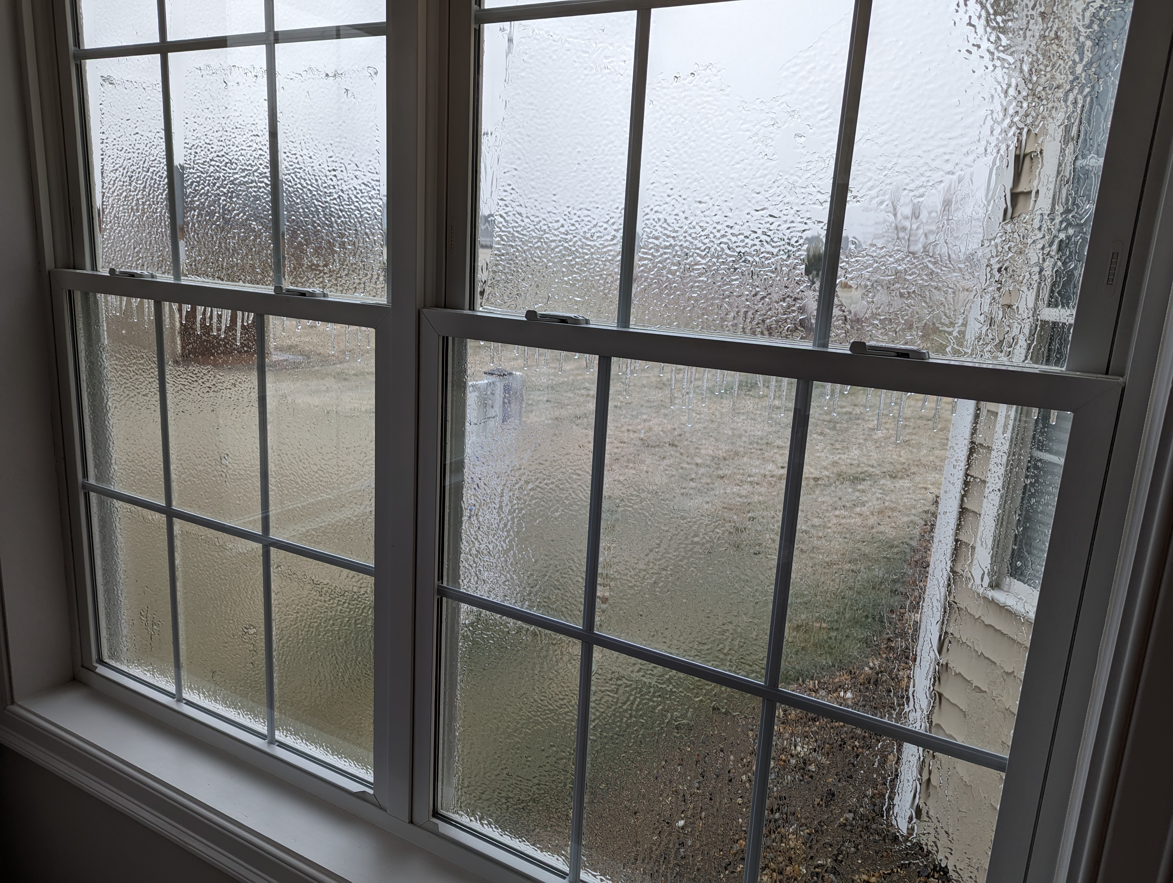
Still glazed on winter hill. Temp has actually ticked down a few tenths the last hour to 31.4F from a high of 32.
Rotting at 31.5 at 1,140 ft in Burlington, CT
-
Still building up


-
10
-
-
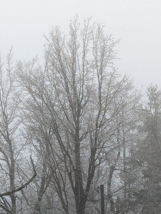
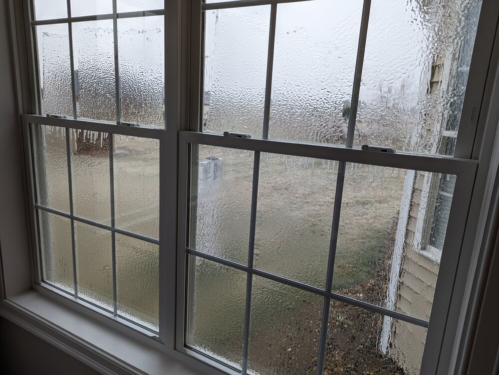
19 minutes ago, FXWX said:
Will grab a couple in a few... 2 trees down in town according to my DPW...
Fog making pic ill-defined...
-
6
-
 1
1
-
-
2 minutes ago, Damage In Tolland said:
Nice. You may never warm above 32. Post pics of trees !
Will grab a couple in a few... 2 trees down in town according to my DPW...
-
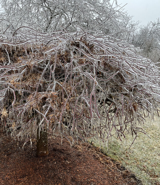
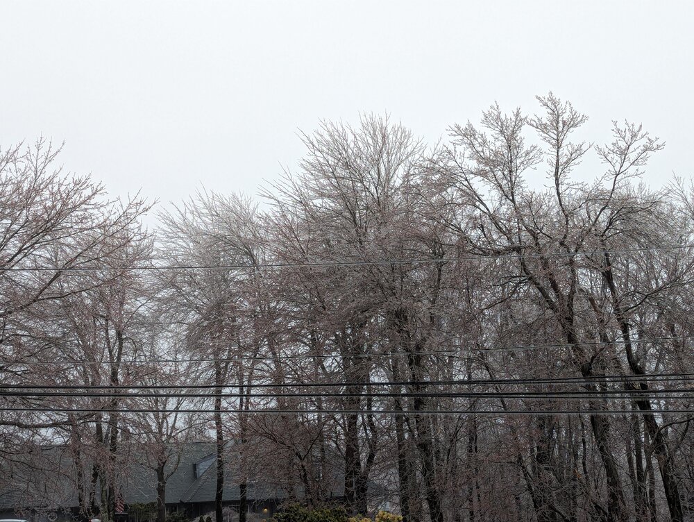
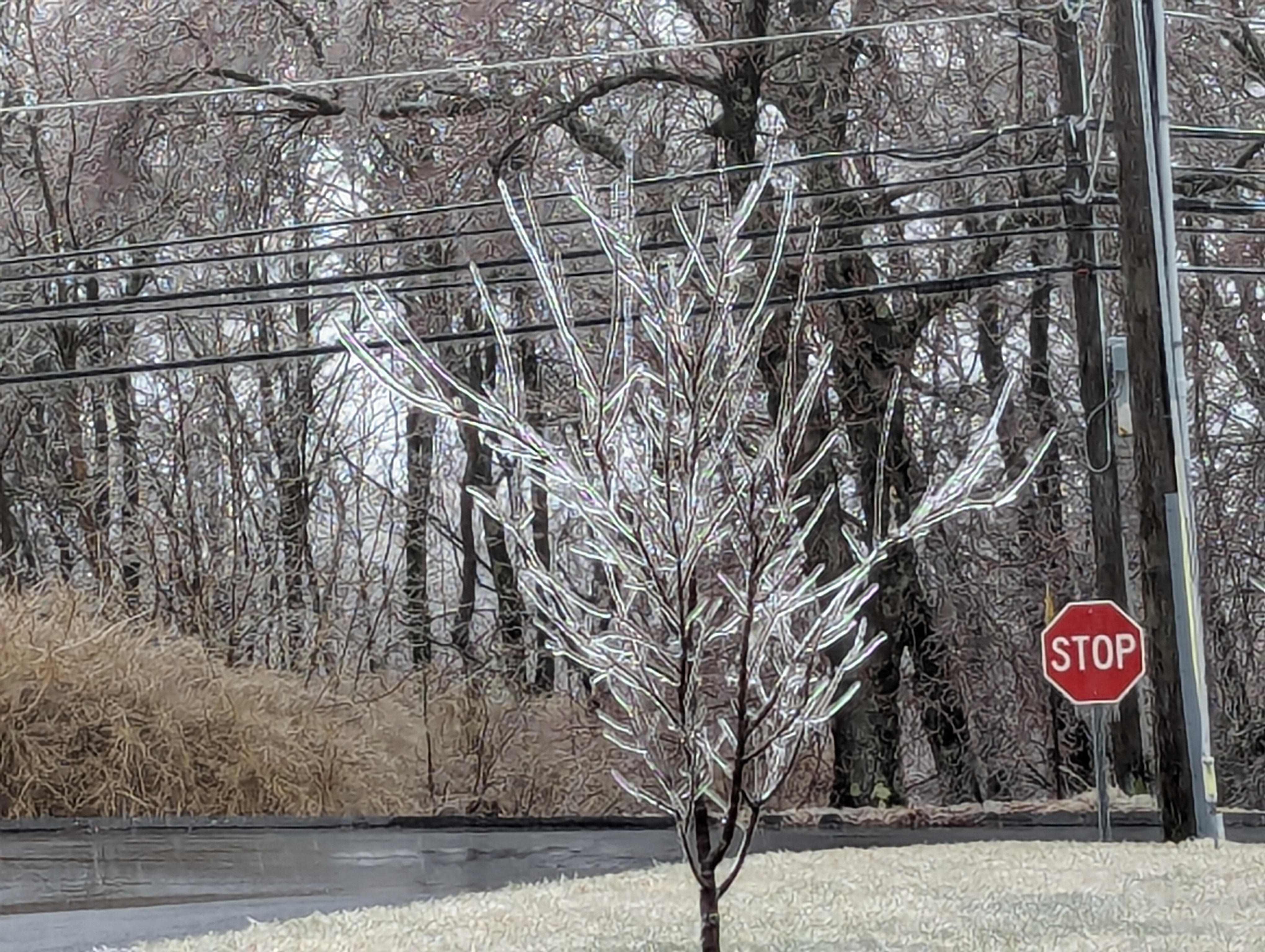
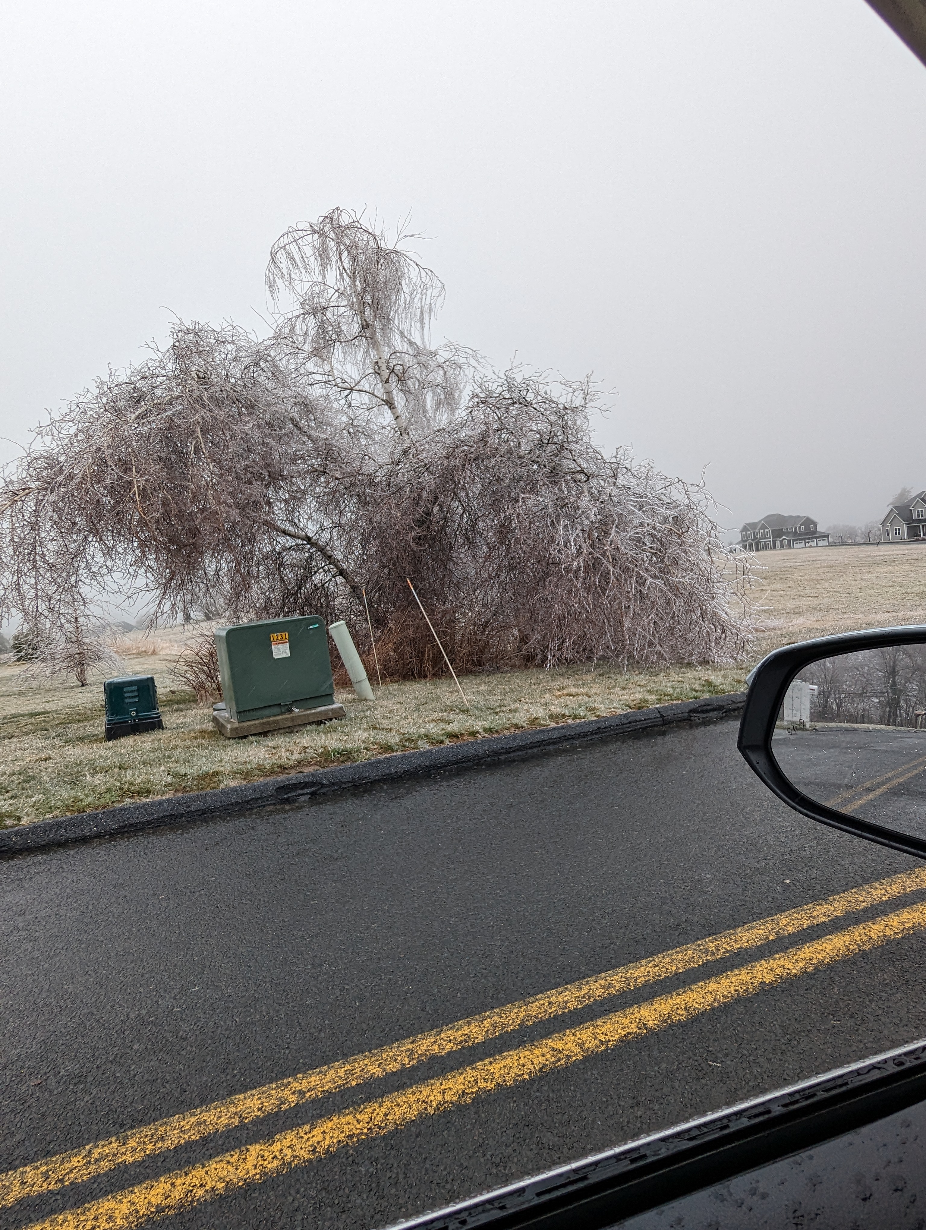
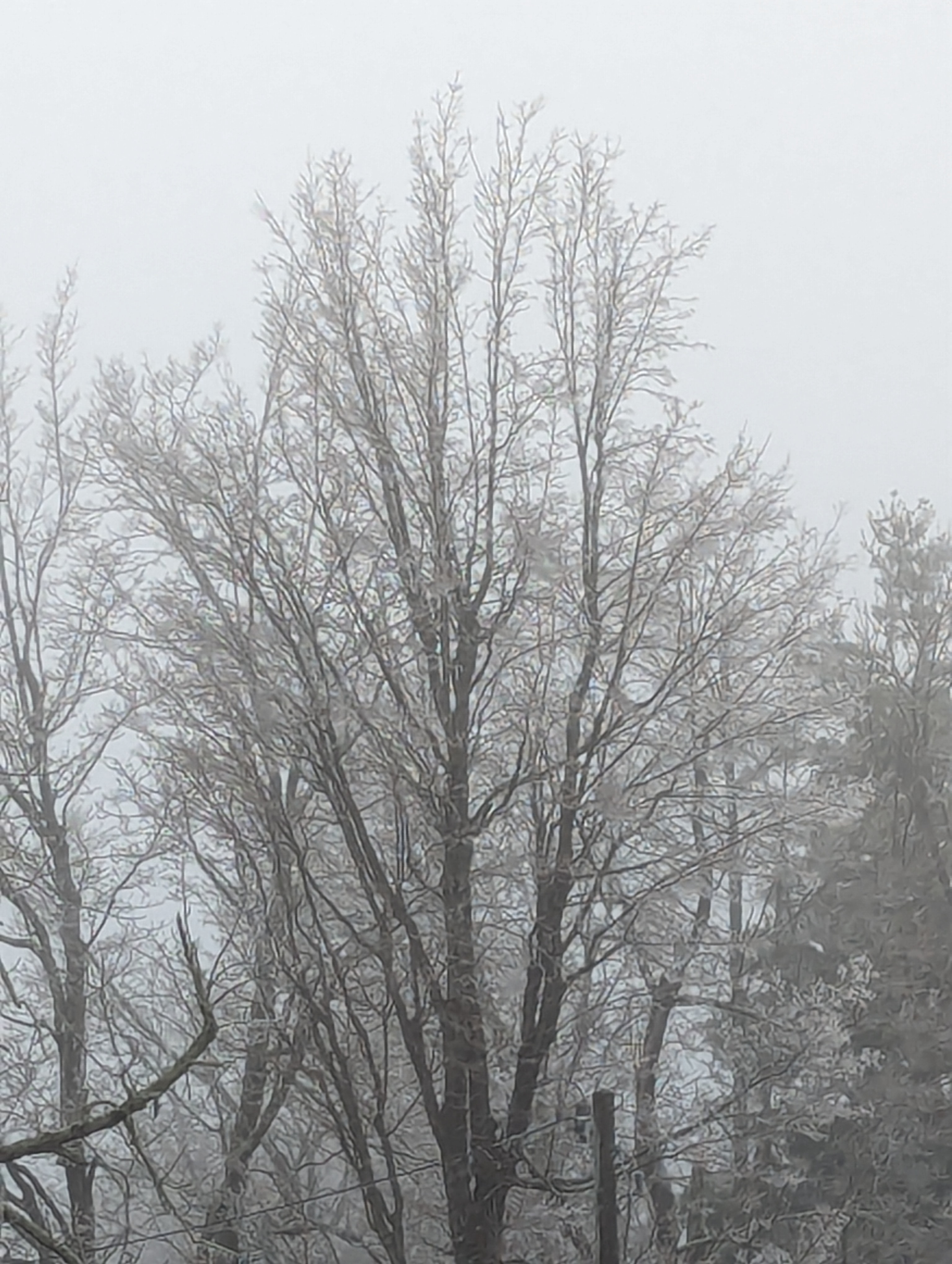
Lots of tree / deck railing icing here in Burlington, CT with a couple of trees down; east facing Windows all iced up...
-
5
-
-
1 hour ago, Damage In Tolland said:
Look at that ORH icestorm . And no one knows it’s coming if they’re not reading here
*** Here's a snippet from my late morning update to my Aubuchon Hardware Group across VT/NH/ME; an hour later I expanded concern into northern Mass...
11:35 AM FRIDAY, MARCH 22, 2024
HEAVY TO LOCALLY EXCESSIVE SNOW AND ICE ACCUMULATION POTENTIAL CONTINUES TO SEE INCREASED MODEL SUPPORT…
VERY CONCERNING TREE DAMAGE / POWER OUTAGE POTENTIAL IN PLAY FROM CENTRAL NY ON NORTH AND EAST ACROSS PORTIONS OF VT, NH AND INTERIOR MAINE…
Discussion: If anything, the outlook for widespread heavy to locally excessive snowfalls and ice accumulations has grown even more worrisome with almost universal model support. While I think the modeling may still be a bit over-blown, even if the totals are only 80% of reality, they still suggest a widespread damaging heavy snowfall and ice accumulation event late tonight and Saturday for many areas along and either side of the axis depicted on the snowfall map below. LONG DURATION OUTAGES A DISTINCT POSSIBILITY???
-
4
-
-
If the modeling is close to correct for portions of VT/ NH/ME, the darkness that follows this storm will blow away the total eclipse many times over! Instead of 2 to 3 minutes of totality it will be a long duration power outage event!!!
-
2
-
1
-
 1
1
-
-
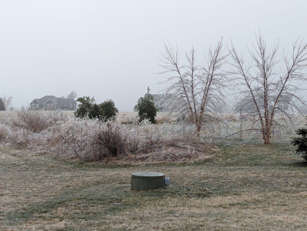
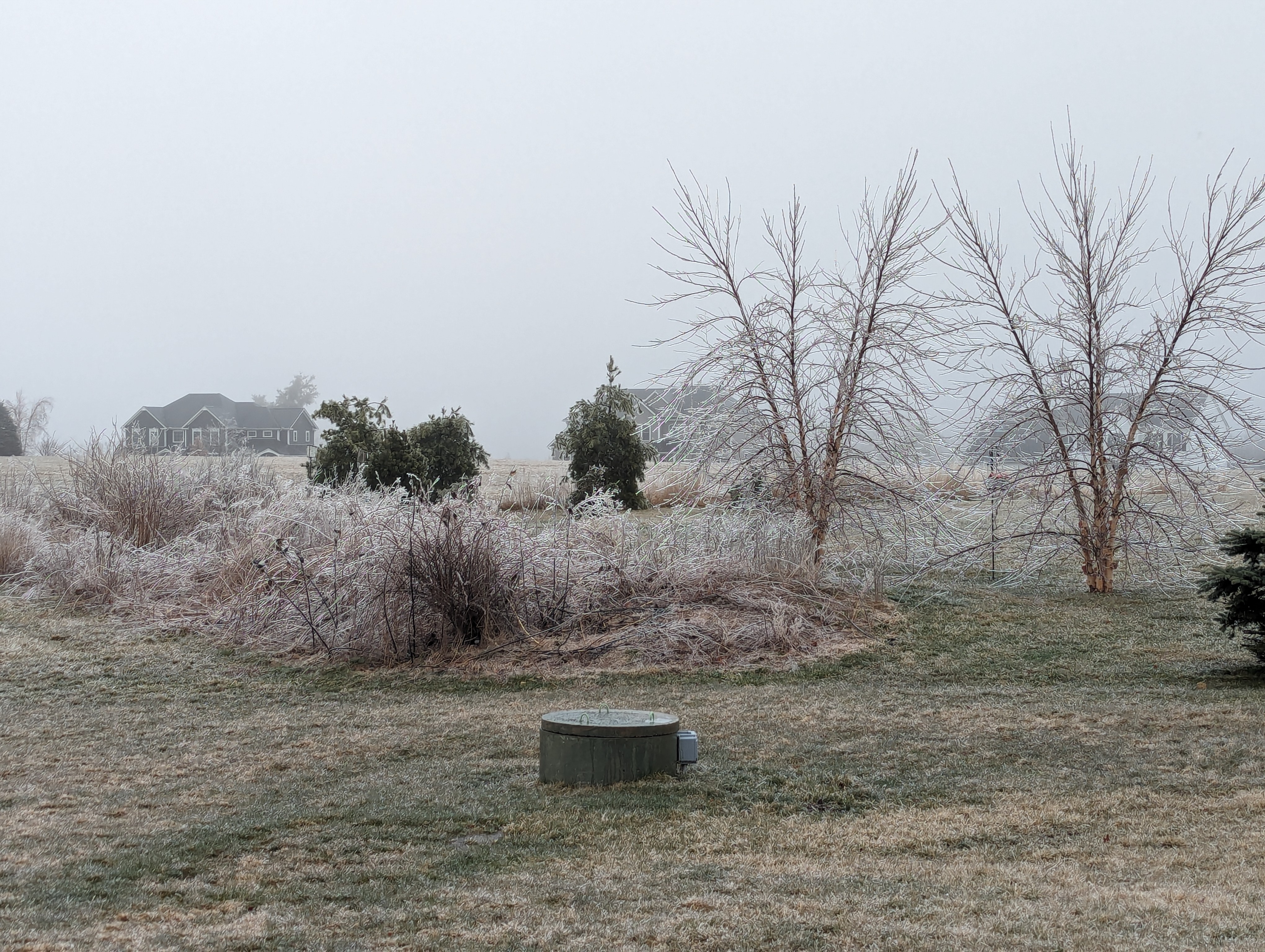
~1" on cold surfaces here...
-
5
-
 1
1
-
-
52 minutes ago, tavwtby said:
we white! except for pavement...
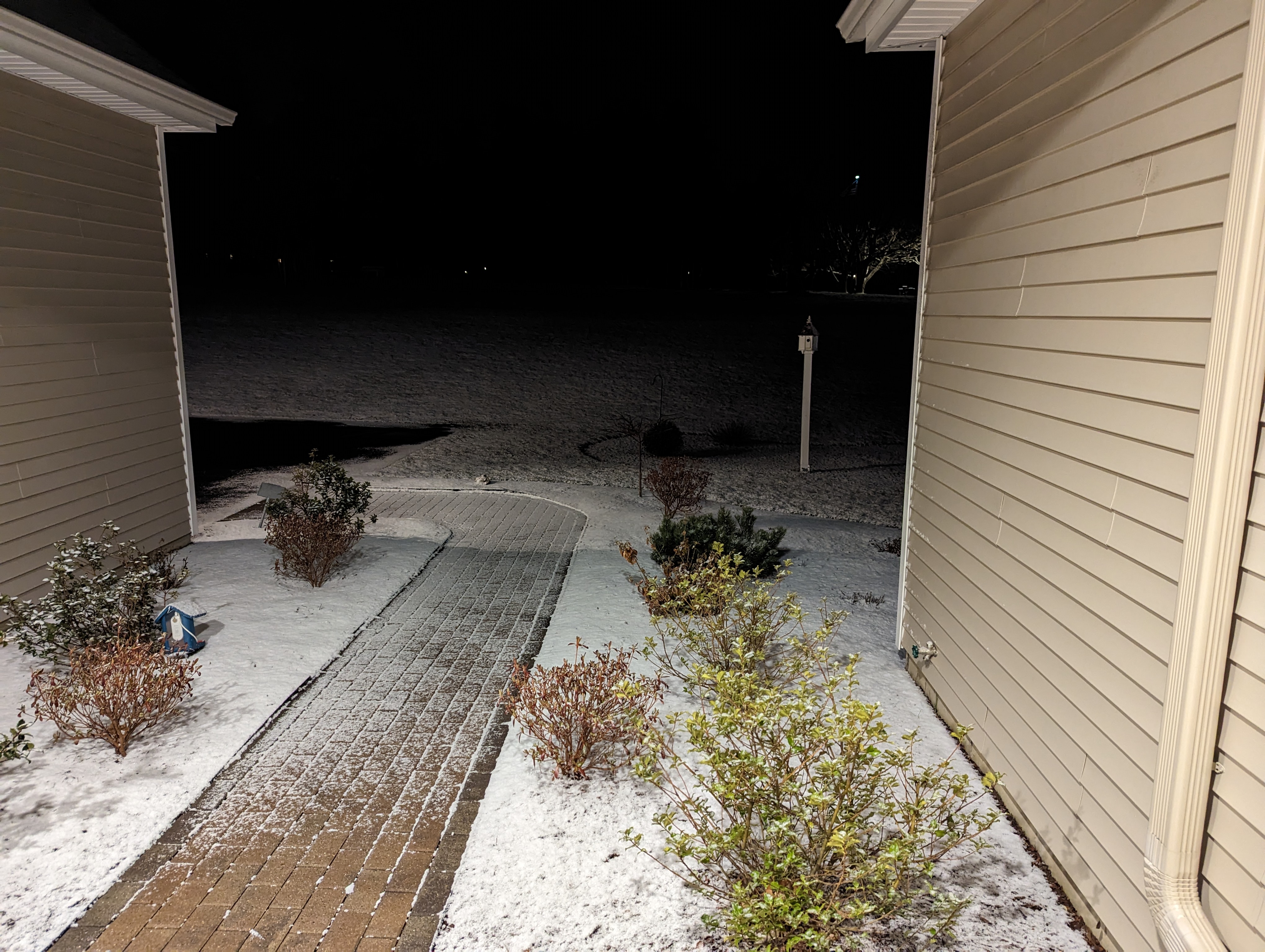
Same here... Solid coating but only on grassy surfaces... Temp down to 29...
-
1
-
-
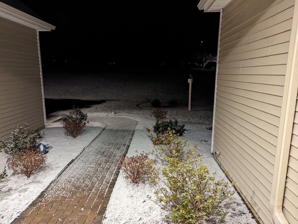
Squall Time Burlington CT.
.
-
6
-
-
42 and steady snow in Burlington, CT...
-
2
-
-
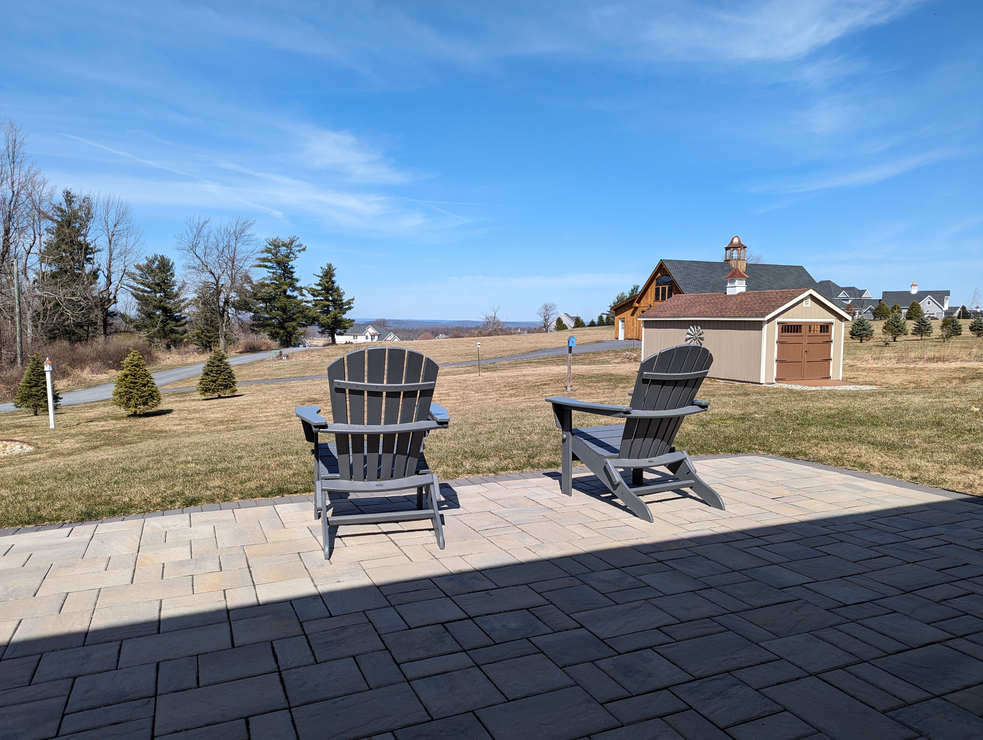
18 minutes ago, AstronomyEnjoyer said:
Ha! In all seriousness though, that really is an awesome view, and nice neighborhood too! For some reason I always forget how hilly Connecticut is, even just west of Hartford. I should probably drag the chairs out to the decks today too - they aren't Adirondack chairs though!
Technically in Hartford county but I'm within a few hundred feet of the Litchfield City line. These are the highest buildings lots in Hartford City. Stay well and get those chairs out!
-
1
-
-
14 minutes ago, AstronomyEnjoyer said:
Incredible view, but I really doubt you can see the Adirondacks from Connecticut, even at 1140 ft!
")
Lol... I assumed everyone would know I was talking about the chairs but as soon as I hit submit I thought there would be a couple of replies about the Adirondacks looking less impressive... Lol... That view is east of the Berks closer to Mtn. Tom area...
-
4
-
-
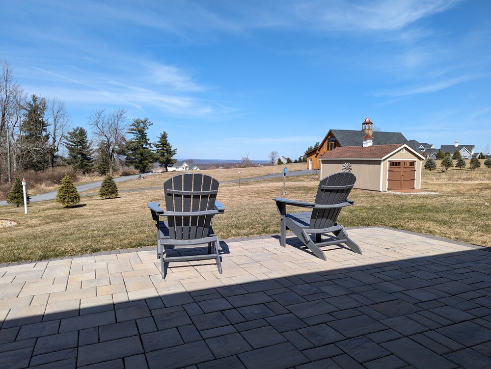
The Adirondacks have made an appearance!!! 64 wonderful degrees at 1,140 ft in Burlington, CT!
-
8
-
-
4 minutes ago, Damage In Tolland said:
PSF 60 and ORH 59
Talking CT
-
29 minutes ago, Damage In Tolland said:
Most hill towns have had 55-60 this afternoon
Haven't seen anything that high. I'm at 1,140' with a max gust of 52 mph so far...
-
9 minutes ago, metagraphica said:
And our power is out again. F*cking, 5th time since Thanksgiving.
.Another dead tree storm!
-
1
-


Significant Miller B Nor'easter Apr 3rd-4th OBS
in New England
Posted
I think there is a tendency for some to look at the radar trends during the early evolution period of a storm, and assume it represents how the storm precip pattern will look hours later during the maturing stage of the storm. In this case, the chaotic look of what is going on now across southeastern NY and SNE will likely blossom into a widespread concentrated precipitation shield across northern Mass / NH and western Maine later tonight and early Thursday.