

FXWX
-
Posts
838 -
Joined
-
Last visited
Content Type
Profiles
Blogs
Forums
American Weather
Media Demo
Store
Gallery
Posts posted by FXWX
-
-
4 hours ago, Damage In Tolland said:
Absolutely the best summer ever. Never ending dews . As well as we could all have ever drawn it up.
You might want to survey summertime businesses about that "best summer ever" comment? Also, do you keep your air off and and your windows wide open so you can experience your best summer ever 24/7? Lol
-
 3
3
-
 1
1
-
 6
6
-
 1
1
-
 1
1
-
-
9 minutes ago, AstronomyEnjoyer said:
Probably off topic, but is there a recommended rain gauge type/model/manufacturer people use? I've got mine as about out in the open as I can, but I'm now a little suspicious of that 6.05" I had reported here, given that the highest official reporting I can find for my area is around 4.5". I am on the very west end of Bradford and right at the base of the east slope of Mount Sunapee, but I'm not sure that would be enough to bump me up that much?
Just go with the old reliable Stratus...
-
1
-
1
-
-
1 hour ago, Typhoon Tip said:
After having sampled the sear on a stroll down to the end of the street and back ... the rapidity of the sweat bead materialization, along with the appeal of that blue flaming sky through which penetrates a relentless sun ... ( yet, not a single f'n zephyr to be found), I can honestly say I have to go back to June of 2021 to match this is pig's ass appeal.
93/72
I think we need a new heat index? Let's go with the "SBMTI"(sweat bead materialization time index)... Lol
-
1
-
-
20 hours ago, WhiteLawns said:
Tonight in Torrington CT! I think I may be the luckiest man on earth with this timing!

We're you able to hear thunder from that bolt? I was following that cell from the Burlington / Harwinton border and monitoring lightning strike data at the same time. The lightning detection network did not record any strikes or cloud to cloud / cloud to air in Litchfield County from what I could tell. I think all of the ones on the network were across the NY or MA border.
-
12 hours ago, WhiteLawns said:
Tonight in Torrington CT! I think I may be the luckiest man on earth with this timing!
That cell put on a show for over an hour last night... I watched it from Burlington... It was great because it was never a real threat to disrupt activities... Rapid collapse once it tried to bodily move into the NY/CT/MA border area.
-
2
-
-
NY cell lightning activity as seen from Burlington, CT
-
1
-
-
9 minutes ago, SouthCoastMA said:
clipped by that Cape cell for .32
some areas in Falmouth/Forestdale/Mashpee, West Barnstable likely tripling that
1.70 at my daughter's house in Mashpee
-
3
-
-
Hail in Mashpee on the Cape...
-
43 mph gust here!!!
-
2
-
-
Here's a comparison of today's (top) smoke density to the plume in late May (bottom)...


-
9
-
-
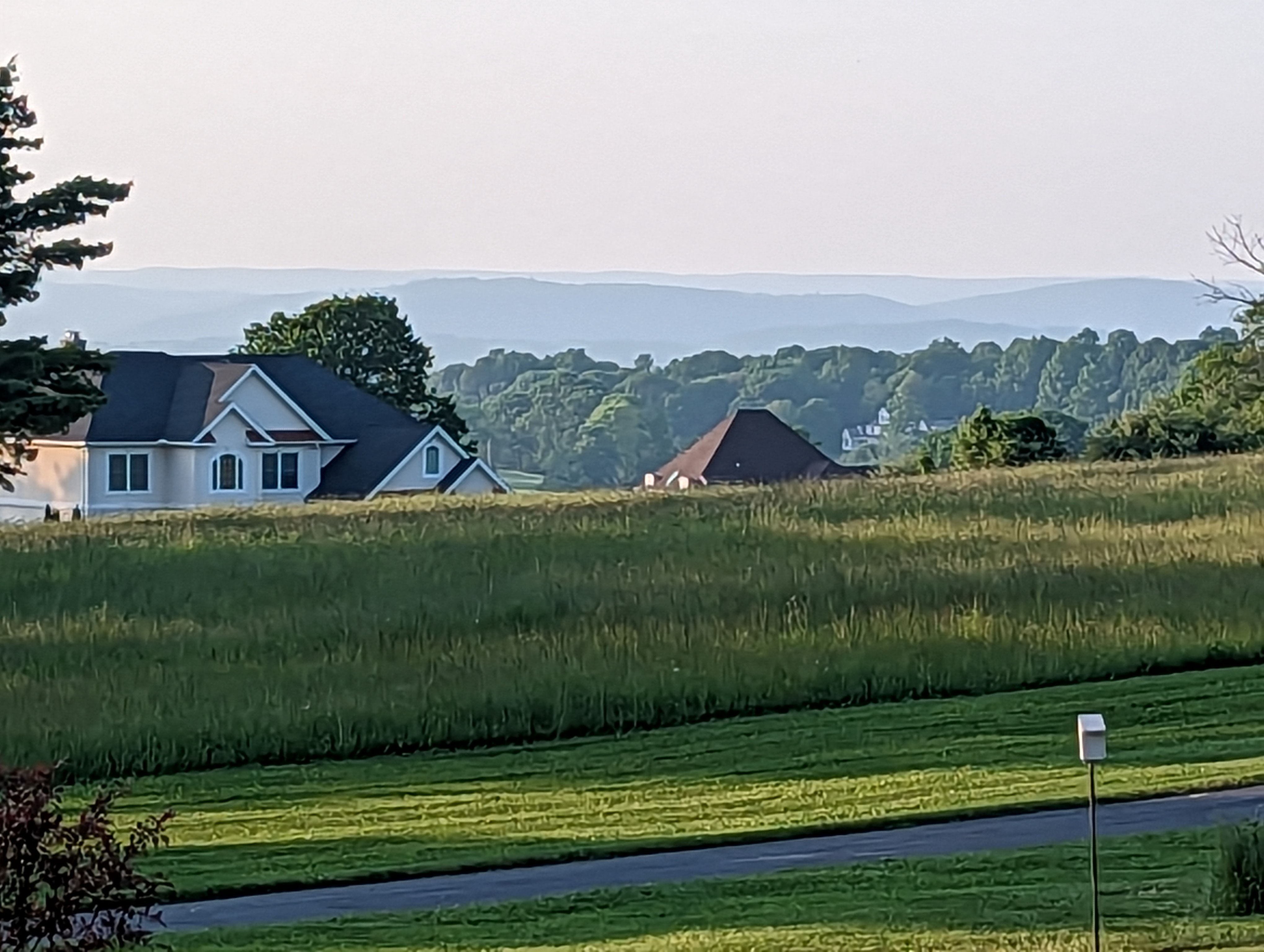
Looking north from Mountain Top Pass in Burlington, CT shows a nice line of towering cumulus continuing to build.


-
3
-
1
-
-
16 minutes ago, CoastalWx said:
Beer?
It must be an east of the river phenomenon... Lol... Only 59 DP here in west/central iCT???
-
56 minutes ago, Damage In Tolland said:
The thick plume moved right overhead here an hour ago. It’s right at ground level. Smells like a fire pit

View of the Litchfield hill from Burlington was crystal clear during the mid-afternoon... Now the smoke plume has completely taken over...
-
6
-
-
It's the same bullshit every April to September! And every years the grass continues to grow, trees and shrubs don't die, and the landscape does not become desert like...
-
2
-
3
-
2
-
1
-
-
Bastardi might need to hire a proof reader. Take a look at his recent post!
"So if you can weaken the el inino and shit it west which I think will happen given how strong it is early and the competing factors around it ( SS"
-
6
-
-
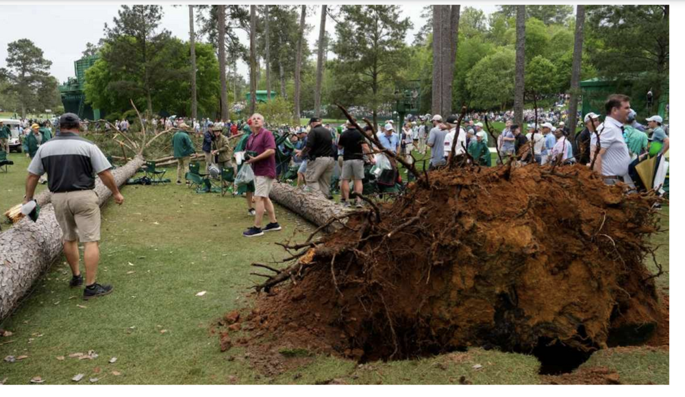
2 hours ago, Ed, snow and hurricane fan said:
I wasn't watching the Masters, but one of the trees made it on TV.
Lucky!!!
-
1 hour ago, ORH_wxman said:
Incredible how cold that storm was too for April. Very powdery snow. Only the 4/4/16 event rivals it for cold with snow falling…but ‘82 was a much heavier event.
It was a beast... By mid/late afternoon heavy snow and strong winds had overwhelmed our location DPW and numerous cars were abandoned... We had a couple of cars abandoned on our street due to the snow being so deep it literally stopped them in their tracks... Straight up blizzard conditions... I think we were in the teens during the height of the heavy snowfall...
-
3
-
-
2 minutes ago, WxWatcher007 said:
The clearing looks legit. Might be able to salvage a solid afternoon.
Clouds breaking across western CT!

-
3
-
1
-
-
5 minutes ago, weatherwiz said:
Agreed, sometimes it's too easy to get caught up with these composites and parameters. Basically, just shows that if mature enough updrafts can materialize they have a ton to work with. I almost can't get over the HRRR...it's like a QLCS line of supercells (and multiple of them). The storm motions are through the roof too which is not good. People will have very little time to react and get to safety.
Agree on all... sometimes you can get all the ingredients and the cake still doesn't get baked; all you can do is point out the worry and hope for the best in terms of life and property. Although the way this severe weather season has started out for the country, I wouldn't bet against another big / bad outcome...
-
2
-
-
22 minutes ago, weatherwiz said:
The HRRR has been trending more and more aggressive which is not a good sign. I know one concern I had against a large-scale widespread outbreak was a "dirty" warm sector but the warm sector is full of breaks. The RAP (using mesoanalysis) is developing widespread 2,000 J MLCAPE and > 200-250 J of 3km CAPE. That is very scary
Still a bit dirty, but the overall setup is very dynamic; wind speeds at multiple levels are at or above levels noted in some of the nastiest of outbreaks... just a quick glance at the SPC meso composite page shows almost all tornado parameters, even their violent tornado composite, covering huge areas... of course, this does not mean it has to happen, but high concern is warranted...
-
6 minutes ago, weatherwiz said:
Two PDS watches coming as well
yep... hopefully we get through this without a big hit, but it certainly looks worrisome and falls close to the dates of a couple of historic events... Aprol,4-6???
-
HIGH RISK zone to be added to a portion of today's tornado risk area...
-
1.0" in Burlington
-
2
-
-
Up to 12.5" here in Burlington
-
4
-


Thursday, July 13 - Friday, July 14, 2023 Convection
in New England
Posted
Sometimes forecasters have to just be honest... Lol... Today is already different than I expected and I'm not sure how it plays out? Just going to watch short term trends for a bit longer...