

schoeppeya
-
Posts
480 -
Joined
-
Last visited
Content Type
Profiles
Blogs
Forums
American Weather
Media Demo
Store
Gallery
Posts posted by schoeppeya
-
-
2 minutes ago, griteater said:
We said it was put up or shut up time. It put up today!
Y'all have confidence this is going to make its way down to the troposphere?
-
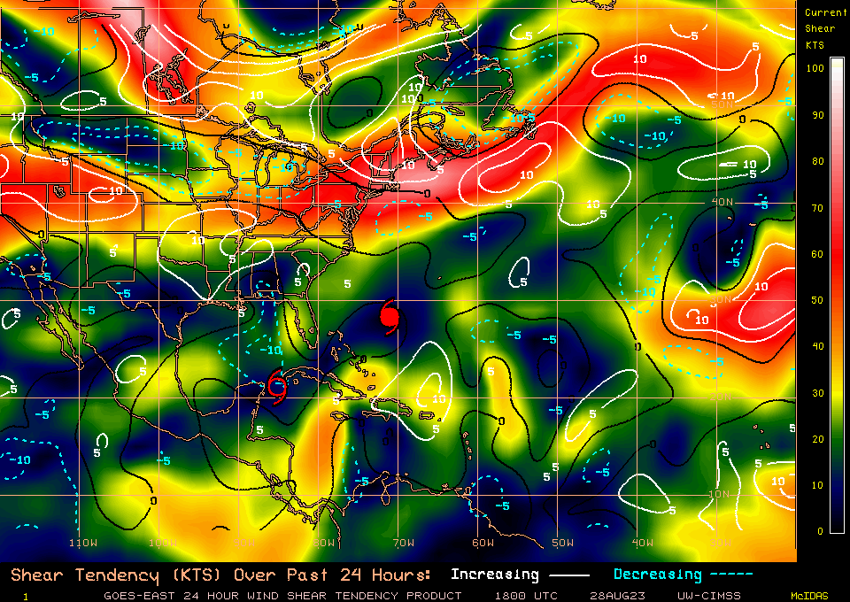
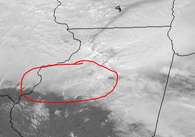
Pretty incredible radar presentation right now
-
 1
1
-
-
4 minutes ago, hawkeye_wx said:
The pressure dropped 1 mb since the last recon pass. The visible loop shows new towers beginning to pinwheel around the eye, so it should be entering another strengthening phase. It's just a question of how fast it can solidify the eyewall and drop the pressure.
Looks like we may be getting an attempt to clear out the eye as well
-
To me, it looks like Idalia still doesn’t have most of its energy focused around the eyewall and think we need to see that bigger outer band really contract before we see winds increase and pressures start dropping. All the feeder bands are currently working into this band rather than the inner eyewall.

-
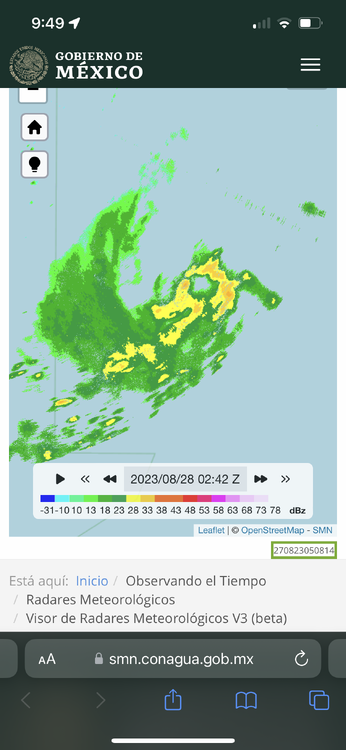
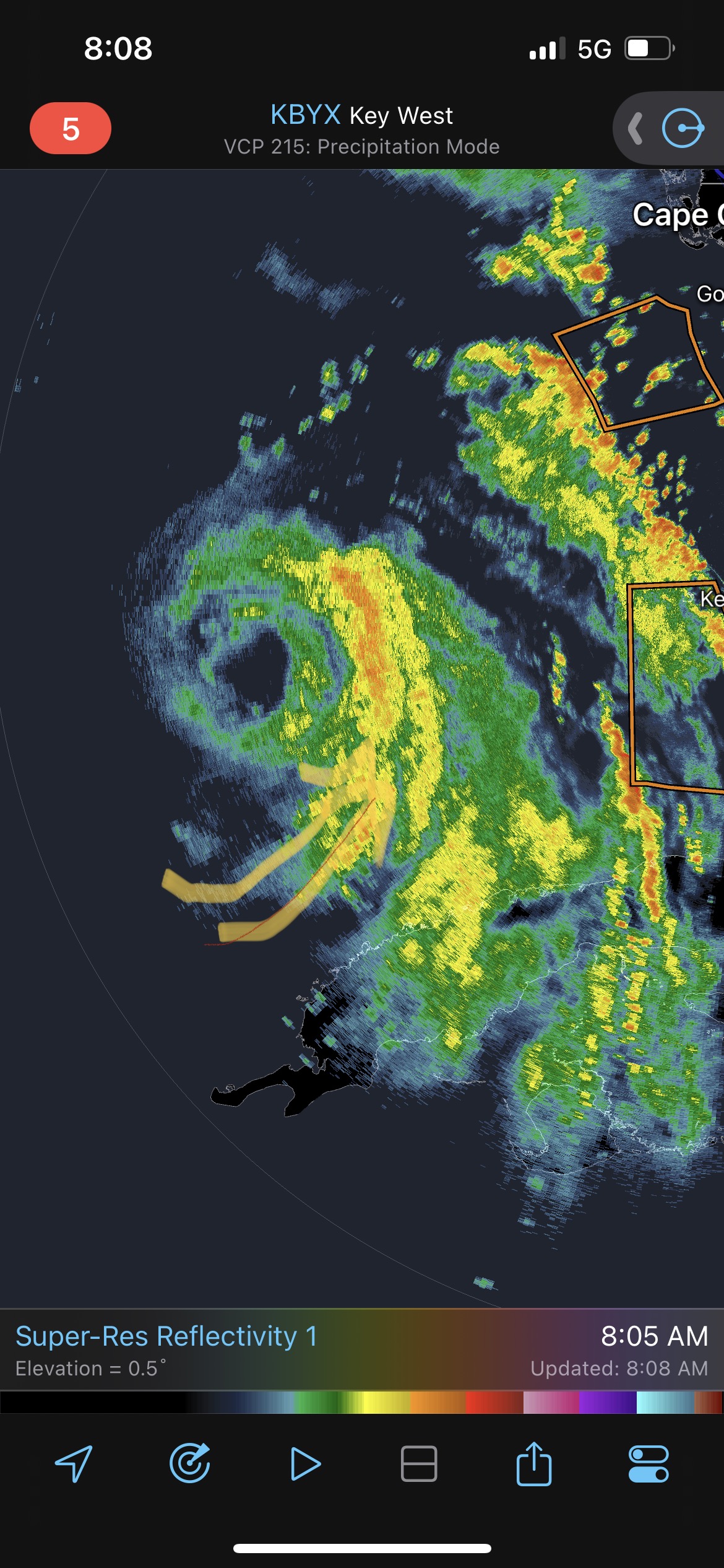
Looking at radar it looks like we are about to have our first fully closed eye shortly.
-
4 minutes ago, Boston Bulldog said:
Stage is now being set for Idalia to organize significantly once it clears Cuba and enters the gulf
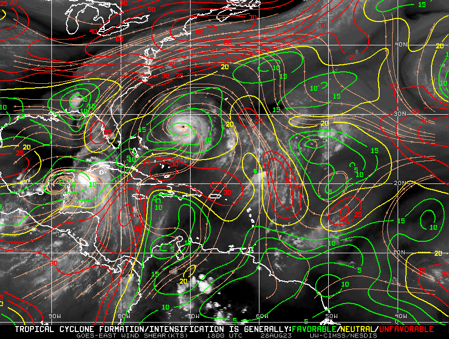
Originally posted in the wrong thread but the low over florida has clearly moved into a better position to provide some ventilation to the northeast
-
1
-
-
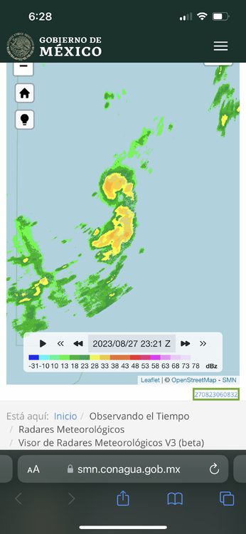
Idalia has had a really hard time actually wrapping feeder bands into the center of the system
-
Getting salty
-
6
-
-
Storm has wrapped convection all the way around the circulation including the ups head side, not convinced it’s not off to the races
-
2 minutes ago, WxWatcher007 said:
This x100. Until we can get persistent convection over the center and convection rotating upshear it'll be hard to build a core. Guidance does have that happen eventually but it may take some time.
It'll be interesting to see what recon finds tonight.
Radar looks like it’s definitely attempting to wrap thunderstorms on the up shear side of the storm
-
Finally seeing really intense sustained convection over the center of the storm
-
1
-
-
Not sure if the llc is feeling the effects of the deeper convection to the east or what but it’s getting pulled that direction in a hurry on visible
-
Very obvious on visible there is an LLC somewhere over the channel
-
Looks like there another aircraft en route, should be great timing to capture whatever peak this thing is going for after the ERWC. Looks great on sat.
-
1
-
-
Pretty apparent outflow boundary from the ongoing storms on visible. Surface obs showing north winds behind the boundary, could focus convergence as the warm front continues lifting north.
-
Going to be an area to watch for any residual boundaries this afternoon
-
My biggest concerns for this event verifying were weak thermodynamics and a lack of backed surface winds. Visible and surface obs are largely showing neither of those will be an issue.
-
1
-
-
Visible showing that a huge chunk of MO, IL, and IN are going to get at the very least several hours of sunshine today.
-
Everything going up in E Tx is getting that bean shape and quickly developing rotation
-
1
-
-
Coming east
-
2 minutes ago, zinski1990 said:
Typical. Can never get a monster snow storm in Indy ever. Just our luck man
Still have at least two days where hope is alive
-
Fingers crossed the westward trend stops here in Indy… that run actually takes the low south of the city just dry slots it pretty hard. I’m sure there would be some once in a lifetime type weather transitions if the low goes right overhead.
-
1
-
-
Anybody know the average SLP error for this time range?
-
1 minute ago, sbnwx85 said:
Pretty good agreement among the models at this stage. Hoping the west trend stops here otherwise I’m going to be dealing with mixing issues. Still in a great spot for now.
Yep, sitting on the north side of Indy, 12z was about 20 miles too far nw from being a biblical storm here.


MO/KS/AR/OK 2023-2024 Winter Discussion
in Central/Western States
Posted
The GFS has been the leader for this entire event... i'm in the GFS camp for now until proven otherwise.