

bristolri_wx
-
Posts
1,486 -
Joined
-
Last visited
Content Type
Profiles
Blogs
Forums
American Weather
Media Demo
Store
Gallery
Posts posted by bristolri_wx
-
-
Latest HRRR still has a stall for 3-4 hours east of the Cape and another .75 to 1.00" of QPF RI east. Sucks for the CNE/WNE folks...
-
 4
4
-
-
Was out for about 45 minutes shoveling out a spot for the dog. Lots of drifts, gonna conservatively say 8-10" out there now. Had drifts over 2 feet in some spots, always tough to measure my yard I'm very exposed to the wind in 3 directions. 8-10 (maybe 12) seems to be in line with peeps to my east and west in the 14-16 range... very good rates out there now, though not white out. Damn cold too!
-
1
-
-
25 minutes ago, Typhoon Tip said:
This is interesting ...
WPC just did a new sfc plot/analysis and relocated the low due E of their previous fix some 200 mi - what? Suddely the GFS is the right model - yeah...right. there we go I guess

You are skeptical of this being the case?
-
3 minutes ago, PowderBeard said:
I hope my post last night is 100% wrong and you get 3-4" an hour.
Ha we will see. Usually the bands are more transient here. We usually get the good stuff at the end more often than not. Surprising to see a juicy band move in from the east this early.
-
Ooh band of yellow incoming… that rarely happens here…
-
3
-
-
Thankfully most of that RI snow hole is over Narragansett Bay. Snowing pretty good here though we’re on the edge of the eastern band…
EDIT: refreshed my RadarScope and it shifted west over land… poor Kent/South county.
-
2
-
-
BOX 6:45
NEAR TERM /UNTIL 6 PM THIS EVENING/... 645 AM update... Very impressive satellite imagery this morning, with half wavelength shortening between trough and downstream ridge, as trough begins to take on a negative tilt. Forecast remains on track, with moderate snow overspreading eastern CT-RI and eastern MA, with snowfall rates approaching 1 inch per hour. Winds have really cranked upward the past hour, with PVC G50 kt/58 mph the past hour! Still expecting the heaviest snow with hourly rates of 2-4" per hour at times along with strongest winds up to 65-75 mph between 9 am and 4 pm. Rain has flipped over to all snow now across Nantucket and the outer Cape. Although this will be a heavy wet snow, including coastal Plymouth county and increase the threat of tree damage and power outages. Earlier discussion below.
-
1
-
-
3-4” here tough to judge drifts everywhere.
-
2
-
-
Canadian and Uncle are meh. Slightly less QPF otherwise the same distribution pattern as their previous runs...
-
Slight improvement on the 03z RAP, especially in eastern areas. That seems to be the trend, slight increases in QPF east of the CT River...
-
3
-
-
1 minute ago, JC-CT said:
you've either got really clouded imby glasses or very foggy weenie glasses
Yeah... actually a mixed bag. QPF is up a little east and down a little west...
-
-
Just now, HIPPYVALLEY said:
Be nice if it slowed down East of LI.
")
If the trends continue... maybe... it didn't chase NE nearly as much as the previous run.
-
1
-
-
Not great for western areas but it's slightly west from last run and much better than CMC/RGEM guidance... it is what it is...

-
 1
1
-
-
The Canadian Herpes is coming in west. Really slows down east of the cape between hours 16-20
-
GFS a little west, but not enough to make much of a difference.
-
Yeah RGEM continues to look out to sea (and lunch).
-
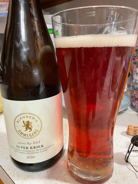
Light snow sticking, 30 here. Had this hanging around, figured it was time to partake. Bottoms up and enjoy the storm.
-
2
-
 1
1
-
-
1 minute ago, NeonPeon said:
Good luck. I'm sticking with my understated 9" idea for lowly Newport. No doubt you'll do better. I buy the idea that we will just staying out of the good business from the east, and I have never not seen a death band to the west that is showing up in more detailed modeling. That's every storm I've seen with a classic track.
I hope I'm wrong, because it would be good for everyone, but even if I make it to that amount, it'll blow my son's mind with the drifting and wind.
I'm done now. At some point you have to look out the window, and now's the time for me. Hope it doesn't disappoint too many, and people actually get out in it!
Even if RI gets a snow hole, I doubt there will be less than 12” anywhere state wide when it’s done. Good luck!
-
2
-
-
Light Snow for last 30 minutes. 31 here.
-
Just took the dog for a walk to get his business done. Took twice as long as usual walked almost over a mile round trip to get it done. If that’s not a sign we are in for a big one tonight and tomorrow, I don’t know what else would be.
-
 1
1
-
-
19 minutes ago, JC-CT said:
No, but if it's a squirter then maybe
I dunno - the latent heat release might make it chase the convection caused by it.
-
3 minutes ago, PowderBeard said:
Really thinking the best banding will be from east of the river to Worcester/PVD area and the typical RI screw hole a little east.
Just because I know this post is factual doesn’t mean I have to like it.
-
5
-
-
2 minutes ago, OceanStWx said:
Actually buoy 41002 has a 1002 mb pressure, so it's probable that the initialization of the SPC is splitting the difference between the RAP background and the actual ob.
I just had to chug an IPA as I had Buoy 41002 in the “Blizzard of ‘22” drinking game.
-
1
-
3
-
OBS/DISCO - The Historic James Blizzard of 2022
in New England
Posted
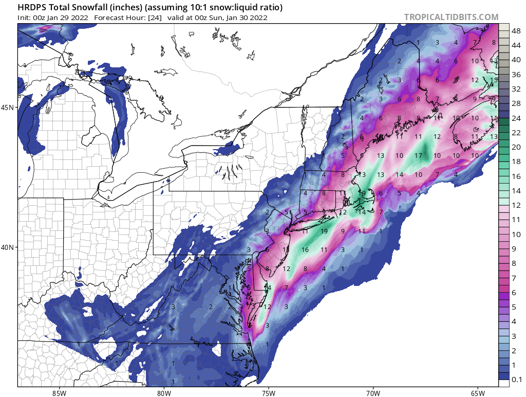
Damn that BOX map is bullish for eastern areas and quite surprising.