

bristolri_wx
-
Posts
1,477 -
Joined
-
Last visited
Content Type
Profiles
Blogs
Forums
American Weather
Media Demo
Store
Gallery
Posts posted by bristolri_wx
-
-
I would be happy with 3-5" on Fri/Sat if it doesn't mix. Would be a while since we've had a "clean" storm down here. Kid would be happy to go sledding too!
-
Anecdotal because I was driving in it, but I feel like this overperformed a little in RI and SE MA before the change over. It was snowing pretty hard for my entire commute into Providence, and there's 3-4" on the ground once you get north of Warren into Bristol County MA, and Providence/Pawtucket.
-
Looks like the coastal plain is the Dallas Cowboys of snow accumulation in this storm...
-
 1
1
-
-
12z GFS has 50-70 MPH winds for SE New England as well. Fun!
-
We do not need another 2-3" of rain in RI...
-
 3
3
-
-
Man that is a lot of precip on radar… wind is really picking up here now almost a constant roar at this point.
-
1
-
-
1 hour ago, jbenedet said:
35/25 at PSM. Allow the great melt to commence.
37/27 BOS


-
1
-
 2
2
-
-
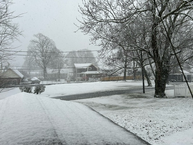
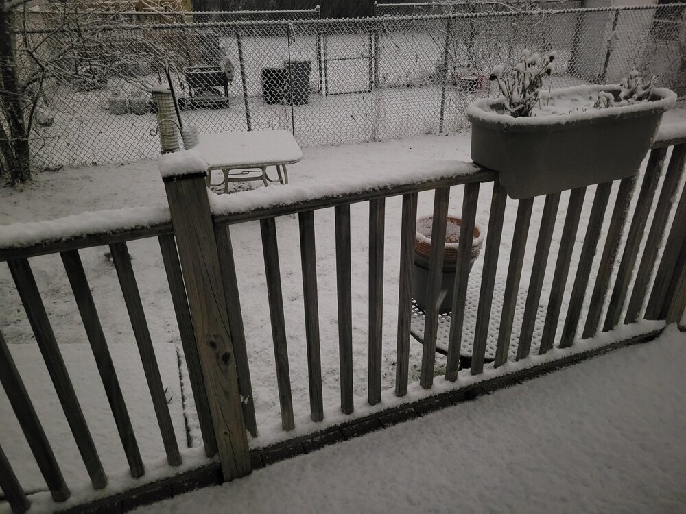
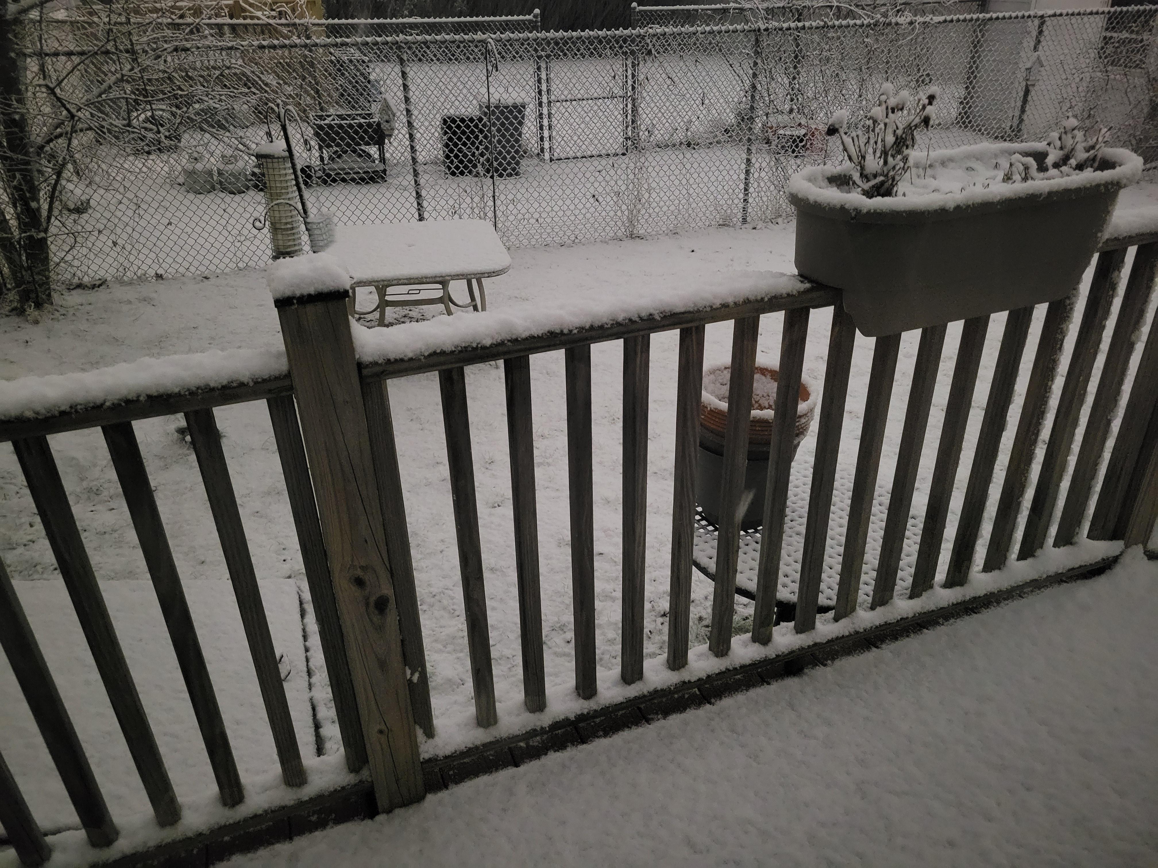
Final total here in Bristol was 4. About a slushy inch overnight before the rain, then 3” during the burst. Seems to match up with the NWS obs maps. Flurries here now. That 3 hour dump was some of the best snowfall in a while, hopefully shows the potential of what’s to come the rest of the winter.
-
Heavy Snow right now, best of the storm. 32. Not sure how long this lasts.
-
Finally switched over to all snow and sticking. 33.
-
1
-
-
Snow still fighting the rain here. You can tell it’s trying to switch over but man this LLW is resistant here… 34…
-
Rain sleet and snow mix starting here in Bristol, 33
-
Just now, Warwick WX said:
Pounding across the pond in Warwick. Bummer it is mixing over there.
Actually right after I posted the intensity picked up and it switched over to mostly snow. Have a coating but back to a little mix again. Figuring this is how it will be here most of the night and tomorrow until temps drop.
-
4 minutes ago, CoastalWx said:
Two cutters coming up. We’ll see about after.
-
2
-
-
2 minutes ago, CoastalWx said:
Not sure I agree for BOS there. Cooked until tomorrow.
Only a few hours below freezing before being dry-slotted even if that does happen...
-
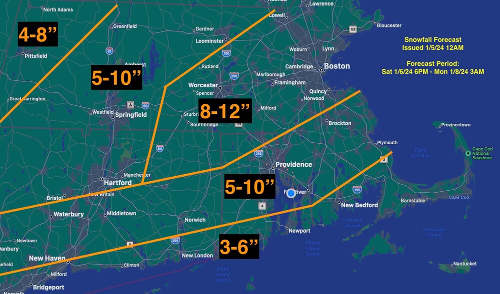
BOX:
Quote1035 PM Update...
Steadier/heavier precip moving across CT/RI on the nose of the
dry slot. Moderate snow at HFD with vsby down to 1/2 mile.
Surface temps marginal for accumulating snow, but colder and
drier air aloft (higher cloud bases across MA) will support some
evaporative cooling with heavier precip bands. For Boston, 37
degs with an east wind yielding wet roads. New 00z NAM model
sounding for Boston, shows column and surface temp cooling below
freezing around 3 AM once heavier precip arrives and winds turn
more to the NE (060 degs). Thus accumulating snow for all areas
overnight except Cape Cod and Islands.00z NAM shows dry slot overspreading the region from SW to NE
06z-09z tonight. This will limit snow intensity and yield a
changeover to rain and freezing rain/drizzle where temps remain
subfreezing. Then the comma head forms tomorrow and begins to
pivot NW to SE across the region 15z-21z, which will be round 2
of accumulating snow. Thus, new redevelops, possibly moderate at
times from 15z to 21z NW to SE across SNE. Still some
uncertainty how quickly comma head forms and its duration
before exiting offshore. This will impact finals snow totals.
More on this after we review the full suite of 00z.-
 1
1
-
-
snow mixed with rain here in bristol... disappointing... radar looks decent overhead too...
-
15 minutes ago, NeonPeon said:
Nice light snow. Kindof the routine here, a lick of snow on the front end into rain, and then underperforming snow on the back end.
There’s a 25% chance this may over-perform. It’s happens for us once in a while lol…
-
Flakes finally flying here, despite what radar has been showing last hour or so…
-
Ugh coastal plain trends are going backwards… it’s the PornHub precip forecast taint taint taint…
-
1
-
1
-
-
8 minutes ago, SJonesWX said:
congrats to the pope on that jackpot

-
6
-
-
24 minutes ago, lurker said:

This is what AI was invented for LOL…
-
1
-
-
8 minutes ago, jbenedet said:
“There are many ways to skin a rat”
Winter 2023-2024 SNE re-analysis

-
5 minutes ago, 40/70 Benchmark said:
Man, I am nervous about busting low....but my map is done. I am just to leery of totally biting off on this damn last minute capture.
I posted this last night, sticking with it.
-
3
-
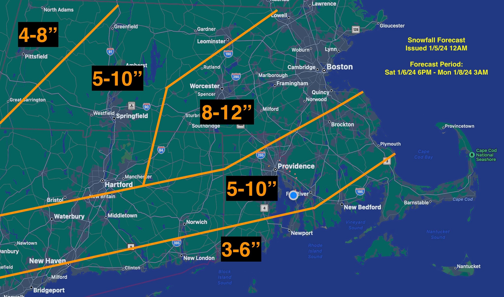
January 2024 -- Discussion
in New England
Posted
Hour 7 of white rain… accumulations so far: