

hudsonvalley21
-
Posts
3,893 -
Joined
-
Last visited
Content Type
Profiles
Blogs
Forums
American Weather
Media Demo
Store
Gallery
Posts posted by hudsonvalley21
-
-
Lost power here. Now I can hear the limbs breaking.
-
23 minutes ago, CPcantmeasuresnow said:
What's your total so far?
I just added another 2" so I,m at 12". Lights flickering here. Still coming down at a good clip. Great band I'm under here, also when the sun went down the snow really started to accumulate.
-
Added another 3.75 in the last 1 1/2 hrs. This band is still dumping snow.
-
Just now, IrishRob17 said:
Ah, yes, that must be that common core math I’ve heard about.
No, it's the measuring Methods you instilled in us. We don't want to be put in time out.

-
 1
1
-
-
6.253333333 OTG
 . Intensity picking back up under another band.
-
Point and click forecast has 10-16 for this afternoon and another 3-7 for tonight.
-
-
9 minutes ago, Juliancolton said:
First major band is here a little earlier than I expected. Vis down to about 1/10th of a mile, heaviest snow I've seen at home all year. Heading out to enjoy it!
Ripping here too. Roads are snow covered.
-
6 minutes ago, Juliancolton said:
The position of the system right now looks consistent with getting the intense forcing overhead for most of us, but like we've said for days, it all depends on the trajectory of the low as it interacts with the upper trough. The HRRR has it jumping barely north of east within a few hours, so that would really limit the northwestward extend of banding. I would say that we all likely get under that primary fronto band for a time. The problem is that it'll be transient on account of the ENE tug, so I wouldn't bet on more than a few hours of rippage west of the Taconic. Somewhere like HPN is going to be under the pivot, and that's where I suspect the 12+ totals will be most common. Should be fun to watch...
Has per the latest radar loops, it appears to be forming well and moving north along the nj coast.
-
1 minute ago, snywx said:
Approaching 5" here as well. All of Orange county upgraded to 15-20" Hopefully we can get the real serious banding up here before the pivot
Hearing reports of thundersnow down in the NYC area in the obs thread.
-
5 minutes ago, Juliancolton said:
It's an elongated trough-like thing right now, so it's sort of subjective to pinpoint where the low is. The circulation is a little offset to the west of the lowest pressures, like you say. The big band is still surging north... I think it'll make it here.
As it stands, every twig and pine needle is already caked in snow. If we do get into double digit totals, it'll probably be another few very cold and dark days in the neighborhood.
Agree, and if we do get into those heavy snow rates, it will put some trees and limbs in stress.
-
Just now, Juliancolton said:
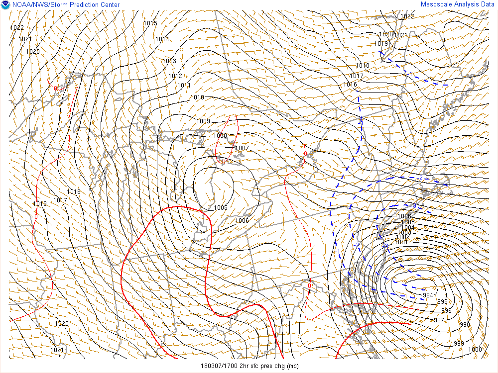
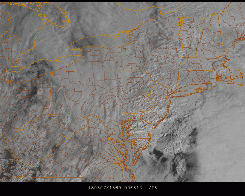
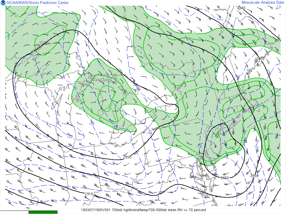
Radar looks fine to me. This thing is bombing out (just check out the gravity waves and rapidly cooling cloud tops on IR sat) and there's hasn't been a model in days that had meaningful snow from the coastal low starting before 1 pm. SPC mesoanalysis has a closed 700mb isohypse well inland over southern NJ. Stay the course.
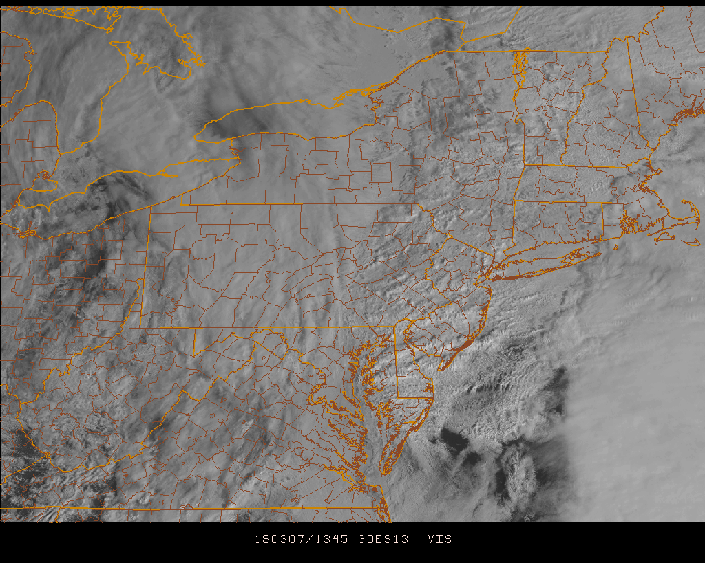
On the vis loop it appears to be closer to the number coast that the pressure drops are showing
-
13 minutes ago, BxEngine said:
Grew up in VC, live on the border of nyack and vc now. Will hopefully move back to vc shortly.
Nice town VC.
vis
-
6 minutes ago, White Gorilla said:
Getting a little tired of the showery, on and off nature of the snow. It is past noon. I barely have anything. 12-18? Don't make me laugh
Picking up in intensity here, but not enough to accumulate on roadways.
-
22 minutes ago, IrishRob17 said:
I’m guessing there’s no lobster bisque at Walgreens?
I mentioned the bisque...
Maybe canned.

-
41 minutes ago, BxEngine said:
I was a member of the dept one number up from tappan for 12 years.
") lol
lol
I thought you were in dept 10 from your location.
-
2 minutes ago, BxEngine said:
Rockland's food scene has made huge strides the last 5 years or so. Im partial to nyack since its my neighborhood lol
The Hilltop was a great place a few years back. Nyack has a few good places.
-
7 minutes ago, Juliancolton said:
Speaking of our favorite namer of bridges, I see a travel advisory is in effect on the freeways. Any idea what that means? Will I get sent to the Gulag if I try to use 84 later?
I would think they would have to close it down first.
-
6 minutes ago, BxEngine said:
He knows. Hes just a jerk. Lol
btw the 76 house in tappan has the best brunch in the area. Wish i had discovered it years ago.
Worked there years ago, life volly member in the firehouse across the street from there.
-
12 minutes ago, IrishRob17 said:
Tappan, that’s close to the Cuomo Bridge, correct?

About 5 miles south.
-
 1
1
-
-
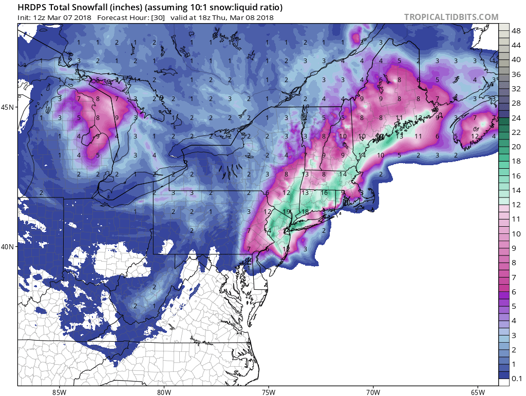
3 minutes ago, snywx said:
12z HRDPS still quite generous for the area. 12"+

-
1
-
-
1 minute ago, Juliancolton said:
6" will go down as low, though I do tend to agree with your tempered expectations. The axis of precip has already materialized over DE and NJ, and it's pivoting northward... just have to watch where that goes from here. 8-12" still looks good for up here.
Wow, huge numbers... unfortunately the NWS getting gung-ho right as things start cranking is usually the KOD, lol.
Let's see if it comes up to the north and west a little more before it kicks out to the northeast. 20 miles could make a huge difference.
-
1 minute ago, White Gorilla said:
Melting on most surfaces
Same here, about 1.5 on grassy surfaces. Roads are all clear.
-
1 hour ago, BxEngine said:
We have a few posters that should spend time in a certain group of buildings on old orangeburg road in orangeburg.
Grew up in Tappan, I know of those buildings. Some posters defiantly quality.
Interior NW Burbs & Hudson Valley Second Half 2018
in New York City Metro
Posted
I guess they didn't get his blessing